Category:Dungeon Banks
| Object location | | View all coordinates using: OpenStreetMap |
|---|

Dungeon Banks is a sandbank and wetland in the River Mersey between Oglet, Speke, and Hale, Cheshire.
Media in category "Dungeon Banks"
The following 12 files are in this category, out of 12 total.
-
 Dungeon Banks - geograph.org.uk - 273757.jpg 640 × 480; 142 KB
-
 Dungeon Banks on the Mersey - geograph.org.uk - 683753.jpg 640 × 480; 57 KB
-
 Mersey River,Dungeon Bank - geograph.org.uk - 28223.jpg 640 × 480; 47 KB
-
 River Mersey ,Dungeon Bank. - geograph.org.uk - 28102.jpg 640 × 480; 58 KB
-
 River Mersey ,Dungeon Bank. - geograph.org.uk - 28115.jpg 640 × 480; 58 KB
-
 River Mersey Dungeon Banks - geograph.org.uk - 30733.jpg 640 × 480; 93 KB
-
 River Mersey,Dungeon Bank - geograph.org.uk - 28120.jpg 640 × 480; 69 KB
-
 River Mersey,Dungeon Bank. - geograph.org.uk - 28109.jpg 640 × 480; 106 KB
-
 River Mersey,Dungeon Bank. - geograph.org.uk - 28217.jpg 640 × 480; 60 KB
-
 River Mersey,Dungeon Bank. - geograph.org.uk - 28219.jpg 640 × 480; 78 KB
-
 The River Mersey from Dungeon Bank - geograph.org.uk - 428440.jpg 640 × 480; 60 KB
-
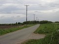 The road to Dungeon Bank - geograph.org.uk - 428438.jpg 640 × 480; 57 KB


