Category:Dunnichen (civil parish)
Scottish parish in Angus, Scotland, UK | |||||
| Upload media | |||||
| Instance of | |||||
|---|---|---|---|---|---|
| Named after | |||||
| Location |
| ||||
| Population |
| ||||
| Area |
| ||||
 | |||||
Subcategories
This category has the following 2 subcategories, out of 2 total.
D
L
- Letham, Angus (46 F)
Media in category "Dunnichen (civil parish)"
The following 168 files are in this category, out of 168 total.
-
 An Angus potato crop - geograph.org.uk - 5907361.jpg 1,024 × 683; 394 KB
-
 Angus farmland from near Lownie - geograph.org.uk - 2629927.jpg 3,264 × 2,448; 4.6 MB
-
 Approaching Craichie on the B9128 - geograph.org.uk - 4354384.jpg 640 × 427; 324 KB
-
 Arable land near Letham - geograph.org.uk - 4538374.jpg 800 × 450; 285 KB
-
 Arable land, Newdyke - geograph.org.uk - 5171851.jpg 1,024 × 768; 283 KB
-
 Ash tree, Dunnichen - geograph.org.uk - 3810729.jpg 640 × 426; 246 KB
-
 B9128 heading northwards - geograph.org.uk - 6359006.jpg 5,184 × 3,888; 5.98 MB
-
 B978 near Tulloes - geograph.org.uk - 3232519.jpg 1,200 × 797; 351 KB
-
 B978, North Draffin - geograph.org.uk - 4538370.jpg 800 × 533; 308 KB
-
 Barley harvest near Kinneries - geograph.org.uk - 5907365.jpg 1,024 × 683; 179 KB
-
 Barley, Craichie - geograph.org.uk - 3608426.jpg 640 × 480; 286 KB
-
 Barley, Craichie - geograph.org.uk - 3608440.jpg 640 × 480; 267 KB
-
 Bowriefauld - geograph.org.uk - 3608551.jpg 640 × 480; 277 KB
-
 Bowriefauld - geograph.org.uk - 3608553.jpg 640 × 480; 291 KB
-
 Bowriefauld Village - geograph.org.uk - 4602934.jpg 640 × 469; 62 KB
-
 Bractullo - geograph.org.uk - 3608558.jpg 640 × 640; 343 KB
-
 Bractullo Bridge - geograph.org.uk - 3608565.jpg 640 × 480; 319 KB
-
 Bridge on the Greenmire Burn - geograph.org.uk - 4354399.jpg 640 × 427; 370 KB
-
 Bridge over burn at Nether Tulloes - geograph.org.uk - 4388342.jpg 640 × 480; 70 KB
-
 Bridge over the Greenmire Burn - geograph.org.uk - 4602926.jpg 640 × 481; 83 KB
-
 Cardyne Street - geograph.org.uk - 5903531.jpg 1,024 × 683; 354 KB
-
 Cattle, Cur Den - geograph.org.uk - 3608562.jpg 640 × 480; 312 KB
-
 Church at Dunnichen - geograph.org.uk - 4590991.jpg 640 × 480; 106 KB
-
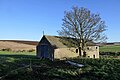
 Church, Dunnichen - geograph.org.uk - 3815098.jpg 640 × 426; 288 KB
-
 Clock and plaque, Hall of Letham - geograph.org.uk - 5554342.jpg 906 × 1,600; 312 KB
-
 Commercial Inn, Letham - geograph.org.uk - 4538420.jpg 800 × 733; 429 KB
-
 Craichie - geograph.org.uk - 5171862.jpg 1,024 × 768; 285 KB
-
 Craichie Mill - geograph.org.uk - 4354388.jpg 640 × 427; 342 KB
-
 Craichie Mill - geograph.org.uk - 6358916.jpg 1,024 × 683; 185 KB
-
 Cut grass, Draffin - geograph.org.uk - 4538369.jpg 800 × 533; 375 KB
-
 Development site, Letham - geograph.org.uk - 5554423.jpg 1,600 × 926; 258 KB
-
 Disused Track - geograph.org.uk - 4354396.jpg 427 × 640; 569 KB
-
 Drummie Road, Letham - geograph.org.uk - 5553910.jpg 1,600 × 1,067; 453 KB
-
 Drummietermont - geograph.org.uk - 3436786.jpg 640 × 480; 56 KB
-
 Drummietermont - geograph.org.uk - 5554568.jpg 1,600 × 1,042; 396 KB
-
 Dundee Road - geograph.org.uk - 3608571.jpg 640 × 480; 266 KB
-

-
 Dunnichen Hill - geograph.org.uk - 3810727.jpg 640 × 426; 250 KB
-
 Dunnichen Hill - geograph.org.uk - 3811721.jpg 640 × 426; 223 KB
-
 Dunnichen Letham and Kirkden Church - geograph.org.uk - 3436803.jpg 640 × 480; 80 KB
-
 Dunnichen Moss - geograph.org.uk - 4354375.jpg 640 × 427; 319 KB
-
 East Den Brae - geograph.org.uk - 5171966.jpg 1,024 × 768; 263 KB
-
 East Mains of Dunnichen - geograph.org.uk - 3811710.jpg 640 × 426; 253 KB
-
 East Mains of Dunnichen Farm - geograph.org.uk - 1079829.jpg 640 × 427; 33 KB
-
 Entrance to Dempster Park, Letham - geograph.org.uk - 5554276.jpg 1,600 × 1,067; 362 KB
-
 Farm at Burnside of Tulloes - geograph.org.uk - 4149508.jpg 640 × 480; 58 KB
-
 Farm at Craichie Mill - geograph.org.uk - 4898217.jpg 640 × 480; 64 KB
-
 Farm road to Nether Tulloes - geograph.org.uk - 4388416.jpg 640 × 480; 70 KB
-
 Farmland at Newdyke - geograph.org.uk - 4898744.jpg 640 × 480; 52 KB
-
 Field by Whiteburn - geograph.org.uk - 5171860.jpg 1,024 × 768; 246 KB
-
 Field Dyke - geograph.org.uk - 4354365.jpg 427 × 640; 414 KB
-
 Field near Bractullo Mill - geograph.org.uk - 4538385.jpg 800 × 450; 304 KB
-
 Field, Nether Tulloes - geograph.org.uk - 4538381.jpg 800 × 450; 308 KB
-
 Fields, Dunnichen - geograph.org.uk - 3810202.jpg 640 × 426; 314 KB
-
 Fir Park Nursery - geograph.org.uk - 3608579.jpg 640 × 380; 228 KB
-
 Fir Park Nursery, Letham - geograph.org.uk - 5553894.jpg 1,600 × 1,036; 371 KB
-

-
 Former Church, Letham - geograph.org.uk - 3437489.jpg 480 × 640; 48 KB
-
 Former school building, Letham - geograph.org.uk - 3608575.jpg 640 × 480; 268 KB
-
 Gate, Letham - geograph.org.uk - 5171872.jpg 1,024 × 768; 375 KB
-
 Girdle Stane of Dunnichen - geograph.org.uk - 5555551.jpg 1,600 × 1,067; 546 KB
-
 Glassmonies Cottage - geograph.org.uk - 5841533.jpg 5,184 × 3,888; 6.36 MB
-
 Hillend - geograph.org.uk - 4354336.jpg 640 × 427; 324 KB
-
 Horse at Drum of Dunnichen - geograph.org.uk - 5841523.jpg 5,184 × 3,888; 5.81 MB
-
 House at Lownie Hill - geograph.org.uk - 2629933.jpg 3,264 × 2,448; 5.23 MB
-
 Houses on Duncan Road, Letham - geograph.org.uk - 5553939.jpg 1,600 × 1,067; 442 KB
-
 Junction with the B9128 at Cockhill - geograph.org.uk - 3232472.jpg 1,200 × 797; 350 KB
-
 Keptie Bakery, Letham - geograph.org.uk - 5555553.jpg 1,600 × 883; 240 KB
-
 Lane overgrown with grass in Letham - geograph.org.uk - 3437501.jpg 640 × 480; 93 KB
-

-
 Letham - geograph.org.uk - 4538418.jpg 800 × 450; 279 KB
-
 Letham Cemetery - geograph.org.uk - 5841519.jpg 5,184 × 3,888; 6.49 MB
-
 Letham Crafts, Auldbar Road - geograph.org.uk - 5555552.jpg 1,600 × 1,067; 367 KB
-
 Letham Hotel - geograph.org.uk - 2067875.jpg 640 × 427; 232 KB
-
 Letham Square - geograph.org.uk - 2067870.jpg 640 × 427; 218 KB
-
 Letham Square - geograph.org.uk - 2067881.jpg 640 × 427; 279 KB
-
 Letham Village - geograph.org.uk - 4602939.jpg 640 × 481; 56 KB
-

-

-
 Looking towards Dunnichen Hill - geograph.org.uk - 4304611.jpg 640 × 427; 473 KB
-
 Lownie Moor - geograph.org.uk - 2629931.jpg 3,264 × 2,448; 3.88 MB
-
 Milepost at Wester Lownie - geograph.org.uk - 6431441.jpg 5,184 × 3,888; 6.73 MB
-
 Milestone, Craichie - geograph.org.uk - 3608434.jpg 480 × 640; 372 KB
-
 Minor road to Lownie Moor - geograph.org.uk - 5177385.jpg 640 × 480; 53 KB
-
 Minor road, Bowriefauld - geograph.org.uk - 4096244.jpg 640 × 480; 266 KB
-

-
 Near Whiteburn - geograph.org.uk - 4354381.jpg 640 × 427; 334 KB
-
 Nechtansmere and Dunnichen Hill - geograph.org.uk - 2710282.jpg 640 × 480; 82 KB
-
 Nechtansmere Memorial - geograph.org.uk - 5434774.jpg 5,184 × 3,888; 5.56 MB
-
 Newdyke - geograph.org.uk - 4304608.jpg 640 × 366; 346 KB
-
 Newdyke Farm - geograph.org.uk - 5615342.jpg 5,184 × 3,888; 5.12 MB
-
 North Draffin Farm - geograph.org.uk - 1124254.jpg 640 × 426; 106 KB
-
 North Watson Street, Letham - geograph.org.uk - 5553940.jpg 1,600 × 1,067; 560 KB
-
 Ornate stone bridge over Greenmire Burn - geograph.org.uk - 4898542.jpg 640 × 480; 124 KB
-
 Park Road, Letham - geograph.org.uk - 3608581.jpg 640 × 480; 317 KB
-
 Park Road, Letham - geograph.org.uk - 5553912.jpg 1,600 × 1,067; 481 KB
-
 Park Road, Letham - geograph.org.uk - 5553936.jpg 1,600 × 1,067; 384 KB
-
 Pillar box, Letham - geograph.org.uk - 5554308.jpg 1,018 × 1,600; 320 KB
-
 Playing field, Kingsmuir - geograph.org.uk - 3810165.jpg 640 × 426; 253 KB
-
 Ploughed field, Bowriefauld - geograph.org.uk - 5171865.jpg 1,024 × 768; 313 KB
-
 Ploughed Fields at Lownie - geograph.org.uk - 4354348.jpg 640 × 427; 410 KB
-
 Ploughing - geograph.org.uk - 3608423.jpg 640 × 480; 222 KB
-
 Powerline, Draffin - geograph.org.uk - 5907375.jpg 1,024 × 683; 315 KB
-
 Quarry, Lownie - geograph.org.uk - 3810185.jpg 640 × 426; 361 KB
-
 Railway Bridge at Muir of Lownie - geograph.org.uk - 938554.jpg 640 × 426; 73 KB
-
 Railway bridge, Lownie Moor - geograph.org.uk - 3810176.jpg 640 × 426; 242 KB
-

-
 Road leading to Vinnybank Farm - geograph.org.uk - 1124241.jpg 640 × 426; 55 KB
-
 Road near Bractullo Mill - geograph.org.uk - 3232524.jpg 1,200 × 797; 369 KB
-
 Road to Bowriefauld - geograph.org.uk - 5171866.jpg 1,024 × 768; 324 KB
-
 Ruin, Lownie Moor - geograph.org.uk - 3810716.jpg 640 × 426; 267 KB
-
 Ruin, Lownie Moor - geograph.org.uk - 3810720.jpg 640 × 426; 326 KB
-

-
 Rusted milepost at Craichie - geograph.org.uk - 6431436.jpg 5,184 × 3,888; 1.2 MB
-
 Shed on Dunnichen Hill - geograph.org.uk - 3810210.jpg 640 × 426; 289 KB
-
 Sheds in the Woods - geograph.org.uk - 4354353.jpg 640 × 427; 573 KB
-
 Sign for the Commercial Inn, Letham - geograph.org.uk - 5554304.jpg 1,067 × 1,600; 261 KB
-
 Signpost Depicting Public Footpath - geograph.org.uk - 1079825.jpg 640 × 427; 134 KB
-
 Site of Nechtansmere - geograph.org.uk - 5841510.jpg 5,184 × 3,888; 4.96 MB
-
 South of Craichie - geograph.org.uk - 5281238.jpg 5,184 × 3,888; 6.55 MB
-
 Spring seedbed, Letham - geograph.org.uk - 5171871.jpg 1,024 × 768; 164 KB
-

-
 Station House - geograph.org.uk - 4354341.jpg 427 × 640; 344 KB
-
 Stubble and round bales, Crosston - geograph.org.uk - 5903528.jpg 1,024 × 683; 243 KB
-
 Stubble, Bowriefauld - geograph.org.uk - 5903526.jpg 1,024 × 683; 314 KB
-
 Stubble, Craichie Mill - geograph.org.uk - 5903522.jpg 1,024 × 683; 324 KB
-
 Stubble, East Mains of Dunnichen - geograph.org.uk - 3811713.jpg 640 × 426; 289 KB
-
 Suttie Wynd, Letham - geograph.org.uk - 5553916.jpg 1,600 × 1,067; 520 KB
-
 Tattie Field - geograph.org.uk - 6378711.jpg 1,024 × 563; 149 KB
-
 The Auld Police Station, Letham - geograph.org.uk - 5554412.jpg 1,600 × 1,067; 289 KB
-
 The B9128, looking down the hill - geograph.org.uk - 5297880.jpg 5,184 × 3,888; 6.1 MB
-
 The big horse - geograph.org.uk - 5297897.jpg 5,184 × 3,888; 6.18 MB
-
 The Commercial Inn, Letham - geograph.org.uk - 5554299.jpg 1,600 × 1,067; 326 KB
-
 The Girdlestane - geograph.org.uk - 2710289.jpg 640 × 480; 132 KB
-
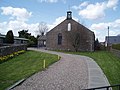
 The Hall of Letham - geograph.org.uk - 5555556.jpg 1,600 × 1,202; 344 KB
-
 The Hall of Letham and the Letham Hotel - geograph.org.uk - 5554318.jpg 1,600 × 971; 252 KB
-
 The Square, Letham - geograph.org.uk - 5554293.jpg 1,600 × 992; 315 KB
-
 The Square, Letham - geograph.org.uk - 5903530.jpg 1,024 × 683; 278 KB
-
 Toilets or changing rooms, Dempster Park, Letham - geograph.org.uk - 5553935.jpg 1,600 × 1,067; 427 KB
-
 Track in Tulloes Wood - geograph.org.uk - 6358999.jpg 5,184 × 3,888; 7.07 MB
-
 Trackbed site, Dundee and Forfar Direct - geograph.org.uk - 5171850.jpg 1,024 × 768; 283 KB
-
 Trig Pillar, Dunnichen Hill - geograph.org.uk - 5434784.jpg 5,184 × 3,888; 7.19 MB
-
 Tulloes Burn - geograph.org.uk - 5903520.jpg 1,024 × 683; 308 KB
-
 Tulloes Wood - geograph.org.uk - 4538365.jpg 800 × 533; 448 KB
-
 Unclassified road near Tulloes - geograph.org.uk - 3232522.jpg 1,200 × 797; 433 KB
-
 Upper Tulloes - geograph.org.uk - 5907370.jpg 1,024 × 683; 277 KB
-

-

-

-

-

-

-
 View towards Letham - geograph.org.uk - 4538409.jpg 800 × 450; 303 KB
-
 Village Hall, Letham - geograph.org.uk - 5554279.jpg 1,600 × 1,039; 353 KB
-
 Village of Letham - geograph.org.uk - 5841506.jpg 5,184 × 3,888; 5.07 MB
-
 Vinnyhill - geograph.org.uk - 4538387.jpg 800 × 450; 291 KB
-
 War Memorial, Dempster Park, Letham - geograph.org.uk - 5553923.jpg 1,600 × 1,067; 548 KB
-
 War Memorial, Dempster Park, Letham - geograph.org.uk - 5553925.jpg 1,600 × 1,380; 414 KB
-
 War Memorial, Dempster Park, Letham - geograph.org.uk - 5553931.jpg 1,600 × 964; 405 KB
-
 Watson Street, Letham - geograph.org.uk - 3608584.jpg 640 × 480; 253 KB
-
 West Mains of Dunnichen - geograph.org.uk - 4354358.jpg 640 × 427; 355 KB
-
 Wheat, Dunnichen - geograph.org.uk - 3608545.jpg 640 × 480; 288 KB
-
 Whitefield - geograph.org.uk - 3436792.jpg 640 × 480; 60 KB
-
 Whitefield Cottages - geograph.org.uk - 5555555.jpg 1,600 × 973; 255 KB
-
 Winter cereal crop, Crosston - geograph.org.uk - 5171868.jpg 1,024 × 768; 314 KB
-
 Winter cereals - geograph.org.uk - 3811717.jpg 640 × 426; 265 KB
-
 Wintry Lownie Moor - geograph.org.uk - 5656019.jpg 5,184 × 3,888; 5.17 MB
-
 Woodland, Dunnichen Hill - geograph.org.uk - 3810194.jpg 640 × 426; 263 KB


