Category:Dunning (civil parish)
Scottish parish in Perth and Kinross, Scotland, UK | |||||
| Upload media | |||||
| Instance of | |||||
|---|---|---|---|---|---|
| Part of |
| ||||
| Named after | |||||
| Location |
| ||||
| Population |
| ||||
| Area |
| ||||
 | |||||
Subcategories
This category has the following 2 subcategories, out of 2 total.
D
- Dunning railway station (1 F)
Media in category "Dunning (civil parish)"
The following 200 files are in this category, out of 468 total.
(previous page) (next page)-
 10-45 from Glasgow - geograph.org.uk - 4335183.jpg 800 × 533; 274 KB
-
 A9 by Dalreoch - geograph.org.uk - 2279065.jpg 800 × 555; 39 KB
-
 A9 north of Aberuthven - geograph.org.uk - 5741640.jpg 640 × 427; 356 KB
-
 A9, Broom of Dalreoch - geograph.org.uk - 4335265.jpg 800 × 533; 198 KB
-
 Aberuthven and Dunning Parish Church - geograph.org.uk - 4233694.jpg 1,600 × 1,062; 542 KB
-
 Aberuthven And Dunning Parish Church - geograph.org.uk - 4237047.jpg 800 × 600; 91 KB
-
 Above Broadslap - geograph.org.uk - 864098.jpg 640 × 480; 100 KB
-
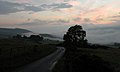 Above the clouds - geograph.org.uk - 938320.jpg 640 × 383; 35 KB
-
 Access to Balquhandy from B934 - geograph.org.uk - 3510023.jpg 3,648 × 2,736; 2.42 MB
-
 Across Corb Glen - geograph.org.uk - 5864661.jpg 1,600 × 1,066; 382 KB
-
 Alders, Garvock Burn - geograph.org.uk - 4335176.jpg 800 × 533; 322 KB
-
 Arable land at Drum of Garvock - geograph.org.uk - 5896628.jpg 1,600 × 1,067; 558 KB
-
 Auchterarder Road, Dunning - geograph.org.uk - 2000303.jpg 2,560 × 1,920; 1.91 MB
-
 Auchterarder Road, Dunning - geograph.org.uk - 4233846.jpg 1,600 × 1,062; 492 KB
-
 B8062 near Millhaugh - geograph.org.uk - 5774564.jpg 1,600 × 1,048; 521 KB
-
 B9141, Dalreoch - geograph.org.uk - 4335256.jpg 800 × 533; 159 KB
-
 B9141, Muir Wood - geograph.org.uk - 4335239.jpg 800 × 533; 243 KB
-
 B934 - geograph.org.uk - 5798900.jpg 1,024 × 683; 342 KB
-
 B934 at Littlerigg Forest - geograph.org.uk - 4601522.jpg 640 × 481; 87 KB
-
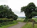
 B934 from Glendevon to Dunning - geograph.org.uk - 1896997.jpg 800 × 531; 224 KB
-
 B934 in winter - geograph.org.uk - 4311642.jpg 640 × 427; 297 KB
-
 B934 looking to Broomhill - geograph.org.uk - 4602010.jpg 640 × 469; 94 KB
-
 B934 near Blaeberry Toll - geograph.org.uk - 2234131.jpg 640 × 480; 209 KB
-
 B934 north of Dunning - geograph.org.uk - 2674080.jpg 1,024 × 768; 112 KB
-
 B934, Dunning - geograph.org.uk - 5619266.jpg 1,600 × 990; 302 KB
-
 B935 north of Dunning - geograph.org.uk - 4602005.jpg 640 × 481; 72 KB
-
 Baldinnies - geograph.org.uk - 6229746.jpg 1,024 × 738; 127 KB
-
 Baldinnies House - geograph.org.uk - 2394522.jpg 4,288 × 2,848; 2.02 MB
-
 Balquhandy Hill - geograph.org.uk - 5798920.jpg 1,024 × 683; 324 KB
-
 Binzian Burn - geograph.org.uk - 5800416.jpg 1,024 × 683; 323 KB
-
 Blaeberry Toll - geograph.org.uk - 5796812.jpg 1,024 × 683; 367 KB
-
 Blair's Den - geograph.org.uk - 4995965.jpg 1,024 × 683; 295 KB
-
 Boghall Hill - geograph.org.uk - 2355474.jpg 4,288 × 2,848; 2.97 MB
-
 Boghall Hill - geograph.org.uk - 2589173.jpg 640 × 424; 76 KB
-
 Bridge of Earn Road, Dunning - geograph.org.uk - 5619171.jpg 1,600 × 1,061; 325 KB
-
 Broadleys Farm - geograph.org.uk - 4697631.jpg 2,513 × 1,831; 804 KB
-
 Broadslap driveway - geograph.org.uk - 863731.jpg 640 × 480; 100 KB
-
 Broadslap Fruit Farm, Dunning - geograph.org.uk - 2516086.jpg 1,024 × 565; 155 KB
-
 Broom of Dalreoch from the A9 - geograph.org.uk - 3807438.jpg 640 × 481; 51 KB
-
 Buildings at Rossiebank Farm - geograph.org.uk - 4233876.jpg 1,600 × 1,062; 635 KB
-
 Burn and wood, Sweel Bridge - geograph.org.uk - 2234150.jpg 640 × 480; 337 KB
-
 Cap Law - geograph.org.uk - 4995953.jpg 1,024 × 683; 309 KB
-
 Cattle at Easter Gatherleys, Perthshire - geograph.org.uk - 2674105.jpg 1,600 × 1,200; 315 KB
-
 Central Perk - geograph.org.uk - 2234563.jpg 640 × 480; 247 KB
-
 Cheer up, the worst is yet to come - geograph.org.uk - 5798933.jpg 1,024 × 683; 381 KB
-
 Church of St Serf, Dunning - geograph.org.uk - 2000297.jpg 1,920 × 2,560; 1.7 MB
-
 Church of St Serf, Dunning - geograph.org.uk - 2674097.jpg 1,600 × 1,200; 465 KB
-
 Church of St Serf, Dunning - geograph.org.uk - 3732425.jpg 480 × 640; 55 KB
-
 Church Of St. Serf, Dunning - geograph.org.uk - 4608620.jpg 2,560 × 1,920; 2.28 MB
-
 Clear fell on the north side of Innerdouny - geograph.org.uk - 5620895.jpg 1,024 × 683; 343 KB
-
 Clear fell on the north side of Innerdouny - geograph.org.uk - 5620897.jpg 1,024 × 683; 331 KB
-
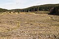
 Clear fell, Little Rig - geograph.org.uk - 4995981.jpg 1,024 × 683; 232 KB
-
 Clearing, Innerdouny Hill - geograph.org.uk - 5621009.jpg 1,024 × 683; 353 KB
-
 Clearing, Innerdouny Hill - geograph.org.uk - 5621011.jpg 1,024 × 683; 369 KB
-
 Clevage Hills - geograph.org.uk - 2589183.jpg 640 × 480; 69 KB
-
 Clevage Hills - geograph.org.uk - 2589657.jpg 640 × 480; 85 KB
-
 Clevage Hills climb - geograph.org.uk - 5800377.jpg 1,024 × 683; 347 KB
-
 Clock Tower, St Serf's Church Dunning - geograph.org.uk - 3510039.jpg 1,368 × 1,824; 374 KB
-
 Clow Hill loop - geograph.org.uk - 5801184.jpg 1,024 × 683; 409 KB
-
 Cock Law - geograph.org.uk - 5797999.jpg 1,024 × 683; 370 KB
-
 Cock Law - geograph.org.uk - 5798005.jpg 1,024 × 683; 405 KB
-
 Cock Law summit - geograph.org.uk - 5798007.jpg 1,024 × 683; 411 KB
-
 Cockersfauld Hill - geograph.org.uk - 5798916.jpg 1,024 × 683; 418 KB
-

-
 Corb Glen - geograph.org.uk - 2236084.jpg 640 × 480; 217 KB
-
 Corb Glen - geograph.org.uk - 2236090.jpg 640 × 480; 234 KB
-
 Corb Glen - geograph.org.uk - 5229451.jpg 4,909 × 3,273; 1.99 MB
-
 Corb Junction - geograph.org.uk - 5865152.jpg 1,600 × 1,066; 536 KB
-
 Corb Law - geograph.org.uk - 2234207.jpg 640 × 480; 233 KB
-
 Corb Law - geograph.org.uk - 2470060.jpg 640 × 480; 68 KB
-

-
 Coulshill to Corb Bridge road - geograph.org.uk - 2234185.jpg 640 × 480; 213 KB
-
 Coulshill to Corb Bridge road - geograph.org.uk - 2234197.jpg 640 × 480; 223 KB
-
 Coulshill to Corb Bridge road - geograph.org.uk - 2236070.jpg 640 × 480; 221 KB
-
 Cows Moss - geograph.org.uk - 5796809.jpg 1,024 × 683; 367 KB
-
 Craig Rossie - geograph.org.uk - 2625739.jpg 640 × 480; 98 KB
-
 Craigbaikie Hill - geograph.org.uk - 3274289.jpg 2,592 × 1,944; 1.83 MB
-
 Crops under netting - geograph.org.uk - 4336991.jpg 800 × 533; 203 KB
-
 Cultivated field by Quilts - geograph.org.uk - 5798931.jpg 1,024 × 683; 320 KB
-
 D.A and C.A. Kinross, Dunning - geograph.org.uk - 2000288.jpg 2,560 × 1,920; 1.88 MB
-
 Derelict Cottage at Boghall - geograph.org.uk - 1048190.jpg 640 × 427; 123 KB
-
 Drinking fountain, Bridge of Earn Road, Dunning - geograph.org.uk - 5619185.jpg 1,290 × 1,600; 453 KB
-
 Driveway looking towards the B8062 - geograph.org.uk - 5619920.jpg 1,067 × 1,600; 572 KB
-
 Driveway to Innerdunning House - geograph.org.uk - 5897742.jpg 1,600 × 1,009; 387 KB
-
 Dunning - geograph.org.uk - 2000319.jpg 2,560 × 1,920; 1.71 MB
-
 Dunning - geograph.org.uk - 4284247.jpg 2,914 × 3,958; 7.41 MB
-
 Dunning - geograph.org.uk - 4335203.jpg 800 × 533; 160 KB
-
 Dunning Post Office - geograph.org.uk - 5800371.jpg 1,024 × 683; 323 KB
-
 Dunning War Memorial - geograph.org.uk - 3732442.jpg 480 × 640; 70 KB
-
 Dunning War Memorial - geograph.org.uk - 4391042.jpg 4,608 × 3,456; 4.23 MB
-
 Dunning War Memorial - geograph.org.uk - 4601615.jpg 640 × 481; 62 KB
-
 Dunning War Memorial - geograph.org.uk - 5368628.jpg 640 × 480; 85 KB
-
 Dunning, St Serf's Church and watch-house - geograph.org.uk - 1779104.jpg 1,300 × 975; 388 KB
-
 Dyke, Innerdouny - geograph.org.uk - 5621018.jpg 1,024 × 683; 448 KB
-
 Dyke-fence junction, Cock Law - geograph.org.uk - 5798001.jpg 1,024 × 683; 464 KB
-
 Earn flood plain, Dalreoch - geograph.org.uk - 4336984.jpg 800 × 533; 203 KB
-
 Earn flood plain, Dalreoch - geograph.org.uk - 4337738.jpg 800 × 533; 196 KB
-
 Easter Clow - geograph.org.uk - 2695982.jpg 640 × 480; 82 KB
-
 Easter Clow - geograph.org.uk - 789447.jpg 640 × 425; 191 KB
-
 Edge of the Forest on Skymore Hill - geograph.org.uk - 824928.jpg 640 × 425; 212 KB
-
 En Route To Innerdouny Hill - geograph.org.uk - 4608646.jpg 2,560 × 1,920; 1.86 MB
-
 Entrance to Meadowbank - geograph.org.uk - 5774565.jpg 1,600 × 1,067; 481 KB
-
 Entrance to Wester Clevage - geograph.org.uk - 5774597.jpg 1,600 × 1,006; 427 KB
-
 Fallen trees - geograph.org.uk - 2589664.jpg 640 × 448; 122 KB
-
 Fanny Hill - geograph.org.uk - 4995978.jpg 1,024 × 683; 287 KB
-
 Farm buildings at Corb - geograph.org.uk - 5229459.jpg 4,896 × 3,672; 6.48 MB
-
 Farm cottage at Broom of Dalreoch - geograph.org.uk - 5701077.jpg 1,024 × 682; 247 KB
-
 Farm road at Innerdunning - geograph.org.uk - 2394496.jpg 4,288 × 2,848; 1.99 MB
-
 Farm sign - geograph.org.uk - 2394506.jpg 3,352 × 2,667; 1.35 MB
-

-
 Farmland in Strathearn - geograph.org.uk - 4430645.jpg 640 × 368; 68 KB
-
 Farmland near Clevage - geograph.org.uk - 833567.jpg 640 × 356; 43 KB
-
 Farmland near Dunning, by Findony Farm - geograph.org.uk - 3274313.jpg 2,592 × 1,944; 1.1 MB
-
 Farmland near Tarnavie - geograph.org.uk - 2489186.jpg 640 × 489; 133 KB
-
 Farmland near Wester Clow - geograph.org.uk - 789455.jpg 640 × 425; 153 KB
-
 Felled and replanted woodland, Clevage Hills - geograph.org.uk - 5800385.jpg 1,024 × 683; 336 KB
-
 Felled area, Littlerig - geograph.org.uk - 5571882.jpg 1,024 × 578; 268 KB
-
 Felled area, north of Innerdouny - geograph.org.uk - 5620963.jpg 1,024 × 683; 361 KB
-
 Felled area, Wether Law - geograph.org.uk - 5798894.jpg 1,024 × 683; 344 KB
-
 Fence junction near the summit of Corb Law - geograph.org.uk - 3155482.jpg 4,448 × 3,232; 5.47 MB
-
 Fence on Corb Law - geograph.org.uk - 2234542.jpg 640 × 480; 237 KB
-
 Fenceline on Corb Law - geograph.org.uk - 3155500.jpg 4,608 × 3,456; 6 MB
-
 Field at Mains of Duncrub - geograph.org.uk - 4423510.jpg 640 × 480; 48 KB
-
 Field boundary near Casken Hill - geograph.org.uk - 2474692.jpg 640 × 438; 76 KB
-
 Field near Drum of Garvock - geograph.org.uk - 4335184.jpg 800 × 533; 220 KB
-
 Field near Dunning - geograph.org.uk - 4335205.jpg 800 × 533; 249 KB
-
 Field track and drain at Garvock - geograph.org.uk - 5774587.jpg 1,600 × 1,067; 604 KB
-
 Field, Mains of Duncrub - geograph.org.uk - 4335206.jpg 800 × 533; 163 KB
-
 Field, Middle Third - geograph.org.uk - 5801189.jpg 1,024 × 683; 322 KB
-
 Fields above Balquhandy - geograph.org.uk - 3098384.jpg 2,592 × 1,944; 1.54 MB
-
 Fields above the Earn - geograph.org.uk - 864077.jpg 640 × 480; 108 KB
-
 Fields at Rossie Farm - geograph.org.uk - 3098362.jpg 2,592 × 1,944; 1.12 MB
-
 Fields at Wellhill - geograph.org.uk - 4233682.jpg 1,600 × 1,062; 663 KB
-
 Fields below Nether Garvock - geograph.org.uk - 3098453.jpg 2,592 × 1,944; 1.26 MB
-
 Fields near Meadowbank - geograph.org.uk - 3098459.jpg 2,592 × 1,944; 1.48 MB
-
 Fields running down to the River Earn - geograph.org.uk - 4964773.jpg 2,592 × 1,944; 1.52 MB
-
 Fields west of Dunning - geograph.org.uk - 3098367.jpg 2,592 × 1,944; 1.58 MB
-
 Fire Beaters and Forest Track - geograph.org.uk - 789509.jpg 640 × 425; 195 KB
-
 Forest clearance - geograph.org.uk - 4416328.jpg 750 × 516; 667 KB
-
 Forest Clearing - geograph.org.uk - 2241807.jpg 640 × 480; 108 KB
-
 Forest path - geograph.org.uk - 4363767.jpg 480 × 640; 686 KB
-
 Forest ride, Brunt Hill - geograph.org.uk - 819273.jpg 640 × 480; 118 KB
-
 Forest road into Littlerig - geograph.org.uk - 1897011.jpg 800 × 531; 226 KB
-
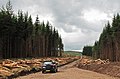
 Forest road, Littlerig - geograph.org.uk - 5571855.jpg 1,024 × 578; 348 KB
-
 Forest track near Innerdouny Hill - geograph.org.uk - 2749950.jpg 640 × 479; 90 KB
-
 Forest track, Little Rig - geograph.org.uk - 819232.jpg 640 × 480; 108 KB
-
 Forest works - geograph.org.uk - 819251.jpg 640 × 480; 141 KB
-

-
 Forestry near Littlerig - geograph.org.uk - 2749970.jpg 640 × 480; 71 KB
-
 Forestry on Balquhandy Hill - geograph.org.uk - 4416354.jpg 750 × 500; 614 KB
-
 Forestry operations - geograph.org.uk - 4416338.jpg 750 × 500; 645 KB
-
 Forestry operations in Sillywinny Wood - geograph.org.uk - 3098390.jpg 2,592 × 1,944; 1.49 MB
-
 Forestry operations near Cap Law - geograph.org.uk - 2469988.jpg 640 × 420; 87 KB
-
 Forestry plantation - geograph.org.uk - 3046930.jpg 640 × 468; 146 KB
-
 Fountain in Dunning - geograph.org.uk - 5368631.jpg 640 × 480; 74 KB
-
 Gated Track entering forestry at Littlerig - geograph.org.uk - 5557596.jpg 4,000 × 3,000; 4.35 MB
-
 Gathered In - geograph.org.uk - 5864336.jpg 1,600 × 1,066; 384 KB
-
 Goats at Middle Third Farm - geograph.org.uk - 2394558.jpg 3,737 × 2,148; 1.15 MB
-
 Grazing land on Balquhandy Hill - geograph.org.uk - 4416344.jpg 750 × 500; 601 KB
-

-
 Green Hill from Craig Rossie - geograph.org.uk - 3231617.jpg 640 × 425; 76 KB
-
 Greenhill and Craigbaikie Forest parking - geograph.org.uk - 1896991.jpg 800 × 531; 277 KB
-
 Greenhill Farmhouse - geograph.org.uk - 3274287.jpg 2,592 × 1,944; 2.05 MB
-
 Greenhill Woods - geograph.org.uk - 2234140.jpg 640 × 480; 247 KB
-
 Groft Place, Dunning - geograph.org.uk - 4233797.jpg 1,600 × 1,062; 544 KB
-
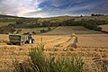 Harvest at Boghall - geograph.org.uk - 1048180.jpg 640 × 426; 95 KB
-
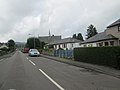 Heading in to Dunning in Perthshire - geograph.org.uk - 3571931.jpg 640 × 480; 45 KB
-
 Heather and forestry near Dunning - geograph.org.uk - 2187556.jpg 480 × 640; 94 KB
-
 Heathery Knowe - geograph.org.uk - 4995943.jpg 1,024 × 683; 304 KB
-
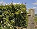 Hedge and gatepost - geograph.org.uk - 2392023.jpg 3,100 × 2,400; 1.35 MB
-
 Highland cow near Dunning - geograph.org.uk - 2187564.jpg 640 × 480; 110 KB
-
 Highlander and forestry near Dunning - geograph.org.uk - 2187526.jpg 640 × 480; 77 KB
-
 Hills around Littlerig - geograph.org.uk - 5571879.jpg 1,024 × 578; 331 KB
-
 House at Drum of Gavock - geograph.org.uk - 4233688.jpg 1,600 × 1,066; 664 KB
-
 Houses at Millhaugh - geograph.org.uk - 4233867.jpg 1,600 × 1,062; 640 KB
-
 Houses at Millhaugh - geograph.org.uk - 4233872.jpg 1,600 × 1,062; 729 KB
-
 Innerdouny clear fell - geograph.org.uk - 819327.jpg 640 × 480; 100 KB
-
 Innerdunning, a farm - geograph.org.uk - 5896620.jpg 1,600 × 928; 362 KB
-
 John's Hill - geograph.org.uk - 4996046.jpg 1,024 × 576; 290 KB
-
 John's Hill - Sim's Hill col - geograph.org.uk - 4996148.jpg 1,024 × 576; 327 KB
-
 Junction of roads (B934, B8062 and B9141) in Dunning - geograph.org.uk - 5559732.jpg 4,000 × 3,000; 2.89 MB
-
 Junction On Forestry Track - geograph.org.uk - 4608628.jpg 2,560 × 1,920; 2.06 MB
-
 Junction, Clow Hill - geograph.org.uk - 5801181.jpg 1,024 × 683; 350 KB
-
 Keltie Loch - geograph.org.uk - 5619913.jpg 1,600 × 1,067; 387 KB
-
 Kincladie Wood - geograph.org.uk - 4335194.jpg 800 × 533; 318 KB
-
 Kincladie Wood - geograph.org.uk - 4335197.jpg 800 × 533; 327 KB
-
 Kincladie Wood - geograph.org.uk - 4335198.jpg 800 × 533; 325 KB
-
 Kirk Wynd, Dunning - geograph.org.uk - 2687097.jpg 1,200 × 1,600; 288 KB
-
 Kirkstyle Inn at Dunning - geograph.org.uk - 2640160.jpg 1,600 × 1,200; 509 KB
-
 Kirkstyle Inn, Dunning - geograph.org.uk - 2000311.jpg 2,560 × 1,920; 1.94 MB
-
 Kirkstyle Inn, Dunning - geograph.org.uk - 4417914.jpg 750 × 509; 467 KB
-
 Kirkstyle Inn, Dunning - geograph.org.uk - 5800365.jpg 1,024 × 683; 316 KB
-
 Knowehead Forest Circular Path - geograph.org.uk - 5797982.jpg 1,024 × 683; 384 KB
-
 Lamb Hill - geograph.org.uk - 4996045.jpg 1,024 × 576; 258 KB
-
 Lamb Hill summit - geograph.org.uk - 4996040.jpg 1,024 × 683; 306 KB
-
 Level crossing at Whitemoss - geograph.org.uk - 5774558.jpg 1,600 × 1,067; 349 KB
-

-
 Little Law - geograph.org.uk - 4996104.jpg 1,024 × 576; 198 KB
-
 Little Rig - geograph.org.uk - 4995976.jpg 1,024 × 683; 282 KB
-
 Littlerig - geograph.org.uk - 4995974.jpg 1,024 × 1,024; 429 KB


_in_Dunning_-_geograph.org.uk_-_5559732.jpg)


&filefrom=Littlerigg+Forest+-+geograph.org.uk+-+3274286.jpg#mw-category-media)