Category:Dunterton
village and civil parish in Devon, England  | |||||
| Upload media | |||||
| Instance of | |||||
|---|---|---|---|---|---|
| Location | West Devon, Devon, South West England, England | ||||
| Population |
| ||||
 | |||||
Subcategories
This category has the following 2 subcategories, out of 2 total.
A
E
Media in category "Dunterton"
The following 27 files are in this category, out of 27 total.
-
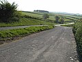
 Access road to Hardstone Farm - geograph.org.uk - 4642530.jpg 1,600 × 1,200; 1 MB
-
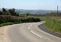 B3362 at Dunterton - geograph.org.uk - 4433782.jpg 1,920 × 1,331; 598 KB
-
 B3362 at Eastacott - geograph.org.uk - 797364.jpg 640 × 480; 96 KB
-
 B3362 east of Dunterton - geograph.org.uk - 793418.jpg 640 × 480; 112 KB
-
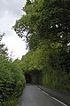 B3362 entering a tunnel-like wood - geograph.org.uk - 4642538.jpg 1,962 × 2,960; 3.73 MB
-
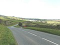
 B3362 near Sherril - geograph.org.uk - 4429932.jpg 2,787 × 1,912; 1.01 MB
-
 Boundary Marker, near Felldownhead - geograph.org.uk - 6707255.jpg 1,024 × 681; 334 KB
-
 Boundary stone near Felldownhead - geograph.org.uk - 4433751.jpg 1,920 × 2,560; 2.08 MB
-
 Churchyard, Dunterton - geograph.org.uk - 797517.jpg 640 × 480; 124 KB
-
 Countryside near Endsleigh - geograph.org.uk - 793489.jpg 640 × 480; 70 KB
-
 Dunterton Church - geograph.org.uk - 4642517.jpg 1,600 × 1,200; 1.33 MB
-
 Dunterton Church - geograph.org.uk - 4642528.jpg 1,600 × 1,067; 952 KB
-
 Dunterton Glebe - geograph.org.uk - 4429945.jpg 1,920 × 1,100; 446 KB
-
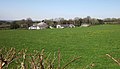
 Eastacott Barton - geograph.org.uk - 4642504.jpg 1,600 × 1,067; 915 KB
-
 Field by Dunterton Glebe - geograph.org.uk - 4433766.jpg 1,920 × 1,393; 619 KB
-
 Field entrance east of Felldownhead - geograph.org.uk - 4429940.jpg 1,920 × 2,421; 1.27 MB
-
 Greystone Bridge Tollhouse, Dunterton - geograph.org.uk - 6114511.jpg 640 × 384; 156 KB
-
 House by Greystone Bridge - geograph.org.uk - 4642545.jpg 1,600 × 1,200; 1.59 MB
-
 Junction on B3362 for Bradstone - geograph.org.uk - 4642512.jpg 1,600 × 1,067; 947 KB
-
 Lay-by near Eastacott Barton - geograph.org.uk - 1290090.jpg 640 × 480; 43 KB
-
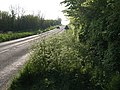
 Layby, Eastacott - geograph.org.uk - 793431.jpg 640 × 480; 96 KB
-

-
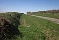
 Tamar valley - geograph.org.uk - 793390.jpg 640 × 480; 95 KB
-
 Tamar Valley Discovery Trail near Felldownhead - geograph.org.uk - 4433737.jpg 1,920 × 1,440; 1.02 MB
-
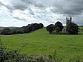 The isolation of Dunterton Church - geograph.org.uk - 4642521.jpg 1,600 × 1,200; 1.31 MB
-
 Turning for climbing centre at Eastacott - geograph.org.uk - 4642506.jpg 1,600 × 1,200; 1.15 MB
-
 Wood near Tredown - geograph.org.uk - 427454.jpg 640 × 480; 155 KB


.jpg)


