Category:Dyke, Moray
English: Dyke is a small village located between Elgin and Forres. It is situated near to Culbin Forest and the village also has its own primary school. The parish was known in Gaelic as 'Sgìre Dhìg'.
village in Moray, Scotland, UK  | |||||
| Upload media | |||||
| Instance of | |||||
|---|---|---|---|---|---|
| Location |
| ||||
 | |||||
Media in category "Dyke, Moray"
The following 103 files are in this category, out of 103 total.
-

-

-
 A Secluded House - geograph.org.uk - 793486.jpg 640 × 427; 284 KB
-
 Arlan - geograph.org.uk - 793442.jpg 640 × 427; 284 KB
-
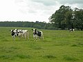
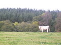
 Beef cattle near Glenshiel (farm), Moray - geograph.org.uk - 265095.jpg 640 × 480; 155 KB
-
 Berryley - geograph.org.uk - 794328.jpg 640 × 356; 194 KB
-
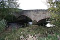 Bridge over Muckle Burn by Earlsmill. - geograph.org.uk - 273185.jpg 640 × 426; 143 KB
-
 Brodie Countryfare - geograph.org.uk - 253564.jpg 640 × 481; 78 KB
-
 Camping at Brodie - geograph.org.uk - 253551.jpg 640 × 481; 116 KB
-
 Cattle at Newton of Darnaway Farm. - geograph.org.uk - 200856.jpg 640 × 427; 80 KB
-
-
 Clear Fell Close Up - geograph.org.uk - 517371.jpg 466 × 600; 74 KB
-
 Conicavel Reservoir. - geograph.org.uk - 379563.jpg 640 × 426; 144 KB
-
 Cottage beside Dyke Parish Church - geograph.org.uk - 264645.jpg 640 × 480; 179 KB
-
 Cottage by Dyke Parish Church - geograph.org.uk - 820253.jpg 640 × 480; 99 KB
-
 Dalvey Smithy Cottages - geograph.org.uk - 264589.jpg 640 × 480; 170 KB
-

-
 Drainage ditch - geograph.org.uk - 371907.jpg 640 × 480; 133 KB
-
 Dyke graveyard - geograph.org.uk - 264649.jpg 640 × 480; 159 KB
-
 Earlsmill House. - geograph.org.uk - 273188.jpg 640 × 426; 158 KB
-
 East Lodge Dalvey House - geograph.org.uk - 264592.jpg 640 × 480; 202 KB
-

-

-
 Farmland at Newton of Darnaway - geograph.org.uk - 518073.jpg 640 × 480; 91 KB
-
 Feeding waterfowl - geograph.org.uk - 373307.jpg 640 × 480; 144 KB
-
 Field Dyke (stone wall) - geograph.org.uk - 265070.jpg 640 × 480; 168 KB
-
 Forest pool - geograph.org.uk - 371975.jpg 640 × 480; 156 KB
-
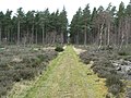
 Forest Track - geograph.org.uk - 517377.jpg 640 × 467; 146 KB
-
 Forestry Clear Fell - geograph.org.uk - 517370.jpg 640 × 480; 100 KB
-
 Forestry Road - geograph.org.uk - 517373.jpg 640 × 480; 107 KB
-
 Forestry track junction - geograph.org.uk - 372000.jpg 640 × 480; 136 KB
-
 Forres Angling Association. - geograph.org.uk - 273100.jpg 640 × 448; 158 KB
-
 Friesian Cattle - geograph.org.uk - 518074.jpg 640 × 480; 76 KB
-
 Giant Hogweed, Beware^^^^^ - geograph.org.uk - 200862.jpg 640 × 427; 144 KB
-
 Glenshiel (farm) - geograph.org.uk - 257458.jpg 640 × 480; 144 KB
-
 Glenshiel (farm) buildings - geograph.org.uk - 265101.jpg 640 × 480; 166 KB
-
 Gorge on the Muckle Burn - geograph.org.uk - 265083.jpg 640 × 480; 181 KB
-

-
 Horses at Whitemire. - geograph.org.uk - 579741.jpg 640 × 480; 202 KB
-

-
 Looking towards Redstone, Morayshire. - geograph.org.uk - 200851.jpg 640 × 427; 94 KB
-

-

-
 Near Bothiewalls (farm) - geograph.org.uk - 265109.jpg 640 × 480; 203 KB
-
 Near Glenshiel (farm), Moray - geograph.org.uk - 265091.jpg 640 × 480; 152 KB
-
 Newton of Dalvey. - geograph.org.uk - 273134.jpg 640 × 426; 79 KB
-
 Newton of Darnaway - geograph.org.uk - 518068.jpg 450 × 600; 63 KB
-
 Newton of Darnaway - geograph.org.uk - 518069.jpg 640 × 480; 101 KB
-
 Path to Kintessack via Culbin Forest - geograph.org.uk - 251949.jpg 640 × 480; 391 KB
-
 Railway bridge south of Banarach Farm. - geograph.org.uk - 273118.jpg 640 × 426; 131 KB
-
 Railway cutting west of Forres - geograph.org.uk - 264597.jpg 640 × 480; 190 KB
-
-
-
 Shaggy Ink Cap or Coprinus comatus. - geograph.org.uk - 275259.jpg 640 × 426; 122 KB
-
 Silver survivors - geograph.org.uk - 371993.jpg 640 × 480; 113 KB
-

-

-
 The Ancient Pump at Whitemires - geograph.org.uk - 579737.jpg 640 × 480; 285 KB
-
 The Burying Place of The Moray Family - geograph.org.uk - 820236.jpg 640 × 480; 88 KB
-
 The Forest Floor - geograph.org.uk - 579666.jpg 640 × 480; 279 KB
-
 The Muckle burn south of Feddan. - geograph.org.uk - 273181.jpg 640 × 426; 165 KB
-
 The Old Kirk - geograph.org.uk - 264641.jpg 640 × 480; 186 KB
-
 The Old Kirk at Dyke - geograph.org.uk - 887233.jpg 640 × 480; 74 KB
-
 The Old Smiddy - geograph.org.uk - 264583.jpg 640 × 480; 167 KB
-

-
 The Sluie Walk, Morayshire. - geograph.org.uk - 250035.jpg 640 × 426; 116 KB
-
 The Track to Oldpots - geograph.org.uk - 579658.jpg 640 × 480; 210 KB
-
 This is My Patch. - geograph.org.uk - 579745.jpg 640 × 480; 187 KB
-
 Thistles - extra tall - geograph.org.uk - 476736.jpg 640 × 427; 154 KB
-
 Track through Low Wood - geograph.org.uk - 372004.jpg 640 × 480; 134 KB
-
 Triangulation Pillar identity plate - geograph.org.uk - 251734.jpg 640 × 441; 385 KB
-
 Unplanted ground - geograph.org.uk - 371980.jpg 640 × 480; 52 KB
-
 Unusual Tree Trunk at Brodie Castle - geograph.org.uk - 704534.jpg 640 × 480; 127 KB
-
 Whitemire Farm - geograph.org.uk - 257444.jpg 640 × 480; 160 KB
-
 Whitemire hamlet - geograph.org.uk - 579739.jpg 640 × 480; 191 KB
-
 Whitemire Village - geograph.org.uk - 257450.jpg 640 × 480; 170 KB
-
 Whitemire Village - geograph.org.uk - 265079.jpg 640 × 480; 148 KB
-
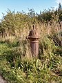 Whitemire village pump - geograph.org.uk - 265074.jpg 480 × 640; 205 KB
-
 Woods near Darnaway Castle - geograph.org.uk - 124216.jpg 640 × 427; 155 KB
-
 Young conifers - geograph.org.uk - 371968.jpg 640 × 480; 122 KB
-

-
 Approaching Dyke from the southwest. - geograph.org.uk - 200876.jpg 640 × 427; 123 KB
-
 Bankhead (farm), Dyke - geograph.org.uk - 246080.jpg 640 × 441; 407 KB
-
 Bankhead (farm), Dyke - geograph.org.uk - 246098.jpg 640 × 441; 280 KB
-
 Building dated 1892 - geograph.org.uk - 657579.jpg 640 × 426; 155 KB
-
 Cottage at Loanhead, near Dyke - geograph.org.uk - 246124.jpg 640 × 480; 358 KB
-
 Cotterton (farm) near Dyke - geograph.org.uk - 246157.jpg 640 × 480; 302 KB
-
 Cran Loch - geograph.org.uk - 371891.jpg 640 × 480; 121 KB
-
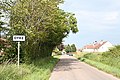
 Entering Conicavel from the north west. - geograph.org.uk - 200854.jpg 640 × 427; 104 KB
-

-
 Findhorn Gorge - geograph.org.uk - 13213.jpg 434 × 640; 244 KB
-
 Forestry Road, Culbin Forest - geograph.org.uk - 246114.jpg 640 × 480; 439 KB
-

-

-
 Muirside (farm), Dyke - geograph.org.uk - 246106.jpg 640 × 480; 301 KB
-
 Riding School at Mundole, Morayshire. - geograph.org.uk - 249986.jpg 640 × 410; 67 KB
-
 River Findhorn - geograph.org.uk - 13196.jpg 434 × 640; 211 KB
-
 River Findhorn, Limekilns Wood - geograph.org.uk - 56542.jpg 640 × 424; 130 KB
-
-
 Roadside steadings east of Whitemire. - geograph.org.uk - 200849.jpg 640 × 427; 63 KB
-

-
 The old school at Darnaway. - geograph.org.uk - 200873.jpg 640 × 427; 83 KB
-
 Triangulation Pillar near Dyke - geograph.org.uk - 246136.jpg 640 × 480; 333 KB


,_Moray_-_geograph.org.uk_-_265095.jpg)


_-_geograph.org.uk_-_265070.jpg)


_-_geograph.org.uk_-_257458.jpg)
_buildings_-_geograph.org.uk_-_265101.jpg)


_-_geograph.org.uk_-_265109.jpg)
,_Moray_-_geograph.org.uk_-_265091.jpg)


,_Dyke_-_geograph.org.uk_-_246080.jpg)
,_Dyke_-_geograph.org.uk_-_246098.jpg)


_near_Dyke_-_geograph.org.uk_-_246157.jpg)


_-_geograph.org.uk_-_246182.jpg)
,_Dyke_-_geograph.org.uk_-_246106.jpg)


