Category:Dyserth
village in Denbighshire, Wales, UK   | |||||
| Upload media | |||||
| Pronunciation audio | |||||
|---|---|---|---|---|---|
| Instance of | |||||
| Location | Denbighshire, Wales, UK | ||||
| Population |
| ||||
| Area |
| ||||
 | |||||
Cymraeg: Pentref canolig ei faint yn Sir Ddinbych, gogledd-ddwyrain Cymru, yw Diserth (ffurf Saesneg: Dyserth). Poblogaeth 2566 (Cyfrifiad 2001). Mae'n gorwedd ychydig o filltiroedd i'r de o Brestatyn ac i'r dwyrain o dref Rhuddlan.
English: Dyserth is a village in Denbighshire, Wales. Population : 2,566 (United Kingdom Census 2001). Its main features are the extensive quarrying remains, its waterfalls, railway line (former LNWR, closed in 1930, and now footpath), and mountain (Moel Hiraddug).
Subcategories
This category has the following 5 subcategories, out of 5 total.
Media in category "Dyserth"
The following 124 files are in this category, out of 124 total.
-
 5151 Curve - geograph.org.uk - 2191188.jpg 4,000 × 3,000; 5.87 MB
-
 A domestic cow (Bos taurus) in a field, near Denbigh and Flintshire.jpg 4,608 × 2,128; 5.21 MB
-
 A steep stile on Offa's Dyke Path - geograph.org.uk - 2056963.jpg 640 × 480; 107 KB
-
 Afon Ffyddion - geograph.org.uk - 6362921.jpg 4,000 × 3,000; 2.87 MB
-
 Afon Ffyddion - geograph.org.uk - 658197.jpg 480 × 640; 136 KB
-
 Afon Ffyddion, Dyserth - geograph.org.uk - 5767026.jpg 1,280 × 851; 499 KB
-
 Afon Ffyddion, Dyserth - geograph.org.uk - 672621.jpg 480 × 640; 126 KB
-
 Arable field next to the Offa's Dyke path - geograph.org.uk - 6155499.jpg 1,024 × 683; 227 KB
-
 Autumn at the Graveyard.jpg 1,664 × 2,496; 3.43 MB
-
 Bench beside a cycleway - geograph.org.uk - 2631405.jpg 640 × 480; 196 KB
-
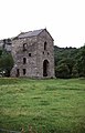
 Bodrhyddan Hall - geograph.org.uk - 29588.jpg 448 × 336; 39 KB
-
 Bodryhyddan Old Park - geograph.org.uk - 5584525.jpg 1,280 × 960; 1.27 MB
-
 Bridge on the cycleway - geograph.org.uk - 2631407.jpg 640 × 480; 177 KB
-
 Capel Dyserth Chapel - geograph.org.uk - 3840876.jpg 1,024 × 667; 103 KB
-
 Capel Dyserth Chapel - geograph.org.uk - 6059570.jpg 4,000 × 3,000; 2.68 MB
-
 Cereal crop by Llewerllyd Farm - geograph.org.uk - 3577901.jpg 1,024 × 768; 154 KB
-
 Chalets below Graig Fawr - geograph.org.uk - 2748473.jpg 640 × 480; 142 KB
-
-

-

-

-

-

-

-
 Crane from Dyserth Railway (enhanced).jpg 960 × 720; 169 KB
-
 Cwm Road on the outskirts of Dyserth - geograph.org.uk - 5987244.jpg 4,000 × 3,000; 3.51 MB
-
 Cwm Road, Dyserth - geograph.org.uk - 5987245.jpg 4,000 × 3,000; 3.95 MB
-
 Datestone, limekiln, Ffordd y Foel, Dyserth - geograph.org.uk - 6150672.jpg 1,280 × 853; 530 KB
-

-
 Disert.jpeg 800 × 449; 175 KB
-
 Dyserth - geograph.org.uk - 5767053.jpg 1,280 × 851; 694 KB
-
 Dyserth - geograph.org.uk - 658201.jpg 640 × 480; 84 KB
-
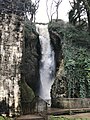 Dyserth Falls - geograph.org.uk - 6369674.jpg 810 × 1,080; 252 KB
-

-
 Dyserth Quarry - site of Dyserth Castle - geograph.org.uk - 6205823.jpg 1,024 × 768; 1.35 MB
-
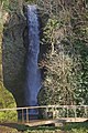 Dyserth Waterfall - geograph.org.uk - 2306500.jpg 856 × 1,280; 349 KB
-
 Dyserth Waterfall - geograph.org.uk - 4392069.jpg 480 × 640; 113 KB
-
 Dyserth Waterfall - geograph.org.uk - 5766999.jpg 851 × 1,280; 481 KB
-
 Dyserth Waterfall - geograph.org.uk - 6205827.jpg 565 × 800; 598 KB
-
 Dyserth Waterfall Shop - geograph.org.uk - 672618.jpg 640 × 435; 90 KB
-
 Dyserth Waterfalls - geograph.org.uk - 4392060.jpg 640 × 480; 120 KB
-
-

-
 Dyserth, red telephone box - geograph.org.uk - 3605041.jpg 640 × 480; 81 KB
-
 Dyserth, the waterfall - geograph.org.uk - 3605045.jpg 480 × 640; 119 KB
-
 Entrance to Graig Fawr - geograph.org.uk - 6370420.jpg 5,184 × 3,888; 3.95 MB
-
 Farm road to Aberkinsey Farm - geograph.org.uk - 4890048.jpg 640 × 480; 89 KB
-
 Farmland near Dyserth - geograph.org.uk - 4890292.jpg 640 × 480; 60 KB
-
 Ffordd Uchaf Foel, Dyserth - geograph.org.uk - 6150686.jpg 1,280 × 853; 404 KB
-
 Ffordd y Foel, Dyserth - geograph.org.uk - 6150693.jpg 1,280 × 837; 407 KB
-
 Field edge footpath north of Dyserth - geograph.org.uk - 2748403.jpg 640 × 480; 44 KB
-
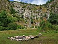
 Field with grazing sheep near Melidan - geograph.org.uk - 4890051.jpg 640 × 480; 108 KB
-
 Footpath from Dyserth to Marian Mills - geograph.org.uk - 6362918.jpg 4,000 × 3,000; 2.91 MB
-

-
 Graig Fawr trig point (153m) - geograph.org.uk - 6369706.jpg 5,184 × 3,888; 4.49 MB
-
 Grass footpath on Graig Fawr - geograph.org.uk - 5987257.jpg 4,000 × 3,000; 3.59 MB
-
 High Street (A5151) in Dyserth - geograph.org.uk - 5987247.jpg 4,000 × 3,000; 3.17 MB
-
 High Street (A5151) in Dyserth - geograph.org.uk - 5987251.jpg 4,000 × 3,000; 3.06 MB
-
 Horse at Bodrhyddan - geograph.org.uk - 5584431.jpg 1,280 × 960; 1.16 MB
-
 In Fields south of Meliden - geograph.org.uk - 1336059.jpg 640 × 480; 120 KB
-

-
 Limekiln, Ffordd y Foel, Dyserth - geograph.org.uk - 6150670.jpg 817 × 1,280; 535 KB
-
 Llwybr Clawdd Offa - Offa's Dyke Path - geograph.org.uk - 3953763.jpg 3,264 × 2,448; 3.56 MB
-
 Long Acre Cottages - geograph.org.uk - 4890291.jpg 640 × 480; 84 KB
-
 Lower Foel Road in Dyserth - geograph.org.uk - 29577.jpg 369 × 308; 26 KB
-

-
 No entry^ - geograph.org.uk - 6567959.jpg 4,000 × 3,000; 2.65 MB
-
 Offa's Dyke Path - geograph.org.uk - 6566867.jpg 4,000 × 3,000; 2.21 MB
-
 Offa's dyke path crossing a field - geograph.org.uk - 6155509.jpg 1,024 × 683; 170 KB
-
 Offa's Dyke Path passes through a wheat field - geograph.org.uk - 6566871.jpg 4,000 × 3,000; 2.82 MB
-
 Offa's Dyke Path signpost - geograph.org.uk - 6566863.jpg 4,000 × 3,000; 2.89 MB
-
 Old crane beside railway path at Dyserth - geograph.org.uk - 4755368.jpg 1,024 × 768; 290 KB
-
 Old Park - geograph.org.uk - 5584063.jpg 1,280 × 960; 1.16 MB
-
 Ordnance Survey Flush Bracket G2911 - geograph.org.uk - 5988253.jpg 4,000 × 3,000; 4.07 MB
-
 Ordnance Survey Fundamental Bench Mark - geograph.org.uk - 5988771.jpg 4,000 × 3,000; 4.9 MB
-
 Parish Church of St Bridget, Dyserth - geograph.org.uk - 6369668.jpg 5,184 × 3,888; 3.21 MB
-
 Part of the Prestatyn-Dyserth Way - geograph.org.uk - 2748421.jpg 640 × 480; 134 KB
-
 Part of the Prestatyn-Dyserth Way - geograph.org.uk - 2748445.jpg 640 × 480; 140 KB
-
 Path onto Graig Fawr hill - geograph.org.uk - 2748396.jpg 640 × 480; 74 KB
-
 Pen y Waen Cottage - geograph.org.uk - 6610906.jpg 3,755 × 2,450; 3.91 MB
-
 Pick your colour of bus or coach - geograph.org.uk - 3996921.jpg 640 × 480; 74 KB
-
 Private Road to Llewerllyd Farm - geograph.org.uk - 4890247.jpg 640 × 480; 60 KB
-
 Railway Bridge facing Dyserth.jpg 1,024 × 685; 694 KB
-
 Reception committee on Graig Fawr - geograph.org.uk - 6369708.jpg 5,184 × 3,888; 3.77 MB
-
 Red Lion, Dyserth - geograph.org.uk - 2306036.jpg 1,280 × 856; 158 KB
-
 Red Lion, Dyserth - geograph.org.uk - 2307350.jpg 1,280 × 856; 215 KB
-
 Rhydwen Farm Mews - geograph.org.uk - 32190.jpg 576 × 432; 54 KB
-

-
 Rocky Stream (enhanced).jpg 960 × 720; 208 KB
-
 Rocky Stream.jpg 4,896 × 3,672; 9.03 MB
-
 Slightly overgrown stile on the Offa's Dyke Path - geograph.org.uk - 6567952.jpg 4,000 × 3,000; 2.89 MB
-
 Step Up - geograph.org.uk - 2191193.jpg 3,000 × 4,000; 4.44 MB
-
 Stile and hedge on Offa's Dyke path - geograph.org.uk - 6155502.jpg 1,024 × 683; 311 KB
-
 Stile near Ty Newydd - geograph.org.uk - 2631431.jpg 640 × 480; 128 KB
-

-
 Tafarn Newydd - New Inn, Dyserth - geograph.org.uk - 658202.jpg 640 × 480; 71 KB
-
 Tearooms at Dyserth waterfalls - geograph.org.uk - 29583.jpg 420 × 331; 48 KB
-
 The A5151 near Ty Newydd - geograph.org.uk - 6155494.jpg 1,024 × 683; 160 KB
-
 The cycleway-footpath to Prestatyn - geograph.org.uk - 2631415.jpg 640 × 480; 137 KB
-
 The Dyserth Falls - geograph.org.uk - 6135563.jpg 3,591 × 5,387; 6.81 MB
-
 The Falls are fallen - geograph.org.uk - 6150718.jpg 1,280 × 853; 317 KB
-
 The grounds of Bodrhyddan Hall - geograph.org.uk - 5019585.jpg 5,184 × 3,456; 6.08 MB
-
 The Old Crown, Meliden - geograph.org.uk - 4890227.jpg 640 × 480; 65 KB
-
 The Parterre at Bodrhyddan Hall - geograph.org.uk - 5025045.jpg 5,184 × 3,456; 7.62 MB
-
 Tre-castell - geograph.org.uk - 5569166.jpg 640 × 447; 56 KB
-
 View from Ffordd Uchaf Foel, Dyserth - geograph.org.uk - 6150684.jpg 1,280 × 854; 305 KB
-
 View from Ffordd Uchaf Foel, Dyserth - geograph.org.uk - 6150685.jpg 1,280 × 853; 318 KB
-
 View towards Moel Hiraddug - geograph.org.uk - 5021145.jpg 4,184 × 2,789; 3.81 MB
-
 Voel Coaches at Dyserth - geograph.org.uk - 3996083.jpg 640 × 480; 101 KB
-
 Voel Coaches depot - geograph.org.uk - 4890235.jpg 640 × 480; 66 KB
-
 Voel, Voel, Voel and Voel - geograph.org.uk - 4009920.jpg 640 × 480; 69 KB
-
 Wales Denbighshire Community Dyserth map.svg 512 × 773; 560 KB
-
 Western panorama to Snowdonia from Graig Fawr, Meliden 1951 - geograph.org.uk - 4226731.jpg 2,393 × 1,413; 1.48 MB
-
 Wheat fields and farmhouse - geograph.org.uk - 30647.jpg 512 × 384; 22 KB
-
 Y Bodunig - geograph.org.uk - 6059562.jpg 4,000 × 3,000; 2.21 MB
-
 Y Llew Coch - The Red Lion, Dyserth - geograph.org.uk - 6369672.jpg 4,586 × 3,421; 2.31 MB
-
 Y Llew Coch - The Red Lion, Dyserth - geograph.org.uk - 657675.jpg 640 × 480; 69 KB
-
 Cottages at Long Acre - geograph.org.uk - 30431.jpg 512 × 384; 36 KB
-
 Country lane at Dyserth - geograph.org.uk - 30712.jpg 512 × 384; 41 KB
-
 Disused farm building - geograph.org.uk - 26226.jpg 384 × 288; 26 KB
-
 Fields at Spital - geograph.org.uk - 25389.jpg 448 × 336; 25 KB
-
 Locals at Siamber Wen - geograph.org.uk - 27725.jpg 512 × 384; 50 KB
-
 Marian-bach farm near Cwm - geograph.org.uk - 542260.jpg 640 × 480; 86 KB
-
 Ruin near the Graig Park Hotel. - geograph.org.uk - 671382.jpg 480 × 640; 86 KB

_in_a_field,_near_Denbigh_and_Flintshire.jpg)


.jpg)


_-_geograph.org.uk_-_2748436.jpg)
_-_geograph.org.uk_-_6369706.jpg)

_in_Dyserth_-_geograph.org.uk_-_5987247.jpg)
_in_Dyserth_-_geograph.org.uk_-_5987251.jpg)


.jpg)


