Category:Earith
village and civil parish in the Fens of Cambridgeshire, England  | |||||
| Upload media | |||||
| Instance of | |||||
|---|---|---|---|---|---|
| Location | Huntingdonshire, Cambridgeshire, East of England, England | ||||
 | |||||
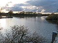
English: Earith is a village in the Fens of Cambridgeshire, England, south of Chatteris and east of Huntingdon. At Earith, two artificial diversion channels of the River Great Ouse, the Old Bedford River and the New Bedford River, leave the river on a course to Denver Sluice near Downham Market, where they rejoin the Great Ouse in its tidal part.
Nederlands: Earith is een dorp (village en civil parish) in het Engelse graafschap Cambridgeshire. Het dorp ligt in het district Fenland en telt 1677 inwoners.
Subcategories
This category has the following 5 subcategories, out of 5 total.
Media in category "Earith"
The following 200 files are in this category, out of 217 total.
(previous page) (next page)-
 100 Foot River at south end - geograph.org.uk - 6064730.jpg 1,024 × 768; 245 KB
-
 A1123 across Ouse Washes - geograph.org.uk - 4664729.jpg 2,560 × 1,920; 2.11 MB
-
 A1123 enters Earith - geograph.org.uk - 6064365.jpg 1,024 × 684; 220 KB
-
 Adelaide Walk, Earith - geograph.org.uk - 4819738.jpg 1,600 × 1,118; 764 KB
-
 Allotments in Earith - geograph.org.uk - 4745085.jpg 4,320 × 3,240; 5.64 MB
-
 Ashmire, Meadow Drove, Earith - geograph.org.uk - 4746361.jpg 4,320 × 3,240; 5.96 MB
-
 Baling - geograph.org.uk - 3349939.jpg 640 × 469; 52 KB
-
 Baling the straw - geograph.org.uk - 3349940.jpg 640 × 465; 51 KB
-
 Boarded up house in Earith - geograph.org.uk - 4058726.jpg 1,600 × 1,277; 784 KB
-
 Brackhill Fen Drove - geograph.org.uk - 3230485.jpg 1,600 × 1,200; 860 KB
-

-
 Bridge Farm - geograph.org.uk - 3230475.jpg 1,600 × 1,200; 595 KB
-
 Bridleway to Earith Bulwark - geograph.org.uk - 4819925.jpg 1,600 × 1,195; 1.66 MB
-
 Bridleway to nowhere - geograph.org.uk - 3165066.jpg 1,600 × 1,200; 747 KB
-
 Campsite and fishing lake, Earith - geograph.org.uk - 4819742.jpg 1,600 × 1,200; 947 KB
-
 Catchwater Drain - geograph.org.uk - 3230510.jpg 1,600 × 1,200; 781 KB
-
 Cattle and Cattle Egret - geograph.org.uk - 5970987.jpg 1,600 × 1,145; 350 KB
-
 Cattle on the Ouse Washes - geograph.org.uk - 5983699.jpg 1,600 × 1,160; 234 KB
-
 Chapel Road, Earith - geograph.org.uk - 4819734.jpg 1,600 × 1,200; 896 KB
-
 Civil War earthworks - geograph.org.uk - 4819936.jpg 1,600 × 1,200; 1.21 MB
-
 Civil War fort earthworks - geograph.org.uk - 3165015.jpg 1,600 × 1,200; 687 KB
-
 Civil War fort earthworks - geograph.org.uk - 3165043.jpg 1,600 × 1,267; 779 KB
-
 Colne Road (B1050), Earith - geograph.org.uk - 5287627.jpg 640 × 480; 89 KB
-
 Colne Road - geograph.org.uk - 4739227.jpg 640 × 480; 50 KB
-
 Colne Road, Earith - geograph.org.uk - 3485675.jpg 4,320 × 3,240; 2.91 MB
-
 Cook's Drove, Earith - geograph.org.uk - 4819740.jpg 1,600 × 1,200; 1.08 MB
-
 Crossing cottage - geograph.org.uk - 440025.jpg 640 × 426; 117 KB
-
 Dead otter near Earith - The Ouse Washes - geograph.org.uk - 6321070.jpg 5,184 × 3,887; 7.58 MB
-
 Depot on Meadow Drove - geograph.org.uk - 4819748.jpg 1,600 × 1,200; 722 KB
-
 Ditch near The Bulwark - The Ouse Washes - geograph.org.uk - 6321055.jpg 5,184 × 3,888; 5.71 MB
-
 Ditch off Rhee Lake Drove - geograph.org.uk - 3230499.jpg 1,600 × 1,200; 685 KB
-
 Ditch off Rhee Lake Drove - geograph.org.uk - 3230502.jpg 1,600 × 1,200; 819 KB
-
 Drying sheds, Bridge Farm - geograph.org.uk - 3230478.jpg 1,600 × 1,200; 590 KB
-
 Earith Bridge - geograph.org.uk - 4739210.jpg 640 × 480; 91 KB
-
 Earith Bulwark - geograph.org.uk - 4790918.jpg 640 × 480; 84 KB
-
 Earith Bulwark - geograph.org.uk - 4819761.jpg 1,600 × 1,200; 1,011 KB
-
 Earith Bulwark - geograph.org.uk - 4819929.jpg 1,600 × 1,200; 1.04 MB
-
 Earith Bulwark - geograph.org.uk - 4819932.jpg 1,600 × 1,200; 1.17 MB
-
 Earith Bulwark - geograph.org.uk - 6065348.jpg 1,024 × 684; 208 KB
-
 Earith Business Park - geograph.org.uk - 3230405.jpg 1,600 × 1,200; 935 KB
-
 Earith entrance sign - geograph.org.uk - 2290280.jpg 640 × 480; 34 KB
-
 Earith gravel pits - geograph.org.uk - 3230455.jpg 1,600 × 1,200; 957 KB
-
 Earith gravel pits - geograph.org.uk - 3230462.jpg 1,600 × 1,200; 893 KB
-
 Earith gravel pits - geograph.org.uk - 3230495.jpg 1,600 × 1,200; 950 KB
-
 Earith Lake Fisheries - geograph.org.uk - 3349918.jpg 640 × 470; 51 KB
-
 Earith Lake Fisheries lakeside - geograph.org.uk - 3349919.jpg 640 × 478; 49 KB
-
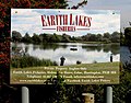 Earith Lake Fisheries sign - geograph.org.uk - 3349920.jpg 640 × 504; 73 KB
-
 Earith Lakes Fisheries - geograph.org.uk - 4270745.jpg 1,600 × 1,200; 606 KB
-
 Earith Village Hall - geograph.org.uk - 4664735.jpg 2,560 × 1,920; 1.69 MB
-
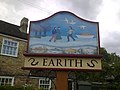 Earith Village Sign - geograph.org.uk - 2667467.jpg 720 × 540; 74 KB
-
 Earith village sign - geograph.org.uk - 3485716.jpg 3,240 × 4,320; 3.4 MB
-
 Earith, at the south end of the Hundred Foot Washes - geograph.org.uk - 5164911.jpg 1,024 × 768; 1.21 MB
-

-
 Edge of Earith Bulwark - geograph.org.uk - 4819926.jpg 1,600 × 1,200; 1.25 MB
-
-
 End of Rhee Lake Drove - geograph.org.uk - 3230512.jpg 1,600 × 1,200; 688 KB
-
 Entering Earith Bridge - geograph.org.uk - 5287642.jpg 640 × 480; 94 KB
-
 Fallen branch - The Ouse Washes - geograph.org.uk - 6320748.jpg 5,184 × 3,888; 7.09 MB
-
 Farm buildings by A1123 - geograph.org.uk - 4437178.jpg 1,600 × 1,200; 575 KB
-
 Fenland Fisheries - geograph.org.uk - 3230418.jpg 1,600 × 1,200; 1.21 MB
-
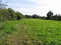
 Field by Earith - geograph.org.uk - 4819745.jpg 1,600 × 1,200; 1.14 MB
-
 Field path between Colne & Earith, Huntingdonshire - geograph-4188030.jpg 4,608 × 3,440; 4.41 MB
-
 Fields by Earith - geograph.org.uk - 4637314.jpg 1,600 × 1,200; 881 KB
-
 Fields by Meadow Drove - geograph.org.uk - 3230468.jpg 1,600 × 1,200; 925 KB
-
 Fisheries Entrance^ - geograph.org.uk - 3349935.jpg 640 × 483; 58 KB
-
 Fishing lake at Ashmire, Earith - geograph.org.uk - 4746364.jpg 4,320 × 3,240; 5.91 MB
-
 Fishing lake near Colne - geograph.org.uk - 4746347.jpg 4,320 × 3,240; 5.52 MB
-
 Fishing lake near to Earith - geograph.org.uk - 3349921.jpg 640 × 486; 105 KB
-
 Fishing point, Earith gravel pits - geograph.org.uk - 3230437.jpg 1,600 × 1,200; 1.01 MB
-
 Flood meadow by the Great Ouse - geograph.org.uk - 4819711.jpg 1,600 × 1,200; 1.04 MB
-
 Flooded field near Earith - geograph.org.uk - 4794707.jpg 4,320 × 3,240; 5.53 MB
-
 Flooded fields near Earith Bridge - geograph.org.uk - 632312.jpg 640 × 427; 89 KB
-
 Flooded land, north of Earith Bridge - geograph.org.uk - 5815368.jpg 1,024 × 768; 290 KB
-
 Flooding near Earith - geograph.org.uk - 4794709.jpg 4,320 × 3,240; 5.44 MB
-
 Flooding near The Bulwark - The Ouse Washes - geograph.org.uk - 6321002.jpg 5,184 × 3,888; 5.51 MB
-
 Footpath around Earith gravel pits - geograph.org.uk - 3230696.jpg 1,600 × 1,200; 855 KB
-
 Footpath around Earith gravel pits - geograph.org.uk - 3230710.jpg 1,600 × 1,200; 976 KB
-
 Footpath by Old Bedford River - geograph.org.uk - 4637307.jpg 1,600 × 1,200; 826 KB
-

-
 Footpath through Earith gravel pits - geograph.org.uk - 3230434.jpg 1,600 × 1,200; 868 KB
-
 Footpath to Earith - geograph.org.uk - 3349922.jpg 640 × 480; 66 KB
-
 Footpath to Earith - geograph.org.uk - 4637304.jpg 1,600 × 1,200; 716 KB
-
 Former bridge supports - geograph.org.uk - 4664720.jpg 2,560 × 1,920; 1.69 MB
-
 Former Wesleyan Chapel, Earith - geograph.org.uk - 4819731.jpg 1,600 × 1,185; 786 KB
-
 Gate on the river bank - The Ouse Washes - geograph.org.uk - 6320714.jpg 5,013 × 3,759; 4.32 MB
-
 Gravel works beyond - geograph.org.uk - 413964.jpg 640 × 480; 119 KB
-
 Great Ouse barrier - geograph.org.uk - 632318.jpg 640 × 427; 57 KB
-
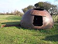 Gun Emplacement - geograph.org.uk - 4790909.jpg 640 × 480; 110 KB
-
 Gun turret - The Ouse Washes - geograph.org.uk - 6320784.jpg 5,184 × 3,888; 5.93 MB
-
 Hawamahall, Earith gravel pits - geograph.org.uk - 3230690.jpg 1,600 × 1,200; 860 KB
-
 Hereward, Earith - geograph.org.uk - 4819739.jpg 1,600 × 1,221; 796 KB
-
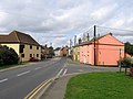
 High Street (A1123), Earith - geograph.org.uk - 5287530.jpg 640 × 480; 70 KB
-
 High Street and the Crown pub, Earith - geograph.org.uk - 3485728.jpg 4,320 × 3,240; 2.87 MB
-
 High Street, Earith - geograph.org.uk - 4664750.jpg 2,560 × 1,920; 1.33 MB
-
 High Street, Earith - geograph.org.uk - 4664752.jpg 2,560 × 1,920; 1.18 MB
-
 High Street, Earith - geograph.org.uk - 4819726.jpg 1,600 × 1,204; 807 KB
-
 High Street, Earith - geograph.org.uk - 4819728.jpg 1,600 × 1,200; 703 KB
-
 High Street, Earith - geograph.org.uk - 5248212.jpg 1,280 × 960; 294 KB
-
 High Street, Earith, Cambs - geograph.org.uk - 227320.jpg 640 × 480; 272 KB
-
 Holme Drove - geograph.org.uk - 3230685.jpg 1,600 × 1,200; 1.03 MB
-
 House in Cook's Drive - geograph.org.uk - 2549371.jpg 640 × 428; 63 KB
-
 House in Earith - geograph.org.uk - 4664733.jpg 2,560 × 1,920; 1.13 MB
-
 Houses on High Street, Earith - geograph.org.uk - 5287525.jpg 640 × 482; 61 KB
-
 Houses through the trees - geograph.org.uk - 1734596.jpg 2,848 × 2,136; 3.05 MB
-
 Hundred Foot River - geograph.org.uk - 3164925.jpg 1,600 × 1,200; 741 KB
-
 Hundred Foot Washes - geograph.org.uk - 4637319.jpg 1,600 × 1,200; 677 KB
-
 Joining the main road in Earith - geograph.org.uk - 5888159.jpg 1,600 × 900; 333 KB
-
 Junction of Chapel Road and Colne Road, Earith - geograph.org.uk - 3485711.jpg 4,320 × 3,240; 2.94 MB
-
-
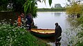 Launching on the River Great Ouse - geograph.org.uk - 5773715.jpg 800 × 449; 112 KB
-
 Little Fen - geograph.org.uk - 4819705.jpg 1,600 × 1,200; 754 KB
-
 Looking towards Holme Fen Drove - geograph.org.uk - 3230704.jpg 1,600 × 1,200; 586 KB
-
 Meadow Drove - geograph.org.uk - 3230427.jpg 1,600 × 1,200; 1.24 MB
-
 Meadow Drove - geograph.org.uk - 3349923.jpg 640 × 473; 78 KB
-
 Meadow Drove - geograph.org.uk - 3349941.jpg 640 × 470; 59 KB
-
 Meadow Drove away from Earith - geograph.org.uk - 3349936.jpg 640 × 466; 71 KB
-
 Meadow Drove towards Earith - geograph.org.uk - 3349937.jpg 640 × 471; 60 KB
-
 Meadow Drove-Holme Drove junction - geograph.org.uk - 3349924.jpg 640 × 470; 59 KB
-
 Memorial to a mid-air crash at Earith - geograph.org.uk - 6420196.jpg 4,608 × 3,072; 7.43 MB
-
 Memorial to a mid-air crash at Earith - geograph.org.uk - 6420197.jpg 4,608 × 3,072; 5.15 MB
-
 Microptilium pulchellum (Allibert, 1844) (3761757069).jpg 2,331 × 1,352; 322 KB
-
 Near Earith Bridge - The Ouse Washes - geograph.org.uk - 6320703.jpg 5,184 × 3,888; 4.59 MB
-
 New access gate to Earith Bulwark site - geograph.org.uk - 6065612.jpg 1,024 × 768; 370 KB
-
 New Bedford River - geograph.org.uk - 4586386.jpg 2,560 × 1,920; 1.4 MB
-
 New Bedford River - geograph.org.uk - 4636896.jpg 1,600 × 1,200; 669 KB
-
 New Bedford River and Ouse Washes - geograph.org.uk - 4636894.jpg 1,600 × 1,200; 602 KB
-
 New Bedford River or Hundred Foot Drain - geograph.org.uk - 5815355.jpg 1,024 × 768; 275 KB
-

-
 New Bedford River, Earith Bridge - geograph.org.uk - 5287638.jpg 640 × 480; 36 KB
-
 New gravel pit - geograph.org.uk - 3230655.jpg 1,600 × 1,200; 670 KB
-
 New gravel pit by Rhee Lake Drove - geograph.org.uk - 3230482.jpg 1,600 × 1,200; 525 KB
-
 New houses in Earith - geograph.org.uk - 4068838.jpg 1,600 × 1,079; 490 KB
-
 No longer a permissive footpath - geograph.org.uk - 4270730.jpg 1,600 × 1,200; 722 KB
-
 Old Bedford Barrier Bank - geograph.org.uk - 4637309.jpg 1,600 × 1,200; 799 KB
-
 Old Bedford River at Earith - geograph.org.uk - 4691777.jpg 3,072 × 1,728; 2.05 MB
-
 Old Bedford River, Earith - geograph.org.uk - 5287636.jpg 640 × 480; 36 KB
-

-
 Ouse Valley Way - geograph.org.uk - 4664724.jpg 2,560 × 1,920; 1.68 MB
-
 Ouse Valley Way - geograph.org.uk - 4664758.jpg 2,560 × 1,920; 2.11 MB
-
 Ouse Valley Way - geograph.org.uk - 4819717.jpg 1,600 × 1,200; 916 KB
-
 Ouse Valley Way towards Earith - geograph.org.uk - 4819714.jpg 1,600 × 1,200; 1.08 MB
-
 Ouse Valley Way towards Earith - geograph.org.uk - 4819719.jpg 1,600 × 1,200; 1.23 MB
-
 Ouse Washes at Earith - geograph.org.uk - 4819755.jpg 1,600 × 1,200; 996 KB
-
 Parking area by Earith Business Park - geograph.org.uk - 4819753.jpg 1,600 × 1,295; 1.06 MB
-
 Path by A1123 - geograph.org.uk - 4437182.jpg 1,600 × 1,200; 682 KB
-
 Path to Earith - geograph.org.uk - 4637179.jpg 1,600 × 1,200; 845 KB
-
 Play area, Earith - geograph.org.uk - 4819736.jpg 1,600 × 1,162; 853 KB
-
 Pond on Brackhill Fen near Colne - geograph.org.uk - 4746330.jpg 4,320 × 3,240; 5.36 MB
-
 Power line bird flight diverter - geograph.org.uk - 6065689.jpg 1,024 × 1,024; 214 KB
-

-
 Pumping station, Earith gravel pits - geograph.org.uk - 3230451.jpg 1,600 × 1,200; 523 KB
-
 Pumping the Ouse - geograph.org.uk - 318218.jpg 480 × 640; 103 KB
-
 Receding floodwater, north of Earith Bridge - geograph.org.uk - 5817863.jpg 1,024 × 768; 268 KB
-
 Rhee Lake Drove - geograph.org.uk - 3230507.jpg 1,600 × 1,200; 891 KB
-
 River Great Ouse - geograph.org.uk - 4664763.jpg 2,560 × 1,920; 1.18 MB
-
 River Great Ouse at Earith - geograph.org.uk - 3215056.jpg 1,600 × 1,200; 870 KB
-
 River Great Ouse at Earith - geograph.org.uk - 3492256.jpg 4,320 × 3,240; 3.38 MB
-
 River Great Ouse at Earith - geograph.org.uk - 4691780.jpg 3,072 × 1,728; 1.33 MB
-
 River Great Ouse at Earith, just before the sluice (right) - geograph.org.uk - 6420202.jpg 4,608 × 3,072; 2.55 MB
-
 River Great Ouse bank - geograph.org.uk - 4637182.jpg 1,600 × 1,200; 732 KB
-
 River Great Ouse upstream of Hermitage Lock - geograph.org.uk - 6064700.jpg 1,024 × 768; 206 KB
-
 River Great Ouse, Earith - geograph.org.uk - 5247232.jpg 960 × 1,280; 308 KB
-
 River Great Ouse, Earith - geograph.org.uk - 5248339.jpg 1,280 × 960; 562 KB
-
 Riverview Hotel, Earith - geograph.org.uk - 3195176.jpg 1,600 × 1,200; 680 KB
-
 Rusting relic - The Ouse Washes - geograph.org.uk - 6320791.jpg 5,184 × 3,888; 5.91 MB
-
 Sand and gravel pit near Earith - geograph.org.uk - 559659.jpg 3,008 × 2,000; 3.51 MB
-
 Security gate at Holme Fen Fishery - geograph.org.uk - 4746338.jpg 4,320 × 3,240; 5.52 MB
-
 Sign for the Crown, Earith - geograph.org.uk - 5287635.jpg 508 × 640; 62 KB
-
 Small building, Earith gravel pits - geograph.org.uk - 3230441.jpg 1,600 × 1,200; 960 KB
-
 Small pit - geograph.org.uk - 4270767.jpg 1,600 × 1,200; 443 KB
-
 Small pit by Brackhill Fen Drove - geograph.org.uk - 3230490.jpg 1,600 × 1,200; 665 KB
-
 Stables off Colne Road, Earith - geograph.org.uk - 5287532.jpg 640 × 480; 104 KB
-
 Swans and willows - The Ouse Washes - geograph.org.uk - 6320727.jpg 5,184 × 3,888; 3.18 MB
-
 The Bandy Player board - geograph.org.uk - 4664747.jpg 2,560 × 1,740; 1.05 MB
-
 The Bulwark - The Ouse Washes - geograph.org.uk - 6320986.jpg 5,184 × 3,888; 6.44 MB
-
 The Crown, Earith - geograph.org.uk - 5287632.jpg 640 × 478; 53 KB
-
 The entrance to Bridge Farm - geograph.org.uk - 4746315.jpg 4,320 × 3,240; 5.68 MB
-
 The head of a dead otter near Earith - The Ouse Washes - geograph.org.uk - 6321073.jpg 2,376 × 2,446; 2.06 MB
-
 The Holme - geograph.org.uk - 3349925.jpg 640 × 474; 67 KB
-
 The Old Bedford River seen from the road bridge - geograph.org.uk - 3492262.jpg 4,320 × 3,240; 2.95 MB
-
 The River Great Ouse near Earith - geograph.org.uk - 6321063.jpg 5,184 × 3,888; 5.8 MB
-
 The road to the park, Earith - geograph.org.uk - 5888163.jpg 1,600 × 900; 413 KB
-
 The start of the New Bedford River - geograph.org.uk - 5170608.jpg 2,592 × 1,944; 1.79 MB
-
 Tiny path in Earith - geograph.org.uk - 4664731.jpg 1,750 × 2,560; 1.09 MB
-
 Towards Hawamahall - geograph.org.uk - 3349926.jpg 640 × 472; 53 KB
-
 Tractor, baler and bale accumulator - geograph.org.uk - 3349942.jpg 640 × 471; 64 KB
-

-
 Tractors at work - geograph.org.uk - 3349944.jpg 640 × 464; 43 KB
-
 Trout Farm - geograph.org.uk - 3349938.jpg 640 × 467; 63 KB
-
 Ungrazed washland - The Ouse Washes - geograph.org.uk - 6320743.jpg 4,895 × 3,671; 2.66 MB
-
 Village pond, Earith - geograph.org.uk - 4664744.jpg 2,560 × 1,920; 1.72 MB
-
 War on War defences - geograph.org.uk - 6065336.jpg 1,024 × 684; 336 KB
-
 Water tubs - The Ouse Washes - geograph.org.uk - 6320708.jpg 5,184 × 3,888; 3 MB
-
 Waterways near Earith - geograph.org.uk - 6065597.jpg 1,024 × 768; 352 KB
-
 Western floodbank of the New Bedford River - geograph.org.uk - 5815362.jpg 1,024 × 768; 227 KB
-
 Westview marina campsite - geograph.org.uk - 4664761.jpg 2,560 × 1,920; 1.66 MB
-
 Westview Marina, Earith - geograph.org.uk - 2738627.jpg 1,600 × 1,200; 649 KB
-
 WW2 gun turret on The Bulwark - The Ouse Washes - geograph.org.uk - 6320817.jpg 5,055 × 3,791; 3.83 MB
-

-
 WWII air crash memorial - geograph.org.uk - 3165039.jpg 1,600 × 1,200; 1.16 MB


,_Earith_-_geograph.org.uk_-_5287627.jpg)


,_Earith_-_geograph.org.uk_-_5287530.jpg)


_(3761757069).jpg)


_-_geograph.org.uk_-_6420202.jpg)


