Category:Earl Soham
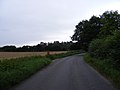
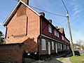
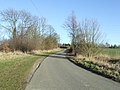
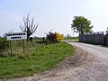
English: Earl Soham is a small settlement in Suffolk, England. It is on the A1120 road and is west of the town of Framlingham.
village in the United Kingdom  | |||||
| Upload media | |||||
| Instance of | |||||
|---|---|---|---|---|---|
| Location |
| ||||
 | |||||
Subcategories
This category has the following 7 subcategories, out of 7 total.
E
- Earl Soham Baptist Church (3 F)
- Earl Soham War Memorial (4 F)
M
O
- Old Hall Farm, Earl Soham (2 F)
V
- The Victoria, Earl Soham (10 F)
- Earl Soham Village Pump (5 F)
- Earl Soham Village Sign (2 F)
Media in category "Earl Soham"
The following 190 files are in this category, out of 190 total.
-
 A1120 at the building site entrance - geograph.org.uk - 4418493.jpg 3,072 × 2,304; 1.82 MB
-
 A1120 junction with Bedfield Road - geograph.org.uk - 2570285.jpg 3,072 × 2,304; 1.33 MB
-
 A1120 junction with Bedfield Road - geograph.org.uk - 3593525.jpg 3,575 × 2,667; 1.5 MB
-
 A1120 junction with Dial Lane - geograph.org.uk - 2570283.jpg 3,072 × 2,304; 1.34 MB
-
 A1120 Mill Hill, Earl Soham - geograph.org.uk - 1832261.jpg 3,072 × 2,304; 1.3 MB
-
 A1120 Mill Hill, Earl Soham - geograph.org.uk - 1832272.jpg 3,072 × 2,304; 1.21 MB
-
 A1120 northeast of Hill Farm - geograph.org.uk - 3595875.jpg 3,648 × 2,736; 1.35 MB
-
 A1120 Saxtead Road, Earl Soham - geograph.org.uk - 4418435.jpg 3,072 × 2,304; 2.04 MB
-
 A1120 Saxtead Road, Saxtead Green - geograph.org.uk - 4590047.jpg 2,805 × 2,102; 3.07 MB
-
 A1120 Saxtead Road, Saxtead Green - geograph.org.uk - 4590073.jpg 3,072 × 2,304; 2.4 MB
-
 A1120 Several Road northeast of Moat Farm - geograph.org.uk - 3593517.jpg 3,648 × 2,736; 1.26 MB
-
 A1120 The Street passes The Victoria - geograph.org.uk - 3594097.jpg 3,549 × 2,586; 1.43 MB
-
 A1120 The Street ^ Bridge - geograph.org.uk - 4689112.jpg 3,072 × 2,304; 1.85 MB
-
 A1120 The Street ^ bridge - geograph.org.uk - 4704215.jpg 3,072 × 2,304; 1.75 MB
-
 A1120 The Street, Earl Soham - geograph.org.uk - 4704192.jpg 3,072 × 2,304; 1.93 MB
-
 A1120 The Street, Earl Soham - geograph.org.uk - 4704204.jpg 3,072 × 2,304; 2.07 MB
-
 A1120 ^ Debenham Young Farmers display - geograph.org.uk - 4214308.jpg 3,072 × 2,304; 1.77 MB
-
 And I'm looking at you^ - geograph.org.uk - 4374355.jpg 1,024 × 768; 408 KB
-
 Bedfield Road - geograph.org.uk - 1909426.jpg 3,072 × 2,304; 1.4 MB
-
 Bedfield Road - geograph.org.uk - 4371014.jpg 1,024 × 768; 331 KB
-
-
 Bedfield road junction - geograph.org.uk - 2570343.jpg 3,072 × 2,304; 1.29 MB
-
 Bedfield Road sign - geograph.org.uk - 2570286.jpg 3,072 × 2,304; 1.65 MB
-
 Bedfield Road ^ Town Corner Postbox - geograph.org.uk - 1909422.jpg 3,072 × 2,304; 1.64 MB
-
 Brandeston Road - geograph.org.uk - 2550660.jpg 3,072 × 2,304; 1.48 MB
-
 Brandeston Road - geograph.org.uk - 2550662.jpg 3,072 × 2,304; 1.34 MB
-
 Brandeston Road George VI Postbox - geograph.org.uk - 2550689.jpg 3,072 × 2,304; 1.32 MB
-
 Brandeston Road George VI Postbox - geograph.org.uk - 2550691.jpg 3,072 × 2,304; 1.28 MB
-
 Brandeston Road George VI Postbox - geograph.org.uk - 2550693.jpg 2,304 × 3,072; 1.49 MB
-
 Brandleston Road ^ Brandeston Road George VI Postbox - geograph.org.uk - 2550686.jpg 3,072 × 2,304; 1.22 MB
-
 Bridleway to Bedfield Road ^ the footpath to the A1120 - geograph.org.uk - 2570330.jpg 3,072 × 2,304; 1.26 MB
-
 Bridleway to Bedfield Road ^ the footpath to the A1120 - geograph.org.uk - 2570332.jpg 3,072 × 2,304; 1.45 MB
-
 Bridleway to Bedfield Road ^ the footpath to the A1120 - geograph.org.uk - 2570334.jpg 3,072 × 2,304; 1.51 MB
-
 Bridleway to Earl Soham Lane - geograph.org.uk - 2026439.jpg 3,072 × 2,304; 1.38 MB
-
 Building site entrance off the A1120 - geograph.org.uk - 4418528.jpg 3,072 × 2,304; 1.87 MB
-
 Building site off the A1120 - geograph.org.uk - 4418509.jpg 3,072 × 2,304; 2.03 MB
-
 Building site off the A1120 - geograph.org.uk - 4418518.jpg 3,072 × 2,304; 1.94 MB
-
 Building site off the A1120 Several Road - geograph.org.uk - 4208681.jpg 3,072 × 2,304; 1.8 MB
-
 Building site off the A1120 Several Road - geograph.org.uk - 4208697.jpg 3,072 × 2,304; 2.33 MB
-
 Church Lane - geograph.org.uk - 3791527.jpg 1,024 × 768; 362 KB
-
 Church Lane, Earl Soham - geograph.org.uk - 2026462.jpg 3,072 × 2,304; 1.55 MB
-
 Church Lane, Earl Soham - geograph.org.uk - 2026508.jpg 3,072 × 2,304; 1.65 MB
-
 Cobbold Row, Earl Soham - geograph.org.uk - 4382035.jpg 1,024 × 768; 408 KB
-
 Cottage and garden on Church Lane, Earl Soham - geograph.org.uk - 6224214.jpg 1,920 × 1,280; 1.26 MB
-
 Cottages on the A1120 road in Earl Soham - geograph.org.uk - 2093537.jpg 640 × 508; 132 KB
-
 Country Lane - geograph.org.uk - 1741715.jpg 1,600 × 1,200; 586 KB
-
 Cretingham Lodge Entrance - geograph.org.uk - 1832496.jpg 3,072 × 2,304; 1.39 MB
-
 Crocuses on The Green at Earl Soham - geograph.org.uk - 4374218.jpg 1,024 × 768; 493 KB
-
 Cut Mark Earl Soham St Mary's Church - geograph.org.uk - 5689976.jpg 2,231 × 2,231; 3.39 MB
-
 Debenham Young Farmers display - geograph.org.uk - 4208673.jpg 3,072 × 2,304; 1.88 MB
-
 Debenham Young Farmers display - geograph.org.uk - 4208725.jpg 3,072 × 2,304; 1.46 MB
-
 Debenham Young Farmers display - geograph.org.uk - 4214309.jpg 3,072 × 2,304; 1.93 MB
-
 Dial Cottage across the meadow - geograph.org.uk - 4374357.jpg 1,024 × 768; 403 KB
-
 Dial Lane, Earl Soham - geograph.org.uk - 2026459.jpg 3,072 × 2,304; 1.67 MB
-
 Earl Soham Bowling Green - geograph.org.uk - 1120606.jpg 3,072 × 2,304; 1.32 MB
-
 Earl Soham Bowls Club - geograph.org.uk - 1120605.jpg 3,072 × 2,304; 1.24 MB
-
 Earl Soham Bowls Club Pavilion - geograph.org.uk - 1120608.jpg 3,072 × 2,304; 1.38 MB
-
 Earl Soham Brewery - geograph.org.uk - 1120622.jpg 3,072 × 2,304; 1.28 MB
-
 Earl Soham Business Park - geograph.org.uk - 2590964.jpg 3,072 × 2,304; 1.46 MB
-
 Earl Soham Business Park - geograph.org.uk - 2590966.jpg 3,072 × 2,304; 1.33 MB
-
 Earl Soham Business Park - geograph.org.uk - 2590967.jpg 2,304 × 3,072; 1.4 MB
-
 Earl Soham Green - geograph.org.uk - 2453341.jpg 3,648 × 2,736; 4.25 MB
-
 Earl Soham Post Office - geograph.org.uk - 1120624.jpg 3,072 × 2,304; 1.28 MB
-
 Earl Soham Post Office - geograph.org.uk - 2445084.jpg 3,072 × 2,304; 1.33 MB
-

-
 Earl Soham Street - geograph.org.uk - 2453352.jpg 3,648 × 2,736; 2.22 MB
-
 Earl Soham Telephone Exchange - geograph.org.uk - 1075154.jpg 3,072 × 2,304; 1.5 MB
-
 Earl Soham Telephone Exchange - geograph.org.uk - 1075160.jpg 3,072 × 2,304; 1.5 MB
-
 Earl Soham Tennis Court - geograph.org.uk - 1120610.jpg 3,072 × 2,304; 1.37 MB
-
 Earl Soham Village Hall - geograph.org.uk - 1081866.jpg 3,072 × 2,304; 1.37 MB
-
 Earl Soham Village Name sign - geograph.org.uk - 4418443.jpg 2,265 × 3,011; 3.18 MB
-
 Earl Soham Village Name sign - geograph.org.uk - 4703837.jpg 3,072 × 2,304; 1.87 MB
-
 Electricity Pylon near Church Lane - geograph.org.uk - 2026505.jpg 2,304 × 3,072; 1.32 MB
-
-
 Entering Earl Soham on the A1120 Mill Hill - geograph.org.uk - 4703831.jpg 3,072 × 2,304; 1.94 MB
-
 Entering Earl Soham on the A1120 Saxtead Road - geograph.org.uk - 4418431.jpg 3,072 × 2,304; 1.9 MB
-
 Entering Earl Soham on the A1120 Saxtead Road - geograph.org.uk - 4418462.jpg 3,072 × 2,304; 1.88 MB
-
 Entrance to Earl Soham Business Centre - geograph.org.uk - 2445069.jpg 2,304 × 3,072; 1.45 MB
-
 Farm buildings at Whitehouse Farm - geograph.org.uk - 4374260.jpg 1,024 × 768; 381 KB
-
 Field by Mill Hill, Earl Soham - geograph.org.uk - 6229557.jpg 1,868 × 1,196; 1.37 MB
-
 Field by Mill Hill, Earl Soham - geograph.org.uk - 6238907.jpg 1,920 × 1,280; 866 KB
-
 Field by Saxted Road near Earl Soham - geograph.org.uk - 6224593.jpg 1,876 × 1,212; 1.37 MB
-
 Fields next to Church Lane - geograph.org.uk - 2026502.jpg 3,072 × 2,304; 1.33 MB
-
 Footpath bridge over field ditch - geograph.org.uk - 4371019.jpg 1,024 × 768; 608 KB
-
 Footpath off the A1120 Saxtead Road - geograph.org.uk - 4590054.jpg 3,072 × 2,304; 2.09 MB
-
 Footpath off the A1120 Saxtead Road - geograph.org.uk - 4590090.jpg 2,995 × 2,244; 3.1 MB
-
 Footpath off the A1120 The Street - geograph.org.uk - 4689066.jpg 2,304 × 3,072; 2.65 MB
-
 Footpath off the A1120 The Street - geograph.org.uk - 4704223.jpg 3,072 × 2,304; 2.15 MB
-
 Footpath sign off gthde A1120o Saxtead Road - geograph.org.uk - 4590064.jpg 2,304 × 3,072; 2.36 MB
-
 Footpath sign to the A1120 ^ The Street Bakery Postbox - geograph.org.uk - 2445054.jpg 3,072 × 2,304; 1.46 MB
-
 Footpath to Bedfield Road - geograph.org.uk - 2445036.jpg 2,304 × 3,072; 1.47 MB
-
 Footpath to Bedfield Road ^ The Street Bakery Postbox - geograph.org.uk - 2445006.jpg 2,304 × 3,072; 1.47 MB
-
 Footpath to Bedfield Road ^ The Street Bakery Postbox - geograph.org.uk - 2445021.jpg 2,304 × 3,072; 1.42 MB
-
 Footpath to Bedfield Road ^ The Street Bakery Postbox - geograph.org.uk - 2445031.jpg 3,072 × 2,304; 1.42 MB
-
 Footpath to Bedfield Road ^ The Street Bakery Postbox - geograph.org.uk - 2445041.jpg 3,072 × 2,304; 1.42 MB
-
 Footpath to Brandeston Road - geograph.org.uk - 2551306.jpg 3,072 × 2,304; 1.66 MB
-
 Footpath to Brandeston Road - geograph.org.uk - 2551316.jpg 3,072 × 2,304; 1.49 MB
-
 Footpath to Brandeston Road - geograph.org.uk - 2551319.jpg 3,072 × 2,304; 1.43 MB
-
 Footpath to Brandeston Road - geograph.org.uk - 2557066.jpg 2,304 × 3,072; 1.46 MB
-
 Footpath to Earl Soham Business Centre entrance - geograph.org.uk - 2445108.jpg 2,304 × 3,072; 1.52 MB
-
 Footpath to Earl Soham Business Centre entrance - geograph.org.uk - 2445110.jpg 2,304 × 3,072; 1.39 MB
-
 Footpath to Swan Lane - geograph.org.uk - 2550648.jpg 2,304 × 3,072; 1.51 MB
-
 Footpath to Swan Lane - geograph.org.uk - 2550651.jpg 2,304 × 3,072; 1.47 MB
-
 Footpath to Swan Lane - geograph.org.uk - 2550653.jpg 2,304 × 3,072; 1.22 MB
-
 Footpath to Swan Lane ^ Brandeston Road - geograph.org.uk - 2550868.jpg 2,304 × 3,072; 1.65 MB
-
 Footpath to the A1120 - geograph.org.uk - 2550645.jpg 3,072 × 2,304; 1.66 MB
-
 Footpath to The A1120 and the Post Office - geograph.org.uk - 2445061.jpg 2,304 × 3,072; 1.64 MB
-
 Footpath to the A1120 ^ bridleway to Bedfield Road - geograph.org.uk - 2570306.jpg 2,304 × 3,072; 1.68 MB
-
 Footpath to the A1120 ^ bridleway to Bedfield Road - geograph.org.uk - 2570326.jpg 3,072 × 2,304; 1.32 MB
-
 Footpath to the Mill Lane Byway to High Road - geograph.org.uk - 2550861.jpg 3,072 × 2,304; 1.33 MB
-
 Footpath ^ entrance to Sloper House - geograph.org.uk - 4589687.jpg 2,291 × 3,046; 3.3 MB
-
 Former allotment gardens, Earl Soham - geograph.org.uk - 3585877.jpg 640 × 480; 114 KB
-

-
 Friendly scarecrow guarding the oilseed rape - geograph.org.uk - 4374279.jpg 1,024 × 768; 302 KB
-
 G VI R postbox near Soham House - geograph.org.uk - 4374274.jpg 1,024 × 768; 341 KB
-
 Glebe Cottage, Earl Soham - geograph.org.uk - 2480386.jpg 1,024 × 768; 236 KB
-
 GR Post Box No. IP13 6387 - geograph.org.uk - 2262224.jpg 640 × 480; 113 KB
-
 GR postbox near Oak Farm, Earl Soham - geograph.org.uk - 2262219.jpg 480 × 640; 201 KB
-
 GRV Postbox near Soham House - geograph.org.uk - 4374270.jpg 1,024 × 768; 311 KB
-
 Houses in The Street, Earl Soham - geograph.org.uk - 2902172.jpg 1,600 × 914; 313 KB
-
 Into The Distance - geograph.org.uk - 337655.jpg 480 × 640; 70 KB
-
 Layby on the A1120 Saxtead Road - geograph.org.uk - 4590086.jpg 3,007 × 2,253; 3.46 MB
-
 Leaving the footpath for the road - geograph.org.uk - 2262273.jpg 640 × 480; 124 KB
-
 Low Road, Earl Soham - geograph.org.uk - 4589676.jpg 3,072 × 2,304; 1.87 MB
-
 Mill Hill - geograph.org.uk - 5083202.jpg 4,288 × 2,848; 5.93 MB
-
 Mill Hill, Earl Soham - geograph.org.uk - 6229553.jpg 1,840 × 1,148; 930 KB
-
 Mill House Farm - geograph.org.uk - 5072364.jpg 4,288 × 2,848; 5.1 MB
-
 Mill Lane Byway from High Road - geograph.org.uk - 4374353.jpg 1,024 × 768; 414 KB
-
 Mill Lane from beside the pond - geograph.org.uk - 4374344.jpg 1,024 × 768; 624 KB
-
 Mill Lane, footpath to Earl Soham - geograph.org.uk - 4374346.jpg 1,024 × 768; 654 KB
-
 Paddock at Whitehouse Farm - geograph.org.uk - 4374255.jpg 1,024 × 768; 319 KB
-
 Pathway into a wonderland - geograph.org.uk - 4374337.jpg 768 × 1,024; 570 KB
-

-
 Pillbox on the A1120 Mill Hill, Earl Soham - geograph.org.uk - 1832266.jpg 3,072 × 2,304; 1.3 MB
-
 Pillbox on the A1120 Mill Hill, Earl Soham - geograph.org.uk - 1832268.jpg 3,072 × 2,304; 1.6 MB
-
 Pond and old shed at Whitehouse Farm - geograph.org.uk - 4374256.jpg 1,024 × 768; 418 KB
-
 Power Lines - geograph.org.uk - 1741227.jpg 1,200 × 1,600; 475 KB
-
 Pumping Station off the A1120 The Street - geograph.org.uk - 4704237.jpg 3,072 × 2,304; 1.93 MB
-
 QEII K6 telephone kiosk in Earl Soham - geograph.org.uk - 4374227.jpg 768 × 1,024; 448 KB
-
 River off the A1120 The Street - geograph.org.uk - 4704293.jpg 2,304 × 3,072; 3.26 MB
-
 River off the A1120 The Street - geograph.org.uk - 4704296.jpg 2,304 × 3,072; 3.37 MB
-
 River off the A1120 The Street - geograph.org.uk - 4704309.jpg 3,072 × 2,304; 1.82 MB
-
 Roadsign on Brandeston Road - geograph.org.uk - 2550670.jpg 2,304 × 3,072; 1.47 MB
-
 Roadsign on the A1120 The Street - geograph.org.uk - 4704304.jpg 2,304 × 3,072; 2.57 MB
-
 Saxted Road leaving Earl Soham - geograph.org.uk - 6224588.jpg 1,920 × 1,280; 717 KB
-
 Sharp bend on The Street, Earl Soham - geograph.org.uk - 6229558.jpg 1,920 × 1,280; 1.29 MB
-
 Sloper House sign - geograph.org.uk - 4589884.jpg 2,192 × 2,914; 2.79 MB
-
 Square Pillbox - geograph.org.uk - 1741743.jpg 1,600 × 1,200; 397 KB
-
 St Mary's Church, Earl Soham - geograph.org.uk - 6224213.jpg 1,920 × 1,280; 1.59 MB
-
 Stile of the footpath to Brandeston Road - geograph.org.uk - 2551318.jpg 2,304 × 3,072; 1.66 MB
-
 Strangely pleasing angular cut hedge - geograph.org.uk - 4371013.jpg 1,024 × 768; 528 KB
-

-

-
 Swan Lane - geograph.org.uk - 2550672.jpg 2,304 × 3,072; 1.41 MB
-
 The A1120 - geograph.org.uk - 3791519.jpg 1,024 × 768; 296 KB
-
 The former Earl Soham Post Office - geograph.org.uk - 4689057.jpg 2,240 × 2,978; 1.94 MB
-
 The former The Old Brewery ^ Post Office - geograph.org.uk - 4689032.jpg 3,072 × 2,304; 2.01 MB
-
 The former The Old Brewery ^ Post Office - geograph.org.uk - 4689081.jpg 3,072 × 2,304; 1.84 MB
-
 The Granary and the Old Mill - geograph.org.uk - 5072370.jpg 4,288 × 2,848; 6.28 MB
-
 The headstone of Marmaduke J. N. ABBAY (reverse) - geograph.org.uk - 5227317.jpg 2,592 × 3,456; 3.29 MB
-
 The Old Brewery sign - geograph.org.uk - 4689037.jpg 2,304 × 3,072; 2.49 MB
-
 The Old Brewery sign - geograph.org.uk - 4689041.jpg 2,228 × 2,962; 3.02 MB
-
 The Old Rectory in Earl Soham - geograph.org.uk - 2093540.jpg 640 × 480; 156 KB
-
 The Street Bakery Postbox - geograph.org.uk - 2445044.jpg 2,304 × 3,072; 1.43 MB
-
 The Street Bakery Postbox - geograph.org.uk - 2445048.jpg 2,304 × 3,072; 1.45 MB
-
 The Street Post Office George V Postbox - geograph.org.uk - 2445104.jpg 2,304 × 3,072; 1.38 MB
-
 The Street Post Office George V Postbox - geograph.org.uk - 4689147.jpg 2,228 × 2,962; 1.72 MB
-
 The Victoria Public House, Earl Soham - geograph.org.uk - 6223402.jpg 1,880 × 1,216; 1.37 MB
-
 Town Corner Postbox - geograph.org.uk - 1909423.jpg 2,304 × 3,072; 1.65 MB
-
 Tree on a field boundary off Mill Lane - geograph.org.uk - 4374335.jpg 1,024 × 768; 369 KB
-
 Undeveloped part of Earl Soham Business Park - geograph.org.uk - 2590969.jpg 3,072 × 2,304; 1.34 MB
-
 Village Green at Earl Soham - geograph.org.uk - 2262210.jpg 640 × 480; 121 KB
-
 Windwhistle Farm - geograph.org.uk - 1741205.jpg 1,600 × 1,200; 557 KB
-
 Woodland off Mill Lane (a track), Earl Soham - geograph.org.uk - 4374333.jpg 1,024 × 768; 543 KB
-
 Yew Tree Courtyard, Earl Soham - geograph.org.uk - 1471750.jpg 3,072 × 2,304; 1.37 MB
-
 Yew Tree Courtyard, Earl Soham - geograph.org.uk - 1471751.jpg 3,072 × 2,304; 1.38 MB
-
 Yew Tree Courtyard, Earl Soham - geograph.org.uk - 1471763.jpg 3,072 × 2,304; 1.39 MB
-
 A1120 Earl Soham - geograph.org.uk - 1075197.jpg 3,072 × 2,304; 1.47 MB
-
 A1120 Junction - geograph.org.uk - 1075191.jpg 3,072 × 2,304; 1.37 MB
-
 A1120 Several Road, Earl Soham - geograph.org.uk - 1471754.jpg 3,072 × 2,304; 1.46 MB
-
 A1120 The Street, Earl Soham - geograph.org.uk - 1120599.jpg 3,072 × 2,304; 1.51 MB
-
 A1120 The Street, Earl Soham - geograph.org.uk - 1120600.jpg 3,072 × 2,304; 1.41 MB
-
 A1120 The Street, Earl Soham - geograph.org.uk - 1120614.jpg 3,072 × 2,304; 1.38 MB
-
 A1120 The Street, Earl Soham - geograph.org.uk - 1120615.jpg 3,072 × 2,304; 1.44 MB
-
 Country Code - geograph.org.uk - 338415.jpg 640 × 480; 99 KB
-
 Country Lane - geograph.org.uk - 337534.jpg 640 × 480; 131 KB
-
 Downhill Country Lane - geograph.org.uk - 337546.jpg 480 × 640; 106 KB
-
 Farmhouse at Whitehouse Farm - geograph.org.uk - 339611.jpg 640 × 480; 106 KB
-
 Road to Cretingham Lodge - geograph.org.uk - 339608.jpg 640 × 480; 69 KB
-
 The A1120 - geograph.org.uk - 342422.jpg 640 × 433; 75 KB


_-_geograph.org.uk_-_5227317.jpg)


,_Earl_Soham_-_geograph.org.uk_-_4374333.jpg)


