Category:Earle, Northumberland
village and civil parish in Northumberland, England | |||||
| Upload media | |||||
| Instance of | |||||
|---|---|---|---|---|---|
| Location | Northumberland, North East England, England | ||||
 | |||||
English: * History of Earle
Subcategories
This category has the following 2 subcategories, out of 2 total.
C
M
Media in category "Earle, Northumberland"
The following 200 files are in this category, out of 716 total.
(previous page) (next page)-
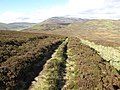
 'Crossing the line' on the Carey Burn path - geograph.org.uk - 2897303.jpg 1,024 × 768; 390 KB
-
 'Don't look up' - geograph.org.uk - 2876832.jpg 1,024 × 641; 303 KB
-
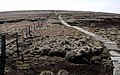
 'Old sheepfold' by Harthope Burn - geograph.org.uk - 2900154.jpg 1,024 × 768; 363 KB
-

-
 A bog under Hedgehope Hill - geograph.org.uk - 6163737.jpg 1,024 × 576; 228 KB
-
 A bog under Hedgehope Hill - geograph.org.uk - 6163739.jpg 1,024 × 576; 250 KB
-
 A lost shoe on The Cheviot - geograph.org.uk - 3809278.jpg 480 × 640; 128 KB
-
 A meander in the upper Harthope Burn - geograph.org.uk - 3799842.jpg 640 × 480; 82 KB
-
 A small scale truncated spur - geograph.org.uk - 6166094.jpg 1,024 × 1,024; 373 KB
-
 A track along the Backwood Burn - geograph.org.uk - 6167096.jpg 1,024 × 683; 198 KB
-

-
 Above Hawsen Burn - geograph.org.uk - 3990135.jpg 2,560 × 1,920; 1.95 MB
-
 Above Hawsen Burn - geograph.org.uk - 3990140.jpg 2,560 × 1,920; 2.02 MB
-
 Above Langleeford - geograph.org.uk - 3991148.jpg 2,560 × 1,920; 2.02 MB
-
 Above Ray Burn - geograph.org.uk - 3991115.jpg 2,560 × 1,920; 2.08 MB
-
 Above Woolhope Crag - geograph.org.uk - 4067717.jpg 1,024 × 768; 326 KB
-
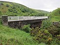
 Abutments of an old Carey Burn Bridge - geograph.org.uk - 3035312.jpg 1,600 × 1,200; 525 KB
-
 Across the bogs towards Hedgehope Hill - geograph.org.uk - 6163734.jpg 1,024 × 576; 213 KB
-
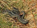 Adder near Harthope Linn - geograph.org.uk - 2809285.jpg 600 × 450; 164 KB
-
 Alder trees by Harthope Burn - geograph.org.uk - 2885274.jpg 1,024 × 769; 439 KB
-
 Alder trees by Harthope Burn - geograph.org.uk - 2908846.jpg 1,024 × 768; 459 KB
-
 Alder woodland by the Harthope Burn - geograph.org.uk - 2885929.jpg 1,024 × 768; 399 KB
-
 Alder woodland east of Langleeford Hope - geograph.org.uk - 2885081.jpg 1,024 × 640; 268 KB
-
 Along the Harthope Burn - geograph.org.uk - 4604353.jpg 1,024 × 768; 210 KB
-
 Along the Harthope Burn - geograph.org.uk - 4604358.jpg 1,024 × 768; 191 KB
-
 Altered andesite rock by Hawsen Burn - geograph.org.uk - 2899367.jpg 768 × 1,024; 461 KB
-
 Altered course of New Burn, Langleeford - geograph.org.uk - 2886883.jpg 1,024 × 768; 285 KB
-
-

-
 Animal feedstore in Lambden Valley - geograph.org.uk - 4225312.jpg 1,600 × 1,200; 747 KB
-
 Approaching Brownhill Plantation - geograph.org.uk - 3035927.jpg 1,600 × 1,200; 453 KB
-
 Approaching Earle - geograph.org.uk - 3035979.jpg 1,600 × 1,200; 262 KB
-
 Approaching Long Crags - geograph.org.uk - 3991127.jpg 2,560 × 1,920; 1.95 MB
-
 Approaching the summit of The Cheviot - geograph.org.uk - 6130029.jpg 1,600 × 1,200; 433 KB
-
 Approaching the top of The Cheviot - geograph.org.uk - 5807099.jpg 2,000 × 1,333; 392 KB
-
 April snow on ridge above Harthope Burn - geograph.org.uk - 2900265.jpg 1,024 × 641; 257 KB
-
 Armour Bank - geograph.org.uk - 6202347.jpg 1,024 × 768; 331 KB
-
 Ascending Comb Fell - geograph.org.uk - 3990617.jpg 2,560 × 1,920; 2.08 MB
-
 Ascending The Cheviot - geograph.org.uk - 6130023.jpg 1,600 × 1,200; 417 KB
-
 Bend on Harthope Burn - geograph.org.uk - 2878884.jpg 1,024 × 768; 312 KB
-
 Beside the Carey Burn - geograph.org.uk - 2897867.jpg 1,024 × 768; 360 KB
-
 Between Comb Fell and Hedgehope Hill - geograph.org.uk - 6164669.jpg 1,024 × 576; 209 KB
-
 Birch woods, Harthope - geograph.org.uk - 6166127.jpg 1,024 × 683; 358 KB
-
 Birches near Langleeford Hope - geograph.org.uk - 6166102.jpg 1,024 × 1,024; 345 KB
-
 Blackseat Hill - geograph.org.uk - 4067182.jpg 1,024 × 768; 293 KB
-
 Blackthorn in flower above the Carey Burn - geograph.org.uk - 2897851.jpg 1,024 × 768; 395 KB
-
 Blaeberry bushes, Hedgehope Hill - geograph.org.uk - 6163746.jpg 1,024 × 576; 240 KB
-
 Block scree near summit of Hedgehope Hill - geograph.org.uk - 2877111.jpg 1,024 × 768; 276 KB
-
 Blue sky over Hedgehope Hill - geograph.org.uk - 2877361.jpg 1,024 × 768; 225 KB
-
 Boggy col between Comb Fell ^ Hedgehope Hill - geograph.org.uk - 2877449.jpg 1,024 × 768; 261 KB
-
-
 Boundary stone on Broadhope Hill - geograph.org.uk - 4068675.jpg 1,024 × 768; 365 KB
-
 Bracken spraying helicopter near Langleeford - geograph.org.uk - 4610812.jpg 1,024 × 769; 106 KB
-

-
 Bridge at Langleeford - geograph.org.uk - 2886725.jpg 1,024 × 768; 365 KB
-
 Bridge over Harthope Burn - geograph.org.uk - 1507855.jpg 640 × 480; 121 KB
-
 Bridge over Harthope Burn - geograph.org.uk - 18398.jpg 480 × 640; 123 KB
-
 Bridge over Harthope Burn at Langlee - geograph.org.uk - 3034936.jpg 1,600 × 1,200; 396 KB
-
 Broadhope Hill - geograph.org.uk - 4152216.jpg 2,560 × 1,920; 2.39 MB
-
 Broadhope Hill ^ Cold Law from Cheviot - geograph.org.uk - 2883553.jpg 1,024 × 768; 234 KB
-
 Broadstruther - geograph.org.uk - 5619020.jpg 1,600 × 1,200; 600 KB
-
 Broadstruther - geograph.org.uk - 6202095.jpg 1,024 × 768; 285 KB
-
 Broadstruther from the east - geograph.org.uk - 6202237.jpg 1,024 × 767; 205 KB
-
 Broadstruther from the south - geograph.org.uk - 6202107.jpg 1,024 × 768; 237 KB
-
 Broadstruther Lodge - geograph.org.uk - 5769476.jpg 1,600 × 1,067; 403 KB
-
 Broadstruthers Burn - geograph.org.uk - 6201294.jpg 1,024 × 768; 282 KB
-
 Broadstruthers Burn towards Watch Hill - geograph.org.uk - 6201299.jpg 1,024 × 768; 250 KB
-
 Burn confluence, Harthope - geograph.org.uk - 6166069.jpg 1,024 × 576; 286 KB
-
 Butterwell Sike above Hawsen Burn - geograph.org.uk - 4068765.jpg 1,024 × 768; 313 KB
-
 Cairn at summit of Hedgehope Hill - geograph.org.uk - 2877128.jpg 1,024 × 768; 242 KB
-
-
 Cairn on Blackseat Hill - geograph.org.uk - 5534797.jpg 1,600 × 1,200; 525 KB
-
 Cairn on north side of Hedgehope Hill - geograph.org.uk - 2876877.jpg 1,024 × 768; 203 KB
-
 Cairn on The Cheviot - geograph.org.uk - 3990504.jpg 2,560 × 1,920; 2.11 MB
-
 Cairn on the subsidiary top of Hart Heugh - geograph.org.uk - 4926112.jpg 1,024 × 768; 269 KB
-
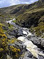
 Carey Burn - geograph.org.uk - 1027461.jpg 640 × 480; 134 KB
-
 Carey Burn - geograph.org.uk - 2898708.jpg 1,024 × 768; 276 KB
-
 Carey Burn - geograph.org.uk - 2898731.jpg 768 × 1,024; 340 KB
-
 Carey Burn - geograph.org.uk - 3035382.jpg 1,600 × 1,200; 453 KB
-
 Carey Burn - geograph.org.uk - 4245282.jpg 1,600 × 1,200; 795 KB
-
 Carey Burn - geograph.org.uk - 6201239.jpg 1,024 × 768; 375 KB
-
 Carey Burn above the bridge - geograph.org.uk - 6178010.jpg 1,024 × 768; 271 KB
-
 Carey Burn above the island - geograph.org.uk - 2896769.jpg 1,024 × 768; 303 KB
-
 Carey Burn at junction with unnamed burn - geograph.org.uk - 2897620.jpg 1,024 × 768; 333 KB
-
 Carey Burn below Hart Heugh - geograph.org.uk - 6201214.jpg 1,024 × 768; 308 KB
-
 Carey Burn below the bridge - geograph.org.uk - 2896736.jpg 1,024 × 693; 328 KB
-
 Carey Burn Bridge - geograph.org.uk - 2896728.jpg 1,024 × 641; 210 KB
-
 Carey Burn Bridge - geograph.org.uk - 3035023.jpg 1,600 × 1,200; 500 KB
-
 Carey Burn Bridge - geograph.org.uk - 4245308.jpg 1,600 × 1,200; 920 KB
-
 Carey Burn south of the waterfall - geograph.org.uk - 2897770.jpg 768 × 1,024; 368 KB
-
 Careyburn Linn - geograph.org.uk - 4245294.jpg 1,600 × 1,200; 913 KB
-
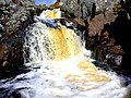 Careyburn Linn after a few days of rain - geograph.org.uk - 2897747.jpg 1,024 × 768; 256 KB
-
 Careyburn Linn from below - geograph.org.uk - 2897720.jpg 1,024 × 768; 329 KB
-
 Careyburn Linn, first view from the south - geograph.org.uk - 2897708.jpg 1,024 × 768; 394 KB
-
 Carling Crags - geograph.org.uk - 6202257.jpg 1,024 × 769; 207 KB
-
 Carling Crags - geograph.org.uk - 6202278.jpg 1,024 × 769; 247 KB
-
 Cascades on the Lambden Burn - geograph.org.uk - 4225288.jpg 1,200 × 1,600; 861 KB
-
 Cattle grid on the track to Langleeford - geograph.org.uk - 3800408.jpg 640 × 480; 130 KB
-
 Cheviot from Scald Hill - geograph.org.uk - 4067370.jpg 1,024 × 768; 244 KB
-
 Cheviot from upper valley of Lambden Burn - geograph.org.uk - 4067398.jpg 1,024 × 768; 281 KB
-
 Cheviot path towards Broadhope Hill - geograph.org.uk - 4067358.jpg 1,024 × 768; 319 KB
-
 Cheviot Summit - geograph.org.uk - 3990515.jpg 2,560 × 1,920; 2.11 MB
-
 Chewed up ground, Harthope - geograph.org.uk - 6164831.jpg 1,024 × 768; 268 KB
-
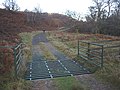
 Circular Sheepfold - geograph.org.uk - 2024380.jpg 1,499 × 950; 2.11 MB
-
 Climbing, Housey Crags - geograph.org.uk - 6162921.jpg 1,024 × 1,024; 271 KB
-
 Cloudberry (Rubus chamaemorus), north Cheviot - geograph.org.uk - 4067452.jpg 1,024 × 768; 462 KB
-
 Col south of Scald Hill from the west - geograph.org.uk - 4067445.jpg 1,024 × 768; 250 KB
-
 Cold Law - geograph.org.uk - 4152196.jpg 2,560 × 1,920; 2.79 MB
-
 Cold Law - geograph.org.uk - 6162909.jpg 1,024 × 683; 176 KB
-
 Cold Law from south-west - geograph.org.uk - 4068761.jpg 1,024 × 769; 289 KB
-
 Cold Law trig - geograph.org.uk - 5769455.jpg 1,600 × 1,067; 399 KB
-
 Coldgate Water - geograph.org.uk - 1814208.jpg 3,872 × 2,592; 3 MB
-
 Coldgate Water - geograph.org.uk - 3244235.jpg 1,024 × 768; 207 KB
-
 Coldgate Water - geograph.org.uk - 3244245.jpg 1,024 × 768; 195 KB
-
 Coldgate Water - geograph.org.uk - 4529732.jpg 1,600 × 1,200; 540 KB
-
 Coldgate Water - geograph.org.uk - 6177368.jpg 1,024 × 768; 330 KB
-
 Coldgate Water in Happy Valley - geograph.org.uk - 6177342.jpg 1,024 × 768; 396 KB
-
 Coldgate Water in Happy Valley - geograph.org.uk - 6177999.jpg 1,024 × 770; 425 KB
-
 Comb Fell - geograph.org.uk - 6164673.jpg 1,024 × 576; 199 KB
-
 Comb Fell - geograph.org.uk - 6164775.jpg 1,600 × 1,200; 282 KB
-
 Comb Fell from slope below Cheviot - geograph.org.uk - 2890049.jpg 1,024 × 640; 242 KB
-
 Confluence of streams - geograph.org.uk - 3632059.jpg 640 × 480; 288 KB
-
 Cottages at Earl - geograph.org.uk - 2810391.jpg 600 × 450; 74 KB
-
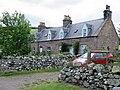 Cottages near Earle - geograph.org.uk - 6205150.jpg 1,024 × 768; 321 KB
-
 Crag near Harthope Burn - geograph.org.uk - 4604413.jpg 1,024 × 768; 262 KB
-
 Crags on Cold Law - geograph.org.uk - 5905641.jpg 1,600 × 1,200; 552 KB
-
 Crags on Hart Heugh - geograph.org.uk - 4926124.jpg 1,024 × 768; 262 KB
-
 Crags on Steely Crag above the Carey Burn - geograph.org.uk - 5575500.jpg 1,600 × 1,067; 252 KB
-
 Cresswell Bog from the west - geograph.org.uk - 6175624.jpg 1,024 × 767; 257 KB
-
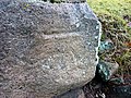 Cut benchmark at Langleeford Hope - geograph.org.uk - 3809660.jpg 640 × 480; 196 KB
-

-

-
 Descending Cairn Hill - geograph.org.uk - 3990587.jpg 2,560 × 1,920; 2.01 MB
-
 Descending from The Cheviot - geograph.org.uk - 6134337.jpg 1,200 × 1,600; 710 KB
-
 Descending Hedgehope Hill - geograph.org.uk - 3990673.jpg 2,560 × 1,920; 2.06 MB
-
 Descending Snear Hill - geograph.org.uk - 6202313.jpg 1,024 × 768; 253 KB
-
 Desolate moorland west of Comb Fell - geograph.org.uk - 5064106.jpg 1,500 × 816; 1.07 MB
-
 Diverted footpath - geograph.org.uk - 3632100.jpg 1,024 × 768; 248 KB
-
 Dovecote at Surrey House - geograph.org.uk - 411112.jpg 480 × 640; 118 KB
-

-
 Dry valley west of Earle Whin - geograph.org.uk - 6180017.jpg 1,024 × 768; 285 KB
-
 Dunmoor Hill - geograph.org.uk - 6163726.jpg 1,024 × 576; 157 KB
-

-
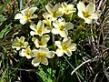 Dwarf primroses, valley of Carey Burn - geograph.org.uk - 2897269.jpg 1,024 × 770; 247 KB
-
 Earle from north-east - geograph.org.uk - 6186011.jpg 1,024 × 768; 293 KB
-
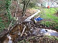
 Earle Mill near Wooler - geograph.org.uk - 3632098.jpg 1,024 × 768; 263 KB
-
 Earlehillhead Farm - geograph.org.uk - 6179946.jpg 1,024 × 768; 232 KB
-
 Early evening below The Cheviot - geograph.org.uk - 6134306.jpg 1,600 × 1,200; 634 KB
-

-
 Electricity pylons and poles through the trees - geograph.org.uk - 3036007.jpg 750 × 1,000; 152 KB
-
 Enclosed birch woodland - geograph.org.uk - 6166129.jpg 1,024 × 683; 300 KB
-
 Entrance to Yearle Quarry - geograph.org.uk - 1729643.jpg 1,024 × 768; 326 KB
-
 Eroded path above Scotsman's Knowe - geograph.org.uk - 4604454.jpg 1,024 × 768; 158 KB
-
 Eroded Peat - geograph.org.uk - 3990611.jpg 2,560 × 1,920; 1.96 MB
-

-
 Erosion gullies on south side of Hawsen Burn - geograph.org.uk - 2899485.jpg 1,024 × 768; 252 KB
-
 Erosion gully above the Hawsen Burn - geograph.org.uk - 2899398.jpg 768 × 1,024; 294 KB
-
 Erosion gully above the Hawsen Burn - geograph.org.uk - 2899426.jpg 1,024 × 768; 303 KB
-
 Erosion on Wooler Water - geograph.org.uk - 3632069.jpg 1,024 × 768; 342 KB
-
 Erosion scars above Harthope Burn - geograph.org.uk - 4604362.jpg 1,024 × 767; 246 KB
-
 Estate road below Cold Law - geograph.org.uk - 6202308.jpg 1,024 × 768; 239 KB
-
 Ewe and lamb - geograph.org.uk - 3632031.jpg 1,024 × 768; 308 KB
-
 Farm building, Earle - geograph.org.uk - 6205141.jpg 1,024 × 768; 357 KB
-
 Farmland near Earle Mill - geograph.org.uk - 6175621.jpg 1,024 × 768; 188 KB
-
 Farmland near Walkerwalls - geograph.org.uk - 6205094.jpg 1,024 × 768; 187 KB
-
 Farmyard, Earle - geograph.org.uk - 6205135.jpg 1,024 × 765; 285 KB
-
 Fell runner on The Cheviot - geograph.org.uk - 4604468.jpg 1,024 × 768; 151 KB
-

-
 Fence and cairn on The Cheviot - geograph.org.uk - 1510710.jpg 640 × 480; 79 KB
-
 Fence angle crossing moorland - geograph.org.uk - 2024330.jpg 1,500 × 875; 1.37 MB
-
 Fence between Hedgehope Hill and Comb Fell - geograph.org.uk - 2877493.jpg 1,024 × 768; 282 KB
-
 Fence corner south of Long Crags - geograph.org.uk - 2876798.jpg 1,024 × 768; 362 KB
-
 Fence corner, Comb Fell - geograph.org.uk - 2877558.jpg 1,024 × 768; 314 KB
-
 Fence from Scald Hill to Broadhope Hill - geograph.org.uk - 1510809.jpg 640 × 480; 100 KB
-
 Fence in the valley of the Goldscleugh Burn - geograph.org.uk - 4225259.jpg 1,200 × 1,600; 858 KB
-
 Fence junction on Hedgehope Hill - geograph.org.uk - 6163775.jpg 1,024 × 576; 216 KB
-

-
 Fence on Scald Hill - geograph.org.uk - 4073662.jpg 640 × 357; 32 KB
-
 Fence on Scotsman's Knowe - geograph.org.uk - 3798732.jpg 640 × 480; 78 KB
-
 Fence on Snear Hill - geograph.org.uk - 5769487.jpg 1,600 × 1,067; 354 KB
-
 Fence south of Long Crags - geograph.org.uk - 2876810.jpg 1,024 × 768; 305 KB
-
 Fence south-west of Cheviot summit - geograph.org.uk - 2879109.jpg 1,024 × 769; 327 KB
-
 Fence west of Langlee Crags - geograph.org.uk - 2876463.jpg 1,024 × 768; 281 KB
-
-
 Field, Earle - geograph.org.uk - 3439314.jpg 640 × 480; 279 KB
-
 Fields north-east of Langleeford - geograph.org.uk - 2886788.jpg 1,024 × 640; 196 KB
-
 Fields, Earle - geograph.org.uk - 3439323.jpg 640 × 480; 277 KB
-
 Flagstone path east of Cheviot summit - geograph.org.uk - 2879132.jpg 1,024 × 644; 229 KB
-
 Flanks of Snear Hill - geograph.org.uk - 4245333.jpg 1,600 × 1,200; 716 KB
-

-
 Footbridge by the Coldgate Ford - geograph.org.uk - 1871587.jpg 1,024 × 768; 362 KB
-
 Footbridge over Broadstruthers Burn - geograph.org.uk - 1421125.jpg 640 × 480; 175 KB
-
 Footbridge over Harthope Burn - geograph.org.uk - 4603066.jpg 1,024 × 768; 316 KB
-
 Footbridge over Hazelly Burn - geograph.org.uk - 779002.jpg 640 × 480; 105 KB
-
 Footbridge, Coldgate Ford - geograph.org.uk - 3439599.jpg 640 × 480; 365 KB
-
 Footpath ascending Cairn Hill - geograph.org.uk - 5807074.jpg 2,000 × 1,500; 415 KB
-
 Footpath climbing Cairn Hill - geograph.org.uk - 5807061.jpg 2,000 × 1,333; 393 KB
-
 Footpath junction at Scotsman's Knowe - geograph.org.uk - 5807066.jpg 2,000 × 1,333; 374 KB
-

-
 Ford at Coldgate Mill - geograph.org.uk - 1871574.jpg 1,024 × 768; 333 KB


,_north_Cheviot_-_geograph.org.uk_-_4067452.jpg)


_north-east_of_Cheviot_-_geograph.org.uk_-_4067540.jpg)


