Category:East Down, Devon
village and civil parish in North Devon, Devon, England  | |||||
| Upload media | |||||
| Instance of | |||||
|---|---|---|---|---|---|
| Location | North Devon, Devon, South West England, England | ||||
 | |||||
Subcategories
This category has the following 5 subcategories, out of 5 total.
Media in category "East Down, Devon"
The following 200 files are in this category, out of 224 total.
(previous page) (next page)-
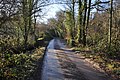 A bridge on Rookbear Lane - geograph.org.uk - 2236498.jpg 1,024 × 680; 350 KB
-
 A bridge on Rookbear Lane - geograph.org.uk - 2236502.jpg 1,024 × 680; 288 KB
-
 A bridge on Rookbear Lane as seen from upstream - geograph.org.uk - 2236528.jpg 1,024 × 642; 230 KB
-
 A North Devon hedge and bank - geograph.org.uk - 2775251.jpg 1,024 × 768; 221 KB
-
 A panoramic view of Churchill. - geograph.org.uk - 1254514.jpg 640 × 480; 69 KB
-
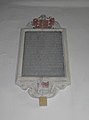
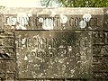 A plaque on Brockham Bridge on the River Yeo - geograph.org.uk - 1858024.jpg 1,024 × 768; 315 KB
-

-
-

-

-
 Access road, Wigmore Farm - geograph.org.uk - 4890387.jpg 1,024 × 768; 257 KB
-
 All alone - geograph.org.uk - 2775245.jpg 1,024 × 768; 155 KB
-
 Approaching Ashelford Corner - geograph.org.uk - 5150738.jpg 1,024 × 768; 287 KB
-
 Ashelford - geograph.org.uk - 1252992.jpg 640 × 427; 76 KB
-
 Ashelford Corner - geograph.org.uk - 1252998.jpg 640 × 427; 87 KB
-
 Ashelford Corner - geograph.org.uk - 5151571.jpg 1,024 × 768; 324 KB
-
 Ashelford corner - geograph.org.uk - 522489.jpg 640 × 425; 105 KB
-
 Barton House Entrance - geograph.org.uk - 722118.jpg 640 × 425; 73 KB
-
 Bowden Corner - geograph.org.uk - 5150733.jpg 1,024 × 846; 191 KB
-
 Bowden corner - geograph.org.uk - 522501.jpg 640 × 425; 78 KB
-

-
 Bridge over the River Yeo^ - geograph.org.uk - 527918.jpg 426 × 640; 106 KB
-
 Brockham Bridge on the River Yeo - geograph.org.uk - 1858018.jpg 1,024 × 768; 163 KB
-

-

-

-
 Bugford Bridge on the River Yeo - geograph.org.uk - 1858002.jpg 1,024 × 768; 320 KB
-
 Bugford Bridge on the River Yeo - geograph.org.uk - 1858003.jpg 1,024 × 768; 319 KB
-

-

-
 Churchill Wood - geograph.org.uk - 518247.jpg 426 × 640; 93 KB
-
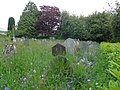
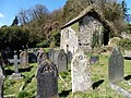 Churchyard, East Down - geograph.org.uk - 4889829.jpg 1,024 × 768; 321 KB
-
 Cleave Farm - geograph.org.uk - 527825.jpg 640 × 426; 91 KB
-
 Cleave Farm, near Bugford - geograph.org.uk - 1862101.jpg 1,024 × 768; 230 KB
-
 Coil Cross - geograph.org.uk - 2904214.jpg 2,743 × 2,312; 1.56 MB
-
 Coil Cross - geograph.org.uk - 4403590.jpg 1,024 × 768; 155 KB
-
 Dudmoor Lane - geograph.org.uk - 4889871.jpg 1,024 × 768; 272 KB
-
 Dudmoor Lane - geograph.org.uk - 4890903.jpg 1,024 × 768; 260 KB
-
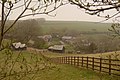
 East Down - geograph.org.uk - 518241.jpg 640 × 426; 72 KB
-
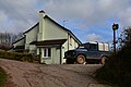
 East Down Village Hall - geograph.org.uk - 4497678.jpg 640 × 480; 68 KB
-
 East Down.jpg 640 × 425; 88 KB
-

-
 Entrance driveway, Shortacombe House - geograph.org.uk - 4889885.jpg 1,024 × 768; 224 KB
-
 Farm building, Clifton - geograph.org.uk - 4889614.jpg 1,024 × 829; 161 KB
-
 Farm track on Berry Down - geograph.org.uk - 4890886.jpg 1,024 × 768; 204 KB
-
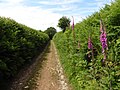
 Footpath off Dudmoor Lane - geograph.org.uk - 722125.jpg 640 × 425; 90 KB
-
 Footpath to Broad Park Farm - geograph.org.uk - 623075.jpg 640 × 480; 92 KB
-
 Footpath to Clifton - geograph.org.uk - 4890347.jpg 1,024 × 768; 340 KB
-

-
 Gateway, East Down Manor - geograph.org.uk - 4889633.jpg 1,024 × 768; 327 KB
-
 Hidden man - geograph.org.uk - 527924.jpg 426 × 640; 111 KB
-
 Holwell - geograph.org.uk - 459100.jpg 640 × 426; 90 KB
-
 House at Shortacombe - geograph.org.uk - 731525.jpg 640 × 416; 100 KB
-
 Houses at Stonecombe - geograph.org.uk - 5150165.jpg 1,024 × 768; 231 KB
-

-

-

-

-

-

-

-

-

-

-
-

-
-

-

-

-

-

-

-

-
-

-
-

-
 Junction on Rockbear Lane - geograph.org.uk - 6178129.jpg 1,024 × 768; 213 KB
-
 Long Lane - geograph.org.uk - 4403601.jpg 1,024 × 768; 192 KB
-
 Millstones - geograph.org.uk - 527932.jpg 426 × 640; 108 KB
-
 Minor road on Ford Hill - geograph.org.uk - 4889855.jpg 1,024 × 768; 287 KB
-
 Muddy gateway near Shortacombe Corner - geograph.org.uk - 4890368.jpg 1,024 × 768; 275 KB
-
 Near Shortacombe Corner - geograph.org.uk - 527532.jpg 640 × 426; 86 KB
-
 North Devon , Bowden Corner - geograph.org.uk - 4863775.jpg 6,000 × 4,000; 7.8 MB
-
 North Devon , Country Lane - geograph.org.uk - 4863798.jpg 6,000 × 4,000; 5.67 MB
-
 North Devon , Country Lane - geograph.org.uk - 4866714.jpg 6,000 × 4,000; 7.4 MB
-
 North Devon , Country Lane - geograph.org.uk - 4868889.jpg 6,000 × 4,000; 6.68 MB
-
 North Devon , Country Lane - geograph.org.uk - 4868891.jpg 6,000 × 4,000; 5.02 MB
-
 North Devon , Countryside Lane - geograph.org.uk - 4863299.jpg 6,000 × 4,000; 7.52 MB
-
 North Devon , Countryside Lane - geograph.org.uk - 4863790.jpg 6,000 × 4,000; 5.64 MB
-
 North Devon , Countryside Lane - geograph.org.uk - 4863792.jpg 6,000 × 4,000; 6.95 MB
-
 North Devon , Countryside Scenery - geograph.org.uk - 4862324.jpg 6,000 × 4,000; 5.85 MB
-
 North Devon , Countryside Scenery - geograph.org.uk - 4862330.jpg 6,000 × 4,000; 7.81 MB
-
 North Devon , Countryside Scenery - geograph.org.uk - 4862354.jpg 6,000 × 4,000; 4.9 MB
-
 North Devon , Countryside Scenery - geograph.org.uk - 4862356.jpg 6,000 × 4,000; 6.66 MB
-
 North Devon , Countryside Scenery - geograph.org.uk - 4862361.jpg 6,000 × 4,000; 5.99 MB
-
 North Devon , Countryside Scenery - geograph.org.uk - 4862362.jpg 6,000 × 4,000; 6.84 MB
-
 North Devon , Countryside Scenery - geograph.org.uk - 4862365.jpg 6,000 × 4,000; 4.98 MB
-
 North Devon , Countryside Scenery - geograph.org.uk - 4863246.jpg 6,000 × 4,000; 6.07 MB
-
 North Devon , Countryside Scenery - geograph.org.uk - 4863263.jpg 6,000 × 4,000; 5.24 MB
-
 North Devon , Countryside Scenery - geograph.org.uk - 4863286.jpg 6,000 × 4,000; 5.39 MB
-
 North Devon , Countryside Scenery - geograph.org.uk - 4863291.jpg 6,000 × 4,000; 5.74 MB
-
 North Devon , Countryside Scenery - geograph.org.uk - 4863807.jpg 6,000 × 4,000; 6.52 MB
-
 North Devon , Countryside Scenery - geograph.org.uk - 4863812.jpg 6,000 × 4,000; 7.71 MB
-
 North Devon , Farm Barn - geograph.org.uk - 4861330.jpg 6,000 × 4,000; 5.29 MB
-
 North Devon , Farm Track - geograph.org.uk - 4861324.jpg 6,000 × 4,000; 5.95 MB
-
 North Devon , Farm Track - geograph.org.uk - 4861325.jpg 6,000 × 4,000; 7.15 MB
-
 North Devon , Farm Track - geograph.org.uk - 4862336.jpg 6,000 × 4,000; 6.12 MB
-
 North Devon , Farm Track - geograph.org.uk - 4862377.jpg 6,000 × 4,000; 7.84 MB
-
 North Devon , Farm Track - geograph.org.uk - 4863271.jpg 6,000 × 4,000; 7.64 MB
-
 North Devon , Farm Track - geograph.org.uk - 4868887.jpg 6,000 × 4,000; 7.11 MB
-
 North Devon , Gate - geograph.org.uk - 4862358.jpg 6,000 × 4,000; 6.57 MB
-
 North Devon , Grassy Field - geograph.org.uk - 4862329.jpg 6,000 × 4,000; 5.45 MB
-
 North Devon , Grassy Field - geograph.org.uk - 4862363.jpg 5,678 × 3,785; 7.32 MB
-
 North Devon , Grassy Field - geograph.org.uk - 4862369.jpg 6,000 × 4,000; 6.63 MB
-
 North Devon , Grassy Field - geograph.org.uk - 4863254.jpg 6,000 × 4,000; 7.19 MB
-
 North Devon , Grassy Field ^ Cattle - geograph.org.uk - 4862294.jpg 6,000 × 4,000; 6.8 MB
-
 North Devon , Grassy Field ^ Gate - geograph.org.uk - 4862371.jpg 6,000 × 4,000; 6.83 MB
-
 North Devon , Grassy Field ^ Gate - geograph.org.uk - 4863787.jpg 6,000 × 4,000; 7.76 MB
-
 North Devon , Grassy Field ^ Telegraph Poles - geograph.org.uk - 4862326.jpg 6,000 × 4,000; 5.7 MB
-
 North Devon , Hewish Down - geograph.org.uk - 4863791.jpg 6,000 × 4,000; 5.6 MB
-
 North Devon , Indicott Cross - geograph.org.uk - 4863820.jpg 6,000 × 4,000; 7.05 MB
-
 North Devon , Muddy Track - geograph.org.uk - 4863778.jpg 6,000 × 4,000; 6.16 MB
-
 North Devon , Plantation - geograph.org.uk - 4866721.jpg 6,000 × 4,000; 6.09 MB
-
 North Devon , Rookbear Lane - geograph.org.uk - 4861321.jpg 6,000 × 4,000; 5.97 MB
-
 North Devon , Rookbear Lane - geograph.org.uk - 4861329.jpg 6,000 × 4,000; 6.03 MB
-
 North Devon , Rookbear Lane - geograph.org.uk - 4861331.jpg 6,000 × 4,000; 6.8 MB
-
 North Devon , Rookbear Lane - geograph.org.uk - 4862327.jpg 6,000 × 4,000; 6.01 MB
-
 North Devon , Rookbear Lane - geograph.org.uk - 4862332.jpg 6,000 × 4,000; 5.55 MB
-
 North Devon , Rookbear Lane - geograph.org.uk - 4862334.jpg 6,000 × 4,000; 7.26 MB
-
 North Devon , Rookbear Lane - geograph.org.uk - 4862337.jpg 6,000 × 4,000; 6.13 MB
-
 North Devon , Rookbear Lane - geograph.org.uk - 4862338.jpg 6,000 × 4,000; 6.13 MB
-
 North Devon , Rookbear Lane - geograph.org.uk - 4862342.jpg 4,000 × 6,000; 7.11 MB
-
 North Devon , Rookbear Lane - geograph.org.uk - 4862355.jpg 6,000 × 4,000; 6.73 MB
-
 North Devon , Rookbear Lane - geograph.org.uk - 4862359.jpg 6,000 × 4,000; 7.41 MB
-
 North Devon , Rookbear Lane - geograph.org.uk - 4862360.jpg 4,000 × 6,000; 6.34 MB
-
 North Devon , Rookbear Lane - geograph.org.uk - 4862367.jpg 6,000 × 4,000; 6.96 MB
-
 North Devon , Rookbear Lane - geograph.org.uk - 4862372.jpg 6,000 × 4,000; 7.8 MB
-
 North Devon , Rookbear Lane - geograph.org.uk - 4862373.jpg 4,000 × 6,000; 7.19 MB
-
 North Devon , Rookbear Lane - geograph.org.uk - 4862374.jpg 6,000 × 4,000; 7.63 MB
-
 North Devon , Rookbear Lane - geograph.org.uk - 4862378.jpg 6,000 × 4,000; 5.91 MB
-
 North Devon , Rookbear Lane - geograph.org.uk - 4863235.jpg 6,000 × 4,000; 5.98 MB
-
 North Devon , Rookbear Lane - geograph.org.uk - 4863239.jpg 6,000 × 4,000; 6.83 MB
-
 North Devon , Rookbear Lane - geograph.org.uk - 4863251.jpg 6,000 × 4,000; 5.15 MB
-
 North Devon , Rookbear Lane - geograph.org.uk - 4863259.jpg 6,000 × 4,000; 7.75 MB
-
 North Devon , Rookbear Lane - geograph.org.uk - 4863270.jpg 6,000 × 4,000; 6.29 MB
-
 North Devon , Rookbear Lane - geograph.org.uk - 4863276.jpg 6,000 × 4,000; 6.47 MB
-
 North Devon , Rookbear Lane - geograph.org.uk - 4863292.jpg 6,000 × 4,000; 5.65 MB
-
 North Devon , Rookbear Lane - geograph.org.uk - 4863294.jpg 6,000 × 4,000; 6.24 MB
-
 North Devon , Small Lane - geograph.org.uk - 4861322.jpg 4,000 × 6,000; 6.34 MB
-
 North Devon , Snowdrops - geograph.org.uk - 4863274.jpg 6,000 × 4,000; 6.2 MB
-
 North Devon , Sorth Indicott - geograph.org.uk - 4863801.jpg 6,000 × 4,000; 6.17 MB
-
 North Devon , South Indicott - geograph.org.uk - 4863804.jpg 6,000 × 4,000; 6.8 MB
-
 North Devon , South Indicott - geograph.org.uk - 4863818.jpg 6,000 × 4,000; 7.25 MB
-
 North Devon , Telegraph Pole - geograph.org.uk - 4868904.jpg 4,000 × 6,000; 5.19 MB
-
 North Devon , Westgate Willows - geograph.org.uk - 4861327.jpg 6,000 × 4,000; 6.87 MB
-
 North Indicott - geograph.org.uk - 5150476.jpg 1,024 × 855; 153 KB
-
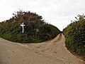 Okewill Cross - geograph.org.uk - 5151575.jpg 1,024 × 768; 180 KB
-
 Okewill Cross. - geograph.org.uk - 1253076.jpg 640 × 427; 58 KB
-
 Ordnance Survey Cut Mark - geograph.org.uk - 5026007.jpg 576 × 640; 152 KB
-
 Ordnance Survey Cut Mark - geograph.org.uk - 5026012.jpg 374 × 640; 98 KB
-
 Park View farm - geograph.org.uk - 523675.jpg 640 × 425; 112 KB
-

-

-
 Road down to Wigmore farm - geograph.org.uk - 523686.jpg 640 × 425; 102 KB
-

-
 Road to Viveham Farms - geograph.org.uk - 6178592.jpg 1,024 × 768; 353 KB
-
 Rockbear Lane - geograph.org.uk - 6178125.jpg 1,024 × 768; 231 KB
-
 Rockbear Lane - geograph.org.uk - 6178134.jpg 1,024 × 768; 237 KB
-
 Rockbear Lane - geograph.org.uk - 6178144.jpg 1,024 × 768; 309 KB
-
 Rook Bear Lane on the way down - geograph.org.uk - 367611.jpg 640 × 480; 82 KB
-

-

-
-
-
-

-

-

-

-

-

-

-

-

-
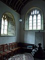
 Saint John The Baptist, East Down, exit - geograph.org.uk - 4499228.jpg 640 × 480; 148 KB
-

-
 Shortacombe Corner - geograph.org.uk - 4889877.jpg 1,024 × 768; 313 KB
-
 Shortacombe corner. - geograph.org.uk - 1260763.jpg 640 × 427; 65 KB
-
 Sitting Cows - geograph.org.uk - 722132.jpg 640 × 425; 76 KB
-
 South Indicott - geograph.org.uk - 459114.jpg 640 × 426; 112 KB
-
 South Indicott - geograph.org.uk - 459147.jpg 426 × 640; 122 KB
-
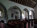
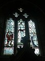
 St John the Baptist, East Down - geograph.org.uk - 4889826.jpg 1,024 × 851; 320 KB
-
 Steep Bend - geograph.org.uk - 518259.jpg 426 × 640; 79 KB
-
 Stile on the north side of Dudmoor Lane - geograph.org.uk - 4889864.jpg 1,024 × 768; 327 KB
-
 The A3123 near Yellaton Lane - geograph.org.uk - 2904247.jpg 2,625 × 1,881; 1.1 MB
-

-

-
 The first Bridge on the River Yeo at Hole Lane - geograph.org.uk - 1857990.jpg 1,024 × 768; 326 KB


_-_geograph.org.uk_-_4499247.jpg)
_-_geograph.org.uk_-_4499248.jpg)
_-_geograph.org.uk_-_4499249.jpg)
_-_geograph.org.uk_-_4499251.jpg)
_-_geograph.org.uk_-_4499253.jpg)
_-_geograph.org.uk_-_4499254.jpg)
_-_geograph.org.uk_-_4499255.jpg)
_-_geograph.org.uk_-_4499256.jpg)
_-_geograph.org.uk_-_4499257.jpg)
_-_geograph.org.uk_-_4499258.jpg)
_-_geograph.org.uk_-_4499235.jpg)
_-_geograph.org.uk_-_4499260.jpg)
_-_geograph.org.uk_-_4499261.jpg)
_-_geograph.org.uk_-_4499262.jpg)
_-_geograph.org.uk_-_4499263.jpg)
_-_geograph.org.uk_-_4499241.jpg)
_-_geograph.org.uk_-_4499237.jpg)
_-_geograph.org.uk_-_4499238.jpg)
_-_geograph.org.uk_-_4499239.jpg)
_-_geograph.org.uk_-_4499240.jpg)
_-_geograph.org.uk_-_4499242.jpg)
_-_geograph.org.uk_-_4499245.jpg)
_-_geograph.org.uk_-_4499246.jpg)


_-_geograph.org.uk_-_4499197.jpg)
_-_geograph.org.uk_-_4499198.jpg)
_-_geograph.org.uk_-_4499201.jpg)
_-_geograph.org.uk_-_4499202.jpg)
_-_geograph.org.uk_-_4499216.jpg)
_-_geograph.org.uk_-_4499203.jpg)
_-_geograph.org.uk_-_4499206.jpg)
_-_geograph.org.uk_-_4499208.jpg)
_-_geograph.org.uk_-_4499209.jpg)
_-_geograph.org.uk_-_4499210.jpg)
_-_geograph.org.uk_-_4499211.jpg)


