Category:East Farleigh
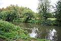
English: East Farleigh is a village and civil parish in the local government district of Maidstone, Kent, England. The village is located on the south side of the River Medway about two miles (3.2 km) upstream of the town of Maidstone. The bridge crossing the river here was built in the 14th century and is considered to be one of the oldest in Kent; although it is not particularly suitable for modern traffic conditions, owing to its narrowness.
village and civil parish in Kent, United Kingdom  | |||||
| Upload media | |||||
| Instance of | |||||
|---|---|---|---|---|---|
| Location | Maidstone, Kent, South East England, England | ||||
| Population |
| ||||
 | |||||
Subcategories
This category has the following 5 subcategories, out of 5 total.
E
- East Farleigh bridge (22 F)
- East Farleigh Lock (14 F)
- East Farleigh railway station (43 F)
M
- St Mary's Church, East Farleigh (14 F)
O
Media in category "East Farleigh"
The following 200 files are in this category, out of 318 total.
(previous page) (next page)-
 A boat at the bottom of the garden - geograph.org.uk - 3013834.jpg 640 × 480; 142 KB
-
 A convenient place to stop - geograph.org.uk - 4942172.jpg 2,048 × 1,536; 1.52 MB
-

-
 Across the Medway, East Farleigh, Kent - geograph.org.uk - 187913.jpg 640 × 480; 345 KB
-
 Apple Orchard - geograph.org.uk - 2785241.jpg 640 × 430; 120 KB
-
 Apple orchard, East Farleigh - geograph.org.uk - 3030578.jpg 640 × 480; 133 KB
-
 Apple orchards south of Amsbury Wood - geograph.org.uk - 1157730.jpg 640 × 430; 85 KB
-
 Approaching Workhouse Lane - geograph.org.uk - 2785358.jpg 640 × 430; 118 KB
-
 Autumnal orchard off Vicarage Lane - geograph.org.uk - 4708721.jpg 4,000 × 3,000; 6.04 MB
-
 Autumnal orchard off Vicarage Lane - geograph.org.uk - 4708723.jpg 4,000 × 3,000; 3.63 MB
-
 Barming Bridge - geograph.org.uk - 3562424.jpg 1,600 × 1,200; 318 KB
-
 Barn, Gallants Lane - geograph.org.uk - 2789754.jpg 640 × 430; 61 KB
-
 Benches by the River Medway - geograph.org.uk - 1622814.jpg 435 × 640; 78 KB
-
 Bend on Workhouse Lane, East Farleigh - geograph.org.uk - 3361582.jpg 4,608 × 3,456; 3.44 MB
-
 Bend, Wilson's Lane - geograph.org.uk - 2789712.jpg 640 × 430; 134 KB
-
 Between the hedges - geograph.org.uk - 2789714.jpg 640 × 430; 80 KB
-
 Boat dock, River Medway - geograph.org.uk - 2773661.jpg 640 × 387; 72 KB
-
 Boat moored on the River Medway - geograph.org.uk - 1265673.jpg 640 × 430; 77 KB
-
 Boats at East Farleigh - geograph.org.uk - 3562379.jpg 1,600 × 1,200; 328 KB
-
 Boats moored at East Farleigh - geograph.org.uk - 2770127.jpg 640 × 430; 77 KB
-

-
 Bridge House (geograph 6796494).jpg 1,024 × 684; 219 KB
-
 Bridge House - geograph.org.uk - 2773645.jpg 640 × 430; 110 KB
-
 Bridge in East Farleigh - geograph.org.uk - 4334003.jpg 640 × 480; 54 KB
-

-
 Bridge over The Medway - geograph.org.uk - 2324097.jpg 640 × 480; 99 KB
-
 Bridleway heading north - geograph.org.uk - 2787462.jpg 640 × 430; 103 KB
-
 Bridleway north - geograph.org.uk - 2787469.jpg 640 × 430; 78 KB
-
 Bridleway off Heath Road, East Farleigh - geograph.org.uk - 3444391.jpg 4,608 × 3,456; 3.38 MB
-
 Bridleway off Wilson Lane - geograph.org.uk - 2787491.jpg 430 × 640; 119 KB
-
 Bridleway to Wilsons Lane - geograph.org.uk - 2787451.jpg 640 × 430; 103 KB
-
 Bridleway to Wilsons Lane - geograph.org.uk - 2787472.jpg 640 × 430; 92 KB
-
 Bridleway to Wilsons Lane - geograph.org.uk - 2787489.jpg 640 × 430; 109 KB
-
 Bridleway, Access Road to Riding School - geograph.org.uk - 3362823.jpg 4,608 × 3,456; 3.33 MB
-
 Bridleway, Horseshoes Riding School - geograph.org.uk - 2787447.jpg 640 × 430; 127 KB
-
 Canada Goose near East Farleigh Lock - geograph.org.uk - 3562313.jpg 1,600 × 1,505; 469 KB
-
 Church of St Mary, East Farleigh - geograph.org.uk - 2770125.jpg 640 × 430; 81 KB
-
 Communication mast in Farm land - geograph.org.uk - 1137194.jpg 640 × 481; 68 KB
-
 Corner of the Priory grounds - geograph.org.uk - 3013858.jpg 640 × 480; 166 KB
-
 Cowl at Oast House - geograph.org.uk - 6046243.jpg 2,592 × 3,456; 369 KB
-
 Coxheath Wastewater Treatment Works - geograph.org.uk - 3358385.jpg 4,608 × 3,456; 3.69 MB
-
 Cuckoo Farm Cattery - geograph.org.uk - 2789731.jpg 640 × 430; 63 KB
-
 Dean St - geograph.org.uk - 2787406.jpg 640 × 430; 75 KB
-
 Dean St - geograph.org.uk - 2787444.jpg 640 × 430; 58 KB
-
 Dean Street at the junction of Forge Lane - geograph.org.uk - 4951689.jpg 1,957 × 1,428; 819 KB
-
 Dean Street, East Farleigh - geograph.org.uk - 3552841.jpg 3,488 × 2,616; 2.18 MB
-
 Dean Street, East Farleigh - geograph.org.uk - 3552846.jpg 3,488 × 2,616; 2.31 MB
-
 Drinking trough and mounting block (geograph 6796452).jpg 1,024 × 684; 202 KB
-
 East Farleigh - geograph.org.uk - 782797.jpg 640 × 480; 141 KB
-
 East Farleigh bridge - geograph.org.uk - 4957714.jpg 640 × 480; 68 KB
-
 East Farleigh Bridge - geograph.org.uk - 6046259.jpg 5,184 × 3,456; 1.74 MB
-
 East Farleigh church - geograph.org.uk - 5653595.jpg 640 × 480; 144 KB
-

-
 East Farleigh from Station Hill.jpg 2,561 × 1,330; 1.6 MB
-
 East Farleigh Primary School - geograph.org.uk - 2789702.jpg 640 × 430; 78 KB
-
 East Farleigh village sign - geograph.org.uk - 2324083.jpg 640 × 640; 125 KB
-
 East Farleigh Village Signs - geograph.org.uk - 1137236.jpg 640 × 481; 96 KB
-
 East Farleigh Weir - geograph.org.uk - 1265681.jpg 640 × 430; 69 KB
-
 Entrance to Public Footpath off Workhouse Lane - geograph.org.uk - 3361580.jpg 4,608 × 3,456; 3.45 MB
-
 Entrance to Public Footpath off Workhouse Lane - geograph.org.uk - 3361581.jpg 3,456 × 4,608; 3.64 MB
-
 Entrance to the scout camp on Stockett Lane - geograph.org.uk - 4947502.jpg 1,996 × 1,466; 1.53 MB
-
 Farleigh Green - geograph.org.uk - 2792814.jpg 640 × 430; 83 KB
-
 Farm building by Dean St - geograph.org.uk - 2787424.jpg 640 × 430; 78 KB
-
 Farmland off Gallant Lane - geograph.org.uk - 2789767.jpg 640 × 430; 72 KB
-
 Fence by the bridleway - geograph.org.uk - 2787467.jpg 640 × 430; 59 KB
-
 Fennington Oast seen from Dean Street - geograph.org.uk - 4381554.jpg 4,000 × 3,000; 4.01 MB
-
 Field by Dean Street - geograph.org.uk - 4951692.jpg 1,976 × 1,434; 729 KB
-
 Field off Heath Road, East Farleigh - geograph.org.uk - 3444396.jpg 4,608 × 3,456; 3.46 MB
-
 Fishing spot on the River Medway - geograph.org.uk - 2770093.jpg 640 × 430; 106 KB
-
 Fishing spot, River Medway - geograph.org.uk - 2770089.jpg 640 × 430; 132 KB
-
 Fishing spot, River Medway - geograph.org.uk - 2770091.jpg 640 × 430; 110 KB
-
 Flooded Orchard in Castle Farm - geograph.org.uk - 1143944.jpg 640 × 481; 98 KB
-
 Footpath by an orchard - geograph.org.uk - 2785348.jpg 640 × 430; 131 KB
-
 Footpath by Roses Farm - geograph.org.uk - 2792789.jpg 640 × 430; 101 KB
-
 Footpath by the shelterbelt. - geograph.org.uk - 2792806.jpg 640 × 430; 101 KB
-
 Footpath crossing a field - geograph.org.uk - 2792794.jpg 640 × 430; 99 KB
-
 Footpath off Gallants Lane - geograph.org.uk - 2792785.jpg 640 × 430; 126 KB
-
 Footpath off Stockett Lane - geograph.org.uk - 2785244.jpg 640 × 430; 83 KB
-
 Footpath off Wilson's Lane - geograph.org.uk - 2789738.jpg 640 × 430; 52 KB
-
 Footpath off Workhouse Lane - geograph.org.uk - 2785249.jpg 640 × 430; 130 KB
-
 Footpath to Farleigh Green - geograph.org.uk - 2792793.jpg 640 × 430; 135 KB
-
 Footpath to Farleigh Green - geograph.org.uk - 2792810.jpg 640 × 430; 109 KB
-
 Footpath to Workhouse Lane - geograph.org.uk - 2785345.jpg 640 × 430; 78 KB
-
 Forge Lane, Dean Street - geograph.org.uk - 4951688.jpg 2,048 × 1,536; 1.49 MB
-
 Forge Lane, East Farleigh - geograph.org.uk - 3552849.jpg 3,488 × 2,616; 2.15 MB
-
 Frith Hall - geograph.org.uk - 1137212.jpg 640 × 481; 88 KB
-
 Gallants Lane, East Farleigh - geograph.org.uk - 1752018.jpg 3,072 × 2,304; 2 MB
-
 Gallants Lane, East Farleigh - geograph.org.uk - 3599242.jpg 3,488 × 2,616; 2.23 MB
-
 Gallants Lane, East Farleigh - geograph.org.uk - 3599243.jpg 3,488 × 2,616; 2.16 MB
-
 Gallants Lane, East Farleigh - geograph.org.uk - 3599246.jpg 3,488 × 2,616; 2.19 MB
-
 Gallants Manor - geograph.org.uk - 1143957.jpg 640 × 481; 105 KB
-
 Gated estate off Dean Street - geograph.org.uk - 4951691.jpg 2,048 × 1,536; 600 KB
-
 George VI postbox at East Farleigh - geograph.org.uk - 1888693.jpg 480 × 640; 88 KB
-
 Hartridge Farm Residential Park - geograph.org.uk - 5653233.jpg 640 × 480; 157 KB
-
 Heath Road, Coxheath - geograph.org.uk - 4942171.jpg 2,048 × 1,536; 1.01 MB
-
 Heath Road, Coxheath - geograph.org.uk - 4942175.jpg 2,048 × 1,536; 1.16 MB
-
 High hedges, Wilson's Lane - geograph.org.uk - 2789716.jpg 640 × 430; 79 KB
-
 Highlands Farmhouse (geograph 6796391).jpg 1,024 × 684; 237 KB
-
 Horseshoes Riding School - geograph.org.uk - 2787418.jpg 640 × 430; 53 KB
-
 Horseshoes Riding School - geograph.org.uk - 2787435.jpg 640 × 430; 63 KB
-
 Horseshoes Riding School, East Farleigh - geograph.org.uk - 3362820.jpg 4,608 × 3,456; 3.64 MB
-
 Horseshoes Riding School, East Farleigh - geograph.org.uk - 3362821.jpg 4,608 × 3,456; 3.31 MB
-
 Hospital Barn Farmhouse - geograph.org.uk - 4708718.jpg 3,911 × 2,607; 3.3 MB
-
 Hospital Barn Farmhouse, Gallants Lane - geograph.org.uk - 4708719.jpg 3,629 × 2,419; 3.31 MB
-
 Hospital Barn Farmhouse, Gallants Lane - geograph.org.uk - 4708720.jpg 4,678 × 2,807; 3.49 MB
-
 House entrance on Heath Road, Farleigh Heath - geograph.org.uk - 4947503.jpg 2,048 × 1,536; 1.32 MB
-
 House on Lower Road, East Farleigh - geograph.org.uk - 4946354.jpg 2,048 × 1,536; 1.51 MB
-
 House on Stockett Lane, Dean Street - geograph.org.uk - 4947501.jpg 2,044 × 1,530; 1.09 MB
-
 House on Wilson's Lane - geograph.org.uk - 2789742.jpg 640 × 430; 91 KB
-
 Houses by Dean Street - geograph.org.uk - 4951690.jpg 2,048 × 1,536; 1.48 MB
-
 Houses on Heath Road, Coxheath - geograph.org.uk - 4942173.jpg 2,048 × 1,536; 986 KB
-

-
 Kettle Lane, West Farleigh - geograph.org.uk - 3627121.jpg 3,488 × 2,616; 2.17 MB
-
 Kilnbridge Close at the junction of Lower Road - geograph.org.uk - 4946355.jpg 2,048 × 1,536; 1.49 MB
-
 Landscape near Farleigh Green - geograph.org.uk - 2792798.jpg 640 × 430; 74 KB
-
 Large gardens alongside the River Medway - geograph.org.uk - 6236151.jpg 2,880 × 2,506; 1.52 MB
-
 Looking along Dean Street - geograph.org.uk - 4382978.jpg 4,000 × 3,000; 4.18 MB
-
 Loose Sewage Works - geograph.org.uk - 2782623.jpg 640 × 430; 99 KB
-
 Lower Road, East Farleigh - geograph.org.uk - 1753285.jpg 3,072 × 2,304; 2.44 MB
-
 Lower Road, East Farleigh - geograph.org.uk - 3552848.jpg 3,488 × 2,616; 2.14 MB
-
 Lower Road, East Farleigh - geograph.org.uk - 4946353.jpg 2,048 × 1,536; 1.59 MB
-
 Lower Road, East Farleigh - geograph.org.uk - 4951687.jpg 1,964 × 1,418; 766 KB
-

-
 Maidstone Waterworks, East Farleigh - geograph.org.uk - 1265692.jpg 640 × 430; 72 KB
-
 Medway below Barming Bridge - geograph.org.uk - 5653208.jpg 640 × 480; 130 KB
-
 Medway Below Barming Bridge - geograph.org.uk - 777846.jpg 640 × 480; 88 KB
-
 Medway Valley Walk - geograph.org.uk - 778185.jpg 640 × 480; 130 KB
-

-
 Morning delivery at Vicarage Lane - geograph.org.uk - 4382980.jpg 4,000 × 3,000; 4 MB
-
 Narrowboat at East Farleigh - geograph.org.uk - 3562268.jpg 1,600 × 1,574; 890 KB
-
 New Cut, near East Farleigh - geograph.org.uk - 3552839.jpg 3,488 × 2,616; 2.34 MB
-
 Oast House - geograph.org.uk - 6046236.jpg 4,319 × 2,879; 644 KB
-
 Oast House - geograph.org.uk - 6046240.jpg 4,920 × 3,280; 1.59 MB
-
 Oast House - geograph.org.uk - 6046241.jpg 4,920 × 3,280; 1.33 MB
-
 Oast House - geograph.org.uk - 6046260.jpg 4,319 × 2,879; 999 KB
-

-
 Oast House, Dean Street, East Farleigh - geograph.org.uk - 5820765.jpg 5,184 × 3,456; 6.26 MB
-

-
 Orchard by the footpath - geograph.org.uk - 2792799.jpg 640 × 430; 86 KB
-
 Orchard by the railway - geograph.org.uk - 1506683.jpg 640 × 430; 73 KB
-
 Orchard in winter - geograph.org.uk - 2785242.jpg 640 × 430; 95 KB
-
 Orchard near Farleigh Green - geograph.org.uk - 2792808.jpg 640 × 430; 92 KB
-
 Orchard on Forge Lane - geograph.org.uk - 782745.jpg 640 × 480; 105 KB
-
 Orchard, East Farleigh - geograph.org.uk - 782752.jpg 640 × 480; 92 KB
-
 Orchard, Wilson's Lane - geograph.org.uk - 2789720.jpg 640 × 430; 82 KB
-
 Orchards - geograph.org.uk - 2787479.jpg 640 × 430; 56 KB
-
 Orchards by Wilson's Lane - geograph.org.uk - 2789718.jpg 640 × 430; 107 KB
-
 Orchards near East Farleigh - geograph.org.uk - 3599249.jpg 3,488 × 2,616; 2.17 MB
-
 Path into Hamlet Wood from Workhouse Lane - geograph.org.uk - 4383121.jpg 4,000 × 3,000; 4.26 MB
-
 Pillbox by the River Medway - geograph.org.uk - 1265109.jpg 640 × 430; 145 KB
-
 Pleasant Valley Road - geograph.org.uk - 780655.jpg 640 × 480; 98 KB
-

-
 Priory House, near East Farleigh - geograph.org.uk - 1265077.jpg 640 × 430; 86 KB
-
 Private Dock near Priory House - geograph.org.uk - 1265085.jpg 640 × 430; 101 KB
-
 Pukka Ponies Equine Rescue - geograph.org.uk - 4679123.jpg 4,608 × 3,456; 3.38 MB
-
 Pylon and farmland - geograph.org.uk - 2792786.jpg 640 × 430; 62 KB
-
 Pylon in a field - geograph.org.uk - 2792796.jpg 640 × 430; 38 KB
-
 Pylon in an orchard - geograph.org.uk - 2792800.jpg 640 × 430; 94 KB
-
 Pylons near East Farleigh - geograph.org.uk - 3599248.jpg 3,488 × 2,616; 2.1 MB
-
 River Lodge, East Farleigh - geograph.org.uk - 1265697.jpg 640 × 430; 61 KB
-
 River Medway - geograph.org.uk - 2770095.jpg 640 × 430; 104 KB
-
 River Medway - geograph.org.uk - 2773669.jpg 640 × 430; 110 KB
-
 River Medway - geograph.org.uk - 5653214.jpg 640 × 480; 149 KB
-
 River Medway - geograph.org.uk - 5653219.jpg 640 × 480; 199 KB
-
 River Medway - geograph.org.uk - 5653224.jpg 640 × 480; 149 KB
-
 River Medway - geograph.org.uk - 5653737.jpg 640 × 480; 193 KB
-
 River Medway - Maidstone - geograph.org.uk - 3562923.jpg 1,600 × 1,200; 566 KB
-
 River Medway and Priory House - geograph.org.uk - 5082503.jpg 1,600 × 1,067; 679 KB
-
 River Medway at East Farleigh - geograph.org.uk - 1753255.jpg 3,072 × 2,304; 2.37 MB
-
 River Medway at East Farleigh - geograph.org.uk - 2322885.jpg 11,453 × 2,400; 6.89 MB
-
 River Medway at East Farleigh - geograph.org.uk - 2325206.jpg 640 × 427; 86 KB
-
 River Medway at East Farleigh - geograph.org.uk - 3562293.jpg 1,600 × 1,200; 437 KB
-
 River Medway at East Farleigh - geograph.org.uk - 3562367.jpg 1,600 × 1,200; 330 KB
-
 River Medway Downstream of Barming Bridge - geograph.org.uk - 5082757.jpg 1,600 × 1,067; 576 KB
-
 River Medway east of East Farleigh - geograph.org.uk - 1265092.jpg 640 × 430; 89 KB
-
 River Medway looking towards East Farleigh - geograph.org.uk - 3059921.jpg 4,000 × 3,000; 4.2 MB
-
 River Medway near Barming Bridge - geograph.org.uk - 3059903.jpg 4,000 × 3,000; 4.34 MB
-
 River Medway, Barming - geograph.org.uk - 3627112.jpg 3,488 × 2,616; 2.15 MB
-

-
 River Medway, near East Farleigh - geograph.org.uk - 3597188.jpg 3,488 × 2,616; 2.25 MB
-
 Riverbanks at East Farleigh - geograph.org.uk - 3562249.jpg 1,600 × 1,200; 820 KB
-
 Riverside houses in Priory Drive - geograph.org.uk - 4957768.jpg 640 × 480; 91 KB
-
 Roses Farm - geograph.org.uk - 1143951.jpg 640 × 481; 73 KB
-
 Roses Farm - geograph.org.uk - 2792790.jpg 640 × 430; 101 KB
-
 Sharp bend on Workhouse Lane - geograph.org.uk - 2785253.jpg 640 × 430; 91 KB
-
 Shelterbelt and orchard - geograph.org.uk - 2792803.jpg 640 × 430; 112 KB
-
 Shelterbelt and orchard - geograph.org.uk - 2792804.jpg 640 × 430; 101 KB
-
 Signs at Lower Road, East Farleigh - geograph.org.uk - 1753280.jpg 3,072 × 2,304; 2.32 MB
-

-
 Small bridged dock off Medway - geograph.org.uk - 5653736.jpg 640 × 480; 201 KB
-

-
 South end of East Farleigh bridge - geograph.org.uk - 4957708.jpg 640 × 480; 104 KB
-
 St Helens Lane from Lower Road - geograph.org.uk - 4727284.jpg 640 × 480; 83 KB
-
 St Mary's Church, East Farleigh and the former school - geograph.org.uk - 4676918.jpg 4,000 × 3,000; 4.3 MB
-

-
 St Mary's Church, East Farleigh, from the River Medway Walk - geograph.org.uk - 6236137.jpg 4,000 × 3,000; 4.68 MB
-
 St Mary's Churchyard, East Farleigh - geograph.org.uk - 4676923.jpg 4,000 × 3,000; 4.34 MB
-
 St Mary's Churchyard, East Farleigh - geograph.org.uk - 4676926.jpg 4,000 × 3,000; 4.03 MB
-
 St Mary's Churchyard, East Farleigh - geograph.org.uk - 4676929.jpg 4,000 × 3,000; 4.06 MB
-
 St Mary, East Farleigh - East end - geograph.org.uk - 4131576.jpg 900 × 600; 183 KB


.jpg)


.jpg)


.jpg)


_-_geograph.org.uk_-_1265694.jpg)


_-_geograph.org.uk_-_4542302.jpg)


