Category:East Malling and Larkfield
English: East Malling and Larkfield is a civil parish in the district of Tonbridge and Malling, Kent, England. It is about 3.9 km (2.4 mi) southeast of West Malling, 8.5 km (5.5 mi) northwest of Maidstone, and 18.3 km (11.4 mi) SSW of Rochester.
civil parish in Kent, England | |||||
| Upload media | |||||
| Instance of | |||||
|---|---|---|---|---|---|
| Location | Tonbridge and Malling, Kent, South East England, England | ||||
 | |||||
Subcategories
This category has the following 5 subcategories, out of 5 total.
B
- Bradbourne House (1 F)
E
L
- Leybourne Lakes Country Park (157 F)
R
- The Rising Sun, Mill Street (3 F)
Media in category "East Malling and Larkfield"
The following 200 files are in this category, out of 305 total.
(previous page) (next page)-

-
 A20, east - geograph.org.uk - 2084996.jpg 640 × 430; 143 KB
-
 A20, London Rd westward - geograph.org.uk - 2085002.jpg 640 × 430; 160 KB
-

-
 A228, Malling Rd - geograph.org.uk - 2592426.jpg 640 × 430; 60 KB
-
 A228, Malling Rd - geograph.org.uk - 3530846.jpg 640 × 375; 44 KB
-
 A228, West Malling bypass - geograph.org.uk - 2500532.jpg 640 × 430; 42 KB
-
 Abbey Meads Lake near Snodland - geograph.org.uk - 3568234.jpg 3,488 × 2,616; 2.16 MB
-
 Abbey Meads Lake near Snodland - geograph.org.uk - 3568237.jpg 3,488 × 2,616; 2.14 MB
-
 Access Lane to Hillberry Farm - geograph.org.uk - 5083845.jpg 640 × 427; 69 KB
-

-
 Apartments on The Lakes - geograph.org.uk - 2090734.jpg 640 × 430; 157 KB
-
 Arden (Maidstone) Mini Dealership - geograph.org.uk - 5640802.jpg 4,096 × 2,304; 2.47 MB
-
 Ashton Way - geograph.org.uk - 5086991.jpg 1,600 × 1,067; 453 KB
-
 At the junction - geograph.org.uk - 2977408.jpg 640 × 480; 102 KB
-
 Belle Court - geograph.org.uk - 5640807.jpg 4,096 × 2,031; 1.63 MB
-
 Blacklands House - geograph.org.uk - 2084863.jpg 640 × 391; 99 KB
-
 Bradbourne Park Rd - geograph.org.uk - 2084990.jpg 640 × 430; 166 KB
-
 Bream Close - geograph.org.uk - 3034675.jpg 640 × 415; 65 KB
-
 Bream Close, The Lakes - geograph.org.uk - 2090755.jpg 640 × 430; 127 KB
-
 Bridge over the M20 - geograph.org.uk - 2500512.jpg 640 × 368; 39 KB
-
 Bridleway off Sweets Lane - geograph.org.uk - 3555222.jpg 4,000 × 3,000; 4.08 MB
-
 Bridleway to Sweets Lane - geograph.org.uk - 2109407.jpg 3,072 × 2,304; 1.76 MB
-
 Broadwater Rd - geograph.org.uk - 2083845.jpg 640 × 430; 157 KB
-
 Broadwater Road, East Malling - geograph.org.uk - 4670331.jpg 2,272 × 1,704; 1.17 MB
-
 Brook Rd - geograph.org.uk - 2053737.jpg 640 × 430; 149 KB
-
 Brooklands Road, New Hythe - geograph.org.uk - 3613223.jpg 3,488 × 2,616; 2.25 MB
-
 Bus stop, New Rd - geograph.org.uk - 2084970.jpg 640 × 430; 138 KB
-
 B^Q, A20 - geograph.org.uk - 2084994.jpg 640 × 430; 125 KB
-
 B^Q, A20 - geograph.org.uk - 2084999.jpg 640 × 430; 121 KB
-

-
 Carp Close - geograph.org.uk - 3034671.jpg 640 × 371; 44 KB
-
 Cattle by Sweets Lane - geograph.org.uk - 3555181.jpg 4,000 × 3,000; 4.08 MB
-
 Cattle next to Sweets Lane - geograph.org.uk - 3555229.jpg 4,000 × 3,000; 3.72 MB
-
 Chapman Way and New Rd, junction - geograph.org.uk - 2084960.jpg 640 × 430; 160 KB
-

-

-
 Cleared Area in Oaken Wood - geograph.org.uk - 4932112.jpg 4,608 × 3,456; 6.56 MB
-
 Coot amongst Greylag Geese - geograph.org.uk - 3257366.jpg 640 × 430; 94 KB
-
 Coot at Leybourne Lakes - geograph.org.uk - 4964985.jpg 3,000 × 4,000; 2.81 MB
-
 Cottages, Mill St - geograph.org.uk - 2084463.jpg 640 × 430; 147 KB
-
 Cul-de-Sac on Larkfield Trading Estate, New Hythe - geograph.org.uk - 3891819.jpg 3,104 × 2,328; 2.49 MB
-

-
 Ducks on the pond by Blacklands - geograph.org.uk - 2084858.jpg 640 × 430; 149 KB
-
 Eagle Close off Swallow Rd - geograph.org.uk - 2086580.jpg 640 × 430; 131 KB
-
-

-
 East Malling ^ Larkfield Parish Council, Church Farm - geograph.org.uk - 5640798.jpg 4,096 × 2,304; 3.3 MB
-
 Elizabeth Smith Almshouses, Mill St - geograph.org.uk - 2084513.jpg 640 × 430; 131 KB
-
 Elm Crescent - geograph.org.uk - 2084948.jpg 640 × 393; 87 KB
-
 Elm Crescent looking to Chapman Way - geograph.org.uk - 2084947.jpg 640 × 430; 133 KB
-
 Esso filling station, A20 - geograph.org.uk - 2084992.jpg 640 × 430; 148 KB
-
 Experimental trees - geograph.org.uk - 1222287.jpg 640 × 480; 231 KB
-
 Field by Broadwater Rd - geograph.org.uk - 2083832.jpg 640 × 430; 132 KB
-
 Fields west of Mill Street - geograph.org.uk - 2083879.jpg 640 × 430; 123 KB
-
 Fields west of Mill Street - geograph.org.uk - 2084427.jpg 640 × 430; 135 KB
-
 Flats at 142-158 The Lakes - geograph.org.uk - 4964415.jpg 4,000 × 3,000; 2.97 MB
-
 Flats, Plover Rd - geograph.org.uk - 2086538.jpg 640 × 430; 143 KB
-
 Footbridge over the M20 - geograph.org.uk - 2086598.jpg 640 × 430; 128 KB
-
 Footbridge over the M20 - geograph.org.uk - 2500504.jpg 640 × 430; 46 KB
-
 Footbridge, M20 - geograph.org.uk - 4569687.jpg 640 × 426; 48 KB
-
 Footpath along the River Medway - geograph.org.uk - 2504134.jpg 640 × 430; 139 KB
-
 Footpath along the River Medway - geograph.org.uk - 2504144.jpg 640 × 430; 122 KB
-

-

-
 Footpath and cycleway to Chaucer Way - geograph.org.uk - 5640779.jpg 4,096 × 2,304; 4.87 MB
-
 Footpath at the end of Swift Close - geograph.org.uk - 2086587.jpg 640 × 430; 134 KB
-

-
 Footpath heading North off Sweets Lane - geograph.org.uk - 5086569.jpg 1,600 × 1,067; 330 KB
-
 Footpath heading North West from Broadwater Road - geograph.org.uk - 5086986.jpg 1,600 × 1,067; 561 KB
-
 Footpath heading North West from Mill Street - geograph.org.uk - 5086981.jpg 1,600 × 1,067; 539 KB
-
 Footpath Junction, Oaken Wood - geograph.org.uk - 4932119.jpg 4,608 × 3,456; 5.79 MB
-
 Footpath north of Swift Close - geograph.org.uk - 2086593.jpg 640 × 430; 150 KB
-
 Footpath north of the M20 - geograph.org.uk - 2086652.jpg 640 × 430; 159 KB
-
 Footpath off Blacklands - geograph.org.uk - 2084946.jpg 640 × 430; 157 KB
-
 Footpath off Broadwater Rd - geograph.org.uk - 2083857.jpg 640 × 430; 150 KB
-
 Footpath off Lucks Hill - geograph.org.uk - 2083726.jpg 640 × 430; 174 KB
-
 Footpath off Lucks Hill - geograph.org.uk - 2083736.jpg 640 × 430; 187 KB
-
 Footpath off Lunsford Lake - geograph.org.uk - 2053690.jpg 640 × 430; 200 KB
-
 Footpath off Lunsford Lane - geograph.org.uk - 2053743.jpg 640 × 430; 131 KB
-
 Footpath parallel with Chapman Way - geograph.org.uk - 2084950.jpg 640 × 430; 201 KB
-

-
 Footpath to Broadwater Rd - geograph.org.uk - 2083818.jpg 640 × 430; 179 KB
-
 Footpath to Fielding Drive - geograph.org.uk - 2090681.jpg 640 × 430; 161 KB
-
 Footpath to Leybourne Lake - geograph.org.uk - 2053744.jpg 640 × 430; 188 KB
-
 Footpath to Mill Street - geograph.org.uk - 2083894.jpg 640 × 430; 199 KB
-
 Footpath to Mill Street - geograph.org.uk - 2083908.jpg 640 × 430; 180 KB
-
 Footpath to the River Medway - geograph.org.uk - 2504089.jpg 640 × 430; 140 KB
-
 Footpath to the River Medway - geograph.org.uk - 2504092.jpg 640 × 430; 140 KB
-
 Footpath West Malling - geograph.org.uk - 4859622.jpg 640 × 480; 82 KB
-
 Former hop fields - geograph.org.uk - 1222249.jpg 640 × 480; 187 KB
-
 Former Lodge, New Rd - geograph.org.uk - 2084958.jpg 640 × 430; 143 KB
-
 Garages off Heron Rd - geograph.org.uk - 2086520.jpg 640 × 430; 156 KB
-
 Garages off Kingfisher Rd - geograph.org.uk - 2086536.jpg 640 × 430; 121 KB
-
 Geese and picnic tables - geograph.org.uk - 3036738.jpg 640 × 430; 89 KB
-
 Geese by 'The Ocean' - geograph.org.uk - 3991454.jpg 4,000 × 3,000; 4.21 MB
-
 Gighill Rd - geograph.org.uk - 3033177.jpg 640 × 430; 64 KB
-
 Glebe House - geograph.org.uk - 5640792.jpg 4,096 × 2,304; 3.48 MB
-
 Goose and gosling - geograph.org.uk - 3036740.jpg 640 × 430; 101 KB
-
 Goose and goslings - geograph.org.uk - 3163374.jpg 640 × 430; 103 KB
-
 Goslings at Leybourne Lakes - geograph.org.uk - 4964776.jpg 3,414 × 2,561; 3.13 MB
-
 Goslings at Leybourne Lakes - geograph.org.uk - 4964983.jpg 3,409 × 2,557; 3.55 MB
-
 Grassy area by Fielding Drive - geograph.org.uk - 2090673.jpg 640 × 430; 133 KB
-
 Great Lunsford Farm - geograph.org.uk - 3257377.jpg 640 × 430; 53 KB
-
 Great Lunsford Farm, Lunsford Lane - geograph.org.uk - 2053675.jpg 640 × 430; 152 KB
-
 Great Lunsford Farmhouse - geograph.org.uk - 2501681.jpg 640 × 430; 97 KB
-
 Green area in front of Catlyn Close - geograph.org.uk - 2084962.jpg 640 × 430; 180 KB
-
 Greylag Geese - geograph.org.uk - 3163370.jpg 640 × 430; 115 KB
-
 Greylag Goose - geograph.org.uk - 3036799.jpg 640 × 430; 72 KB
-
-
 Heron Rd - geograph.org.uk - 2086526.jpg 640 × 430; 144 KB
-
 Heron Rd, Larkfield - geograph.org.uk - 2086524.jpg 640 × 430; 128 KB
-
 Horse exercise area - geograph.org.uk - 1222196.jpg 640 × 480; 189 KB
-
 Horse pond, Mill St - geograph.org.uk - 2084529.jpg 640 × 430; 188 KB
-
 House on Broadwater Rd - geograph.org.uk - 2083836.jpg 640 × 430; 141 KB
-
 House on Broadwater Rd - geograph.org.uk - 2083868.jpg 640 × 430; 130 KB
-
 Houses at The Lakes - geograph.org.uk - 4964725.jpg 4,000 × 3,000; 3.81 MB
-
 Houses on The Lakes - geograph.org.uk - 4964409.jpg 3,570 × 2,380; 2.41 MB
-
 Houses, Lakes Estate - geograph.org.uk - 2501722.jpg 640 × 430; 67 KB
-
 Invicta Works, Mill St - geograph.org.uk - 2084451.jpg 640 × 348; 73 KB
-
 Joining the M20, J4 - geograph.org.uk - 4569685.jpg 640 × 450; 43 KB
-

-
 Junction of Heron Rd and Kingfisher Rd - geograph.org.uk - 2086532.jpg 640 × 430; 131 KB
-
 Junction of Stickens Lane and Mill St - geograph.org.uk - 2084457.jpg 640 × 430; 134 KB
-

-
 Kentish orchard at the start of Spring - geograph.org.uk - 1222253.jpg 640 × 480; 138 KB
-
 Kentish tall hedges - geograph.org.uk - 1222228.jpg 640 × 480; 129 KB
-
 Kingfisher Rd - geograph.org.uk - 2086534.jpg 640 × 430; 130 KB
-
 Kingfisher Rd - geograph.org.uk - 2086535.jpg 640 × 430; 128 KB
-
 Lakes Estate - geograph.org.uk - 3033228.jpg 640 × 430; 63 KB
-
 Lakes Estate - geograph.org.uk - 3628100.jpg 640 × 430; 44 KB
-
 Lakes Estate house - geograph.org.uk - 2501715.jpg 640 × 430; 71 KB
-
 Landscaped area, The Lakes - geograph.org.uk - 2090739.jpg 640 × 430; 127 KB
-
 Large pond by the Blacklands path - geograph.org.uk - 2084854.jpg 640 × 430; 156 KB
-

-
 Larkspur Rd - geograph.org.uk - 2084975.jpg 640 × 430; 128 KB
-
 Level Crossing - geograph.org.uk - 2504085.jpg 640 × 430; 106 KB
-

-
 Leybourne Lakes - geograph.org.uk - 4964760.jpg 4,000 × 3,000; 3.97 MB
-
 Leybourne Lakes - geograph.org.uk - 4964764.jpg 4,000 × 3,000; 3.61 MB
-
 Leybourne Way - geograph.org.uk - 2053734.jpg 640 × 417; 135 KB
-
 Leybourne Way - geograph.org.uk - 3033181.jpg 640 × 430; 67 KB
-
 Leybourne Way - geograph.org.uk - 3033236.jpg 640 × 430; 61 KB
-
 Listed building on Mill St - geograph.org.uk - 2084449.jpg 640 × 430; 143 KB
-
 London Road at the junction of New Road - geograph.org.uk - 4365789.jpg 2,048 × 1,536; 1.47 MB
-
 Looking north along New Rd - geograph.org.uk - 2084986.jpg 640 × 430; 162 KB
-
 Lorries in a layby, Malling Rd - geograph.org.uk - 2592069.jpg 640 × 430; 57 KB
-
 Lunsford Lane - geograph.org.uk - 2053668.jpg 640 × 430; 176 KB
-
 Lunsford Lane - geograph.org.uk - 2053739.jpg 640 × 430; 128 KB
-
 Lunsford Lane - geograph.org.uk - 2501668.jpg 640 × 430; 101 KB
-
 Lunsford Lane - geograph.org.uk - 2592421.jpg 640 × 430; 116 KB
-
 Lunsford Lane - geograph.org.uk - 2614515.jpg 640 × 430; 109 KB
-
 Lunsford Lane - geograph.org.uk - 2614519.jpg 640 × 430; 113 KB
-
 Lunsford Lane, Leybourne Way junction - geograph.org.uk - 2053727.jpg 640 × 430; 135 KB
-
 Lunsford Lane, near Leybourne - geograph.org.uk - 3613121.jpg 3,488 × 2,616; 3.25 MB
-
 Lunsford Lane, near Leybourne - geograph.org.uk - 3613142.jpg 3,488 × 2,616; 2.71 MB
-
 M20 approaching junction 4 - geograph.org.uk - 2500493.jpg 640 × 430; 41 KB
-
 M20 near New Hythe - geograph.org.uk - 3604425.jpg 3,029 × 2,110; 1.26 MB
-
 M20 near New Hythe - geograph.org.uk - 3709331.jpg 640 × 427; 233 KB
-
 M20, Dover bound - geograph.org.uk - 2086609.jpg 640 × 430; 142 KB
-
 M20, London bound - geograph.org.uk - 2086600.jpg 640 × 430; 134 KB
-
 Medway Valley line - geograph.org.uk - 2504071.jpg 640 × 430; 108 KB
-
 Medway Valley line - geograph.org.uk - 2991475.jpg 640 × 480; 145 KB
-
 Memorial to six unmarried sisters - geograph.org.uk - 3556855.jpg 4,000 × 3,000; 4.01 MB
-
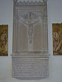 Memorial to two brothers killed in the First World War - geograph.org.uk - 3556863.jpg 3,000 × 4,000; 4.04 MB
-
 Merlin Avenue - geograph.org.uk - 2086544.jpg 640 × 430; 128 KB
-
 Middle Mill Rd and Mill St junction - geograph.org.uk - 2084527.jpg 640 × 430; 159 KB
-
 Mill St - geograph.org.uk - 2084441.jpg 640 × 430; 152 KB
-
 Modern housing, Blacklands - geograph.org.uk - 2084944.jpg 640 × 430; 132 KB
-
 Mouse Cottage at Mill Street - geograph.org.uk - 3555158.jpg 4,000 × 3,000; 4.02 MB
-
 New Hythe Lane (2) - geograph.org.uk - 3891882.jpg 3,104 × 2,328; 1.89 MB
-
 New Hythe Lane - geograph.org.uk - 3891825.jpg 3,104 × 2,328; 2.23 MB
-
 New Hythe Lane Bridge over the M20 - geograph.org.uk - 3709340.jpg 640 × 480; 257 KB
-
 New Hythe Lane Bridge, M20 - geograph.org.uk - 4569692.jpg 640 × 426; 47 KB
-
 New Hythe Lane crossing the M20 - geograph.org.uk - 4111185.jpg 4,000 × 3,000; 4.32 MB
-
 New Hythe Lane over the M20 - geograph.org.uk - 2086613.jpg 640 × 430; 134 KB
-
 New Hythe Lane, New Hythe - geograph.org.uk - 3568248.jpg 3,488 × 2,616; 2.21 MB
-
 New Hythe Lane, New Hythe - geograph.org.uk - 3613240.jpg 3,488 × 2,616; 2.51 MB
-
 New Hythe railway station, Kent - geograph.org.uk - 3227690.jpg 800 × 600; 107 KB
-
 New Hythe station - geograph.org.uk - 3429192.jpg 4,000 × 3,000; 4.17 MB
-
 New Rd - geograph.org.uk - 2084987.jpg 640 × 430; 168 KB
-
 New Rd heading north - geograph.org.uk - 2084967.jpg 640 × 430; 156 KB
-
 New Rd heading south to East Malling - geograph.org.uk - 2084959.jpg 640 × 430; 168 KB
-
 Northbound M20 at Junction 4 - geograph.org.uk - 3709327.jpg 640 × 480; 264 KB
-
 Northbound M20 near New Hythe - geograph.org.uk - 3709336.jpg 640 × 480; 242 KB
-
 Northbound M20, Lunsford Lane Bridge - geograph.org.uk - 3709317.jpg 640 × 480; 254 KB
-
 Oast House at Broadwater Farm, Broadwater Road, West Malling - geograph.org.uk - 5795494.jpg 5,184 × 3,456; 3.03 MB
-
 Oasts at Broadwater Farm (2) - geograph.org.uk - 5559250.jpg 741 × 1,024; 216 KB
-
 Oasts at Broadwater Farm - geograph.org.uk - 5559165.jpg 717 × 1,024; 175 KB
-
 Obelisk in modern estate landscaping - geograph.org.uk - 1146134.jpg 640 × 481; 108 KB
-

-
 Paper Mills, New Hythe - geograph.org.uk - 3568242.jpg 3,488 × 2,616; 2.19 MB
-
 Path to the River Medway - geograph.org.uk - 2504098.jpg 640 × 430; 109 KB
-
 Pedestrian Level Crossing near New Hythe - geograph.org.uk - 3568227.jpg 3,488 × 2,616; 2.23 MB
-
 Pedestrian Level crossing near New Hythe - geograph.org.uk - 3568230.jpg 3,488 × 2,616; 2.16 MB
-

-

-
 Pike Close - geograph.org.uk - 3034672.jpg 640 × 430; 91 KB
-
 Pike Close, The Lakes - geograph.org.uk - 2090749.jpg 640 × 430; 142 KB
-
 Pillbox by the River Medway - geograph.org.uk - 2504125.jpg 640 × 430; 135 KB


_Mini_Dealership_-_geograph.org.uk_-_5640802.jpg)


_-_geograph.org.uk_-_5556344.jpg)
_-_geograph.org.uk_-_5556389.jpg)


_-_geograph.org.uk_-_5558929.jpg)
_-_geograph.org.uk_-_5558945.jpg)


_-_geograph.org.uk_-_3891882.jpg)


_-_geograph.org.uk_-_5559250.jpg)


