Category:East Stour, Dorset
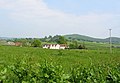
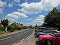
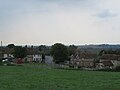
English: East Stour is a village on the River Stour between Gillingham and Sturminster Newton in the Blackmore Vale area of Dorset, England. The village has a population of 548 (2001). The village lies on the A30 road a mile east of West Stour.
village and civil parish in Dorset, United Kingdom  | |||||
| Upload media | |||||
| Instance of | |||||
|---|---|---|---|---|---|
| Location | Dorset, South West England, England | ||||
 | |||||
Subcategories
This category has the following 2 subcategories, out of 2 total.
C
T
Media in category "East Stour, Dorset"
The following 113 files are in this category, out of 113 total.
-
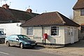
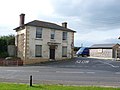
 A30 Front Street, East Stour - geograph.org.uk - 5406078.jpg 640 × 427; 78 KB
-
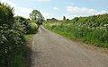
 B3092 near Butterwell Farm - geograph.org.uk - 5113820.jpg 3,072 × 2,048; 1.44 MB
-
 Back Street, East Stour - geograph.org.uk - 5113241.jpg 3,060 × 1,726; 1.17 MB
-
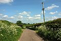
 Bend in Standpitts Lane - geograph.org.uk - 5073028.jpg 3,072 × 2,048; 1.34 MB
-
 Building works East Stour Dorset - geograph.org.uk - 922080.jpg 1,024 × 658; 166 KB
-
 Butterwell Farm - geograph.org.uk - 5406074.jpg 640 × 427; 91 KB
-

-
 Cart shed Hartgill Farm East Stour Dorset - geograph.org.uk - 922037.jpg 640 × 480; 113 KB
-
 Church Farm, East Stour - geograph.org.uk - 5113367.jpg 3,072 × 2,048; 1.15 MB
-
 Church Farm, East Stour - geograph.org.uk - 5113535.jpg 2,630 × 1,645; 737 KB
-
 Cole Street Farm - geograph.org.uk - 4968957.jpg 1,920 × 1,280; 429 KB
-
 Cole Street Farm - geograph.org.uk - 5070707.jpg 1,920 × 1,280; 709 KB
-
 Cole Street Lane - geograph.org.uk - 4969070.jpg 1,920 × 1,280; 491 KB
-
 Cole Street Lane - geograph.org.uk - 5070652.jpg 1,920 × 1,227; 597 KB
-
 Cole Street Lane - geograph.org.uk - 5070775.jpg 1,920 × 1,280; 717 KB
-
 Cole Street Lane - geograph.org.uk - 5071726.jpg 2,959 × 1,381; 1.23 MB
-
 Cole Street Lane - geograph.org.uk - 5071730.jpg 3,072 × 2,048; 1.35 MB
-
 Cottage on the B3092 - geograph.org.uk - 5113767.jpg 3,068 × 1,931; 1.12 MB
-
 Cows beside the A30 at East Stour - geograph.org.uk - 5406096.jpg 640 × 427; 73 KB
-
 Cows off the A30 - geograph.org.uk - 3391025.jpg 4,320 × 3,240; 5.17 MB
-
 East Stour Common, paddocks - geograph.org.uk - 2374142.jpg 1,024 × 768; 194 KB
-
 East Stour Common, postbox № SP8 66 - geograph.org.uk - 2134023.jpg 640 × 480; 122 KB
-
 East Stour Common, the Kings Arms car park - geograph.org.uk - 5295808.jpg 4,032 × 3,024; 4.11 MB
-
 East Stour Cottage - geograph.org.uk - 390774.jpg 640 × 480; 141 KB
-
 East Stour mill - geograph.org.uk - 3062580.jpg 2,048 × 1,536; 3.13 MB
-

-
 East Stour Telephone Exchange, Wilts - geograph.org.uk - 2385999.jpg 3,072 × 2,304; 1.78 MB
-
 East Stour, farm shop - geograph.org.uk - 3394762.jpg 1,024 × 768; 134 KB
-

-
 East Stour, postbox № SP8 63 - geograph.org.uk - 2134018.jpg 640 × 480; 70 KB
-

-
 Entering Duncliffe Wood - geograph.org.uk - 408853.jpg 430 × 640; 164 KB
-
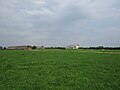
 Farmland near East Stour - geograph.org.uk - 5113180.jpg 3,047 × 1,805; 1.24 MB
-
 Field by Witch Lane - geograph.org.uk - 5086938.jpg 3,072 × 2,048; 1.43 MB
-
 Field by Witch Lane - geograph.org.uk - 5086947.jpg 3,059 × 1,635; 1.01 MB
-
 Field entrance beside the A30 - geograph.org.uk - 5406097.jpg 640 × 427; 103 KB
-
 Field, Cole Street Lane - geograph.org.uk - 5071729.jpg 2,339 × 1,279; 576 KB
-
 Folly Lane - geograph.org.uk - 5073076.jpg 3,072 × 2,048; 1.34 MB
-
 Footpath at East Stour Common - geograph.org.uk - 475179.jpg 640 × 480; 103 KB
-
 Footpath north of Stour Provost - geograph.org.uk - 1569981.jpg 640 × 480; 157 KB
-
 Footpath through field at East Stour - geograph.org.uk - 5406084.jpg 640 × 427; 97 KB
-
 Former pub, East Stour - geograph.org.uk - 5113248.jpg 3,072 × 2,048; 866 KB
-
 Fry's Farm - geograph.org.uk - 5119757.jpg 640 × 480; 69 KB
-
 Garage, East Stour - geograph.org.uk - 5113257.jpg 1,920 × 1,135; 443 KB
-
 Gate and field, Cole Street Lane - geograph.org.uk - 5071728.jpg 3,072 × 2,048; 1.32 MB
-
 Hairdresser, East Stour, Dorset - geograph.org.uk - 1223561.jpg 640 × 426; 86 KB
-
 Hedge, East Stour Common - geograph.org.uk - 1565896.jpg 640 × 480; 155 KB
-
 Houses at Witchfields, East Stour - geograph.org.uk - 5406093.jpg 640 × 427; 97 KB
-
 Houses on Back Street, East Stour - geograph.org.uk - 5406087.jpg 640 × 427; 82 KB
-
 Houses, East Stour, Dorset - geograph.org.uk - 1249919.jpg 640 × 362; 85 KB
-

-
 Kissing gate near East Stour - geograph.org.uk - 1565935.jpg 480 × 640; 126 KB
-
 Kissing gate, East Stour, Dorset - geograph.org.uk - 1046529.jpg 640 × 480; 126 KB
-
 Madjeston - geograph.org.uk - 453970.jpg 640 × 480; 102 KB
-
 Milepost at East Stower - geograph.org.uk - 1155450.jpg 640 × 480; 160 KB
-
 Milepost, East Stower - geograph.org.uk - 1155460.jpg 480 × 640; 177 KB
-
-
-

-
 Poppies at East Stour - geograph.org.uk - 5406072.jpg 640 × 427; 132 KB
-
 Primrose (Primula vulgaris) - geograph.org.uk - 348327.jpg 640 × 480; 185 KB
-
 Sheep grazing by Pennymoor Pitt Farm - geograph.org.uk - 409114.jpg 640 × 430; 89 KB
-
 Small weir at East Stour - geograph.org.uk - 3062597.jpg 2,048 × 1,536; 3.18 MB
-
 Solo powering up the hill with a scenic view (8695964913).jpg 4,272 × 2,848; 5.11 MB
-
 Standpitts Lane - geograph.org.uk - 5072953.jpg 2,048 × 3,072; 1.72 MB
-
 Standpitts Lane - geograph.org.uk - 5072990.jpg 2,048 × 3,072; 1.4 MB
-
 Standpitts Lane - geograph.org.uk - 5073085.jpg 2,048 × 3,072; 1.68 MB
-
 Stile, East Stour, Dorset - geograph.org.uk - 1046540.jpg 640 × 480; 173 KB
-
 Streamside trees near footpath N64 79 - geograph.org.uk - 5070629.jpg 2,537 × 1,650; 719 KB
-
 Streamside trees near footpath N64 79 - geograph.org.uk - 5070649.jpg 2,745 × 1,774; 964 KB
-
 Sunset over the campsite - geograph.org.uk - 84945.jpg 640 × 480; 40 KB
-
 Telephone box, East Stour - geograph.org.uk - 1155478.jpg 640 × 481; 128 KB
-
 The A30 at East Stour - geograph.org.uk - 3490808.jpg 800 × 600; 163 KB
-
 The attractive village of East Stour - geograph.org.uk - 5119758.jpg 640 × 480; 38 KB
-
 The former White Horse Pub at East Stour - geograph.org.uk - 420630.jpg 640 × 480; 153 KB
-

-
 The Udder Farm Shop at East Stour - geograph.org.uk - 4046180.jpg 640 × 234; 39 KB
-
 The Udder Farm Shop on the A30 - geograph.org.uk - 5119730.jpg 640 × 480; 49 KB
-
 Towards Folly Farm - geograph.org.uk - 5073097.jpg 3,064 × 1,824; 1.29 MB
-

-
 Valley, East Stour - geograph.org.uk - 5113350.jpg 3,072 × 1,746; 1.45 MB
-

-
 White Horse Public House - geograph.org.uk - 1548848.jpg 640 × 480; 64 KB
-
 Witch Lane - geograph.org.uk - 4969076.jpg 1,920 × 2,880; 893 KB
-
 Witch Lane - geograph.org.uk - 5086942.jpg 2,048 × 3,072; 1.22 MB
-
 Witch Lane - geograph.org.uk - 5113176.jpg 2,974 × 1,851; 1.32 MB
-
 Witch Lane - geograph.org.uk - 5113182.jpg 3,072 × 2,048; 1.23 MB
-
 Bluebells and footpath in Duncliffe Wood - geograph.org.uk - 410847.jpg 640 × 430; 173 KB
-
 Clearing in Duncliffe Woods - geograph.org.uk - 410864.jpg 640 × 430; 156 KB
-
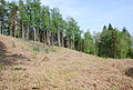
 Climbing Duncliffe Hill - geograph.org.uk - 410860.jpg 430 × 640; 158 KB
-
 Disused ponds - geograph.org.uk - 101694.jpg 640 × 480; 202 KB
-
 Duncliffe Wood - geograph.org.uk - 410884.jpg 640 × 430; 88 KB
-
 Farmland off Bleet Lane - geograph.org.uk - 499973.jpg 640 × 480; 76 KB
-
 Farmland off Harpitts Lane - geograph.org.uk - 500004.jpg 640 × 480; 49 KB
-
 Footpath along top of Duncliffe Hill - geograph.org.uk - 408863.jpg 640 × 430; 177 KB
-
 Footpath to Duncliffe Wood-Hill - geograph.org.uk - 409083.jpg 640 × 430; 110 KB
-
 Fry's Farm - geograph.org.uk - 408876.jpg 640 × 430; 100 KB
-
 Gate on footpath along Duncliffe Hill - geograph.org.uk - 410873.jpg 430 × 640; 170 KB
-
 Hillside by Pennymoor Pitt Farm - geograph.org.uk - 408871.jpg 640 × 430; 98 KB
-
 Lane to Woodville - geograph.org.uk - 409089.jpg 430 × 640; 102 KB
-
 Main track through Duncliffe Woods - geograph.org.uk - 410893.jpg 430 × 640; 135 KB
-
 New Gate Farm - geograph.org.uk - 409092.jpg 640 × 430; 90 KB
-
 Pennymoor Pitt Farm - geograph.org.uk - 408869.jpg 640 × 430; 96 KB
-
 Pennymoor Pitt Farm buildings - geograph.org.uk - 409112.jpg 640 × 430; 97 KB
-
 Rear of Fry's Farm - geograph.org.uk - 409106.jpg 640 × 430; 103 KB
-
 Southeast corner of Duncliffe Wood - geograph.org.uk - 408852.jpg 640 × 430; 97 KB
-
 Spring near Duncliffe Hill - geograph.org.uk - 410891.jpg 640 × 430; 175 KB
-
 Spring on Duncliffe Hill - geograph.org.uk - 410880.jpg 640 × 430; 192 KB
-
 The Crown Inn East Stour Dorset - geograph.org.uk - 101683.jpg 640 × 480; 107 KB
-
 The Udder Farm Shop East Stour Dorset - geograph.org.uk - 101704.jpg 640 × 480; 94 KB
-
 Trig point on Duncliffe Hill - geograph.org.uk - 408865.jpg 640 × 430; 190 KB
-
 View of Fry's Farm - geograph.org.uk - 409100.jpg 640 × 430; 97 KB
-
 View towards Duncliffe Hill - geograph.org.uk - 408881.jpg 640 × 430; 98 KB


_-_geograph.org.uk_-_348327.jpg)


.jpg)


