Category:East Wall, Dublin
village  | |||||
| Upload media | |||||
| Instance of | |||||
|---|---|---|---|---|---|
| Location | Dublin, Ireland | ||||
 | |||||
English: East Wall (An Port Thoir in Irish) is an area of the Northside of the city of Dublin, Ireland. It is bounded by the North Strand Road to the west, by North Wall to the south, and by East Wall Road to the north. It is linked to Ringsend by the East-Link bridge; it is linked to Fairview by the Annesley Bridge.
Français : East Wall (An Port Thoir en irlandais ) est un quartier de la partie Nord de la ville de Dublin en Irlande. Il est délimité par North Strand Road à l'ouest, par North Wall au sud, et par East Wall Road au nord. Elle est liée à Ringsend par le pont East-Link, et à Fairview par Annesley Bridge.
Subcategories
This category has the following 3 subcategories, out of 3 total.
A
- Alexandra Road, Dublin (9 F)
E
- East Road, Dublin (1 F)
Media in category "East Wall, Dublin"
The following 35 files are in this category, out of 35 total.
-

-
 Conway House - East Wall Road - panoramio.jpg 6,000 × 4,000; 17.72 MB
-
 Docklands Innovation Centre - East Wall Road - panoramio.jpg 6,000 × 4,000; 22.38 MB
-
 Docklands Innovation Centre - East Wall Road.jpg 6,000 × 4,000; 23.27 MB
-
 EAST WALL ROAD - 38KV STATION - panoramio.jpg 6,000 × 4,000; 20.27 MB
-
 East Wall Road - Dublin Docklands - panoramio (1).jpg 6,000 × 4,000; 16.97 MB
-
 East Wall Road - Dublin Docklands - panoramio (2).jpg 4,000 × 6,000; 18.03 MB
-
 East Wall Road - Dublin Docklands - panoramio (3).jpg 5,719 × 3,813; 17.92 MB
-
 East Wall Road - Dublin Docklands - panoramio (4).jpg 6,000 × 4,000; 16.89 MB
-
 East Wall Road - dublin Docklands - panoramio.jpg 6,000 × 3,242; 12.67 MB
-
 East Wall Road - Dublin Docklands - panoramio.jpg 4,000 × 6,000; 17.78 MB
-
 East Wall sign.jpg 3,024 × 4,032; 5.58 MB
-
 East Wall train yard.jpg 9,504 × 6,336; 33.4 MB
-
 Ford Dealer On East Wall Road - panoramio.jpg 6,000 × 4,000; 18.87 MB
-
 Irish College Of Traditional Chinese Medicine (7006145490).jpg 6,000 × 4,000; 21.9 MB
-
 Leaning Lampost - East Wall Road - panoramio.jpg 4,000 × 6,000; 18.46 MB
-
 Mamselle Factory, Merchant's Road, East Wall, Dublin sign.jpg 3,024 × 4,032; 6.38 MB
-
 Mamselle Factory, Merchant's Road, East Wall, Dublin.jpg 3,024 × 4,032; 3.87 MB
-
 Merchant's Road, East Wall 01.jpg 4,032 × 3,024; 2.76 MB
-
 Merchant's Road, East Wall 02.jpg 3,024 × 4,032; 13.6 MB
-
 Merchants Yard, East Wall, Dublin.jpg 3,024 × 4,032; 3.43 MB
-
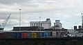 Odlum Flour Mills from East Wall Road - geograph.org.uk - 1759254.jpg 1,024 × 551; 77 KB
-
 Railway depot, East Wall, Dublin - geograph.org.uk - 1577171.jpg 640 × 480; 170 KB
-
 Seabank House - East Wall Road - panoramio.jpg 6,000 × 4,000; 17.95 MB
-
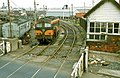 Sherrif Street level crossing, Dublin - geograph.org.uk - 1084531.jpg 640 × 414; 103 KB
-
 St Barnabas Gardens, East Wall commemorative plaque.jpg 3,024 × 4,032; 7.63 MB
-

-
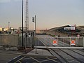
 The East Wall Road Level Crossing - geograph.org.uk - 1746613.jpg 1,024 × 768; 121 KB
-

-
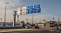
 The junction of Alexandra Road and the East Wall Road - geograph.org.uk - 1746639.jpg 1,600 × 1,200; 269 KB
-

-
 The rear of Odlums Flour Mill - geograph.org.uk - 1759277.jpg 1,024 × 544; 76 KB
-
 Urban Decline On The East Wall Road (Dublin) - panoramio.jpg 6,000 × 3,073; 14.73 MB
-
 View across the East Wall area of Dublin - geograph.org.uk - 1577181.jpg 640 × 480; 151 KB
-


.jpg)
.jpg)
.jpg)
.jpg)


.jpg)


_-_panoramio.jpg)
