Category:East Witton
village in United Kingdom  | |||||
| Upload media | |||||
| Instance of | |||||
|---|---|---|---|---|---|
| Location | Richmondshire, North Yorkshire, Yorkshire and the Humber, England | ||||
 | |||||
Subcategories
This category has the following 5 subcategories, out of 5 total.
Media in category "East Witton"
The following 200 files are in this category, out of 320 total.
(previous page) (next page)-
 A Misty Day on High Newstead - geograph.org.uk - 364692.jpg 496 × 640; 61 KB
-
 A rainbow rides ahead of the storm - geograph.org.uk - 5857557.jpg 960 × 720; 79 KB
-
-
 A tricky and slippery crossing today - geograph.org.uk - 4856126.jpg 640 × 480; 109 KB
-
 A walk in the park - geograph.org.uk - 2282635.jpg 1,024 × 768; 699 KB
-
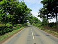
 A6108 approaching East Witton - geograph.org.uk - 3085504.jpg 640 × 461; 51 KB
-
 A6108 approaching East Witton - geograph.org.uk - 3196531.jpg 1,024 × 683; 149 KB
-
 A6108 approaching Jervaulx Abbey - geograph.org.uk - 3085495.jpg 640 × 476; 89 KB
-
 A6108 at Cover Bridge - geograph.org.uk - 3085512.jpg 640 × 481; 60 KB
-
 A6108 from East Witton Mill entrance - geograph.org.uk - 3085500.jpg 640 × 440; 88 KB
-
 A6108 going north to Jervaulx Abbey - geograph.org.uk - 4076819.jpg 4,608 × 3,456; 4.29 MB
-
 A6108 near East Witton - geograph.org.uk - 3453369.jpg 3,648 × 2,736; 5.81 MB
-
 A6108 outside East Witton Mill - geograph.org.uk - 3533099.jpg 4,320 × 3,240; 4.72 MB
-
 A6108, towards Masham - geograph.org.uk - 2282606.jpg 1,024 × 768; 618 KB
-
 Above Sowden Beck Farm - geograph.org.uk - 4500511.jpg 1,600 × 1,200; 563 KB
-
 Access Lane to East Witton Mill - geograph.org.uk - 3533109.jpg 4,320 × 3,240; 3.91 MB
-
 Access road to Helming - geograph.org.uk - 4086483.jpg 4,608 × 3,456; 3.26 MB
-
 Access to Braithwaite Cottage - geograph.org.uk - 3533545.jpg 4,320 × 3,240; 3.7 MB
-
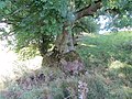
 Agra Moor - geograph.org.uk - 309827.jpg 640 × 480; 96 KB
-
 An old chapel - geograph.org.uk - 5574191.jpg 2,000 × 1,333; 2.11 MB
-
 Angram Cote Farm - geograph.org.uk - 310789.jpg 640 × 480; 94 KB
-

-
 Approaching Cover Bridge - geograph.org.uk - 4004742.jpg 640 × 369; 52 KB
-
 Avenue near the Jervaulx Abbey tearoom - geograph.org.uk - 2460725.jpg 640 × 427; 132 KB
-
 Avenue of Trees, Jervaulx - geograph.org.uk - 6220939.jpg 1,024 × 768; 308 KB
-
 Barn on Sowden Beck Road - geograph.org.uk - 3156279.jpg 1,024 × 683; 187 KB
-
 Barns in East Witton - geograph.org.uk - 6226450.jpg 2,000 × 1,200; 1.94 MB
-
 Benchmark on 'The Old School' - geograph.org.uk - 3196559.jpg 683 × 1,024; 275 KB
-
 Benchmark on barn beside Sowden Beck Road - geograph.org.uk - 3156157.jpg 683 × 1,024; 227 KB
-
 Benchmark on building at Sowden Beck Farm - geograph.org.uk - 3156650.jpg 694 × 1,024; 264 KB
-
 Benchmark on Cover Bridge - geograph.org.uk - 3196248.jpg 683 × 1,024; 231 KB
-

-
 Benchmark on house garage, formerly inn stable - geograph.org.uk - 3196534.jpg 683 × 1,024; 253 KB
-
 Benchmark on outbuilding at Cover Bridge Farm - geograph.org.uk - 5315556.jpg 666 × 1,024; 151 KB
-

-
 Benchmark on parapet of Ulshaw Bridge - geograph.org.uk - 3194516.jpg 1,024 × 683; 279 KB
-
 Benchmark on Sowden Beck Road gatepost - geograph.org.uk - 3155806.jpg 683 × 1,024; 243 KB
-

-

-

-
 Benchmarked gatepost beside A6108 - geograph.org.uk - 3196524.jpg 683 × 1,024; 288 KB
-
 Blessed Relief - geograph.org.uk - 2467130.jpg 3,264 × 2,448; 2.24 MB
-
 Boundary Fence on East Wharrell - geograph.org.uk - 3533580.jpg 4,320 × 3,240; 4.98 MB
-
 Boundary stone beside A6108 near Brough Farm - geograph.org.uk - 3167624.jpg 683 × 1,024; 266 KB
-
 Braithwaite Hall - geograph.org.uk - 5574336.jpg 2,000 × 1,333; 1.97 MB
-
 Braithwaite Hall - geograph.org.uk - 6226459.jpg 2,000 × 1,134; 1.92 MB
-
 Braithwaite Lane - geograph.org.uk - 3533554.jpg 4,320 × 3,240; 5.28 MB
-
 Braithwaite Lane in Coverdale - geograph.org.uk - 2609680.jpg 2,736 × 3,648; 3.29 MB
-
 Braithwaite Lane, East Witton - geograph.org.uk - 6226455.jpg 2,000 × 1,312; 2.41 MB
-
 Braithwaite Moor - geograph.org.uk - 3534222.jpg 4,320 × 3,240; 3.62 MB
-
 Bridge over the River Ure at Ulshaw - geograph.org.uk - 2983189.jpg 1,600 × 1,200; 466 KB
-
 Bridge over the River Ure at Ulshaw - geograph.org.uk - 708219.jpg 600 × 450; 53 KB
-
 Bridleway - geograph.org.uk - 489896.jpg 640 × 480; 130 KB
-

-
 Brymor Icecream - geograph.org.uk - 5926911.jpg 2,000 × 1,333; 1.69 MB
-
 Car park at the icecream dairy - geograph.org.uk - 5926910.jpg 2,000 × 1,333; 2.03 MB
-
 Car Park, Jervaulx Abbey - geograph.org.uk - 3166495.jpg 1,024 × 682; 235 KB
-
 Centre of East Witton - geograph.org.uk - 4004733.jpg 640 × 381; 57 KB
-
 Chapter House, Jervaulx Abbey - geograph.org.uk - 4632058.jpg 1,024 × 768; 976 KB
-
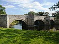
 Cover Bridge - geograph.org.uk - 2339805.jpg 640 × 480; 178 KB
-
 Cover Bridge on the A6108 - geograph.org.uk - 3196341.jpg 1,024 × 683; 207 KB
-
 Deep Gill Force - geograph.org.uk - 2237290.jpg 1,600 × 1,200; 636 KB
-
 Do not attempt to cross^ - geograph.org.uk - 882993.jpg 480 × 640; 133 KB
-
 Downstream from Kilgram Bridge - geograph.org.uk - 4328698.jpg 4,320 × 3,240; 4.92 MB
-
 Dwellings in East Witton - geograph.org.uk - 3533130.jpg 4,320 × 3,240; 3.74 MB
-
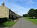 East Witton - geograph.org.uk - 3533540.jpg 4,320 × 3,240; 4.11 MB
-
 East Witton - geograph.org.uk - 4642406.jpg 640 × 373; 40 KB
-
 East Witton - geograph.org.uk - 4642409.jpg 1,024 × 585; 463 KB
-
 East Witton - geograph.org.uk - 5574185.jpg 2,000 × 1,333; 1.88 MB
-
 East Witton - geograph.org.uk - 6306382.jpg 1,600 × 900; 527 KB
-
 East Witton - geograph.org.uk - 977519.jpg 640 × 547; 108 KB
-

-
 East Witton church ahead - geograph.org.uk - 4004730.jpg 640 × 432; 58 KB
-
 East Witton Mill entrance ahead - geograph.org.uk - 4004737.jpg 640 × 328; 65 KB
-
 East Witton Village Green - geograph.org.uk - 3676026.jpg 4,608 × 3,456; 5.49 MB
-
 East Witton village Green - geograph.org.uk - 4084500.jpg 4,608 × 3,456; 3.66 MB
-
 East Witton village green - geograph.org.uk - 5574195.jpg 2,000 × 1,333; 3.42 MB
-
 EastWitton.jpg 640 × 465; 82 KB
-
 Entrance to Low Newstead Farm - geograph.org.uk - 3533093.jpg 4,320 × 3,240; 3.65 MB
-
 Fallen carved stones - geograph.org.uk - 2460707.jpg 640 × 427; 251 KB
-

-
 Farmland near Helming, Lower Wensleydale - geograph.org.uk - 6095112.jpg 1,946 × 1,460; 779 KB
-
 Farmland, East Witton - geograph.org.uk - 3451502.jpg 3,648 × 2,736; 4.49 MB
-
 Farmland, Low Thorpe near East Witton - geograph.org.uk - 3453359.jpg 3,593 × 2,227; 4.35 MB
-
 Fence on ha ha wall at Jervaulx Abbey - geograph.org.uk - 3638992.jpg 1,024 × 768; 227 KB
-
 Field and Woodland west of Stark Bank Road - geograph.org.uk - 4076798.jpg 4,608 × 3,456; 3.64 MB
-
 Field edge to High Jervaulx Farm and A6108 - geograph.org.uk - 4454230.jpg 4,608 × 3,456; 4.64 MB
-
 Field south of Sowden Beck Farm - geograph.org.uk - 308501.jpg 640 × 480; 89 KB
-
 Fields near East Witton - geograph.org.uk - 3676031.jpg 4,608 × 3,456; 3.73 MB
-
 Fields near East Witton - geograph.org.uk - 5574193.jpg 2,000 × 1,333; 2.53 MB
-
 Fields near East Witton - geograph.org.uk - 5574207.jpg 2,000 × 1,333; 2.16 MB
-
 Fields near Jervaulx - geograph.org.uk - 5574345.jpg 2,000 × 1,333; 2.07 MB
-
 Fingerpost on the Caldbergh footpath - geograph.org.uk - 5799949.jpg 720 × 540; 102 KB
-
 Footbridge by Sowden Beck - geograph.org.uk - 4856153.jpg 640 × 480; 93 KB
-
 Footpath to Caldbergh from Braithwaite Lane in Coverdale - geograph.org.uk - 2609806.jpg 3,648 × 2,736; 2.63 MB
-
 Former public house at East Witton - geograph.org.uk - 408857.jpg 640 × 480; 87 KB
-
 Gate Post at High Jervaulx Farm with O-S Benchmark - geograph.org.uk - 4454308.jpg 4,506 × 3,316; 7.57 MB
-
 Gates on footpath from Jervaulx Abbey - geograph.org.uk - 3640233.jpg 1,024 × 768; 222 KB
-

-
 Gateway beside Sowden Beck Road - geograph.org.uk - 3156098.jpg 1,024 × 683; 196 KB
-
 Geese gathering to graze - geograph.org.uk - 4328709.jpg 4,320 × 3,240; 3.56 MB
-
 Good farming land - geograph.org.uk - 5574330.jpg 2,000 × 1,333; 2.1 MB
-
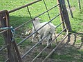
 Grazing sheep, East Witton - geograph.org.uk - 2135957.jpg 640 × 480; 105 KB
-
 Grouse Butt on Witton Moor - geograph.org.uk - 310204.jpg 640 × 480; 98 KB
-
 Hammer Road - geograph.org.uk - 3533076.jpg 4,320 × 3,240; 5.94 MB
-
 Heather burning - geograph.org.uk - 4856148.jpg 640 × 480; 56 KB
-
 Henry FitzHugh - geograph.org.uk - 5372861.jpg 1,024 × 683; 349 KB
-
 Hillside, north of Helming - geograph.org.uk - 6095117.jpg 1,024 × 768; 165 KB
-
 House and garage on A6108 bend - geograph.org.uk - 3196540.jpg 1,024 × 683; 137 KB
-
 House near Jervaulx Abbey - geograph.org.uk - 1047744.jpg 640 × 480; 88 KB
-

-
 Hullo Bridge - geograph.org.uk - 4856112.jpg 640 × 491; 117 KB
-
 Hullo Bridge and the River Cover - geograph.org.uk - 5799957.jpg 720 × 540; 157 KB
-
 Hullo Bridge seen from the south bank of the River Cover - geograph.org.uk - 6226425.jpg 1,331 × 2,000; 3.89 MB
-
 Hullo Bridge seen from the south bank of the River Cover - geograph.org.uk - 6226432.jpg 2,000 × 1,331; 4.28 MB
-
 Ice Cream Parlour near Jervaulx - geograph.org.uk - 4004692.jpg 640 × 401; 51 KB
-
 Ivy-covered trees along the lane to Rookwith - geograph.org.uk - 6095049.jpg 1,600 × 1,200; 583 KB
-
 Ivy-covered trees along the road from Rookwith - geograph.org.uk - 6095102.jpg 1,024 × 768; 192 KB
-
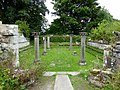
 Jervaulx Abbey - geograph.org.uk - 5372384.jpg 1,024 × 683; 212 KB
-
 Jervaulx Abbey - geograph.org.uk - 5372826.jpg 1,024 × 683; 233 KB
-
 Jervaulx Abbey - geograph.org.uk - 5372834.jpg 1,024 × 683; 289 KB
-
 Jervaulx Abbey - geograph.org.uk - 5372847.jpg 1,024 × 683; 310 KB
-
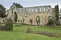 Jervaulx Abbey - geograph.org.uk - 5574380.jpg 2,000 × 1,333; 2.6 MB
-
 Jervaulx Abbey - geograph.org.uk - 6220943.jpg 768 × 1,024; 304 KB
-
 Jervaulx Abbey - geograph.org.uk - 6227078.jpg 2,000 × 1,172; 2.64 MB
-
 Jervaulx Abbey - geograph.org.uk - 6227080.jpg 2,000 × 1,094; 2.71 MB
-
 Jervaulx Abbey - geograph.org.uk - 6227082.jpg 2,000 × 1,148; 2.88 MB
-
 Jervaulx Abbey access and carved stones, East Witton, Wensleydale.jpg 1,920 × 1,080; 958 KB
-
 Jervaulx Abbey chapter house area, East Witton, Wensleydale.jpg 1,920 × 1,080; 689 KB
-
 Jervaulx Abbey church and other ruins, East Witton, Wensleydale.jpg 1,920 × 1,080; 787 KB
-
 Jervaulx Abbey church, cloisters and other ruins, East Witton, Wensleydale.jpg 1,920 × 1,080; 674 KB
-
 Jervaulx Abbey cloisters and other ruins, East Witton, Wensleydale.jpg 1,920 × 1,080; 1,015 KB
-
 Jervaulx Abbey dormitory and other ruins, East Witton, Wensleydale.jpg 1,920 × 1,080; 785 KB
-
 Jervaulx car park view - geograph.org.uk - 5574348.jpg 2,000 × 1,333; 2.04 MB
-
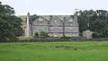
 Jervaulx Hall - geograph.org.uk - 3458331.jpg 640 × 383; 109 KB
-
 Jervaulx Hall Gatehouse (geograph 7023590).jpg 1,600 × 900; 782 KB
-
 Jervaulx Park - geograph.org.uk - 2282623.jpg 1,024 × 768; 573 KB
-
 Jervaulx Park - geograph.org.uk - 4055898.jpg 1,024 × 768; 149 KB
-
 Jervaulx Park - geograph.org.uk - 5372877.jpg 1,024 × 683; 327 KB
-
 Jervaulx Park - geograph.org.uk - 5372879.jpg 1,024 × 683; 233 KB
-
 Junction with A6108 at Ulshaw - geograph.org.uk - 4004516.jpg 640 × 435; 50 KB
-
 Kilgram Bridge - geograph.org.uk - 4328708.jpg 4,320 × 2,476; 2.37 MB
-
 Kilgram Lane - geograph.org.uk - 6220933.jpg 1,024 × 768; 246 KB
-
 Lambs in a Field near East Witton - geograph.org.uk - 5352505.jpg 1,024 × 683; 300 KB
-
 Lambs on the riverbank River Ure Six Dales Trail - geograph.org.uk - 4458464.jpg 3,075 × 2,304; 5.9 MB
-
-
 Looking downstream from Ulshaw Bridge - geograph.org.uk - 4329047.jpg 4,320 × 2,736; 2.37 MB
-
 Looking upstream along the Ure - geograph.org.uk - 4328723.jpg 4,299 × 2,736; 2.3 MB
-
 Looking upstream from Ulshaw Bridge - geograph.org.uk - 4329062.jpg 3,240 × 4,320; 4.25 MB
-
 Lower Coverdale - geograph.org.uk - 287680.jpg 640 × 480; 95 KB
-
 Lowland pasture at Jervaulx Abbey - geograph.org.uk - 4632051.jpg 3,266 × 2,445; 5.48 MB
-
 Many grazing sheep - geograph.org.uk - 5574749.jpg 2,000 × 1,333; 2.12 MB
-
 Milestone Bank - geograph.org.uk - 310195.jpg 640 × 480; 82 KB
-
 Moorcote Farm - geograph.org.uk - 5094865.jpg 4,320 × 3,240; 4.14 MB
-
 Moorland of Braithwaite Moor - geograph.org.uk - 4180831.jpg 1,500 × 855; 1.4 MB
-
 Mortared Stonework - geograph.org.uk - 4571170.jpg 3,920 × 2,204; 2.16 MB
-
 Old Boundary Marker (geograph 6477370).jpg 325 × 542; 54 KB
-

-
 Old quarry, East Witton - geograph.org.uk - 1960724.jpg 4,000 × 3,000; 2.78 MB
-
 Ordnance Survey Cut Mark with Bolt - geograph.org.uk - 3565940.jpg 4,000 × 3,000; 3.84 MB
-
 Ordnance Survey Cut Mark with Bolt - geograph.org.uk - 3566670.jpg 4,000 × 3,000; 4.1 MB
-
 Ordnance Survey Flush Bracket S7959 - geograph.org.uk - 3603926.jpg 4,000 × 3,000; 3.82 MB
-
 Ordnance Survey Flush Bracket S7960 - geograph.org.uk - 3566632.jpg 4,000 × 3,000; 3.69 MB
-

-
 Over the village green East Witton - geograph.org.uk - 4084510.jpg 4,608 × 3,456; 3.54 MB
-
 Parapet of A6108 bridge over Cold Kelds Beck - geograph.org.uk - 3196520.jpg 1,024 × 683; 192 KB
-
 Parkland seen from Jervaulx Abbey - geograph.org.uk - 6227070.jpg 2,000 × 1,096; 2.01 MB
-
 Parkland seen from Jervaulx Abbey - geograph.org.uk - 6227072.jpg 2,000 × 1,019; 2.01 MB
-
 Pasture at Jervaulx Abbey - geograph.org.uk - 4632060.jpg 1,024 × 766; 663 KB
-
 Path approaching Jervaulx Abbey - geograph.org.uk - 6227063.jpg 2,000 × 1,123; 2.42 MB
-

-
 Path between Hullo Bridge and Braithwaite Lane, East Witton - geograph.org.uk - 6226438.jpg 2,000 × 1,160; 1.88 MB
-
 Path from Jervaulx Abbey - geograph.org.uk - 2282597.jpg 1,024 × 768; 665 KB
-
 Path towards Ramshaw - geograph.org.uk - 6286674.jpg 5,184 × 3,888; 7.04 MB
-
 Pond in a field, north of Helming - geograph.org.uk - 6095114.jpg 1,600 × 1,200; 434 KB
-
 Pond in Jervaulx Park - geograph.org.uk - 4328713.jpg 4,320 × 3,240; 3.37 MB
-
 Pond in the park - geograph.org.uk - 2282629.jpg 1,024 × 768; 703 KB
-

-
 Rainbow over Tranmire Hill - geograph.org.uk - 309840.jpg 640 × 480; 57 KB
-
 Rape off Longdike Lane - geograph.org.uk - 2377483.jpg 640 × 480; 95 KB
-
 Red Beck Gill - geograph.org.uk - 2234285.jpg 1,200 × 1,600; 662 KB
-
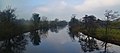 Reflections on the River Ure at East Witton, North Yorkshire (32915556382).jpg 7,354 × 3,278; 6.89 MB
-
 Residents of Abbey Hill, Jervaux - geograph.org.uk - 2880548.jpg 640 × 427; 386 KB
-
 River Cover - geograph.org.uk - 1757893.jpg 1,600 × 1,200; 649 KB
-
 River Cover - geograph.org.uk - 3566686.jpg 4,000 × 3,000; 3.37 MB
-
 River Cover - geograph.org.uk - 3566690.jpg 4,000 × 3,000; 4.69 MB
-
 River Cover below Cover Bridge - geograph.org.uk - 4329042.jpg 4,320 × 3,240; 3.51 MB
-
 River Cover seen from Hullo Bridge - geograph.org.uk - 6226414.jpg 2,000 × 1,432; 3.37 MB
-
 River Cover seen from Hullo Bridge - geograph.org.uk - 6226418.jpg 2,000 × 1,334; 3.19 MB
-
 River Cover upstream of Hullo Bridge - geograph.org.uk - 2617274.jpg 1,024 × 768; 188 KB
-
 River Ure - geograph.org.uk - 3490898.jpg 1,600 × 1,200; 797 KB
-
 River Ure - geograph.org.uk - 3490937.jpg 1,600 × 1,200; 590 KB
-
 River Ure in Flood - geograph.org.uk - 4759392.jpg 4,208 × 2,368; 3.47 MB
-
 River Ure near Jervaulx Abbey - geograph.org.uk - 107359.jpg 640 × 480; 84 KB
-

-
 Riverside pastures - geograph.org.uk - 1402469.jpg 640 × 480; 71 KB
-
 Road Junction - geograph.org.uk - 6220930.jpg 1,024 × 768; 195 KB
-
 Road junction at East Witton - geograph.org.uk - 1357942.jpg 640 × 426; 90 KB
-

-
 Roadside Barn near the entrance to Braithwaite Hall - geograph.org.uk - 4136722.jpg 4,000 × 3,000; 3.57 MB


.jpg)


.jpg)


.jpg)


