Category:Easton Royal
village in Wiltshire, United Kingdom  | |||||
| Upload media | |||||
| Instance of | |||||
|---|---|---|---|---|---|
| Location | Easton, Wiltshire, South West England, England | ||||
| official website | |||||
 | |||||
English: Easton Royal is a village in the civil parish of Easton in the English county of Wiltshire. In the Census 2001 the parish had a population of 283.
Nederlands: Easton Royal is een dorp (village) en civil parish in de unitary authority Wiltshire, in het Engelse graafschap Wiltshire. De civil parish telt
Subcategories
This category has only the following subcategory.
T
- Holy Trinity, Easton Royal (10 F)
Media in category "Easton Royal"
The following 101 files are in this category, out of 101 total.
-
 2011 , B3087 Burbage Road at Easton Royal - geograph.org.uk - 2725964.jpg 4,317 × 3,127; 3.39 MB
-
 2011 , B3087 Burbage Road heading west at Easton Royal - geograph.org.uk - 2726970.jpg 3,944 × 2,914; 4.65 MB
-
 2011 , Minor road to Ram Alley - geograph.org.uk - 2724775.jpg 3,748 × 2,835; 5.23 MB
-
 2011 , Minor road to Ram Alley - geograph.org.uk - 2725952.jpg 4,328 × 2,992; 5.35 MB
-
 2011 , North of west from the road to Ram Alley - geograph.org.uk - 2725772.jpg 4,739 × 2,529; 4.29 MB
-
 2011 , North west from the road to Ram Alley - geograph.org.uk - 2725780.jpg 4,211 × 2,301; 3.78 MB
-
 2011 , North west near Ram Alley - geograph.org.uk - 2724679.jpg 3,996 × 2,307; 1.89 MB
-
 2011 , Pipeline marker on the road to Ram Alley - geograph.org.uk - 2724810.jpg 3,876 × 3,078; 4.73 MB
-
 2011 , Plantation and track north of Conygre Farm - geograph.org.uk - 2725761.jpg 4,002 × 2,927; 5.69 MB
-
 B3087 Burbage Road, passes The Bruce Arms - geograph.org.uk - 3387704.jpg 3,648 × 2,736; 1.73 MB
-
 B3087 passes entrance to Conygre Farm - geograph.org.uk - 2985670.jpg 3,507 × 2,545; 1.02 MB
-
 Bridleway near Easton Royal - geograph.org.uk - 446025.jpg 640 × 480; 148 KB
-
 Burbage Road enters Easton Royal - geograph.org.uk - 2985663.jpg 3,648 × 2,706; 2.07 MB
-
 Burbage Road passes The Bruce Arms - geograph.org.uk - 2985659.jpg 3,648 × 2,736; 1.72 MB
-
 Burbage Road, Easton Royal - geograph.org.uk - 6207578.jpg 1,920 × 1,280; 1.46 MB
-
 Burbage Road, Easton Royal - geograph.org.uk - 6207591.jpg 1,834 × 1,134; 1.53 MB
-
 Burbage Road, Easton Royal - geograph.org.uk - 6207592.jpg 1,870 × 1,202; 1.16 MB
-
 Burbage Road, Milton Lilbourne - geograph.org.uk - 6207567.jpg 1,868 × 1,196; 1.49 MB
-
 Bus shelter on Burbage Road, Easton Royal - geograph.org.uk - 6207583.jpg 1,920 × 1,280; 1.84 MB
-

-
 Byway near Easton Royal - geograph.org.uk - 5235607.jpg 4,000 × 3,000; 3.65 MB
-
 Cereal crops near Easton Royal - geograph.org.uk - 1327403.jpg 640 × 480; 144 KB
-
 Cock Lane - geograph.org.uk - 4393442.jpg 640 × 480; 222 KB
-
 Cock Lane, near Cuckoo's Knob - geograph.org.uk - 1327540.jpg 640 × 480; 293 KB
-
 Cock Lane, near Ram Alley - geograph.org.uk - 1327273.jpg 640 × 480; 302 KB
-
 Downland above Easton Royal - geograph.org.uk - 5235622.jpg 4,000 × 3,000; 2.51 MB
-
 Downland, Easton Royal - geograph.org.uk - 1568865.jpg 640 × 480; 163 KB
-
 Easton Crossroads - geograph.org.uk - 2985667.jpg 3,586 × 2,696; 1.55 MB
-
 Easton Crossroads - geograph.org.uk - 6205680.jpg 1,878 × 1,214; 1.56 MB
-
 Easton House, Easton Royal - geograph.org.uk - 446394.jpg 640 × 480; 131 KB
-
 Entrance to Cock Lane - geograph.org.uk - 4552892.jpg 640 × 480; 151 KB
-

-
 Farmland and pylons, near Easton Royal - geograph.org.uk - 516069.jpg 640 × 480; 231 KB
-
 Farmland near Easton Royal - geograph.org.uk - 1327372.jpg 640 × 480; 181 KB
-
 Farmland near Easton Royal - geograph.org.uk - 5235598.jpg 4,000 × 3,000; 2.5 MB
-
 Farmland, Easton - geograph.org.uk - 4373279.jpg 640 × 480; 215 KB
-
 Farmland, Easton Hill - geograph.org.uk - 391101.jpg 640 × 480; 121 KB
-
 Farmland, Easton Royal - geograph.org.uk - 1327247.jpg 640 × 480; 170 KB
-
 Farmland, Easton Royal - geograph.org.uk - 1560592.jpg 640 × 480; 150 KB
-
 Farmland, Easton Royal - geograph.org.uk - 1568869.jpg 640 × 480; 164 KB
-
 Farmland, Easton Royal - geograph.org.uk - 1568875.jpg 640 × 480; 164 KB
-
 Farmland, Milton Hill - geograph.org.uk - 370433.jpg 640 × 480; 159 KB
-
 Field margin north of Easton Royal - geograph.org.uk - 1327412.jpg 640 × 480; 156 KB
-
 Field margin, north of Easton Royal - geograph.org.uk - 1327369.jpg 640 × 480; 273 KB
-
 Fields and crops north of Easton Royal - geograph.org.uk - 1327365.jpg 640 × 480; 190 KB
-
 Footpath to Milton Lilbourne - geograph.org.uk - 1224478.jpg 640 × 480; 162 KB
-
 Footpath towards Burbage - geograph.org.uk - 4393395.jpg 640 × 480; 147 KB
-
 Footpath, Easton Royal - geograph.org.uk - 1347663.jpg 640 × 480; 145 KB
-

-
 Green Wiltshire, near Easton Royal - geograph.org.uk - 1327527.jpg 640 × 400; 276 KB
-
 Hedgerow trees near Bowden Farm - geograph.org.uk - 6394473.jpg 1,024 × 768; 471 KB
-
 Lane to Wootton Rivers - geograph.org.uk - 4393424.jpg 640 × 480; 200 KB
-
 Lane towards Wootton Rivers - geograph.org.uk - 6394756.jpg 1,024 × 768; 510 KB
-
-
 Ploughed field, south of Easton Royal - geograph.org.uk - 516336.jpg 640 × 480; 384 KB
-
 Poppies, south of Easton Royal - geograph.org.uk - 518722.jpg 640 × 480; 317 KB
-
 Pylon, near Easton Royal, Wiltshire - geograph.org.uk - 357363.jpg 480 × 640; 106 KB
-
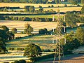
 Pylons at sunset, south of Easton Royal - geograph.org.uk - 516121.jpg 640 × 479; 205 KB
-
 Road junction north of Easton Royal - geograph.org.uk - 6394750.jpg 1,024 × 768; 399 KB
-
 Road towards Easton Royal - geograph.org.uk - 4393413.jpg 640 × 428; 91 KB
-
 Tail Enders - geograph.org.uk - 472285.jpg 640 × 480; 94 KB
-
 Thatched cottage in Easton Royal - geograph.org.uk - 446408.jpg 640 × 480; 110 KB
-

-
 Thatched cottages, Kepnal, Wiltshire - geograph.org.uk - 356934.jpg 640 × 480; 101 KB
-
 The lane continues on up the hill - geograph.org.uk - 4552890.jpg 640 × 480; 133 KB
-
 Track and farmland, Easton - geograph.org.uk - 2921227.jpg 640 × 480; 128 KB
-
 Village scene, Easton Royal - geograph.org.uk - 1347672.jpg 640 × 480; 137 KB
-
 Village street, Easton Royal - geograph.org.uk - 5235592.jpg 4,000 × 3,000; 2.07 MB
-
 Village Street, Milton Lilbourne - geograph.org.uk - 446001.jpg 640 × 510; 90 KB
-
 Weather vane, Easton Royal - geograph.org.uk - 1347668.jpg 479 × 640; 59 KB
-
 Wheat crop, north of Easton Royal - geograph.org.uk - 1327549.jpg 640 × 480; 148 KB
-
 Wheat field north of Easton Royal - geograph.org.uk - 1327556.jpg 640 × 479; 127 KB
-

-

-

-
 After the harvest, south of Easton Royal - geograph.org.uk - 518758.jpg 640 × 479; 254 KB
-

-

-
 Evening south of Easton Royal - geograph.org.uk - 519802.jpg 640 × 480; 293 KB
-
 Farmland, Easton Royal - geograph.org.uk - 391091.jpg 640 × 480; 152 KB
-
 Farmland, near Easton Royal - geograph.org.uk - 516073.jpg 640 × 480; 336 KB
-
 Farmland, south of Easton Royal - geograph.org.uk - 516072.jpg 640 × 480; 303 KB
-

-
 Field south of Easton Royal - geograph.org.uk - 628454.jpg 640 × 480; 118 KB
-

-

-

-

-

-

-
 Harvesting, south of Easton Royal - geograph.org.uk - 516071.jpg 640 × 480; 324 KB
-
 Houses in Kepnal, Wiltshire - geograph.org.uk - 356921.jpg 640 × 480; 104 KB
-
 Kennet and Avon Canal at Wootton Rivers - geograph.org.uk - 432704.jpg 640 × 480; 208 KB
-

-

-
 Lower Farm House, Milton Lilbourne - geograph.org.uk - 445945.jpg 640 × 480; 92 KB
-
 Ox-eye Daisy - geograph.org.uk - 446365.jpg 640 × 480; 160 KB
-
 Ploughed field south of Easton Royal - geograph.org.uk - 628455.jpg 640 × 480; 134 KB
-
 Returning - geograph.org.uk - 472277.jpg 640 × 480; 78 KB
-

-
 Waiting for a beer - geograph.org.uk - 472271.jpg 640 × 480; 73 KB


_-_geograph.org.uk_-_357388.jpg)
_-_geograph.org.uk_-_357396.jpg)
_-_geograph.org.uk_-_357401.jpg)


