Category:Ebbw Vale
town in south Wales, United Kingdom  | |||||
| Upload media | |||||
| Instance of | |||||
|---|---|---|---|---|---|
| Location | Blaenau Gwent County Borough, Wales | ||||
| Population |
| ||||
 | |||||

Cymraeg: Glynebwy yw prif dref Blaenau Gwent. Mae ganddi boblogaeth o dua 25,000.
English: Ebbw Vale is a town at the head of the valley formed by the Ebbw Fawr tributary of the Ebbw River, south Wales. It is the largest town and the administrative centre of Blaenau Gwent county borough. The Ebbw Vale and Brynmawr conurbation has a population of roughly 33,000.
Norsk bokmål: Ebbw Vale ( walisisk Glyn Ebwy) er administrasjonsbyen i Blaenau Gwent i det sørlige Wales. Den ligger i øvre ende av dalen som elven Ebbw Fawr renner gjennom. Byen er grevskapsdistriktets største, med omkring 25 000 innbyggere (2004).
Polski: Ebbw Vale ( wal. Glyn Ebwy) miasto położone w dolinie rzecznej uformowanej przez rzekę Ebbw Fawr w tradycyjnym hrabstwie Monmouthshire w południowej Walii. Ebbw Vale jest siedzibą administracyjną hrabstwa miejskiego Blaenau Gwent oraz największym ośrodkiem miejskim hrabstwa, z populacją liczącą około 18 500 mieszkańców.
Українська: Е́ббу-Вейл — місто на південному сході Уельсу, адміністративний центр області Бланау-Гвент.
Subcategories
This category has the following 20 subcategories, out of 20 total.
A
- Ash Grove, Ebbw Vale (2 F)
B
- Bethcar Street (2 F)
- Breeze block factory, Ebbw Vale (14 F)
C
- Cwmdraw Industrial Estate (3 F)
E
- Ebbw Vale Town Clock (2 F)
- Ebbw Vale Town railway station (19 F)
F
H
I
- Ebbw Vale Innovation Centre (7 F)
J
M
N
- Newtown Bridge, Ebbw Vale (5 F)
S
W
- Ebbw Vale War Memorial (4 F)
Media in category "Ebbw Vale"
The following 48 files are in this category, out of 48 total.
-
 1st Ebbw Vale (Penuel) Scout Group HQ, Ebbw Vale (geograph 2625832).jpg 480 × 640; 105 KB
-
 2010 Wales Blaenau Gwent Community Ebbw Vale map.svg 512 × 655; 233 KB
-
 37178 + 37190 at Ebbw Vale on Hertfordshire Railtours The Valley Basher on 03 May 1980.jpg 4,788 × 3,096; 2.82 MB
-
 Bere-architects welsh-futureworks-housing.jpg 787 × 525; 625 KB
-
 Bus station substitute in Ebbw Vale - geograph.org.uk - 4496155.jpg 800 × 540; 119 KB
-
 Cows on Darren Ddu - geograph.org.uk - 549742.jpg 640 × 480; 69 KB
-
 Ebbw Vale - geograph.org.uk - 911980.jpg 640 × 480; 112 KB
-
 Ebbw Vale - geograph.org.uk - 911982.jpg 640 × 480; 110 KB
-
 Ebbw Vale - geograph.org.uk - 911984.jpg 640 × 480; 127 KB
-
 Ebbw Vale - geograph.org.uk - 911986.jpg 640 × 480; 136 KB
-
 Ebbw Vale Library - geograph.org.uk - 1830232.jpg 640 × 579; 101 KB
-

-
 Ebbw Vale Rugby Ground - geograph.org.uk - 498156.jpg 640 × 480; 111 KB
-
 Ebbw Vale Sports Centre - geograph.org.uk - 4479197.jpg 800 × 546; 85 KB
-
 Ebbw Vale-panorama.jpg 640 × 480; 122 KB
-
 EbbwVale1.jpg 800 × 533; 350 KB
-
 EbbwVale2.jpg 800 × 533; 313 KB
-
 Garden city from Festival Drive - geograph.org.uk - 731748.jpg 640 × 480; 68 KB
-
Gwaith Cyfoeth Naturiol Cymru yng Nghoedwig Cwmcarn.webm 2 min 0 s, 640 × 360; 11.9 MB
-
 Hendre, Ebbw Vale - geograph.org.uk - 1222604.jpg 640 × 480; 56 KB
-
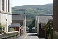
 Hillside terrace and Primary school - geograph.org.uk - 1517848.jpg 640 × 480; 77 KB
-

-
 Ironmasters House, Ebbw Vale - geograph.org.uk - 750500.jpg 640 × 480; 107 KB
-
 Looking towards Victoria - geograph.org.uk - 508483.jpg 640 × 480; 162 KB
-
 Marine Colliery taken from Hertfordshire Rail Tours The Valley Basher on 03 May 1980.jpg 4,824 × 3,120; 4.47 MB
-
 Market Square, Ebbw Vale - geograph.org.uk - 366353.jpg 640 × 480; 76 KB
-
 New housing estate bring built. - geograph.org.uk - 725026.jpg 640 × 480; 106 KB
-
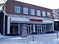 Now closed down Woolworths - geograph.org.uk - 1175140.jpg 640 × 480; 72 KB
-
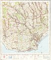
 Ordnance Survey One-Inch Sheet 154 Cardiff, Published 1947.jpg 10,917 × 12,746; 66.06 MB
-
 Ordnance Survey One-Inch Sheet 154 Cardiff, Published 1952.jpg 8,302 × 9,889; 11.28 MB
-
 Ordnance Survey One-Inch Sheet 154 Cardiff, Published 1966.jpg 8,374 × 9,990; 11.94 MB
-
 Ordnance Survey One-Inch Sheet 154 Cardiff, Published 1972.jpg 11,067 × 13,190; 50.86 MB
-
 Park hotel - geograph.org.uk - 1671550.jpg 1,600 × 1,200; 688 KB
-
 R.T.B. rugby club - geograph.org.uk - 1517847.jpg 640 × 480; 71 KB
-
 Remains of Incline leading into Ebbw Vale - geograph.org.uk - 781267.jpg 480 × 640; 116 KB
-
 Roundabout in Ebbw Vale - geograph.org.uk - 951641.jpg 640 × 480; 64 KB
-
 Rushing water, Ebbw Vale - geograph.org.uk - 731633.jpg 640 × 480; 122 KB
-
 Scrap metal - geograph.org.uk - 951619.jpg 640 × 480; 88 KB
-
 Springtime bank in Ebbw Vale - geograph.org.uk - 731662.jpg 640 × 480; 136 KB
-
 The Bridgend Pub, Ebbw Vale - geograph.org.uk - 734090.jpg 640 × 480; 67 KB
-
 The Kings Arms, Ebbw Vale - geograph.org.uk - 733484.jpg 640 × 480; 89 KB
-
 The Wetlands, Ebbw Vale - geograph.org.uk - 731702.jpg 640 × 480; 90 KB
-
 Travel Lodge, Ebbw Vale - geograph.org.uk - 1503829.jpg 640 × 480; 71 KB
-
Tree felling at Cwmcarn Forest, Ebbw valley, Wales.webm 2 min 0 s, 640 × 360; 11.78 MB
-
 View from Radio Station - geograph.org.uk - 667765.jpg 640 × 480; 85 KB
-
 Whitsun Monday Marchers - West End Church - geograph.org.uk - 867405.jpg 640 × 402; 153 KB
-
 Wood carved railings - geograph.org.uk - 1519281.jpg 640 × 480; 83 KB
-
 Wood carving on new railings - geograph.org.uk - 1222600.jpg 640 × 480; 84 KB
_Scout_Group_HQ,_Ebbw_Vale_(geograph_2625832).jpg)


.jpg)


