Category:Ebernoe

village in United Kingdom  | |||||
| Upload media | |||||
| Instance of | |||||
|---|---|---|---|---|---|
| Location | Chichester, West Sussex, South East England, England | ||||
| Area |
| ||||
 | |||||
Subcategories
This category has the following 7 subcategories, out of 7 total.
B
- Balls Cross (34 F)
C
- Ebernoe Cricket Club (7 F)
E
- Ebernoe War Memorial (1 F)
H
- Ebernoe Horn Fair (6 F)
R
- Roads in Ebernoe (53 F)
Media in category "Ebernoe"
The following 104 files are in this category, out of 104 total.
-

-

-

-
 Aston by Roundwyck Pond - geograph.org.uk - 1852072.jpg 640 × 425; 87 KB
-
-
 Blind Lane - geograph.org.uk - 2907740.jpg 640 × 428; 196 KB
-
 Blind Lane - geograph.org.uk - 2907755.jpg 640 × 428; 202 KB
-

-
 Boxes at Ebernoe - geograph.org.uk - 3024502.jpg 4,288 × 3,216; 3.64 MB
-
 Bridleway near Colhook Farm - geograph.org.uk - 1833842.jpg 800 × 600; 204 KB
-
 Bullocks in a field by Pipers Lane - geograph.org.uk - 5016573.jpg 2,304 × 1,728; 940 KB
-
 Bullocks in a field by Pipers Lane - geograph.org.uk - 5016576.jpg 2,216 × 1,606; 1.75 MB
-
 Bullocks in a field by Pipers Lane - geograph.org.uk - 5016579.jpg 2,304 × 1,728; 859 KB
-
 Colhook Farm at Ebernoe - geograph.org.uk - 1833823.jpg 800 × 600; 122 KB
-
 Colourful caravan or outbuilding - geograph.org.uk - 1850634.jpg 800 × 600; 101 KB
-

-
 Crosstracks near Colhook Farm - geograph.org.uk - 1833837.jpg 800 × 600; 198 KB
-
 Derelict farm bridge near Roundwyck House - geograph.org.uk - 2163284.jpg 2,592 × 1,944; 2.04 MB
-
 Disused limekiln at Ebernoe - geograph.org.uk - 1833768.jpg 800 × 600; 150 KB
-
 Early morning sun near Hilland Furze and cattle - geograph.org.uk - 6009367.jpg 2,048 × 1,536; 646 KB
-
 Ebernoe Common - geograph.org.uk - 880208.jpg 640 × 480; 154 KB
-
 Ebernoe Common - geograph.org.uk - 880214.jpg 640 × 480; 150 KB
-
 Ebernoe ^ idling (10) - geograph.org.uk - 5522316.jpg 640 × 480; 89 KB
-
 Ebernoe ^ idling (3) - geograph.org.uk - 5522297.jpg 640 × 480; 88 KB
-
 Ebernoe ^ idling (4) - geograph.org.uk - 5522300.jpg 480 × 640; 104 KB
-
 Ebernoe ^ idling (5) - geograph.org.uk - 5522303.jpg 640 × 480; 150 KB
-
 Ebernoe ^ idling (6) - geograph.org.uk - 5522304.jpg 640 × 480; 116 KB
-
 Ebernoe ^ idling (7) - geograph.org.uk - 5522307.jpg 640 × 480; 112 KB
-
 Ebernoe ^ idling (8) - geograph.org.uk - 5522309.jpg 480 × 640; 122 KB
-
 Ebernoe ^ idling (9) - geograph.org.uk - 5522311.jpg 640 × 480; 111 KB
-
 Field with sheep near Ebernoe - geograph.org.uk - 1502866.jpg 640 × 360; 56 KB
-
 Fields near Balls Cross - geograph.org.uk - 6009384.jpg 2,048 × 1,536; 784 KB
-
 Fields near Hilland Farm - geograph.org.uk - 6009345.jpg 1,600 × 1,200; 347 KB
-
 Fields near Petworth - geograph.org.uk - 2060230.jpg 491 × 640; 179 KB
-
 Fishing at Roundwyck Pond - geograph.org.uk - 1852077.jpg 640 × 480; 88 KB
-
 Floor of Ebernoe brick kiln - geograph.org.uk - 1162757.jpg 640 × 480; 151 KB
-
 Flowers at Ebernoe - geograph.org.uk - 1833749.jpg 800 × 600; 171 KB
-
 Footbridge over drainage ditch - geograph.org.uk - 5502114.jpg 4,608 × 3,456; 5.47 MB
-
 Footpath across marshy field - geograph.org.uk - 1162428.jpg 640 × 480; 86 KB
-
 Footpath at Roundwyck - geograph.org.uk - 1852140.jpg 640 × 425; 59 KB
-
 Footpath at the rear of Ebernoe House - geograph.org.uk - 1163178.jpg 640 × 480; 151 KB
-
 Footpath by Ebernoe House - geograph.org.uk - 3024488.jpg 4,288 × 3,216; 3.81 MB
-
 Footpath crossing field - geograph.org.uk - 5503107.jpg 4,608 × 3,456; 4.62 MB
-

-
 Footpath on Ebernoe Common - geograph.org.uk - 1162871.jpg 480 × 640; 139 KB
-
 Footpath on South of Ebernoe Common - geograph.org.uk - 259925.jpg 640 × 480; 190 KB
-
 Footpath on South of Ebernoe Common - geograph.org.uk - 880171.jpg 640 × 480; 156 KB
-
 Footpath on South of Ebernoe Common - geograph.org.uk - 880175.jpg 640 × 480; 166 KB
-
 Footpath on South of Ebernoe Common - geograph.org.uk - 880185.jpg 640 × 480; 191 KB
-
 Footpath on South of Ebernoe Common - geograph.org.uk - 880195.jpg 640 × 480; 173 KB
-
 Footpath running past Ebernoe Churchyard - geograph.org.uk - 2278415.jpg 480 × 640; 132 KB
-

-
 Footpath to Ebernoe - geograph.org.uk - 5495279.jpg 4,608 × 3,456; 5.41 MB
-
 Frayles at Langhurst Common - geograph.org.uk - 6010045.jpg 1,024 × 690; 283 KB
-
 Fruit trees in blossom - geograph.org.uk - 1850643.jpg 800 × 600; 169 KB
-
 Furnace Pond, Ebernoe - geograph.org.uk - 2907703.jpg 640 × 428; 112 KB
-
 Gate and stile - geograph.org.uk - 5505052.jpg 4,608 × 3,456; 4.76 MB
-

-
 Grassland - geograph.org.uk - 1162883.jpg 640 × 480; 77 KB
-

-
 Hilland Farm - geograph.org.uk - 6009329.jpg 1,600 × 1,200; 434 KB
-
 History and making of Ebernoe brickworks - geograph.org.uk - 1162784.jpg 640 × 480; 110 KB
-
 Holly Berries on Ebernoe Common - geograph.org.uk - 259929.jpg 640 × 480; 129 KB
-
 Hot Air Balloon over Hoe Bridge - geograph.org.uk - 1570081.jpg 640 × 480; 101 KB
-
 Isling Bridge - geograph.org.uk - 5367238.jpg 3,872 × 2,592; 4.87 MB
-
 Kiln at Ebernoe Brickworks - geograph.org.uk - 1162748.jpg 640 × 480; 143 KB
-
 Langhurst Farm - geograph.org.uk - 6009409.jpg 1,024 × 673; 211 KB
-
 Leaving Hilland Furze - geograph.org.uk - 6009351.jpg 1,600 × 1,200; 768 KB
-
 Log Piles - geograph.org.uk - 6009349.jpg 1,024 × 768; 332 KB
-
 Mowed footpath - geograph.org.uk - 5502142.jpg 4,608 × 3,456; 5.09 MB
-
 Northchapel motocross track - geograph.org.uk - 80160.jpg 600 × 400; 95 KB
-
 Old Bracken - geograph.org.uk - 6016382.jpg 1,600 × 1,200; 820 KB
-

-
 Ordnance Survey Trig Pillar S6284 - geograph.org.uk - 2902895.jpg 3,264 × 2,448; 2.81 MB
-

-
 Palfrey Farm seen across fields - geograph.org.uk - 1836529.jpg 800 × 600; 111 KB
-
 Path ahead - geograph.org.uk - 6010135.jpg 1,600 × 1,114; 885 KB
-
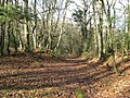 Path through Ebernoe Common - geograph.org.uk - 1162481.jpg 640 × 480; 163 KB
-
 Perimeter wall at Roundwyck House - geograph.org.uk - 1569468.jpg 640 × 480; 105 KB
-
 Pheasant encounter - geograph.org.uk - 1569483.jpg 640 × 480; 129 KB
-
 Picnic area in Colhook Industrial Estate - geograph.org.uk - 1836404.jpg 800 × 600; 233 KB
-
 Pond on Ebernoe Common - geograph.org.uk - 1162491.jpg 640 × 480; 121 KB
-
 Poplar windbreak at Roundwyck House - geograph.org.uk - 1569457.jpg 640 × 480; 141 KB
-

-
-
 Rhododendrons at Roundwyck - geograph.org.uk - 1852090.jpg 640 × 426; 127 KB
-
 River Kird - geograph.org.uk - 5368604.jpg 3,872 × 2,592; 5.63 MB
-
 River Kird - geograph.org.uk - 77953.jpg 636 × 440; 122 KB
-
 Roof tops on Butcherland Farm - geograph.org.uk - 1162459.jpg 640 × 480; 67 KB
-
 Roundwyck Pond - geograph.org.uk - 1852101.jpg 640 × 425; 88 KB
-
 Seat in Colhook Industrial Estate - geograph.org.uk - 1836401.jpg 800 × 600; 168 KB
-
 Sluice at Wassell Mill - geograph.org.uk - 6018625.jpg 1,600 × 1,200; 924 KB
-
 Stream by Ashfold Copse - geograph.org.uk - 3025652.jpg 4,288 × 3,216; 3.34 MB
-
 Stream crossing, Willand Wood - geograph.org.uk - 2907723.jpg 640 × 428; 211 KB
-

-
 Terrapin at Ebernoe Car Park - geograph.org.uk - 691421.jpg 640 × 480; 121 KB
-
 The Old Vicarage - geograph.org.uk - 6018631.jpg 1,024 × 768; 279 KB
-
 The River Kird at Isling Bridge - geograph.org.uk - 2234236.jpg 800 × 600; 197 KB
-
 Track in Lodgefield Copse - geograph.org.uk - 1850379.jpg 679 × 800; 162 KB
-
 Vertical reflections in ice - geograph.org.uk - 1162470.jpg 640 × 480; 101 KB
-
 Watching and waiting - geograph.org.uk - 5505032.jpg 4,608 × 3,456; 3.35 MB
-
 West of Colhook Common - geograph.org.uk - 260002.jpg 640 × 480; 96 KB
-
 Winter sun over Hilland Farm - geograph.org.uk - 6009337.jpg 1,600 × 1,200; 401 KB
-
 Woodland near Ebernoe - geograph.org.uk - 1833739.jpg 800 × 600; 200 KB


_-_geograph.org.uk_-_5522316.jpg)
_-_geograph.org.uk_-_5522297.jpg)
_-_geograph.org.uk_-_5522300.jpg)
_-_geograph.org.uk_-_5522303.jpg)
_-_geograph.org.uk_-_5522304.jpg)
_-_geograph.org.uk_-_5522307.jpg)
_-_geograph.org.uk_-_5522309.jpg)
_-_geograph.org.uk_-_5522311.jpg)


