Category:Ecclesmachan (civil parish)
Scottish parish in West Lothian, Scotland, UK  | |||||
| Upload media | |||||
| Instance of | |||||
|---|---|---|---|---|---|
| Part of |
| ||||
| Named after | |||||
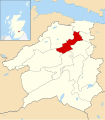
| Location |
| ||||
| Population |
| ||||
| Area |
| ||||
 | |||||
Subcategories
This category has the following 3 subcategories, out of 3 total.
Media in category "Ecclesmachan (civil parish)"
The following 197 files are in this category, out of 197 total.
-
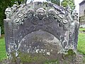
 18thC tombstone, Ecclesmachan - geograph.org.uk - 2103164.jpg 640 × 480; 108 KB
-
 18thC tombstone, Ecclesmachan - geograph.org.uk - 2103170.jpg 640 × 480; 117 KB
-
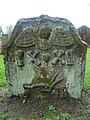 18thC tombstone, Ecclesmachan - geograph.org.uk - 2103173.jpg 480 × 640; 94 KB
-
 18thC tombstone, Ecclesmachan - geograph.org.uk - 2103176.jpg 480 × 640; 85 KB
-
 18thC tombstone, Ecclesmachan - geograph.org.uk - 2103180.jpg 480 × 640; 114 KB
-
 A footpath sign to Ecclesmachan - geograph.org.uk - 4337314.jpg 3,000 × 2,250; 5.52 MB
-
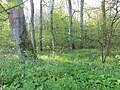
 A strip of woodland - geograph.org.uk - 4541107.jpg 800 × 533; 342 KB
-
 A Tumbledown Dyke - geograph.org.uk - 3343565.jpg 640 × 427; 412 KB
-
 Approaching Burnhouse - geograph.org.uk - 5858331.jpg 3,776 × 2,520; 4.01 MB
-
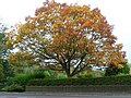 Autumnal tree at Ecclesmachan - geograph.org.uk - 2103188.jpg 640 × 480; 124 KB
-
 Awaiting the baler - geograph.org.uk - 4156505.jpg 800 × 600; 487 KB
-
 Bale Stacks - geograph.org.uk - 4914075.jpg 640 × 427; 333 KB
-
 Bangour General Hospital site - geograph.org.uk - 2612408.jpg 640 × 480; 280 KB
-
 Bangour Hospital Church - geograph.org.uk - 5281561.jpg 1,600 × 900; 329 KB
-
 Bangour Hospital, from above Livingston - geograph.org.uk - 2714280.jpg 3,264 × 2,448; 2.81 MB
-
 Bangour Reservoir - geograph.org.uk - 4914280.jpg 640 × 427; 318 KB
-
 Bangour Reservoir Trout Fishery - geograph.org.uk - 3075774.jpg 3,264 × 2,448; 4.52 MB
-
 Bangour Trout Fishery - geograph.org.uk - 3075780.jpg 3,264 × 2,448; 5.41 MB
-
 Bangour Trout Fishery - geograph.org.uk - 3734977.jpg 640 × 480; 302 KB
-
 Bangour Trout Fishery and dam - geograph.org.uk - 3075770.jpg 3,264 × 2,448; 4.57 MB
-
 Bangour Village Hospital - geograph.org.uk - 3725946.jpg 640 × 480; 234 KB
-
 Bangour Village Hospital - geograph.org.uk - 5281583.jpg 1,600 × 900; 240 KB
-
 Bangour Village Hospital Church - geograph.org.uk - 3832267.jpg 640 × 480; 57 KB
-
 Bangour Village Hospital Church - geograph.org.uk - 3832269.jpg 640 × 480; 42 KB
-
 Bangour Village Hospital Church - geograph.org.uk - 3832273.jpg 640 × 480; 48 KB
-
 Bankhead Farm Guest House - geograph.org.uk - 3075863.jpg 3,264 × 2,448; 5.81 MB
-
 Barley near Dechmont - geograph.org.uk - 4156508.jpg 800 × 450; 360 KB
-
 Beech trees along the Ochiltree road - geograph.org.uk - 2720734.jpg 3,648 × 2,736; 5.98 MB
-
 Binnie Craig from Hangingside - geograph.org.uk - 5521755.jpg 2,200 × 1,467; 3.55 MB
-
 Binny Burn - geograph.org.uk - 3229073.jpg 640 × 427; 357 KB
-
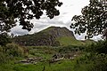
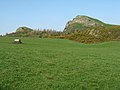
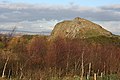
 Binny Craig - geograph.org.uk - 2453808.jpg 640 × 436; 148 KB
-
 Binny Craig - geograph.org.uk - 2871694.jpg 3,264 × 2,448; 4.91 MB
-
 Binny Craig - geograph.org.uk - 2876028.jpg 640 × 427; 410 KB
-
 Binny Craig - geograph.org.uk - 3229030.jpg 640 × 427; 379 KB
-
 Binny Craig - geograph.org.uk - 3974937.jpg 800 × 545; 405 KB
-
 Binny Craig - geograph.org.uk - 4642811.jpg 800 × 600; 231 KB
-
 Binny Craig from Linlithgow - geograph.org.uk - 3206700.jpg 1,024 × 577; 80 KB
-
 Binny Plants - geograph.org.uk - 3228954.jpg 640 × 427; 408 KB
-
 Binny Plants garden centre - geograph.org.uk - 2871723.jpg 3,264 × 2,448; 5.71 MB
-
 Blackcraig - geograph.org.uk - 3229086.jpg 640 × 394; 339 KB
-
 Boat House - geograph.org.uk - 4914085.jpg 480 × 640; 473 KB
-
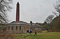
 Boiler house, Bangour Hospital - geograph.org.uk - 3832333.jpg 1,024 × 678; 310 KB
-
 Boilerhouse, Bangour Village Hospital - geograph.org.uk - 3833832.jpg 1,024 × 678; 187 KB
-
 Brassica field near Faucheldean - geograph.org.uk - 2109264.jpg 2,048 × 1,536; 2.24 MB
-
 Bridge over the Ecclesmachan Burn - geograph.org.uk - 4337409.jpg 3,000 × 2,000; 6.83 MB
-
 Buildings at Bangour Hospital - geograph.org.uk - 3833773.jpg 1,024 × 618; 141 KB
-
 Burn in Old Wood - geograph.org.uk - 4914058.jpg 640 × 480; 575 KB
-
 Burnhouse Road leaving Dechmont - geograph.org.uk - 5858155.jpg 3,776 × 2,520; 3.88 MB
-
 Bus shelter, Bangour Hospital - geograph.org.uk - 3832400.jpg 1,024 × 678; 202 KB
-
 Byburn - geograph.org.uk - 3228951.jpg 640 × 427; 61 KB
-
 Cattle in a quarry - geograph.org.uk - 2394611.jpg 640 × 480; 256 KB
-
 Cereal crop, Hillend - geograph.org.uk - 3988136.jpg 640 × 480; 267 KB
-
 Cleared woodland - geograph.org.uk - 3465344.jpg 2,048 × 1,536; 1.1 MB
-
 Country road between Winchburgh and Ecclesmachan - geograph.org.uk - 2109257.jpg 2,048 × 1,536; 2.24 MB
-
 Covered Reservoir - geograph.org.uk - 3343574.jpg 640 × 427; 391 KB
-
 Craig Binning - geograph.org.uk - 3229059.jpg 640 × 427; 366 KB
-
 Cut grass, West Binney - geograph.org.uk - 4645434.jpg 800 × 450; 159 KB
-
 Decommissioned road, Bangour - geograph.org.uk - 4149086.jpg 800 × 600; 462 KB
-
 Demolition - geograph.org.uk - 6353329.jpg 2,322 × 4,128; 2.15 MB
-
 Derelict bus shelter, Bangour Village Hospital - geograph.org.uk - 3832425.jpg 1,024 × 678; 307 KB
-

-

-

-
-

-

-
 Disused Quarry at Bangour hospital site - geograph.org.uk - 4375710.jpg 960 × 1,600; 800 KB
-
 Ecclesmachan Kirk - geograph.org.uk - 2103148.jpg 640 × 480; 140 KB
-
 Ecclesmachan kirkyard - geograph.org.uk - 2103157.jpg 640 × 480; 99 KB
-
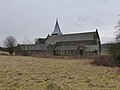
 Ecclesmachan Parish Kirk - geograph.org.uk - 3228943.jpg 640 × 427; 412 KB
-
 Engineer's Stores, Bangour Hospital - geograph.org.uk - 3832340.jpg 1,024 × 678; 206 KB
-
 Estate Department building, Bangour Hospital - geograph.org.uk - 3832319.jpg 1,024 × 678; 194 KB
-
 Fallen Conifers - geograph.org.uk - 4914043.jpg 480 × 640; 572 KB
-
 Farm and fields at Bankhead - geograph.org.uk - 3075828.jpg 3,264 × 2,448; 4.84 MB
-
 Farmland at Bankhead - geograph.org.uk - 2853001.jpg 480 × 640; 106 KB
-
 Farmland at Dechmont - geograph.org.uk - 3345296.jpg 640 × 427; 315 KB
-
 Faucheldean Woodland Strip - geograph.org.uk - 3684614.jpg 640 × 427; 624 KB
-
 Felled area, Mounthooly - geograph.org.uk - 5882159.jpg 1,024 × 683; 424 KB
-
 Fenced off buildings at Bangour Village Hospital - geograph.org.uk - 3833800.jpg 1,024 × 678; 233 KB
-
 Field edge - geograph.org.uk - 4156546.jpg 800 × 450; 333 KB
-
 Field edge, Faucheldean - geograph.org.uk - 5882197.jpg 1,024 × 683; 490 KB
-
 Field, Kirklands - geograph.org.uk - 4541126.jpg 800 × 450; 160 KB
-
 Field, Trinlaymire - geograph.org.uk - 4482771.jpg 800 × 533; 365 KB
-
 Fields at Old Glendevon Farm - geograph.org.uk - 3684605.jpg 640 × 427; 402 KB
-
 Fields near Faucheldean - geograph.org.uk - 3684609.jpg 640 × 427; 503 KB
-
 Fields of BlackCraig - geograph.org.uk - 2525483.jpg 4,000 × 3,000; 2.92 MB
-
 Footbridge over Mains Burn - geograph.org.uk - 3255370.jpg 640 × 480; 133 KB
-

-
 Former hospital buildings, Bangour - geograph.org.uk - 3832403.jpg 1,024 × 678; 176 KB
-
 Former industrial land, Faucheldean - geograph.org.uk - 5882201.jpg 1,024 × 683; 584 KB
-

-
 Hangingshaw Wood - geograph.org.uk - 3229039.jpg 640 × 427; 338 KB
-
 Hangingside Wood - geograph.org.uk - 2871705.jpg 3,264 × 2,448; 5.76 MB
-
 Heathers on Binnie Craig - geograph.org.uk - 5521764.jpg 2,750 × 2,063; 6.81 MB
-
 Hedge separating two fields of rape - geograph.org.uk - 2109241.jpg 2,048 × 1,536; 1.99 MB
-
 Hillend Farm - geograph.org.uk - 3343582.jpg 640 × 291; 279 KB
-
 Hillend through the mist - geograph.org.uk - 2109253.jpg 2,048 × 1,536; 1.67 MB
-
 Houses at West Binny - geograph.org.uk - 3075856.jpg 3,264 × 2,448; 4.22 MB
-
 Kirklands Farm - geograph.org.uk - 2340140.jpg 1,024 × 768; 192 KB
-
 Large building at Bangour Village Hospital - geograph.org.uk - 3833787.jpg 1,024 × 678; 189 KB
-
 Limpid Waters - geograph.org.uk - 4914062.jpg 480 × 640; 572 KB
-
 Looking across Mains Burn - geograph.org.uk - 1946445.jpg 1,024 × 768; 139 KB
-
 Looking east from near Hillend - geograph.org.uk - 2109250.jpg 2,048 × 1,536; 1.93 MB
-
 Looking towards Glendevon - geograph.org.uk - 3343553.jpg 640 × 356; 305 KB
-
 Looking towards the Law - geograph.org.uk - 2525732.jpg 4,000 × 3,000; 2.33 MB
-

-
 Marshy enclosure near Binny Craig - geograph.org.uk - 2871707.jpg 3,264 × 2,448; 6.37 MB
-
 Minor road at Bangour - geograph.org.uk - 3832409.jpg 1,024 × 678; 251 KB
-
 Minor Road near Faucheldean - geograph.org.uk - 3343534.jpg 640 × 427; 455 KB
-
 Minor road near Kirkland - geograph.org.uk - 4541124.jpg 800 × 450; 252 KB
-
 Minor road to Bathgate - geograph.org.uk - 3832412.jpg 1,024 × 678; 130 KB
-
 Minor road to Dumcross - geograph.org.uk - 4597727.jpg 640 × 480; 77 KB
-
 Minor road, Kirklands - geograph.org.uk - 3988130.jpg 640 × 480; 342 KB
-
 Minor road, Law - geograph.org.uk - 3734965.jpg 640 × 480; 252 KB
-
 Near Faucheldean - geograph.org.uk - 3343543.jpg 640 × 427; 467 KB
-
 Near Hillend - geograph.org.uk - 3343560.jpg 640 × 427; 428 KB
-
 Near Little Ochiltree - geograph.org.uk - 3248765.jpg 427 × 640; 461 KB
-
 Near the Binny Burn - geograph.org.uk - 3229067.jpg 640 × 427; 392 KB
-
 Near Threemiletown - geograph.org.uk - 3248787.jpg 640 × 427; 332 KB
-
 Near Trinlaymire - geograph.org.uk - 3248631.jpg 640 × 427; 430 KB
-
 Nervous calves - geograph.org.uk - 4156550.jpg 800 × 450; 356 KB
-
 No Entry - geograph.org.uk - 4339111.jpg 640 × 427; 411 KB
-
-
 Oatridge Farm - geograph.org.uk - 4337382.jpg 3,530 × 2,353; 7.57 MB
-
 Oatridge Golf Course - geograph.org.uk - 3228999.jpg 640 × 427; 446 KB
-
 Oilseed rape near Ecclesmachan - geograph.org.uk - 4540471.jpg 800 × 533; 205 KB
-
 Oilseed rape, Binny - geograph.org.uk - 3982877.jpg 640 × 480; 293 KB
-
 Oilseed rape, Kirklands - geograph.org.uk - 4284213.jpg 800 × 600; 474 KB
-

-

-

-

-

-
 Old hospital buildings at Bangour - geograph.org.uk - 3832231.jpg 640 × 480; 54 KB
-
-
 Old Wood - geograph.org.uk - 4914029.jpg 640 × 480; 580 KB
-
 Open Woodland - geograph.org.uk - 4914034.jpg 640 × 480; 554 KB
-
 Pheasant Pheeders - geograph.org.uk - 4914040.jpg 640 × 480; 492 KB
-
 Pig Unit - geograph.org.uk - 3976754.jpg 2,560 × 1,920; 2.59 MB
-
 Plaque - geograph.org.uk - 3684615.jpg 427 × 640; 433 KB
-

-

-
 Rehabilitation Unit, Bangour Hospital - geograph.org.uk - 3832397.jpg 1,024 × 678; 182 KB
-
 Reservoir near Ecclesmachan - geograph.org.uk - 2109243.jpg 2,048 × 1,536; 1.78 MB
-
 Riccarton Hills and Longmuir Plantation - geograph.org.uk - 3075836.jpg 3,264 × 2,448; 5.08 MB
-
 Road C21 crossing Binny Burn - geograph.org.uk - 5858338.jpg 3,776 × 2,520; 3.53 MB
-
 Road junction, Bangour Village Hospital - geograph.org.uk - 3832418.jpg 1,024 × 678; 236 KB
-
 Road junction, Waterstone - geograph.org.uk - 3985063.jpg 640 × 480; 264 KB
-
 Road passing Blackcraig - geograph.org.uk - 6350236.jpg 1,024 × 683; 177 KB
-
 Road south of Binny Craig - geograph.org.uk - 3982875.jpg 640 × 480; 292 KB
-
 Road, Binny - geograph.org.uk - 4642809.jpg 800 × 600; 228 KB
-
 Roadside Beech trees in the snow - geograph.org.uk - 5654455.jpg 3,300 × 2,475; 6.97 MB
-
 Roadside trees near Faucheldean - geograph.org.uk - 2109260.jpg 2,048 × 1,536; 1.72 MB
-
 Sheep on Chapel Hill - geograph.org.uk - 4339043.jpg 640 × 427; 360 KB
-
 Shifting Bales - geograph.org.uk - 4914067.jpg 640 × 427; 338 KB
-
 Silage bales at Bankhead - geograph.org.uk - 3075842.jpg 3,264 × 2,448; 3.92 MB
-
 Silage clamp, Blackcraig - geograph.org.uk - 3734972.jpg 640 × 480; 283 KB
-

-

-
 South entrance to Bangour village hospital church - geograph.org.uk - 4596609.jpg 1,200 × 1,600; 669 KB
-
 Straw bales at Kirklands Farm - geograph.org.uk - 2720660.jpg 3,648 × 2,429; 3.47 MB
-
 Stripwood, Burnhouse Road - geograph.org.uk - 3968518.jpg 640 × 480; 363 KB
-
 Stubble, Blackcraig - geograph.org.uk - 3734962.jpg 640 × 480; 253 KB
-
 Stubble, Blackcraig - geograph.org.uk - 6350234.jpg 1,024 × 683; 246 KB
-
 Tar Hill - geograph.org.uk - 4484393.jpg 800 × 450; 313 KB
-

-

-
 The C21 crossing Mains Burn - geograph.org.uk - 5858436.jpg 3,776 × 2,520; 3.8 MB
-
 The Gullet - geograph.org.uk - 4914080.jpg 640 × 480; 473 KB
-
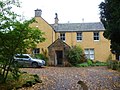 The Manse at Ecclesmachan - geograph.org.uk - 2103152.jpg 640 × 480; 101 KB
-
-
 The valley of the Ecclesmachan Burn - geograph.org.uk - 2109236.jpg 2,048 × 1,536; 1.8 MB
-
 The View from Chapel Hill - geograph.org.uk - 4339048.jpg 640 × 427; 375 KB
-
 Trees surrounding Bangour Fishery - geograph.org.uk - 2525453.jpg 4,000 × 3,000; 2.28 MB
-
 Twelve-mile Lodge - geograph.org.uk - 1808029.jpg 1,024 × 768; 190 KB
-
 Vertical pine - geograph.org.uk - 3465333.jpg 1,536 × 2,048; 746 KB
-
 View south-east to Cauldstane Slap in the Pentland Hills - geograph.org.uk - 5858359.jpg 3,776 × 2,520; 3.72 MB
-
 View towards Binny Craig - geograph.org.uk - 4646008.jpg 800 × 533; 201 KB
-
 Volcanic activity in the Lothians - geograph.org.uk - 3826249.jpg 3,077 × 1,728; 3.05 MB
-
 Walled garden at Binny House - geograph.org.uk - 2871719.jpg 3,264 × 2,448; 5.83 MB
-
 Waterstone Farm - geograph.org.uk - 3811601.jpg 3,000 × 1,800; 5.23 MB
-
 West Binny - geograph.org.uk - 3229045.jpg 640 × 427; 368 KB
-
 West Lothian fieldscape - geograph.org.uk - 5678799.jpg 3,264 × 2,448; 3.96 MB
-
 West Lothian lane - geograph.org.uk - 2871711.jpg 3,264 × 2,448; 4.45 MB
-
 West Lothian UK parish map Ecclesmachan.svg 1,214 × 1,384; 870 KB
-
 Wet area, Waterstone - geograph.org.uk - 3983063.jpg 640 × 480; 278 KB
-
 Wet pasture - geograph.org.uk - 2394620.jpg 640 × 480; 257 KB
-
 Wet tramlines - geograph.org.uk - 3983069.jpg 640 × 480; 248 KB
-
 Whins, Craig Binning - geograph.org.uk - 2394604.jpg 640 × 480; 266 KB
-
 Winter afternoon near Waterstone Farm - geograph.org.uk - 2720673.jpg 3,648 × 2,049; 2.86 MB
-
 Wood-sorrel (Oxalis acetosella) - geograph.org.uk - 3873324.jpg 640 × 427; 56 KB
-
 Woodland near Mounthooly - geograph.org.uk - 3988236.jpg 640 × 480; 365 KB
-
 Woodland near Mounthooly - geograph.org.uk - 4482765.jpg 800 × 600; 407 KB
-
 Woodland Ride - geograph.org.uk - 4914047.jpg 640 × 480; 547 KB
-
 Woodland, Bangour Village Hospital - geograph.org.uk - 3720900.jpg 640 × 480; 351 KB
-
 Woodland, Binny - geograph.org.uk - 3982884.jpg 640 × 480; 370 KB
-
 Young woodland below Binny Craig - geograph.org.uk - 6084261.jpg 1,024 × 768; 297 KB


_-_geograph.org.uk_-_3873324.jpg)


