Category:Egerton, Cheshire
English: Egerton is a civil parish in the unitary authority of Cheshire East and the ceremonial county of Cheshire, England. A largely rural area, the parish includes the small settlement of Egerton Green (at ), which lies 3¾ miles to the north east of Malpas and 8 miles to the west of Nantwich, as well as Fairy Glen. Nearby villages include Bickerton, Bulkeley and No Man's Heath.
civil parish in Cheshire, UK .jpg) | |||||
| Upload media | |||||
| Instance of | |||||
|---|---|---|---|---|---|
| Location | Cheshire East, Cheshire, North West England, England | ||||
 | |||||
Media in category "Egerton, Cheshire"
The following 28 files are in this category, out of 28 total.
-
 Bickerton Road approaching Bickerton Hall - geograph.org.uk - 3765044.jpg 5,184 × 3,456; 5.31 MB
-
 Bickerton Road approaching Egerton Green - geograph.org.uk - 3765083.jpg 5,184 × 3,456; 3.9 MB
-
 Bickerton Road near Egerton Green - geograph.org.uk - 3765064.jpg 5,184 × 3,456; 4.02 MB
-
 Bickerton Road near Ivy Farm - geograph.org.uk - 5192851.jpg 640 × 480; 137 KB
-
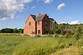 Egerton - House.jpg 640 × 427; 139 KB
-
 Egerton Lane - geograph.org.uk - 3593294.jpg 4,000 × 3,000; 2.2 MB
-
 Entering Cholmondeley - geograph.org.uk - 5192861.jpg 640 × 480; 85 KB
-
 Entrance to Harthill Stud - geograph.org.uk - 3593385.jpg 4,000 × 3,000; 1.9 MB
-

-
 Grazing and hedgerow - geograph.org.uk - 5192842.jpg 640 × 480; 73 KB
-
 Grazing off Bickerton Road - geograph.org.uk - 5192843.jpg 640 × 480; 54 KB
-
 Grazing, Egerton - geograph.org.uk - 5192854.jpg 640 × 480; 61 KB
-
 Grazing, Egerton Bank Farm - geograph.org.uk - 6143551.jpg 640 × 480; 70 KB
-
 Grazing, Egerton Green - geograph.org.uk - 5192847.jpg 640 × 480; 103 KB
-
 Harthill Stud - geograph.org.uk - 3593329.jpg 4,000 × 3,000; 2.04 MB
-
 Harthill Stud, Egerton Hall - geograph.org.uk - 6143560.jpg 640 × 418; 49 KB
-

-
 Lane at Egerton - geograph.org.uk - 3592402.jpg 4,000 × 3,000; 2.45 MB
-
 Lane Junction at Egerton - geograph.org.uk - 3593303.jpg 4,000 × 3,000; 2.53 MB
-
 Lane near Egerton Bank Farm - geograph.org.uk - 6143557.jpg 800 × 600; 139 KB
-
 Lane to Egerton Cottages - geograph.org.uk - 3592410.jpg 4,000 × 3,000; 3.19 MB
-
 Lane to Hetherson Green - geograph.org.uk - 3593315.jpg 4,000 × 3,000; 4.07 MB
-
 Minor road towards Hampton Post - geograph.org.uk - 6143563.jpg 800 × 600; 164 KB
-
 National Cycle Route 45 - geograph.org.uk - 5192844.jpg 640 × 480; 51 KB
-
 National Cycle Route 45 - geograph.org.uk - 5192858.jpg 640 × 480; 62 KB
-
 Sheep pasture near Egerton Green - geograph.org.uk - 712390.jpg 640 × 427; 164 KB
-
 Track to Egerton Bank Farm - geograph.org.uk - 6143553.jpg 800 × 600; 127 KB
-
 Yew Tree Organic Farm, Egerton Green (geograph 3765072).jpg 5,184 × 3,456; 3.51 MB


_off_Bickerton_Road_-_geograph.org.uk_-_5192849.jpg)


