Category:Egerton, Kent
English: Egerton is a village and civil parish in the Ashford District of Kent, England. The village is located on the Greensand Ridge nine miles (14.4km) north of Ashford. The parish is a scattered rural one; the settlement of Stonebridge Green, adjacent to Egerton, is also in the parish.
Français : Egerton (prononciation: è-djeu-tone) est un village et une paroisse du district d'Ashford, dans le Kent, au Royaume-Uni. Le village comptait 1104 habitants en 2001.
village and civil parish in Kent, UK  | |||||
| Upload media | |||||
| Instance of | |||||
|---|---|---|---|---|---|
| Location | Ashford, Kent, South East England, England | ||||
| Area |
| ||||
| Said to be the same as | Egerton (Wikimedia duplicated page, civil parish) | ||||
 | |||||
Subcategories
This category has the following 3 subcategories, out of 3 total.
Media in category "Egerton, Kent"
The following 200 files are in this category, out of 227 total.
(previous page) (next page)-
 1 Hillside Villas, Rock Hill Road - geograph.org.uk - 4082912.jpg 1,142 × 856; 199 KB
-
 1 ^ 2, Hillside Cottages, Rock Hill Road - geograph.org.uk - 4535574.jpg 3,264 × 2,448; 1.75 MB
-
 2, Elm Close - geograph.org.uk - 5603665.jpg 3,264 × 2,448; 1.67 MB
-
 A field of wheat - geograph.org.uk - 3329463.jpg 640 × 426; 69 KB
-
 A young crop of wheat - geograph.org.uk - 3329458.jpg 640 × 426; 96 KB
-
 An entrance to Mundy Bois House - geograph.org.uk - 3947627.jpg 640 × 430; 84 KB
-
 Apple orchards at Egerton - geograph.org.uk - 2599286.jpg 4,000 × 3,000; 4.17 MB
-
 Apple orchards near Egerton - geograph.org.uk - 4150918.jpg 4,000 × 3,000; 4.1 MB
-
 Appleby Farmhouse - geograph.org.uk - 3943996.jpg 640 × 430; 151 KB
-
 Approaching Coach Rd - geograph.org.uk - 3329468.jpg 640 × 426; 67 KB
-
 At Mundy Bois - geograph.org.uk - 3947629.jpg 640 × 430; 109 KB
-
 Attractive period houses on The Street, Egerton - geograph.org.uk - 3949889.jpg 4,288 × 2,848; 1.6 MB
-
 Barns, Kingsden Farm - geograph.org.uk - 3930672.jpg 640 × 430; 77 KB
-
 Bedlam Lane - geograph.org.uk - 3762319.jpg 3,696 × 2,448; 2.28 MB
-
 Bedlam Lane - geograph.org.uk - 3930683.jpg 640 × 430; 89 KB
-
 Bedlam Lane - geograph.org.uk - 3930731.jpg 640 × 430; 90 KB
-
 Bedlam Lane - geograph.org.uk - 3930752.jpg 640 × 430; 99 KB
-
 Bedlam Lane - geograph.org.uk - 3930753.jpg 640 × 430; 103 KB
-
 Bedlam Lane - geograph.org.uk - 3930770.jpg 640 × 430; 96 KB
-
 Bend, Forstal Rd - geograph.org.uk - 3930784.jpg 640 × 430; 91 KB
-
 Box Farm - geograph.org.uk - 3930756.jpg 640 × 430; 85 KB
-

-
 Burnt Mill - geograph.org.uk - 3323604.jpg 640 × 426; 76 KB
-
 By Mundy Bois Rd - geograph.org.uk - 3943992.jpg 640 × 430; 137 KB
-
 Chapel Lane - geograph.org.uk - 3930831.jpg 640 × 430; 102 KB
-
 Clark Hill Farm - geograph.org.uk - 3930654.jpg 640 × 430; 58 KB
-
 Clark Hill Farm - geograph.org.uk - 3930740.jpg 640 × 430; 78 KB
-
 Coach Rd (Stour Valley Walk) - geograph.org.uk - 3323407.jpg 640 × 426; 94 KB
-
 Coach Rd (Stour Valley Walk) - geograph.org.uk - 3323415.jpg 640 × 426; 67 KB
-
 Coach Rd - geograph.org.uk - 3323417.jpg 640 × 426; 105 KB
-
 Coach Rd - geograph.org.uk - 3329494.jpg 640 × 426; 96 KB
-
 Coach Rd over the Great Stour - geograph.org.uk - 3323409.jpg 640 × 426; 93 KB
-
 Coach Road - geograph.org.uk - 2956198.jpg 640 × 480; 97 KB
-
 Coach Road - geograph.org.uk - 4044680.jpg 4,000 × 3,000; 4.39 MB
-
 Coach Road goes right - geograph.org.uk - 3323404.jpg 640 × 426; 95 KB
-
 Coach Road near Egerton - geograph.org.uk - 4044676.jpg 4,000 × 3,000; 4.18 MB
-
 Converted barn, Mundy Bois Rd - geograph.org.uk - 3943980.jpg 640 × 430; 122 KB
-
 Coppiced trees in Foxden Wood - geograph.org.uk - 1291114.jpg 640 × 480; 137 KB
-
 Crocken Hill Road - geograph.org.uk - 3943952.jpg 640 × 430; 126 KB
-
 Crossroads, Mundy Bois - geograph.org.uk - 3947634.jpg 640 × 429; 91 KB
-
 Drain near Bedlam Lane - geograph.org.uk - 3930660.jpg 640 × 430; 85 KB
-
 Drain near Bedlam Lane - geograph.org.uk - 3930663.jpg 640 × 430; 82 KB
-
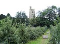 Egerton Church - geograph.org.uk - 43976.jpg 640 × 475; 113 KB
-
 Egerton Church tower, seen from The Street - geograph.org.uk - 2597547.jpg 4,000 × 3,000; 4.13 MB
-
 Egerton Free Church - geograph.org.uk - 1207099.jpg 640 × 480; 99 KB
-
 Egerton House Road - geograph.org.uk - 4044700.jpg 4,000 × 3,000; 4.05 MB
-
 Egerton House Road - geograph.org.uk - 4044702.jpg 4,000 × 3,000; 4.31 MB
-

-
 Egerton K6 Phone Box - geograph.org.uk - 2252844.jpg 640 × 480; 90 KB
-
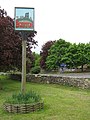 Egerton Village Sign - geograph.org.uk - 1291125.jpg 480 × 640; 86 KB
-
 Egerton Village Sign - geograph.org.uk - 5915677.jpg 768 × 1,024; 307 KB
-
 Egerton village sign and pub - geograph.org.uk - 2599301.jpg 3,000 × 4,000; 4 MB
-
 Egerton Village Stores and Post Office - geograph.org.uk - 3949873.jpg 3,887 × 2,581; 6.6 MB
-
 Egerton War Memorial - geograph.org.uk - 2599223.jpg 4,000 × 3,000; 4.06 MB
-
 Electrical station - geograph.org.uk - 3930810.jpg 640 × 430; 107 KB
-
 Entering Egerton Forstal - geograph.org.uk - 3930807.jpg 640 × 430; 128 KB
-
 Farmland by Bedlam Lane - geograph.org.uk - 3930720.jpg 640 × 430; 60 KB
-
 Farmland by Coach Rd - geograph.org.uk - 3329472.jpg 640 × 426; 64 KB
-
 Farmland by Forstal Rd - geograph.org.uk - 3930783.jpg 640 × 430; 55 KB
-
 Farmland by Mundy Bois Rd - geograph.org.uk - 3943959.jpg 640 × 430; 73 KB
-
 Farmland by Mundy Bois Rd - geograph.org.uk - 3943964.jpg 640 × 430; 60 KB
-
 Farmland by Mundy Bois Rd - geograph.org.uk - 3943983.jpg 640 × 401; 102 KB
-
 Farmland by Mundy Bois Rd - geograph.org.uk - 3943988.jpg 640 × 430; 128 KB
-
 Farmland by the Stour Valley Walk - geograph.org.uk - 3323587.jpg 640 × 426; 41 KB
-
 Farmland near Burnt Mill - geograph.org.uk - 3323608.jpg 640 × 426; 60 KB
-
 Farmland, Mundy Bois - geograph.org.uk - 3947639.jpg 640 × 430; 91 KB
-
 Field edge off New Road, Pluckley - geograph.org.uk - 4945153.jpg 640 × 480; 328 KB
-
 Field Mill - geograph.org.uk - 1292667.jpg 640 × 480; 81 KB
-
 Field near Egerton Forstal - geograph.org.uk - 3943951.jpg 640 × 430; 87 KB
-
 Field with sheep at Egerton - geograph.org.uk - 4945156.jpg 640 × 480; 322 KB
-
 Flat grassland - geograph.org.uk - 3923201.jpg 640 × 430; 65 KB
-
 Following the Greensand Way - geograph.org.uk - 4150941.jpg 4,000 × 3,000; 4.18 MB
-
 Footpath along the field edge - geograph.org.uk - 3329452.jpg 640 × 426; 68 KB
-
 Footpath by a woodland - geograph.org.uk - 3329455.jpg 640 × 426; 97 KB
-
 Footpath junction in Postenfield Shaw - geograph.org.uk - 1291121.jpg 640 × 480; 149 KB
-
 Footpath off Bedlam Lane - geograph.org.uk - 3930732.jpg 640 × 430; 108 KB
-
 Footpath off Bedlam Lane - geograph.org.uk - 3930747.jpg 640 × 430; 68 KB
-
 Footpath off Coach Rd - geograph.org.uk - 3323416.jpg 640 × 426; 55 KB
-
 Footpath off Crocken Hill Road - geograph.org.uk - 3943945.jpg 640 × 430; 114 KB
-
 Footpath off Munday Bois Rd - geograph.org.uk - 3943963.jpg 574 × 640; 92 KB
-
 Footpath off Munday Bois Rd - geograph.org.uk - 3943967.jpg 640 × 430; 106 KB
-
 Footpath off Munday Bois Rd - geograph.org.uk - 3943978.jpg 640 × 430; 126 KB
-
 Footpath off Munday Bois Rd - geograph.org.uk - 3943989.jpg 640 × 430; 105 KB
-
 Footpath signpost, Coach Rd - geograph.org.uk - 3329475.jpg 640 × 426; 138 KB
-
 Footpath to Burnt Mill - geograph.org.uk - 3323597.jpg 640 × 426; 59 KB
-
 Footpath to Coach Rd - geograph.org.uk - 3329460.jpg 640 × 426; 48 KB
-
 Forstal Rd - geograph.org.uk - 3930787.jpg 640 × 430; 87 KB
-
 Forstal Rd - geograph.org.uk - 3943933.jpg 640 × 430; 99 KB
-
 Forstal Rd - geograph.org.uk - 3943935.jpg 640 × 430; 78 KB
-
 Forstal Villas - geograph.org.uk - 3930819.jpg 640 × 430; 124 KB
-
 Frid Farm - geograph.org.uk - 1207104.jpg 640 × 480; 52 KB
-
 Gate by Bedlam Lane - geograph.org.uk - 3930766.jpg 640 × 430; 64 KB
-
 Gate by Forstal Rd - geograph.org.uk - 3930793.jpg 640 × 430; 91 KB
-
 Glebe Cottage (geograph 6766688).jpg 1,024 × 684; 201 KB
-
 Grassland - geograph.org.uk - 3923205.jpg 640 × 430; 67 KB
-
 Grazing land by Mundy Bois Rd - geograph.org.uk - 3943961.jpg 640 × 430; 62 KB
-
 Great Stour - geograph.org.uk - 3323411.jpg 640 × 426; 108 KB
-
 Great Stour - geograph.org.uk - 3323412.jpg 640 × 426; 96 KB
-
 Greenhill Farm - geograph.org.uk - 4150946.jpg 4,000 × 3,000; 4.37 MB
-
 Greenhill Lane - geograph.org.uk - 3947636.jpg 640 × 430; 104 KB
-
 Greenhill Lane - geograph.org.uk - 3947638.jpg 640 × 430; 98 KB
-
 Greenhill Lane, Mundy Bois - geograph.org.uk - 6023427.jpg 1,024 × 684; 340 KB
-
 Greensand Way near Egerton - geograph.org.uk - 2599276.jpg 4,000 × 3,000; 4.15 MB
-
 Hazeldene Farmhouse (geograph 6759486).jpg 1,024 × 685; 218 KB
-
 Heading East - geograph.org.uk - 1141332.jpg 640 × 426; 83 KB
-
 Hedge of trees - geograph.org.uk - 3323420.jpg 640 × 426; 111 KB
-
 House at Field Farm - geograph.org.uk - 3329450.jpg 640 × 426; 71 KB
-
 House, Mundy Bois Rd - geograph.org.uk - 3943969.jpg 640 × 534; 87 KB
-
 House, Mundy Bois Rd - geograph.org.uk - 3943974.jpg 640 × 430; 138 KB
-
 House, Mundy Bois Rd - geograph.org.uk - 3943981.jpg 640 × 430; 117 KB
-
 Houses on Forstal Road - geograph.org.uk - 1614337.jpg 640 × 480; 75 KB
-

-
 Houses, Mundy Bois Rd - geograph.org.uk - 3943971.jpg 640 × 430; 101 KB
-
 Iden Farm Cottage and Iden Lane - geograph.org.uk - 4150903.jpg 4,000 × 3,000; 4.07 MB
-
 Iden Farm Cottages - geograph.org.uk - 4945160.jpg 640 × 480; 258 KB
-

-
 Isolated tree in farmland - geograph.org.uk - 3943965.jpg 640 × 430; 84 KB
-

-
 Kingsden Farm - geograph.org.uk - 3930675.jpg 640 × 430; 59 KB
-
 Kingsden Farmhouse - geograph.org.uk - 3930679.jpg 640 × 430; 59 KB
-
 Kingsland Lane - geograph.org.uk - 3943985.jpg 640 × 430; 131 KB
-
 Knocking Hitler out of bed - geograph.org.uk - 718719.jpg 640 × 569; 87 KB
-
 Large house on Bedlam Lane - geograph.org.uk - 3930736.jpg 640 × 430; 84 KB
-
 Line of trees, Mundy Bois - geograph.org.uk - 3947641.jpg 640 × 430; 94 KB
-
 Little Wanden - geograph.org.uk - 1207160.jpg 640 × 480; 98 KB
-
 Looking across the valley of the Great Stour - geograph.org.uk - 4150905.jpg 4,000 × 3,000; 4.12 MB
-
 Looking towards Egerton - geograph.org.uk - 3943966.jpg 640 × 430; 59 KB
-
 Looking towards Simmond's Wood - geograph.org.uk - 4044688.jpg 4,000 × 3,000; 4.24 MB
-
 Mad Boote - geograph.org.uk - 3930729.jpg 640 × 430; 102 KB
-
 Memorial to Farmer - geograph.org.uk - 1291189.jpg 640 × 480; 150 KB
-
 Mill House (geograph 6766678).jpg 1,024 × 684; 151 KB
-
 Minor road junction - geograph.org.uk - 1141589.jpg 640 × 480; 74 KB
-
 Mother and child behind the gate - geograph.org.uk - 3930802.jpg 640 × 430; 121 KB
-
 Mount Pleasant Farmhouse - geograph.org.uk - 1207096.jpg 640 × 480; 120 KB
-
 Muck heap - geograph.org.uk - 2956214.jpg 640 × 480; 98 KB
-
 Munday Bois House (geograph 6641240).jpg 1,024 × 684; 234 KB
-
 Mundy Bois Rd - geograph.org.uk - 3943975.jpg 640 × 430; 112 KB
-
 Mundy Bois Rd - geograph.org.uk - 3943987.jpg 640 × 430; 96 KB
-
 Mundy Bois Rd - geograph.org.uk - 3943990.jpg 640 × 430; 99 KB
-
 Mundy Bois Rd - geograph.org.uk - 3943995.jpg 640 × 430; 97 KB
-
 Mundy Bois Road - geograph.org.uk - 6023416.jpg 1,024 × 684; 327 KB
-
 Myrtle Cottages - geograph.org.uk - 3930759.jpg 640 × 430; 85 KB
-
 Newland Green Lane - geograph.org.uk - 3943968.jpg 640 × 430; 85 KB
-
 Old wall alongside the Greensand Way - geograph.org.uk - 4150936.jpg 4,000 × 3,000; 4.08 MB
-
 Orchard near Egerton - geograph.org.uk - 2599283.jpg 4,000 × 3,000; 4.05 MB
-
 Orchards near Egerton - geograph.org.uk - 4150917.jpg 4,000 × 3,000; 4.46 MB
-
 Ornamental Pond and duck bridge - geograph.org.uk - 1292620.jpg 640 × 480; 131 KB
-
 Path through a cornfield - geograph.org.uk - 4085519.jpg 4,000 × 3,000; 4.3 MB
-
 Pond by Bedlam Lane - geograph.org.uk - 3930745.jpg 640 × 430; 111 KB
-
 Pond by Bedlam Lane - geograph.org.uk - 3930762.jpg 640 × 415; 78 KB
-
 Potter's Forstal farmhouse - geograph.org.uk - 1207094.jpg 640 × 480; 91 KB
-
 Public Notices at Egerton - geograph.org.uk - 3949841.jpg 3,433 × 2,149; 1.72 MB
-
 Queen's Arms - geograph.org.uk - 3930836.jpg 640 × 430; 76 KB
-
 Ragged House Farmhouse and Oast (geograph 6641226).jpg 1,024 × 684; 281 KB
-
 Remembering Victory in Europe - geograph.org.uk - 3949905.jpg 3,116 × 2,068; 5.13 MB
-
 Road sign, Rock Hill Rd - geograph.org.uk - 3943958.jpg 640 × 430; 80 KB
-
 Road to Barnfield - geograph.org.uk - 3323401.jpg 640 × 426; 106 KB
-
 Road to Stonebridge Green - geograph.org.uk - 3323403.jpg 640 × 426; 103 KB
-
 Rock Hill House, Rock Hill Road - geograph.org.uk - 4082904.jpg 1,064 × 807; 199 KB
-
 Rock Hill House, Rock Hill Road - geograph.org.uk - 4535596.jpg 3,264 × 2,448; 2.65 MB
-
 Rock Hill Rd - geograph.org.uk - 3943956.jpg 640 × 430; 66 KB
-
 Rock Hill Rd - geograph.org.uk - 3943957.jpg 640 × 430; 74 KB
-
 Rock Hill Road, Egerton - geograph.org.uk - 6023410.jpg 1,024 × 684; 227 KB
-
 Rusting farm machinery - geograph.org.uk - 3930655.jpg 640 × 430; 81 KB
-
 Shack under an oak - geograph.org.uk - 395316.jpg 640 × 428; 461 KB
-
 Sheep grazing, Mundy Bois - geograph.org.uk - 3943993.jpg 640 × 430; 80 KB
-
 Sheep grazing, Mundy Bois - geograph.org.uk - 3943994.jpg 640 × 430; 69 KB
-
 Signpost, Mundy Bois - geograph.org.uk - 3947635.jpg 640 × 430; 101 KB
-

-
 St James Church Egerton - geograph.org.uk - 3949685.jpg 2,080 × 3,088; 1.32 MB
-
 St. James Church, Egerton - geograph.org.uk - 3949695.jpg 2,113 × 3,129; 1.92 MB
-
 Star & Garter Cottage (geograph 6759496).jpg 1,024 × 684; 198 KB
-
 Stile on footpath junction - geograph.org.uk - 1207141.jpg 640 × 480; 121 KB
-
 Stone built house - geograph.org.uk - 3943954.jpg 640 × 430; 81 KB
-
 Stone Hill Farm Ponds - geograph.org.uk - 1291129.jpg 640 × 480; 108 KB
-
 Stonebridge Green - geograph.org.uk - 229982.jpg 640 × 480; 144 KB
-
 Stonebridge Green - geograph.org.uk - 6023329.jpg 1,024 × 684; 282 KB
-
 Stour Cottage - geograph.org.uk - 3323594.jpg 640 × 426; 57 KB
-
 Stour Valley Walk - geograph.org.uk - 3323419.jpg 640 × 426; 80 KB
-
 Stour Valley Walk - geograph.org.uk - 3323590.jpg 640 × 426; 103 KB
-
 Telephone exchange, Egerton Forstal - geograph.org.uk - 3943937.jpg 640 × 443; 86 KB
-
 The Cliffe from the Greensand Way - geograph.org.uk - 4151281.jpg 4,000 × 3,000; 4.16 MB
-
 The Crossroads at Stonebridge Green - Kent - geograph.org.uk - 3967400.jpg 1,575 × 1,050; 1.89 MB
-
 The end of Bedlam Lane - geograph.org.uk - 3930776.jpg 640 × 430; 100 KB
-
 The George Inn sign - geograph.org.uk - 2254956.jpg 480 × 640; 69 KB
-
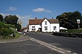
 The George Inn, Egerton - geograph.org.uk - 2254951.jpg 640 × 480; 73 KB
-
-
 The George, Egerton - geograph.org.uk - 4945151.jpg 640 × 480; 300 KB
-
 The Greensand Ridge, west to Egerton - geograph.org.uk - 2210324.jpg 1,109 × 757; 362 KB
-
 The Greensand Way from Greenhill Lane - geograph.org.uk - 4151274.jpg 4,000 × 3,000; 4.37 MB
-
 The Greensand Way passes through Egerton Churchyard - geograph.org.uk - 2599292.jpg 4,000 × 3,000; 4.35 MB
-
 The Queen's Arms - geograph.org.uk - 2956239.jpg 640 × 480; 83 KB
-
 The Queen's Arms - geograph.org.uk - 3930827.jpg 640 × 430; 88 KB
-

-
 The Queen's Arms sign - geograph.org.uk - 2249036.jpg 480 × 640; 108 KB
-
 The Queen's Arms, Potter's Forstal - geograph.org.uk - 2249035.jpg 640 × 480; 72 KB
-
 The Stour Valley - geograph.org.uk - 3329453.jpg 640 × 356; 36 KB
-
 The Street, Egerton - geograph.org.uk - 2595975.jpg 4,000 × 3,000; 3.94 MB
-
 The village band at Egerton, Kent - geograph.org.uk - 718696.jpg 640 × 568; 107 KB
-
 Three stiles, one footbridge - geograph.org.uk - 1207143.jpg 480 × 640; 125 KB


_-_geograph.org.uk_-_3323407.jpg)
_-_geograph.org.uk_-_3323415.jpg)


.jpg)


.jpg)


.jpg)


.jpg)


.jpg)


.jpg)


