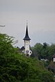
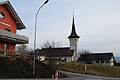
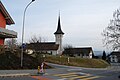
Category:Eglise de Villars-sur-Glâne
| Object location | | View all coordinates using: OpenStreetMap |
|---|
church building in Villars-sur-Glâne in the canton of Fribourg, Switzerland _06.jpg) _08.jpg) | |||||
| Upload media | |||||
| Instance of | |||||
|---|---|---|---|---|---|
| Part of | |||||
| Location |
| ||||
| Street address |
| ||||
| Heritage designation | |||||
 | |||||
Media in category "Eglise de Villars-sur-Glâne"
The following 22 files are in this category, out of 22 total.
-
 2014-03-11-Friburgo (Foto Dietrich Michael Weidmann) 205.JPG 3,872 × 2,592; 3.38 MB
-
 Eglise Saint-Pierre-et-Paul (Villars-sur-Glâne) 01.jpg 2,592 × 3,872; 2.56 MB
-
 Eglise Saint-Pierre-et-Paul (Villars-sur-Glâne) 02.jpg 3,872 × 2,592; 2.98 MB
-
 Eglise Saint-Pierre-et-Paul (Villars-sur-Glâne) 03.jpg 3,872 × 2,592; 3.14 MB
-
 Eglise Saint-Pierre-et-Paul (Villars-sur-Glâne) 04.jpg 2,592 × 3,872; 2.86 MB
-
 Eglise Saint-Pierre-et-Paul (Villars-sur-Glâne) 05.jpg 2,592 × 3,872; 2.56 MB
-
 Eglise Saint-Pierre-et-Paul (Villars-sur-Glâne) 06.jpg 2,592 × 3,872; 3.29 MB
-
 Eglise Saint-Pierre-et-Paul (Villars-sur-Glâne) 07.jpg 2,592 × 3,872; 4.08 MB
-
 Eglise Saint-Pierre-et-Paul (Villars-sur-Glâne) 08.jpg 3,872 × 2,592; 4.34 MB
-
 Eglise Saint-Pierre-et-Paul (Villars-sur-Glâne) 09.jpg 2,592 × 3,872; 4.11 MB
-
 Eglise Saint-Pierre-et-Paul (Villars-sur-Glâne) 10.jpg 2,592 × 3,872; 3.68 MB
-
 Eglise Saint-Pierre-et-Paul (Villars-sur-Glâne) 11.jpg 3,872 × 2,592; 3.56 MB
-
 Eglise Saint-Pierre-et-Paul (Villars-sur-Glâne) 12.jpg 2,592 × 3,872; 3.17 MB
-
 Eglise Saint-Pierre-et-Paul (Villars-sur-Glâne) 13.jpg 3,872 × 2,592; 3.21 MB
-
 Eglise Saint-Pierre-et-Paul (Villars-sur-Glâne) 14.jpg 2,592 × 3,872; 3.58 MB
-
 Eglise Saint-Pierre-et-Paul (Villars-sur-Glâne) 15.jpg 3,872 × 2,592; 3.77 MB
-
 Eglise Saint-Pierre-et-Paul (Villars-sur-Glâne) 16.jpg 3,872 × 2,592; 4.38 MB
-
 Eglise Saint-Pierre-et-Paul (Villars-sur-Glâne) 17.jpg 3,872 × 2,592; 3.64 MB
-
 Eglise Saint-Pierre-et-Paul (Villars-sur-Glâne) 18.jpg 3,872 × 2,592; 3.35 MB
-
 Eglise Saint-Pierre-et-Paul (Villars-sur-Glâne) 19.jpg 3,872 × 2,592; 3.24 MB
-
 Eglise Saint-Pierre-et-Paul (Villars-sur-Glâne) 20.jpg 2,592 × 3,872; 3.95 MB
-
 Église de Villars-sur-Glâne.jpg 2,448 × 2,448; 1.29 MB
_205.JPG)
_01.jpg)
_02.jpg)
_03.jpg)
_04.jpg)
_05.jpg)
_07.jpg)
_09.jpg)
_10.jpg)
_11.jpg)
_12.jpg)
_13.jpg)
_14.jpg)
_15.jpg)
_16.jpg)
_17.jpg)
_18.jpg)
_19.jpg)
_20.jpg)
