Category:Ehemaliges Amthaus Meienberg
| Object location | | View all coordinates using: OpenStreetMap |
|---|
building in the canton of Aargau, Switzerland  | |||||
| Upload media | |||||
| Instance of | |||||
|---|---|---|---|---|---|
| Part of | |||||
| Location | Meienberg, Sins, Muri District, Aargau, Switzerland | ||||
| Street address |
| ||||
| Heritage designation | |||||
 | |||||
Media in category "Ehemaliges Amthaus Meienberg"
The following 18 files are in this category, out of 18 total.
-
 Freiamt 012.jpg 1,024 × 250; 144 KB
-
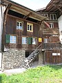
 Meienberg Amtshaus backside 01.jpg 3,807 × 2,592; 5.27 MB
-
 Meienberg Amtshaus backside 02.jpg 3,888 × 2,592; 7.44 MB
-
 Meienberg Amtshaus backside 03.jpg 3,888 × 2,592; 5.33 MB
-
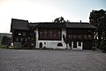
 Meienberg Amtshaus.JPG 2,816 × 2,112; 2.7 MB
-
 Meienberg Sins 01.jpg 1,024 × 683; 424 KB
-
 Meienberg Sins 02.jpg 1,004 × 667; 378 KB
-
 Meienberg Sins 03.jpg 1,024 × 683; 381 KB
-
 Meienberg Sins 04.jpg 3,888 × 2,592; 4.99 MB
-
 Meienberg Stadtmauer 02.JPG 2,816 × 2,112; 3.32 MB
-
 Meienberg Stadtmauer 03.JPG 2,816 × 2,112; 3.21 MB
-
 Meienberg Stadtmauer 04.JPG 2,816 × 2,112; 3 MB
-
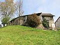 Meienberg Stadtmauer 05.JPG 2,816 × 2,112; 2.93 MB
-
 Meienberg Stadtmauer.JPG 2,816 × 2,112; 2.98 MB
-
 Meienberg Stadtplatz 4 6.JPG 2,816 × 2,112; 2.03 MB
-
 Meienberg Stadtplatz 4.JPG 2,816 × 2,112; 1.88 MB
-
 Meienberg Stadtplatz 6.JPG 2,112 × 2,816; 2.55 MB
-
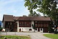
 Sins Ehemaliges Amthaus Meienberg.jpg 4,288 × 2,848; 4.62 MB


