Category:Ehemaliges Doppelbauernhaus (Oberdorf 27, Wileroltigen)
| Object location | | View all coordinates using: OpenStreetMap |
|---|
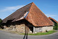
rural house in Wileroltigen in the canton of Bern, Switzerland _252.JPG) | |||||
| Upload media | |||||
| Instance of | |||||
|---|---|---|---|---|---|
| Part of | |||||
| Location | Wileroltigen, Bern-Mittelland administrative district, Bernese Mittelland administrative region, Bern, Switzerland | ||||
| Street address |
| ||||
| Heritage designation |
| ||||
| Inception |
| ||||
 | |||||
Media in category "Ehemaliges Doppelbauernhaus (Oberdorf 27, Wileroltigen)"
This category contains only the following file.
-
 2012-07-18-Regiono Arbergo (Foto Dietrich Michael Weidmann) 252.JPG 3,872 × 2,592; 4.49 MB