Category:Ehemaliges Gesundheitsamt, Blumenhof 6–6a, Pforzheim
| Object location | | View all coordinates using: OpenStreetMap |
|---|
Media in category "Ehemaliges Gesundheitsamt, Blumenhof 6–6a, Pforzheim"
The following 5 files are in this category, out of 5 total.
-
 Pforzheim - Blumenhof - Barfüßerkirche - panoramio - Augenstein.jpg 1,200 × 798; 294 KB
-
 Pforzheim - Blumenhof - panoramio.jpg 1,024 × 681; 178 KB
-
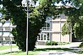
 Pforzheim 2016 076.jpg 3,456 × 2,304; 4.96 MB
-
 Pforzheim 2016 077.jpg 3,456 × 2,304; 5.22 MB
-
 Pforzheim 2016 078.jpg 3,456 × 2,304; 5.05 MB


