Category:Ehemaliges Pfarrhaus / Lindenschulhaus (Absyte 7, Grenchen)
| Object location | | View all coordinates using: OpenStreetMap |
|---|
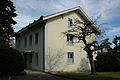
school building in Grenchen in the canton of Solothurn, Switzerland  | |||||
| Upload media | |||||
| Instance of | |||||
|---|---|---|---|---|---|
| Part of | |||||
| Location | Grenchen, Lebern District, Solothurn-Lebern, Solothurn, Switzerland | ||||
| Street address |
| ||||
| Heritage designation | |||||
 | |||||
Media in category "Ehemaliges Pfarrhaus / Lindenschulhaus (Absyte 7, Grenchen)"
This category contains only the following file.
-
 Absyte 7 Grenchen.JPG 3,008 × 2,000; 2.32 MB