Category:Ehrenthal
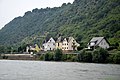
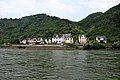
English: St.Goarshausen-Ehrenthal, Rhineland-Palatinate, Germany
Deutsch: St.Goarshausen-Ehrenthal, Rheinland-Pfalz
| Object location | | View all coordinates using: OpenStreetMap |
|---|
human settlement in Germany  | |||||
| Upload media | |||||
| Instance of |
| ||||
|---|---|---|---|---|---|
| Location | Sankt Goarshausen, Verbandsgemeinde Loreley, Rhein-Lahn-Kreis, Rhineland-Palatinate, Germany | ||||
| Elevation above sea level |
| ||||
 | |||||
Subcategories
This category has only the following subcategory.
S
Media in category "Ehrenthal"
The following 18 files are in this category, out of 18 total.
-
 16a Oberes Mittelrheintal IMG 20180608 154122 (32536482378).jpg 1,612 × 908; 731 KB
-
 17 Zur Klosterschenke, Ehrenthal 34DSC 0548 (32536482258).jpg 1,612 × 1,075; 834 KB
-
 17 Zur Klosterschenke, Ehrenthal 34DSC 0549 (45685203694).jpg 1,612 × 1,075; 835 KB
-
 17 Zur Klosterschenke, Ehrenthal 34DSC 0550 (45685203454).jpg 1,612 × 1,075; 872 KB
-
 17 Zur Klosterschenke, Ehrenthal 34DSC 0551 (45685203194).jpg 1,612 × 873; 617 KB
-
 17 Zur Klosterschenke, Ehrenthal 34DSC 0552 (45685203014).jpg 1,612 × 1,075; 882 KB
-
 17 Zur Klosterschenke, Ehrenthal 34DSC 0553 (45685202804).jpg 1,612 × 1,075; 969 KB
-
 18 Ehrenthal 34DSC 0546 (45685202574).jpg 1,612 × 1,075; 842 KB
-
 18 Ehrenthal 34DSC 0547 (45685202404).jpg 1,612 × 1,075; 539 KB
-
 18 Ehrenthal 34DSC 0554 (45685202224).jpg 1,612 × 886; 700 KB
-
 18 Ehrenthal 34DSC 0555 (45685202004).jpg 1,612 × 911; 430 KB
-
 18 Ehrenthal 34DSC 0556 (45685201784).jpg 1,612 × 1,075; 520 KB
-
 Ehrenthal Sankt Goarshausen Grube Gute Hoffnung Hunt.jpg 11,282 × 8,496; 6.04 MB
-
 Ehrenthaler Hahn.JPG 3,888 × 2,592; 7.92 MB
-
 Gefallenenehrenmal Friedhof Wellmich Sankt Goarshausen.jpg 5,853 × 4,393; 2 MB
-
 Sankt Goarshausen, Ortsteil Wellmich-Ehrenthal - Gasthof Klosterschenke - panoramio.jpg 4,000 × 3,000; 5.44 MB
-
 St Goarshausen Ehrenthal Grube Gute Hoffnung.JPG 3,888 × 2,592; 2.07 MB
-
 StGoarshausenEhrenthalAbraumhalde.JPG 3,121 × 2,153; 1.39 MB
.jpg)
.jpg)
.jpg)
.jpg)
.jpg)
.jpg)
.jpg)
.jpg)
.jpg)
.jpg)
.jpg)
.jpg)


