Category:Election maps of Fiji
Countries of Oceania: Australia · Fiji · Nauru · New Zealand · Papua New Guinea · Samoa · Solomon Islands · Tuvalu · Vanuatu
Other areas: American Samoa · Cook Islands · French Polynesia · Guam · Hawaii · New Caledonia · Northern Mariana Islands · Wallis and Futuna – Partly: British overseas territories · Indonesia
Other areas: American Samoa · Cook Islands · French Polynesia · Guam · Hawaii · New Caledonia · Northern Mariana Islands · Wallis and Futuna – Partly: British overseas territories · Indonesia
Media in category "Election maps of Fiji"
The following 4 files are in this category, out of 4 total.
-
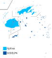 2014 Fijian general election by Division.svg 485 × 540; 195 KB
-
 2014 Fijian general election results.svg 640 × 625; 329 KB
-
 2018 Fijian general election by Division.svg 485 × 540; 195 KB
-
 2018 Fijian general election results.svg 640 × 625; 330 KB


