Category:Election maps of Ontario
Provinces and territories of Canada: Alberta · British Columbia · Manitoba · New Brunswick · Newfoundland and Labrador · Nova Scotia · Ontario · Prince Edward Island · Quebec · Saskatchewan · Northwest Territories · Nunavut · Yukon
Subcategories
This category has the following 9 subcategories, out of 9 total.
B
- Election maps of Brantford (1 F)
H
L
M
- Election maps of Mississauga (1 F)
O
- Election maps of Ottawa (11 F)
T
W
Media in category "Election maps of Ontario"
The following 19 files are in this category, out of 19 total.
-
 2020OLPLeadership.svg 2,445 × 1,040; 5.66 MB
-
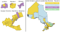 2023-OLP-Leadership-Round1.svg 1,827 × 961; 11.25 MB
-
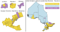 2023-OLP-Leadership-Round2.svg 1,827 × 961; 11.24 MB
-
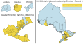 2023-OLP-Leadership-Round3.svg 1,827 × 961; 11.24 MB
-
 Hamilton Burlington Niagara (44th Parl).png 257 × 175; 8 KB
-
 No04.PNG 539 × 538; 16 KB
-
 Nocpc.PNG 539 × 538; 16 KB
-
 Nogpc.PNG 539 × 538; 16 KB
-
 Nolpc.PNG 539 × 538; 17 KB
-
 Nondp.PNG 539 × 538; 17 KB
-
 Northern Ontario (41st Parl).png 539 × 538; 11 KB
-
 Ontario elections 2007.png 1,500 × 1,078; 268 KB
-
 Ontario 2018.png 6,881 × 4,381; 1.73 MB
-
 Ontario PC Party Leadership Election 2018 - Results by Riding.svg 2,016 × 2,382; 1.34 MB
-
 Ontario Progressive Conservative Party Leadership Election 2015 - Results by Riding.svg 2,310 × 2,263; 514 KB
-
 Ontario Referendum on electoral reform.GIF 1,327 × 623; 17 KB
-
 Ontario2003transposition.PNG 794 × 723; 36 KB
-
 Ontariopc09.PNG 896 × 1,485; 66 KB
-
 Ontelectresult07.gif 1,327 × 623; 19 KB


.png)


.png)


