Category:Election maps of West Sussex
This category contains election maps for the ceremonial county of West Sussex.
Subcategories
This category has only the following subcategory.
D
Media in category "Election maps of West Sussex"
The following 95 files are in this category, out of 95 total.
-
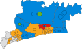
 2019 Horsham District Council election results.svg 1,849 × 1,549; 815 KB
-
 Adur (42140582295).png 2,330 × 1,334; 163 KB
-
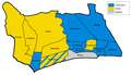
 Adur 2006 election map.png 800 × 466; 48 KB
-
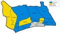
 Adur 2008 election map.png 800 × 466; 48 KB
-
 Adur UK local election 1979 map.png 1,217 × 699; 125 KB
-
 Adur UK local election 1980 map.png 1,217 × 699; 125 KB
-
 Adur UK local election 1982 map.png 1,217 × 699; 126 KB
-
 Adur UK local election 1983 map.png 1,217 × 699; 123 KB
-
 Adur UK local election 1984 map.png 1,217 × 699; 124 KB
-
 Adur UK local election 1986 map.png 1,217 × 699; 127 KB
-
 Adur UK local election 1987 map.png 1,217 × 699; 126 KB
-
 Adur UK local election 1988 map.png 1,217 × 699; 129 KB
-
 Adur UK local election 1990 map.png 1,217 × 699; 130 KB
-
 Adur UK local election 2004 map.svg 1,425 × 1,170; 191 KB
-
 Adur UK local election 2010 map.svg 1,425 × 1,170; 190 KB
-
 Adur UK local election 2012 map.svg 1,425 × 1,170; 192 KB
-
 Adur UK local election 2014 map.svg 1,425 × 1,170; 192 KB
-
 Adur UK local election 2016 map.svg 1,425 × 1,170; 190 KB
-
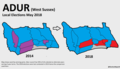
 Adur UK local election 2018 map.svg 1,425 × 1,170; 190 KB
-
 Adur UK local election 2021 map.svg 1,425 × 1,170; 192 KB
-
 Adur UK ward map 2022.svg 1,425 × 1,170; 191 KB
-
 Adur UK ward map 2024.svg 1,425 × 1,170; 191 KB
-
 ARUN (49910224573).png 2,160 × 1,080; 424 KB
-
 Arun District Council election 2011 map.svg 1,425 × 925; 384 KB
-
 Arun UK local election 2003 map.svg 1,425 × 925; 384 KB
-
 Arun UK local election 2007 map.svg 1,425 × 925; 384 KB
-
 Arun UK ward map 2010 (blank).svg 1,425 × 925; 383 KB
-
 Arun UK ward map 2015 (blank).svg 1,425 × 925; 451 KB
-
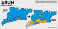
 Arun UK ward map 2015.svg 635 × 380; 199 KB
-
 Arun UK ward map 2019.svg 635 × 380; 199 KB
-
 Arun UK ward map 2023.svg 635 × 380; 199 KB
-
 CHICHESTER (49910742486).png 2,160 × 1,080; 452 KB
-
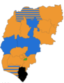
 ChichesterDistrictelection2007.png 821 × 1,024; 127 KB
-
 ChichesterDistrictelection2019.png 4,910 × 6,411; 3.95 MB
-
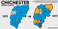
 ChichesterDistrictelection2023.png 4,910 × 6,411; 1.34 MB
-
 CRAWLEY (29372292848).png 1,200 × 1,000; 175 KB
-
 CRAWLEY (49911038477).png 2,160 × 1,080; 350 KB
-
 Crawley UK local election 2004 map.svg 1,188 × 1,266; 434 KB
-
 Crawley UK local election 2006 map.svg 1,188 × 1,266; 433 KB
-
 Crawley UK local election 2007 map.svg 1,188 × 1,266; 433 KB
-
 Crawley UK local election 2008 map.svg 1,188 × 1,266; 434 KB
-
 Crawley UK local election 2010 map.svg 1,188 × 1,266; 433 KB
-
 Crawley UK local election 2011 map.svg 1,188 × 1,266; 433 KB
-
 Crawley UK local election 2012 map.svg 1,188 × 1,266; 434 KB
-
 Crawley UK local election 2014 map.svg 1,188 × 1,266; 433 KB
-
 Crawley UK local election 2015 map.svg 1,188 × 1,266; 433 KB
-
 Crawley UK local election 2016 map.svg 1,188 × 1,266; 434 KB
-
 Crawley UK local election 2019 map.svg 1,188 × 1,266; 441 KB
-
 Crawley UK local election 2021 map.svg 1,188 × 1,266; 442 KB
-
 Crawley UK ward map 2022.svg 1,188 × 1,266; 441 KB
-
 Crawley UK ward map 2023.svg 1,188 × 1,266; 442 KB
-
 Crawley wards 2016.svg 1,188 × 1,266; 431 KB
-
 HORSHAM (49910741056).png 2,160 × 1,080; 481 KB
-
 Horsham UK ward map 2010 (blank).svg 1,187 × 1,226; 650 KB
-
 Horsham UK ward map 2023.svg 444 × 548; 475 KB
-
 MID SUSSEX (49910740401).png 2,160 × 1,080; 385 KB
-
 Mid Sussex UK ward map 2003.svg 817 × 1,227; 552 KB
-
 Mid Sussex UK ward map 2007.svg 817 × 1,227; 552 KB
-
 Mid Sussex UK ward map 2010 (blank).svg 817 × 1,227; 544 KB
-
 Mid Sussex UK ward map 2011.svg 817 × 1,227; 552 KB
-
 Mid Sussex UK ward map 2015.svg 817 × 1,227; 552 KB
-
 Mid Sussex UK ward map 2019.svg 817 × 1,227; 552 KB
-
 Mid Sussex UK ward map 2023.svg 476 × 722; 496 KB
-
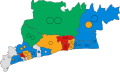
 West Sussex County Council election results 2013.svg 1,425 × 995; 1.38 MB
-
 West Sussex County Council election results 2017.svg 1,425 × 995; 1.4 MB
-
 West Sussex UK local election 2021 map.png 2,560 × 1,788; 709 KB
-
 West Sussex UK local election 2021 map.svg 1,425 × 995; 1.4 MB
-
 West Sussex wards 2009.svg 1,425 × 995; 1.37 MB
-
 WestSussexParliamentaryConstituency1885Results.svg 886 × 763; 21 KB
-
 WestSussexParliamentaryConstituency1918Results.svg 888 × 759; 18 KB
-
 WestSussexParliamentaryConstituency1923Results.svg 888 × 759; 18 KB
-
 WestSussexParliamentaryConstituency1945Results.svg 888 × 759; 21 KB
-
 WestSussexParliamentaryConstituency1950Results.svg 893 × 763; 24 KB
-
 WestSussexParliamentaryConstituency1974Results.svg 931 × 773; 31 KB
-
 WestSussexParliamentaryConstituency1983Results.svg 2,265 × 1,602; 45 KB
-
 WestSussexParliamentaryConstituency2005Results2.png 212 × 157; 26 KB
-
 WestSussexParliamentaryConstituency2005Results3.png 212 × 157; 27 KB
-
 WestSussexParliamentaryConstituency2010Results2.png 212 × 156; 26 KB
-
 WORTHING (43193614532).png 1,200 × 1,000; 165 KB
-
 WORTHING (49910218388).png 2,160 × 1,080; 347 KB
-
 Worthing UK local election 2004 map.svg 1,425 × 1,105; 140 KB
-
 Worthing UK local election 2006 map.svg 1,425 × 1,105; 139 KB
-
 Worthing UK local election 2007 map.svg 1,425 × 1,105; 139 KB
-
 Worthing UK local election 2008 map.svg 1,425 × 1,105; 139 KB
-
 Worthing UK local election 2010 map.svg 1,425 × 1,105; 139 KB
-
 Worthing UK local election 2011 map.png 2,000 × 1,551; 258 KB
-
 Worthing UK local election 2012 map.svg 1,425 × 1,105; 140 KB
-
 Worthing UK local election 2014 map.svg 1,425 × 1,105; 140 KB
-
 Worthing UK local election 2015 map.svg 1,425 × 1,105; 140 KB
-
 Worthing UK local election 2016 map.svg 1,425 × 1,105; 140 KB
-
 Worthing UK local election 2018 map.svg 1,425 × 1,105; 141 KB
-
 Worthing UK local election 2019 map.svg 1,425 × 1,105; 141 KB
-
 Worthing UK local election 2021 map.svg 1,425 × 1,105; 140 KB
-
 Worthing UK ward map 2022.svg 1,425 × 1,105; 140 KB
-
 Worthing UK ward map 2023.svg 1,425 × 1,105; 141 KB

.png)


.png)


.png)


.png)
.png)


.png)

.png)


.png)
.png)


.svg)
.svg)
.svg)
.svg)