Category:Election maps of Wirral
Media in category "Election maps of Wirral"
The following 47 files are in this category, out of 47 total.
-
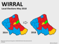
 2014 Wirral Council Election Map.png 1,274 × 1,256; 209 KB
-
 2014 Wirral Council Wards Map.png 664 × 700; 89 KB
-
 2022 Wirral Borough Council Election Map.svg 1,509 × 1,347; 245 KB
-
 2023 Wirral Borough Council Election Map.svg 1,509 × 1,347; 247 KB
-
 Wirral (42140588885).png 1,448 × 1,088; 70 KB
-
 Wirral Council Election Results Map 1973.png 2,294 × 2,099; 18.4 MB
-
 Wirral Council Election Results Map 1975.png 2,294 × 2,099; 243 KB
-
 Wirral Council Election Results Map 1978.png 2,294 × 2,099; 243 KB
-
 Wirral Council Election Results Map 1979.png 2,294 × 2,099; 243 KB
-
 Wirral Council Election Results Map 1980.svg 1,407 × 1,305; 67 KB
-
 Wirral Council Election Results Map 1982.svg 1,407 × 1,305; 67 KB
-
 Wirral Council Election Results Map 1984.svg 1,407 × 1,305; 67 KB
-
 Wirral Council Election Results Map 1986.svg 1,407 × 1,305; 67 KB
-
 Wirral Council Election Results Map 1987.svg 1,407 × 1,305; 67 KB
-
 Wirral Council Election Results Map 1988.svg 1,407 × 1,305; 67 KB
-
 Wirral Council Election Results Map 1990.svg 1,407 × 1,305; 67 KB
-
 Wirral Council Election Results Map 1991.svg 1,407 × 1,305; 67 KB
-
 Wirral Council Election Results Map 1992.svg 1,407 × 1,305; 67 KB
-
 Wirral Council Election Results Map 1994.svg 1,407 × 1,305; 67 KB
-
 Wirral Council Election Results Map 1995.svg 1,407 × 1,305; 67 KB
-
 Wirral Council Election Results Map 1999.svg 1,407 × 1,305; 67 KB
-
 Wirral Council Election Results Map 2000.svg 1,407 × 1,305; 67 KB
-
 Wirral Council Election Results Map 2002.svg 1,407 × 1,305; 67 KB
-
 Wirral Council Election Results Map 2003.svg 1,407 × 1,305; 67 KB
-
 Wirral Council Election Results Map 2004.svg 1,407 × 1,305; 247 KB
-
 Wirral Council Election Results Map 2006 and 2007.svg 1,407 × 1,305; 238 KB
-
 Wirral Council Election Results Map 2008.svg 1,407 × 1,305; 238 KB
-
 Wirral Council Election Results Map 2010.svg 1,407 × 1,305; 250 KB
-
 Wirral Council Election Results Map 2011, 2012 and 2016.svg 1,407 × 1,305; 238 KB
-
 Wirral Council Election Results Map 2011.svg 1,407 × 1,305; 238 KB
-
 Wirral Council Election Results Map 2015.svg 1,407 × 1,305; 238 KB
-
 Wirral Council Election Results Map 2018.svg 1,407 × 1,305; 238 KB
-
 Wirral Council Election Results Map 2019.svg 1,407 × 1,305; 238 KB
-
 Wirral Council Election Results Map 2021.svg 1,407 × 1,305; 238 KB
-
 Wirral Council Election Results Map 2023.svg 1,407 × 1,305; 244 KB
-
 Wirral Local Election Map 2008.png 500 × 432; 93 KB
-
 Wirral Local Election Map 2008.svg 495 × 432; 216 KB
-
 Wirral UK local election 2004 map.svg 1,407 × 1,305; 319 KB
-
 Wirral UK local election 2006 map.svg 1,407 × 1,305; 318 KB
-
 Wirral wards 2004.png 1,407 × 1,305; 232 KB
-
 Wirral wards 2006 and 2007.png 1,407 × 1,305; 232 KB
-
 Wirral wards 2008.png 1,407 × 1,305; 232 KB
-
 Wirral wards 2010.png 1,407 × 1,305; 232 KB
-
 Wirral wards 2011.png 1,407 × 1,305; 232 KB
-
 Wirral wards 2012.png 1,407 × 1,305; 232 KB
-
 Wirral wards 2014.png 1,407 × 1,305; 232 KB
-
 Wirral wards 2015.png 1,407 × 1,305; 232 KB


.png)


