Category:Election maps of the Wellington Region
Regions of New Zealand: Bay of Plenty · Canterbury · Hawke's Bay · Waikato · Wellington ·
Outlying islands, territories and dependencies: – Territory with specific status:
Associated countries: Cook Islands ·
Outlying islands, territories and dependencies: – Territory with specific status:
Associated countries: Cook Islands ·
Subcategories
This category has the following 5 subcategories, out of 5 total.
L
- Election maps of Lower Hutt (1 F)
M
- Election maps of Masterton (1 F)
P
U
W
- Election maps of Wellington (4 F)
Media in category "Election maps of the Wellington Region"
This category contains only the following file.
-
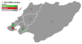 2022 Greater Wellington Regional Council election map.svg 984 × 526; 44 KB
