Category:Electronic nautical charts
geographic information system used for nautical navigation that complies with International Maritime Organization (IMO) regulations as an alternative to paper nautical charts  | |||||
| Upload media | |||||
| Instance of | |||||
|---|---|---|---|---|---|
| Has use | |||||
| |||||
Subcategories
This category has the following 2 subcategories, out of 2 total.
N
O
Media in category "Electronic nautical charts"
The following 23 files are in this category, out of 23 total.
-
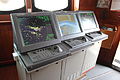 Cap San Diego Brücke Radar ECDIS.jpg 5,184 × 3,456; 5.64 MB
-
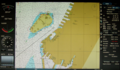
 Cartografia SOHMA.jpg 1,280 × 960; 594 KB
-
 ECDISTA.jpg 1,205 × 1,346; 307 KB
-
 Electronic Chart Display.jpg 1,398 × 827; 606 KB
-
 Electronic chart display.xcf 1,392 × 810; 3.17 MB
-
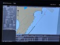
 Electronic nautical chart of Periscal Tresco (01).JPG 4,288 × 2,848; 2.98 MB
-
 Electronic nautical chart of Periscal Tresco (02).JPG 3,811 × 2,681; 2.63 MB
-
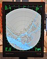
 Electronic nautical chart of Radar Pilot 720º.JPG 2,848 × 3,909; 2.44 MB
-
 Greif (ship, 1946) 2007 by-RaBoe 06.jpg 1,134 × 850; 1.04 MB
-
 Iamsar searchpattern.JPG 2,592 × 1,944; 1.75 MB
-

-
 METS 2009 Periskal Radaroverlay.jpg 2,602 × 3,114; 1.83 MB
-
 NOAA chart 25664 1976 detail.png 906 × 759; 1.19 MB
-
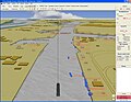
 Periskal Inland ECDIS viewer (01).jpg 2,948 × 2,211; 2.35 MB
-
 Port Gdynia.svg 1,820 × 2,350; 84 KB
-
 Rotterdam Ahoy Europort 2011 (23).JPG 1,652 × 2,430; 1.12 MB
-
 Rotterdam Ahoy Europort 2011 (34).JPG 2,136 × 2,672; 1.32 MB
-
 Sail Amsterdam 2010 Sail-in (078).JPG 4,288 × 2,848; 3 MB
-
 Ship Electronic Map.jpg 4,032 × 3,024; 4.46 MB
-
 Sichem Osprey radar and ECDIS.jpg 1,218 × 908; 61 KB
-
 Tresco 3D AIS.JPG 1,280 × 994; 173 KB
-
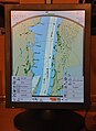
 Tresco Navigis Inland ECDIS kaart (01).jpg 2,054 × 2,738; 1.51 MB
-
 US NOAA nautical chart of Bering Strait.png 597 × 422; 30 KB


.JPG)
.JPG)

_2007_by-RaBoe_06.jpg)

.jpg)


.jpg)

.JPG)
.JPG)
.JPG)


.jpg)
