Category:English-language maps of China
Countries of Asia: Armenia‡ · Bhutan · Cambodia · People's Republic of China · Egypt‡ · India · Indonesia‡ · Iraq · Japan · Jordan · Kazakhstan‡ · Kyrgyzstan · Laos · Lebanon · Malaysia · Mongolia · Myanmar · Nepal · North Korea · Qatar · Russia‡ · South Korea · Sri Lanka · Tajikistan · Thailand · Turkey‡ · Turkmenistan · Uzbekistan · Yemen
‡: partly located in Asia
‡: partly located in Asia
Subcategories
This category has the following 3 subcategories, out of 3 total.
Media in category "English-language maps of China"
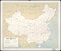
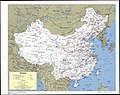
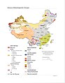
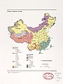
The following 181 files are in this category, out of 181 total.
-

-

-
 1853 Mitchell Map of China - Geographicus - China-mitchell-1850.jpg 3,500 × 2,797; 3.91 MB
-

-

-
 1945 Korea & Manchuria (30249111473).jpg 5,179 × 7,696; 3.43 MB
-
 1957 China Rails (30884891035).jpg 2,612 × 2,186; 3 MB
-
 1963 China Communist Areas (30249402713).jpg 1,415 × 1,215; 1.1 MB
-
 1992 China Coal (30849142886).jpg 2,509 × 3,300; 4.37 MB
-
 A map of China prepared for the China Inland Mission - btv1b530644162.jpg 10,669 × 12,903; 25.05 MB
-
 A Map of China... - btv1b8439046p (1 of 2).jpg 8,002 × 7,159; 10.43 MB
-
 Administrative Divisions of China.png 2,008 × 2,281; 2.92 MB
-
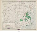
 Agricultural Regions (China) - DPLA - 85f74580327a588619a8956141c64a49.jpg 2,081 × 1,959; 2.4 MB
-
 Agriculture regions - (China). LOC 2007628758.jpg 2,497 × 3,258; 627 KB
-
 Area of the Shantung champaign LOC 2008622145.jpg 3,180 × 4,191; 1.18 MB
-

-
 Battle of Changping.png 831 × 545; 614 KB
-
 China (First Revision) - DPLA - b5fab2ada8a51b0fcd08ad9481eadb68.jpg 11,560 × 8,824; 7.09 MB
-
 China - btv1b84591848.jpg 5,412 × 6,898; 3.1 MB
-
 China - Communist Administrative Areas - 1952 - DPLA - 4587485b915f2e6f15ae3f4864c26e7e.jpg 6,904 × 5,894; 3.56 MB
-
 China - distribution of industry. LOC 2007628760.jpg 2,539 × 3,301; 731 KB
-
 China - DPLA - 02ce3c4c551c5a9887af94022e4d6e04.jpg 4,536 × 5,262; 2.49 MB
-
 China - DPLA - 271b39e2e25ca60e1a7b331b8d5a1454.jpg 12,011 × 8,820; 8.97 MB
-
 China - DPLA - 284485f480c67bc2d5b05fd4765157cf.jpg 6,320 × 4,326; 2.68 MB
-
 China - DPLA - 3c8a43af3bf01eb92392267a0ec28bd7.jpg 11,977 × 8,820; 9.91 MB
-
 China - DPLA - 557c6769ed739822b597564c8ba90576.jpg 2,558 × 3,280; 5.12 MB
-
 China - DPLA - a28bce74f50e4fb036129424ca57123d.jpg 11,978 × 8,833; 7.03 MB
-
 China - DPLA - abc393876e2d6a488fe05f10b5ebf54d.jpg 11,562 × 8,820; 6.43 MB
-
 China - DPLA - d5fd274d7abe6a26e346f0ffbd7564fd.jpg 6,294 × 4,319; 3.08 MB
-
 China - DPLA - e55ed2992228f75704d089d649de37c2.jpg 4,528 × 5,257; 2.61 MB
-
 China - DPLA - e731a4f303544890c351ecfa23b590d2.jpg 12,018 × 8,841; 11.44 MB
-
 China - Hunan Province - DPLA - 7c3c1f53525b58bcbf8547ef78c7bf77.jpg 7,200 × 8,296; 6.57 MB
-
 China - Iron and Steel Industry - DPLA - 4e197045845e90218927f38b5219dc19.jpg 4,278 × 5,563; 2.56 MB
-
 China - Principal Non-Ferrous Metal Deposits - DPLA - 092ec216346709c923676b04c9fa6a31.jpg 6,537 × 5,529; 4.23 MB
-
 China . LOC 2006629420.jpg 6,831 × 5,520; 7.09 MB
-
 China 1940 At War.JPG 7,123 × 4,603; 5.54 MB
-
 China 1949 Flood and Drought Areas - DPLA - b9f3b8ed76d95083829510306aec6bc9.jpg 7,392 × 6,502; 4.13 MB
-
 China Administrative Areas - DPLA - 22a656e8833daa9fbe4263d11fb6d22f.jpg 6,960 × 5,985; 4.31 MB
-
 China Administrative Divisions - DPLA - 423936b7600ef26654ccf4aa810a08ab.jpg 8,772 × 7,715; 4.71 MB
-
 China Administrative Divisions.jpg 2,008 × 2,281; 670 KB
-
 China agricultural 1986.jpg 1,024 × 848; 97 KB
-
 China autonomous regions.svg 857 × 699; 149 KB
-
 China city plans. 1 - 12.500. Ningpo (Tchékiang) - btv1b525087122.jpg 9,375 × 9,877; 11.49 MB
-
 China coal production and consumption. 180kms - btv1b531969518.jpg 7,932 × 9,484; 10.59 MB
-
 China energy infrastructure. LOC 2005629215.jpg 6,472 × 5,560; 4.55 MB
-
 China Hokiang Province - DPLA - 2ca336705212841be746c4b23efd8202.jpg 6,204 × 8,505; 4.41 MB
-
 China Jehol Province - DPLA - 57f9a4c2d440d5f8fe02911c92427429.jpg 6,360 × 8,404; 5.29 MB
-
 China Kirin Province - DPLA - 01ba13bd1c0f1e9f117493e07a3080f5.jpg 6,324 × 8,374; 4.07 MB
-
 China LOC 2006629353.jpg 5,291 × 4,059; 3.58 MB
-
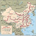 China military regions.jpg 800 × 798; 253 KB
-
 China Mineral Resources - DPLA - aa30265024fc91c016f8568561360fc6.jpg 8,766 × 7,695; 7.91 MB
-
 China oil infrastructure. LOC 2005629213.jpg 2,937 × 2,719; 820 KB
-
 China precipitation.jpg 1,256 × 956; 115 KB
-
 China province-level divisions-ar.svg 857 × 699; 561 KB
-
 China province-level divisions.svg 857 × 699; 191 KB
-
 China railroads and selected roads, May 1959. LOC 2007627271.jpg 6,517 × 5,326; 3.36 MB
-
 China, administrative areas 1948 LOC 2013591014.jpg 9,344 × 7,655; 6.28 MB
-
 China, communist administrative areas 1952. LOC 2013591015.jpg 9,175 × 7,369; 5.83 MB
-
 China, communist administrative divisions (December 1954). LOC 2013591017.jpg 9,042 × 7,226; 7.33 MB
-
 China, communist administrative divisions 1953. LOC 2013591016.jpg 9,127 × 7,462; 7.04 MB
-
 China, communist administrative divisions 1963. LOC 2013591023.jpg 4,269 × 3,283; 1.56 MB
-
 China, communist administrative divisions, March 1959. LOC 2013591021.jpg 4,233 × 3,183; 1.71 MB
-
 China, communist administrative units, 1962. LOC 2013591026.jpg 9,067 × 7,621; 6.82 MB
-
 China, communist autonomous administrative units, March 1959. LOC 2013591020.jpg 9,379 × 7,322; 6.76 MB
-
 China, communist autonomous administrative units, November 1958. LOC 2013591019.jpg 7,032 × 5,434; 4.21 MB
-
 China, ethnolinguistic groups. LOC 84696940.jpg 4,356 × 3,330; 1.42 MB
-
 China- Administration - DPLA - a73cc62f1bddc0e0f4b59ef45b8b6e95.jpg 2,556 × 3,280; 4.83 MB
-
 China- Coal Production and Consumption - DPLA - 976e37529e746d585c38fb2aaf28a36a.jpg 15,360 × 18,469; 22 MB
-
 China- Industry - DPLA - b45549293070fce9db175114ab9b4372.jpg 3,278 × 2,552; 630 KB
-
 China- Military Regions - DPLA - 5b0620831b96a009f25c79e8ad8950eb.jpg 2,554 × 3,280; 4.62 MB
-
 China- Population Density - DPLA - 5b4c329d3c8a25a7492d85fb3d576c92.jpg 2,548 × 3,284; 3.04 MB
-
 China- Precipitation - DPLA - 92cafbff12d188dd64c7c7d040778ae6.jpg 3,274 × 2,558; 600 KB
-
 China. 1 - 25.000. Hankow (Hu-Pe) - btv1b52508923p.jpg 8,195 × 11,466; 10.57 MB
-
 China. Food surpluses and deficiencies. 180 kms - btv1b53196950t.jpg 7,996 × 9,484; 15.13 MB
-
 China. LOC 2006626649.jpg 1,844 × 2,201; 642 KB
-
 China. LOC 2006626650.jpg 1,803 × 2,203; 559 KB
-
 China. LOC 2006629369.jpg 6,918 × 5,414; 6.69 MB
-
 China. LOC 84696064.jpg 7,177 × 5,682; 6.61 MB
-
 China. Special strategic map - btv1b53189307b.jpg 9,202 × 8,048; 11.19 MB
-
 Chinese Ethnolinguistic Groups (China) - DPLA - fafd3a280531dbc897250d8bdc062064.jpg 2,554 × 3,276; 3.22 MB
-
 Chinese linguistic groups. LOC 90686002.jpg 3,300 × 4,362; 1.05 MB
-
 Chongqing1.svg 948 × 969; 1.76 MB
-
 Coal Deposits (China) - DPLA - 068a13b11a63326ed744ff6cec0c2a6c.jpg 2,532 × 3,262; 4.66 MB
-
 Coal deposits - (China). LOC 2007628757.jpg 2,509 × 3,300; 666 KB
-
 Colton's China. LOC 2006629365.jpg 6,804 × 5,677; 7.66 MB
-
 Communist China 14 December 1949 - DPLA - 96c46fc755f7c2c9d8637659fe17a37f.jpg 3,720 × 3,334; 1.28 MB
-
 Communist China administrative divisions, June 1967. LOC 2013591028.jpg 8,406 × 7,136; 5.65 MB
-
 Communist China administrative divisions. LOC 2013591031.jpg 4,232 × 3,253; 1.38 MB
-
 Communist China agriculture. LOC 2007627219.jpg 8,450 × 7,120; 8.82 MB
-
 Communist China autonomous regions. LOC 2013591022.jpg 4,448 × 3,225; 1.75 MB
-
 Communist China industry. LOC 2013591034.jpg 8,417 × 7,159; 7.86 MB
-
 Communist China province-level administrative divisions. LOC 2013591027.jpg 8,650 × 7,028; 10.2 MB
-
 Communist China railroads and selected roads, June 1960. LOC 2007627279.jpg 7,366 × 6,073; 4.17 MB
-
 Communist China railroads and selected roads, June 1961. LOC 2007627278.jpg 7,176 × 5,960; 3.87 MB
-
 Communist China railroads and selected roads, May 1959. LOC 2007632038.jpg 13,595 × 11,383; 16.16 MB
-
 Communist China, administrative divisions, March 1956. LOC 2013591018.jpg 8,819 × 7,075; 5.77 MB
-
 Communist China, crude oil resources and refineries. LOC 2007627264.jpg 4,895 × 4,098; 2.45 MB
-
 Communist China, ethnologistic groups. LOC 80691542.jpg 3,150 × 4,128; 1.15 MB
-
 Communist China, fuels and power. LOC 2007627267.jpg 8,262 × 6,934; 6.75 MB
-
 Communist China, major new railroad construction 1953-1957. LOC 2007627275.jpg 2,880 × 2,350; 713 KB
-
 Communist China, minerals and metals. LOC 2007627252.jpg 8,253 × 6,959; 7.9 MB
-
 Communist China, petroleum prospects and facilities. LOC 2007627255.jpg 5,834 × 4,692; 2.68 MB
-
 Communist China, precipitation. LOC 2013591104.jpg 8,322 × 6,984; 8.3 MB
-
 Communist China, subprovince-level administrative divisions. 2-69. LOC gm70003214.jpg 8,280 × 6,653; 5.09 MB
-
 Communist China- Selected Highways - DPLA - d2ecd25557aa17e1a7d86e8db73a5be2.jpg 3,280 × 2,558; 1.64 MB
-
 Consular District of China Map.jpg 924 × 771; 98 KB
-
 Eastern China. LOC 2007628761.jpg 2,299 × 3,083; 850 KB
-
 Expansion of Chinese Empire - DPLA - 80c09860ca5659eabafe000e4a0f1db3.jpg 4,480 × 3,553; 1.68 MB
-
 FormerFrenchConcessionMap.jpg 1,024 × 684; 449 KB
-
 G219 China.jpg 2,008 × 2,212; 1.09 MB
-
 Gas infrastructure - (China). LOC 2007628759.jpg 2,539 × 3,310; 562 KB
-
 Historical xinjiang.png 1,088 × 891; 488 KB
-
 Japanese pre-war colonization. LOC 80675188-18.jpg 3,162 × 3,874; 1.43 MB
-
 Japanese pre-war colonization. LOC 80675188-19.jpg 3,153 × 3,887; 1.48 MB
-
 Jinyufen qu.png 512 × 646; 157 KB
-
 Johnson's China and Japan. LOC 2007627525.jpg 8,009 × 5,369; 6.83 MB
-
 Magnolia and Northwest China - DPLA - 6c70efa6282baf8d043b7fa02ba02164.jpg 12,020 × 8,923; 12.48 MB
-
 Mainland China railroads. LOC 2007627274.jpg 2,864 × 2,481; 677 KB
-
 Major Oil and Gas Basins (China) - DPLA - 635c95a3d719dd75fa887b04759554d5.jpg 2,558 × 3,274; 5.44 MB
-
 Manchuria "Manchuko" Number of Koreans - DPLA - fd7dad51ca66ec61d78014846c64505a.jpg 4,776 × 5,290; 3.18 MB
-
 Manchuria - DPLA - 7ac20a4ccbdcc2ab877df6616cc72575.jpg 12,006 × 8,804; 9.48 MB
-
 Manchuria - DPLA - bd891d8889df9a3a63547178e3067c1c.jpg 12,021 × 8,808; 11.26 MB
-
 Manchuria and Jehol Administration Divisions - DPLA - 42ae8666e4e58af1f0e25120eecd7355.jpg 5,112 × 6,612; 3.44 MB
-
 Manchuria and Jehol Administrative Divisions - DPLA - aa5e041874de99099ceb0a1fdf3cc81a.jpg 6,828 × 8,883; 5.66 MB
-
 Manchuria Coal, Petroleum, Electric Power - DPLA - 489304a2659f858ef0cf715db9d255c8.jpg 4,432 × 4,157; 2.06 MB
-
 Manchuria Construction Materials - DPLA - 9e8fa46d546b5761c45ebe61ddb2e23d.jpg 3,808 × 3,988; 2.1 MB
-
 Manchuria Density of Population - DPLA - 04f3f27e7530ddb9de58da1c033a8a91.jpg 5,366 × 6,012; 4.58 MB
-

-
 Manchuria Roads - DPLA - 6e0ff9d51679b840fa4897f168f2cb7f.jpg 5,400 × 6,033; 3.83 MB
-
 Manchuria Water Supply and Sewage Disposal - DPLA - ef72a16262146f9d8e02bbba091e332f.jpg 3,784 × 4,096; 1.87 MB
-
 Manchuria- An-Shan - DPLA - 83c72bff639d1e256dd43101a7ad8427.jpg 7,000 × 4,138; 2.71 MB
-
 Map of China prepared for the China Inland Mission LOC 2006459040.jpg 13,434 × 11,321; 27.06 MB
-
 Map of China with Flak and Railroads - NARA - 140696124.jpg 13,248 × 17,444; 21.42 MB
-
 Map of China with Friendly and Japanese Airfields - NARA - 140696128.jpg 13,312 × 17,457; 20.04 MB
-
 Map of China with Japanese Supply Requirements - NARA - 140696120.jpg 13,280 × 17,461; 23.16 MB
-
 Map of China with War Areas - NARA - 140696126.jpg 13,248 × 17,447; 22.14 MB
-

-
 Map of China... (Second... edition) - by E. Bretschneider... - btv1b53029908x.jpg 10,080 × 8,698; 14.6 MB
-
 Map of East Central China - NARA - 76028917.jpg 11,000 × 13,688; 83.08 MB
-
 Map of Greater China - NARA - 140696114.jpg 14,488 × 11,136; 8.78 MB
-
 Map of Shanghai LOC 2007628701.jpg 17,835 × 9,103; 22.26 MB
-
 Map of sinitic languages full-en.svg 2,219 × 1,759; 181 KB
-
 Map of the Empire of China - shewing the chief navigable waterways LOC 2007633436.jpg 10,152 × 9,504; 9.18 MB
-

-
 Mongolia - DPLA - 674cf7730c04f7cdf425024d7cb9df91.jpg 4,360 × 3,323; 1.62 MB
-
 Mongolia and Northwest China - DPLA - 0e42a1e44943fb0b70a6d62039cd7ed4.jpg 11,099 × 8,736; 7.56 MB
-
 Mongolia and Northwest China - DPLA - 4d44e35333d1e005688fee237f0caa56.jpg 11,098 × 8,685; 7.64 MB
-
 North China - DPLA - 11d8a08f165d6e87a20d7bd96b3026da.jpg 11,875 × 8,324; 6.14 MB
-
 North China - DPLA - 5c46691ac1f20a023efc2c2bb7f6e0ba.jpg 11,876 × 8,337; 9.98 MB
-
 North China - DPLA - 70698c69387c73a749f7c25533e36e04.jpg 11,836 × 7,035; 5.1 MB
-

-

-

-
 North China. Transportation - btv1b53196949f.jpg 8,050 × 8,474; 7.97 MB
-
 Northeast China and Adjacent Areas - DPLA - 83f27bcd7476fef5111e76236672d029.jpg 2,400 × 3,126; 6.51 MB
-

-
 Overlay- Map of Asia - DPLA - 2f9102fddf31c95d483481be48661e7d.jpg 3,840 × 3,923; 1.62 MB
-

-

-
 Port Arthur Naval Base Area - DPLA - e171846883db3e004f02c3a388f16675.jpg 7,908 × 4,876; 3.26 MB
-
 Postal Map of Shanghai Showing Sectional Divisions in 1930 (cropped).jpg 14,920 × 11,259; 18.1 MB
-

-

-
 Railroads in China, December 1953. LOC 2007627280.jpg 7,525 × 6,310; 4.49 MB
-
 Relief map of Japan-Korea area. Mercator projection - btv1b531953970.jpg 12,209 × 14,191; 17.87 MB
-
 Shanghai 1935 S1 AMS-WO.jpg 6,261 × 4,180; 9.96 MB
-
 Shanghai 1935 S2 AMS-WO.jpg 5,080 × 4,468; 8.02 MB
-

-
 South Central China. Political divisions. 250 kms - btv1b53196952q.jpg 9,332 × 6,208; 6.11 MB
-
 South China - DPLA - 100ff9d41161b55f107a20f30768d324.jpg 12,010 × 8,803; 12.44 MB
-

-
 South China- Ethnic groups. 3-63. LOC 75696359.jpg 5,054 × 5,270; 3.71 MB
-
 Southeast China - DPLA - 543743bc47ed3bf139136400fe67015f.jpg 7,804 × 8,761; 7.37 MB
-
 Southeast China - Selected Strategic Areas - DPLA - 257da00ef8a37c3e157299cb7c323cf1.jpg 8,064 × 10,924; 6.3 MB
-
 Taiyuan map 1954.jpg 711 × 755; 164 KB
-
 The West River from chinese maps - btv1b53058654n.jpg 4,888 × 3,496; 2.01 MB
-
 Tianjin 1942 AMS.jpg 4,475 × 6,266; 6.36 MB
-
 Txu-oclc-6614368-nm53-11.jpg 5,000 × 3,749; 4.75 MB
-
 Txu-oclc-6654394-nj-45-3rd-ed.jpg 4,746 × 5,169; 7.17 MB
-
 War map of China LOC 2006459038.jpg 8,955 × 6,343; 9.31 MB
-
 Z . Pratical map of Kwangtung province - btv1b531955556.jpg 11,838 × 8,512; 16.55 MB
.jpg)
.jpg)


.jpg)
.jpg)
.jpg)
.jpg)

.jpg)

_-_DPLA_-_85f74580327a588619a8956141c64a49.jpg)
._LOC_2007628758.jpg)


_-_DPLA_-_b5fab2ada8a51b0fcd08ad9481eadb68.jpg)


_-_btv1b525087122.jpg)


._LOC_2013591017.jpg)


_-_btv1b52508923p.jpg)


_-_DPLA_-_fafd3a280531dbc897250d8bdc062064.jpg)


_-_DPLA_-_068a13b11a63326ed744ff6cec0c2a6c.jpg)
._LOC_2007628757.jpg)


._LOC_2007628759.jpg)


_-_DPLA_-_635c95a3d719dd75fa887b04759554d5.jpg)


_-_DPLA_-_5ae72f7a1f69955fce1b7fda54cc31ae.jpg)


_-_by_E._Bretschneider..._-_btv1b53029908x.jpg)


.jpg)


_Seats_-_DPLA_-_5a6b581d914c3cd5e86f5a367856d737.jpg)


