Category:English-language maps of Massachusetts
States of the United States: Alabama · Alaska · Arkansas · California · Florida · Maryland · Massachusetts · New Jersey · New Mexico · New York · North Carolina · Ohio · Oklahoma · Pennsylvania · Texas · Utah – Washington, D.C.
Media in category "English-language maps of Massachusetts"
The following 18 files are in this category, out of 18 total.
-
 2011 Massachusetts state House of Representatives district map US.jpg 4,500 × 3,352; 1.52 MB
-
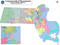 2011 Massachusetts state senate district map.jpg 4,500 × 3,353; 1.55 MB
-
 Amercianmap.png 412 × 259; 15 KB
-
 Boston printable tourist attractions map.jpg 2,105 × 1,488; 1.5 MB
-

-
 Hydrologic unit map, Massachusetts LOC 81693477.jpg 5,076 × 3,306; 1.98 MB
-
 Map of Boston from the latest surveys - btv1b8439014q.jpg 9,561 × 12,168; 16.79 MB
-
 Massachusetts Köppen.svg 1,017 × 945; 585 KB
-
 Massachusetts map by George W. Boynton, 1851.jpg 3,969 × 2,885; 4.67 MB
-
 Massachusetts population map.png 600 × 600; 170 KB
-
 Massachusetts; county subdivisions, towns and places. 1970. LOC gm72003053.jpg 7,710 × 5,562; 3.64 MB
-
 Outline map of Massachusetts (2674595573).jpg 2,000 × 1,318; 2.05 MB
-
 Race and Ethnicity in Massachusetts 2020.png 14,400 × 10,800; 11.7 MB
-
 States of Massachusetts, Rhode Island, and Connecticut - base map LOC 2009579047.jpg 8,940 × 7,194; 8.51 MB
-

-

-
 Status of soil surveys, Massachusetts - 1987 LOC 87694365.jpg 5,023 × 3,250; 1.74 MB
-
 U.S. Route 20 in Massachusetts Map.svg 1,028 × 609; 3.84 MB


.jpg)


_LOC_81690119.jpg)
_LOC_81690113.jpg)

