Category:Engraved maps from Lahainaluna Seminary
Media in category "Engraved maps from Lahainaluna Seminary"
The following 20 files are in this category, out of 20 total.
-
 A map of the Hawaiian Islands, 1838, portion with Maui.jpg 6,385 × 5,202; 9.8 MB
-
 A Map of the Hawaiian Islands. According to the Latest Surveys, 1838.jpg 13,236 × 8,698; 35.49 MB
-
 Hemispheres, 1840, engraved by Kapeau.jpg 1,874 × 1,088; 691 KB
-
 Large atlas map of the Pacific, 1840, engraved by Pikao.jpg 1,657 × 1,289; 718 KB
-
 Map of Christmas Island, 1837.jpg 139 × 200; 7 KB
-
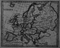 Map of Europe, engraved by Kepohoni.jpg 371 × 300; 32 KB
-
 Map of Palestine, engraved by Kunui.jpg 237 × 300; 11 KB
-
 Map of St. Paul's Journeys, engraved by Kunui.jpg 400 × 270; 35 KB
-
 Map of Two Hemispheres, 1836, engraved by Kalama.jpg 400 × 250; 19 KB
-
 Map of Two Hemispheres, 1839, engraved by Kalama and Kepohoni.jpg 400 × 243; 20 KB
-
-
 Na Mokupuni o Hawaii Nei, 1837.jpg 5,790 × 4,163; 8.41 MB
-
 Na Mokupuni o Hawaii, 1839, engraved by Kapeau.jpg 2,018 × 1,275; 851 KB
-
 Na Mokupuni o Hawaii, 1839, engraved by Kepohoni.jpg 4,000 × 2,537; 2.84 MB
-
 Old Man and Child, 1840, engraved by Pikao.jpg 846 × 613; 177 KB
-
 Temperance Map, 1843, by C. Wilthberger.jpg 3,811 × 4,000; 4.72 MB
-

-

-
 World Map, 1834, engraved by Kawailepolepo.jpg 1,325 × 673; 333 KB
-
 World Map, 1836, engraved by Kalama.jpg 1,131 × 590; 220 KB


