Category:Environs of Rockland St Mary
Media in category "Environs of Rockland St Mary"
The following 15 files are in this category, out of 15 total.
-
 Fallen tree in peat by Short Dyke - geograph.org.uk - 812376.jpg 640 × 426; 115 KB
-
 Fields beside the path - geograph.org.uk - 1440676.jpg 640 × 480; 110 KB
-
 Hellington Beck - geograph.org.uk - 1334557.jpg 480 × 640; 111 KB
-
 Machinery at Broad Hall Farm - geograph.org.uk - 1413209.jpg 576 × 580; 103 KB
-
 Poppies growing on field edge - geograph.org.uk - 1433356.jpg 640 × 480; 134 KB
-
 Potato field beside footpath - geograph.org.uk - 1413271.jpg 640 × 480; 121 KB
-
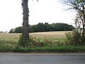
 Private road leading east - geograph.org.uk - 1413213.jpg 640 × 480; 95 KB
-
 Shed in pasture - geograph.org.uk - 1440687.jpg 640 × 480; 114 KB
-
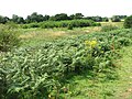
 Sugar beet crop beside the path - geograph.org.uk - 1433361.jpg 640 × 480; 110 KB
-
 The northern edge of Low Common - geograph.org.uk - 1433363.jpg 640 × 480; 116 KB
-
 Triangular owl box in the trees - geograph.org.uk - 1733318.jpg 800 × 531; 112 KB
-
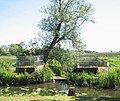 View across Hellington Beck - geograph.org.uk - 1334564.jpg 640 × 541; 128 KB
-
 View across Low Common - geograph.org.uk - 1433371.jpg 640 × 480; 128 KB
-
 View south along the Beck - geograph.org.uk - 1493382.jpg 480 × 640; 139 KB
-
 Woodland west of Low Road - geograph.org.uk - 1493366.jpg 640 × 480; 79 KB


