Category:Epperstone
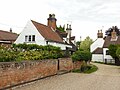
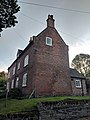
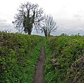
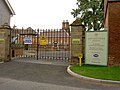
English: Epperstone is a village and civil parish in Nottinghamshire located near Lowdham and Calverton. The village has a population of about 500, many of whom commute to work or school in Nottingham (10 miles, 16 km). (→Epperstone)
Polski: Epperstone – wieś w Anglii, w hrabstwie Nottinghamshire. Leży 12 km na północny wschód od miasta Nottingham i 180 km na północ od Londynu. (→Epperstone)

village in the United Kingdom | |||||
| Upload media | |||||
| Instance of | |||||
|---|---|---|---|---|---|
| Location | Newark and Sherwood, Nottinghamshire, East Midlands, England | ||||
| Population |
| ||||
 | |||||
Subcategories
This category has only the following subcategory.
H
Media in category "Epperstone"
The following 200 files are in this category, out of 230 total.
(previous page) (next page)-
 A misty view over Epperstone - geograph.org.uk - 5175449.jpg 800 × 600; 57 KB
-
 A view of Hayfield Farm, Epperstone - geograph.org.uk - 5864221.jpg 4,801 × 3,515; 3.7 MB
-
 A6097 south of Oxton - geograph.org.uk - 4230321.jpg 1,024 × 768; 110 KB
-

-
 B6386 Epperstone Road - geograph.org.uk - 2859436.jpg 1,024 × 768; 96 KB
-
 B6386 Epperstone Road south of Oxton - geograph.org.uk - 4230323.jpg 1,024 × 768; 135 KB
-
 Barn at The Old House, Epperstone - geograph.org.uk - 5611863.jpg 1,024 × 768; 206 KB
-
 Barn conversion at Lady Well - geograph.org.uk - 5864240.jpg 4,883 × 3,644; 2.99 MB
-
 Barn conversion south of Bankwood Farm - geograph.org.uk - 4062799.jpg 1,024 × 768; 226 KB
-
 Barn, The Old House, Epperstone.jpg 1,024 × 768; 188 KB
-
 Below Epperstone - geograph.org.uk - 1629005.jpg 640 × 479; 148 KB
-
 Belvedere Cottage, Epperstone.jpg 1,280 × 960; 398 KB
-
 Bentley Wood - geograph.org.uk - 5611664.jpg 1,024 × 768; 279 KB
-
 Bridge over Thurgarton Beck near Hill Farm - geograph.org.uk - 5864230.jpg 4,833 × 3,659; 5.58 MB
-
 Bridge to the pub at Epperstone - geograph.org.uk - 1069398.jpg 640 × 480; 129 KB
-
 Bridleway at twilight south of Oxton - geograph.org.uk - 4230316.jpg 1,024 × 768; 82 KB
-
 Bridleway near Criftin Mill Cottage - geograph.org.uk - 2558575.jpg 1,280 × 959; 401 KB
-
 Bridleway near Eastwood Farm - geograph.org.uk - 1758711.jpg 640 × 480; 87 KB
-
 Bridleway to Epperstone east of Eastwood Farm - geograph.org.uk - 4237404.jpg 1,024 × 768; 148 KB
-
 Bridleway to Hagg Farm and Halloughton - geograph.org.uk - 5611675.jpg 1,024 × 647; 330 KB
-
 Bridleway to Lowdham - geograph.org.uk - 5611848.jpg 1,024 × 768; 340 KB
-
 Bridleway towards Thistly Coppice - geograph.org.uk - 4237409.jpg 1,024 × 768; 134 KB
-
 Broad beans, Epperstone - geograph.org.uk - 2429769.jpg 3,648 × 2,736; 5.64 MB
-
 Bus stop, Epperstone - geograph.org.uk - 4080829.jpg 1,024 × 768; 240 KB
-
 Cattle grazing off Gonalston Lane - geograph.org.uk - 5611832.jpg 1,024 × 768; 261 KB
-
 Chapel Farm, Epperstone - geograph.org.uk - 5864208.jpg 4,883 × 3,604; 3.8 MB
-
 Chapel Lane, Epperstone - geograph.org.uk - 4079403.jpg 1,024 × 768; 231 KB
-
 Church of the Holy Cross (interior), Epperstone - geograph.org.uk - 4079404.jpg 1,024 × 768; 183 KB
-
 Colourful field corner - geograph.org.uk - 2429850.jpg 3,648 × 2,736; 5.8 MB
-
 Corner of Epperstone Park woods - geograph.org.uk - 2321582.jpg 1,280 × 959; 186 KB
-

-
 Criftin Farm - geograph.org.uk - 2558565.jpg 1,280 × 959; 302 KB
-
 Criftin Mill Cottage - geograph.org.uk - 2558572.jpg 1,280 × 959; 461 KB
-
 Crops and trees on a sunny Country walk - geograph.org.uk - 1069393.jpg 640 × 480; 100 KB
-
 Cross Keys, Epperstone - geograph.org.uk - 1628971.jpg 640 × 479; 82 KB
-
 Date stone - geograph.org.uk - 1628978.jpg 640 × 479; 112 KB
-
 Den Cottages, Epperstone, Nottinghamshire (1).jpg 3,024 × 4,032; 2.48 MB
-
 Den Cottages, Epperstone, Nottinghamshire (2).jpg 3,024 × 4,032; 8.12 MB
-
 Den Cottages, Epperstone.jpg 750 × 1,024; 236 KB
-
 Dovecote in Epperstone - geograph.org.uk - 1749027.jpg 800 × 600; 207 KB
-
 Eastern access to Park Farm - geograph.org.uk - 4237214.jpg 1,024 × 768; 292 KB
-
 Edge of a field - geograph.org.uk - 4931059.jpg 640 × 478; 129 KB
-
 Edge of the woods - near Hill Farm - geograph.org.uk - 5864234.jpg 4,868 × 3,783; 4.74 MB
-
 Emerging into the light south of Hagg Farm - geograph.org.uk - 4060898.jpg 1,024 × 768; 182 KB
-
 Enclosed footpath towards Car Holt Farm - geograph.org.uk - 4931062.jpg 640 × 477; 124 KB
-
 Enclosed footpath towards Hagg Farm - geograph.org.uk - 4931060.jpg 640 × 634; 171 KB
-
 Enclosed footpath towards Hagg Farm - geograph.org.uk - 4931069.jpg 640 × 589; 132 KB
-
 Entrance to Chestnut Farm - geograph.org.uk - 2321515.jpg 1,280 × 959; 247 KB
-
 Epperstone - geograph.org.uk - 1629010.jpg 640 × 479; 72 KB
-
 Epperstone bus stop - geograph.org.uk - 1629024.jpg 640 × 479; 133 KB
-
 Epperstone church from Hagg Lane - geograph.org.uk - 5611114.jpg 1,024 × 768; 246 KB
-
 Epperstone Cottage - geograph.org.uk - 1069401.jpg 640 × 480; 127 KB
-
 Epperstone dovecote - geograph.org.uk - 1628970.jpg 640 × 479; 102 KB
-
 Epperstone Dovecote and Main Street - geograph.org.uk - 843268.jpg 640 × 427; 84 KB
-
 Epperstone Manor - geograph.org.uk - 116546.jpg 640 × 480; 74 KB
-
 Epperstone Manor - geograph.org.uk - 1628988.jpg 640 × 479; 113 KB
-
 Epperstone Manor - geograph.org.uk - 1629002.jpg 640 × 479; 100 KB
-
 Epperstone Manor.jpg 1,280 × 960; 306 KB
-
 Epperstone postbox (Ref-NG14 348) - geograph.org.uk - 1629026.jpg 640 × 479; 145 KB
-
 Epperstone Road - geograph.org.uk - 5931463.jpg 5,376 × 3,024; 3.81 MB
-

-
 Farmhouse in arable landscape - geograph.org.uk - 2429858.jpg 2,918 × 2,126; 1,019 KB
-
 Farmland east of Oxton (2) - geograph.org.uk - 4237211.jpg 1,024 × 768; 137 KB
-
 Farmland near Eastwood Farm - geograph.org.uk - 1758708.jpg 640 × 480; 75 KB
-
 Farmland near Kennels - geograph.org.uk - 1758846.jpg 640 × 480; 75 KB
-
 Farmland near Netherfield Farm - geograph.org.uk - 1758831.jpg 640 × 480; 64 KB
-
 Farmland South of Epperstone Park - geograph.org.uk - 1758869.jpg 640 × 480; 69 KB
-
 Farmland to the north of Epperstone - geograph.org.uk - 2429763.jpg 3,648 × 2,736; 4.81 MB
-
 Field above Netherfield Farm - geograph.org.uk - 5611671.jpg 1,024 × 768; 231 KB
-
 Field and field boundary near Hill Farm - geograph.org.uk - 5175456.jpg 800 × 600; 159 KB
-
 Field barn - geograph.org.uk - 2321566.jpg 1,280 × 959; 251 KB
-
 Field boundaries near Netherfield Farm - geograph.org.uk - 5609407.jpg 1,024 × 768; 206 KB
-
 Field boundary - geograph.org.uk - 4931070.jpg 640 × 454; 100 KB
-
 Field east of Netherfield Farm (1) - geograph.org.uk - 4060857.jpg 1,024 × 768; 236 KB
-
 Field east of Netherfield Farm (2) - geograph.org.uk - 4060863.jpg 1,024 × 768; 199 KB
-
 Field edge path near Hill Farm - geograph.org.uk - 4079396.jpg 1,024 × 768; 217 KB
-
 Field edge path north of Epperstone - geograph.org.uk - 4079398.jpg 1,024 × 768; 272 KB
-
 Field near Hill Farm, Epperstone - geograph.org.uk - 5169903.jpg 5,376 × 3,024; 6.15 MB
-
 Field near Hill Farm, Epperstone - geograph.org.uk - 5169926.jpg 5,376 × 3,024; 5.79 MB
-
 Field off Hagg Lane - geograph.org.uk - 5611106.jpg 1,024 × 768; 193 KB
-
 Field south of Park Farm - geograph.org.uk - 4237215.jpg 1,024 × 768; 170 KB
-
 Field west of Cottage Farm (1) - geograph.org.uk - 4237216.jpg 1,024 × 768; 136 KB
-
 Field west of Cottage Farm (2) - geograph.org.uk - 4237217.jpg 1,024 × 768; 103 KB
-
 Fields near Epperstone - geograph.org.uk - 1098326.jpg 640 × 480; 75 KB
-
 Fields near Epperstone - geograph.org.uk - 1098370.jpg 640 × 480; 87 KB
-
 Fields near Epperstone - geograph.org.uk - 1098380.jpg 640 × 480; 96 KB
-
 Fields near Epperstone - geograph.org.uk - 1628957.jpg 640 × 479; 83 KB
-
 Finger post, Epperstone - geograph.org.uk - 4086493.jpg 1,024 × 768; 212 KB
-
 Fingerpost at Epperstone - geograph.org.uk - 1628960.jpg 486 × 640; 105 KB
-
 Footbridge near Hagg Cottage - geograph.org.uk - 5609406.jpg 1,024 × 768; 339 KB
-
 Footpath and fields - geograph.org.uk - 4931061.jpg 640 × 442; 119 KB
-
 Footpath at Epperstone - geograph.org.uk - 1629012.jpg 640 × 479; 133 KB
-
 Footpath to Wash Bridge - geograph.org.uk - 1629013.jpg 640 × 479; 111 KB
-
 Footpath towards Car Holt Farm - geograph.org.uk - 4931063.jpg 640 × 488; 153 KB
-
 Footpath towards Gonalston Lane - geograph.org.uk - 4931064.jpg 640 × 442; 124 KB
-
 Footpath towards Hagg Farm - geograph.org.uk - 4931071.jpg 640 × 483; 141 KB
-
 Footpath towards Halloughton - geograph.org.uk - 4931065.jpg 640 × 482; 136 KB
-
 Former chapel on Chapel Lane - geograph.org.uk - 1628976.jpg 640 × 479; 120 KB
-
 Former library in Epperstone - geograph.org.uk - 5175443.jpg 800 × 649; 160 KB
-
 Former Methodist Chapel, Epperstone.jpg 1,024 × 768; 205 KB
-
 Gate at the end of the bridleway - geograph.org.uk - 5611755.jpg 1,024 × 768; 213 KB
-
 Gate near Eastwood Farm - geograph.org.uk - 5611416.jpg 1,024 × 768; 353 KB
-
-
 Going up hill out of Epperstone - geograph.org.uk - 5169932.jpg 5,376 × 3,024; 4.76 MB
-
 Gonalston Lane north of Lowdham - geograph.org.uk - 4060842.jpg 1,024 × 768; 285 KB
-
 Gonalston Lane towards Epperstone - geograph.org.uk - 4931066.jpg 640 × 457; 102 KB
-
 Gonalston Lane towards Gonalston - geograph.org.uk - 4931067.jpg 640 × 427; 98 KB
-
 Hagg Lane - geograph.org.uk - 1628958.jpg 640 × 479; 151 KB
-
 Hagg Lane - geograph.org.uk - 5611422.jpg 1,024 × 768; 226 KB
-
 Hagg Lane at Eastwood Farm - geograph.org.uk - 5611417.jpg 1,024 × 768; 299 KB
-
 Hagg Lane near Eastwood Farm - geograph.org.uk - 5609397.jpg 1,024 × 768; 179 KB
-
 Hagg Lane, Epperstone - geograph.org.uk - 1758706.jpg 640 × 480; 87 KB
-
 Hagg Lane, Epperstone - geograph.org.uk - 5609396.jpg 1,024 × 768; 213 KB
-
 Hagg Lane, Epperstone - geograph.org.uk - 5864698.jpg 3,613 × 4,857; 4.7 MB
-
 Hayfield Farm - geograph.org.uk - 2321553.jpg 1,280 × 959; 304 KB
-
 Heap of fertiliser by Eastwood Farm - geograph.org.uk - 2429877.jpg 3,648 × 2,736; 4.96 MB
-
 Hemmed in bridleway east of Netherfield Farm - geograph.org.uk - 4060879.jpg 1,024 × 768; 334 KB
-
 Hillside above Epperstone - geograph.org.uk - 2321547.jpg 1,280 × 959; 368 KB
-
 Holly bush on Hagg Lane - geograph.org.uk - 5611120.jpg 1,024 × 768; 257 KB
-
 House near Epperstone - geograph.org.uk - 1069400.jpg 640 × 480; 110 KB
-
 Isolated tree near Eastwood Farm - geograph.org.uk - 5611425.jpg 1,024 × 768; 186 KB
-
 Ivy topiary in Epperstone - geograph.org.uk - 4080824.jpg 1,024 × 768; 163 KB
-

-
 Just a slight dusting - geograph.org.uk - 1624920.jpg 640 × 479; 189 KB
-
 Just another pipe - geograph.org.uk - 5169954.jpg 1,280 × 720; 417 KB
-
 K6 Telephone Kiosk, Chapel Lane, Epperstone, Nottinghamshire (1).jpg 3,024 × 4,032; 3.14 MB
-
 K6 Telephone Kiosk, Chapel Lane, Epperstone, Nottinghamshire (2).jpg 3,024 × 4,032; 2.65 MB
-
 K6 Telephone Kiosk, Chapel Lane, Epperstone, Nottinghamshire (3).jpg 3,024 × 4,032; 2.61 MB
-
 Lady Well Barn - geograph.org.uk - 5169899.jpg 5,376 × 3,024; 5.04 MB
-
 Lane to Netherfield Farm - geograph.org.uk - 5611849.jpg 1,024 × 768; 167 KB
-
 Library Lintel - geograph.org.uk - 1629019.jpg 640 × 479; 97 KB
-
 Local park for local people, Epperstone - geograph.org.uk - 4086496.jpg 1,024 × 768; 212 KB
-
 Lowdham Lane - geograph.org.uk - 1758702.jpg 640 × 480; 93 KB
-
 Main Street Epperstone - geograph.org.uk - 894706.jpg 640 × 480; 69 KB
-
 Main Street, Epperstone - geograph.org.uk - 1628973.jpg 640 × 479; 97 KB
-
 Main Street, Epperstone - geograph.org.uk - 1628975.jpg 640 × 479; 124 KB
-
 Main Street, Epperstone - geograph.org.uk - 1758704.jpg 640 × 480; 90 KB
-
 Main Street, Epperstone - geograph.org.uk - 1758841.jpg 640 × 480; 104 KB
-
 Main Street, Epperstone Village - geograph.org.uk - 38983.jpg 640 × 480; 128 KB
-
 Narrow bridleway - geograph.org.uk - 5611684.jpg 1,024 × 768; 181 KB
-
 Near Ricketwood Farm - geograph.org.uk - 1956674.jpg 640 × 480; 216 KB
-
 Netherfield Farm - geograph.org.uk - 1508157.jpg 640 × 479; 85 KB
-
 Netherfield Farm House - geograph.org.uk - 1508150.jpg 640 × 479; 77 KB
-
 New build at Epperstone Manor - geograph.org.uk - 1628991.jpg 640 × 479; 115 KB
-
 New build at Epperstone Manor - geograph.org.uk - 1628995.jpg 640 × 479; 101 KB
-
 New Houses by Dover Beck - geograph.org.uk - 6130376.jpg 5,376 × 3,024; 3.42 MB
-
 Oil seed rape crop and footpath post - geograph.org.uk - 2429869.jpg 3,648 × 2,736; 5.79 MB
-
 Oil seed rape on pile of manure - geograph.org.uk - 2429774.jpg 3,648 × 2,736; 6.16 MB
-
 Old Mill House, Epperstone.jpg 1,280 × 960; 518 KB
-
 Old wall and gate, Epperstone - geograph.org.uk - 2429759.jpg 2,762 × 2,038; 1.48 MB
-
 Orchard Cottages, Epperstone.jpg 1,280 × 960; 318 KB
-
 Order Beck - geograph.org.uk - 2321557.jpg 1,280 × 959; 441 KB
-
 Outbuilding at Grove Farm - geograph.org.uk - 1628965.jpg 640 × 479; 152 KB
-
 Outbuildings, Epperstone Manor.jpg 1,280 × 960; 317 KB
-
 Outbuildings, The Old Forge. Epperstone.jpg 1,280 × 960; 359 KB
-
 Overlooking Epperstone - geograph.org.uk - 1098365.jpg 640 × 480; 107 KB
-
 Parking area on the minor road to Oxton - geograph.org.uk - 5800988.jpg 800 × 600; 145 KB
-
 Path doubles back - geograph.org.uk - 2429783.jpg 3,648 × 2,736; 5.57 MB
-

-

-

-

-

-
 Pigeoncote In Field Facing House Called The Cottage, Epperstone, Nottinghamshire (1).jpg 3,016 × 2,159; 1.38 MB
-
 Pigeoncote In Field Facing House Called The Cottage, Epperstone, Nottinghamshire (2).jpg 3,062 × 2,168; 1.34 MB
-
 Pigeoncote, Poplars, Epperstone.jpg 1,280 × 960; 693 KB
-
 Pinfold, Epperstone - geograph.org.uk - 1628967.jpg 640 × 479; 119 KB
-
 Plantation Cottages - geograph.org.uk - 1628994.jpg 640 × 479; 126 KB
-
 Playing field sign, Epperstone - geograph.org.uk - 4086500.jpg 1,024 × 768; 219 KB
-
 Ploughed field and woods near Oxton - geograph.org.uk - 1575441.jpg 640 × 247; 44 KB
-
 Ploughed field off Gonalston Lane - geograph.org.uk - 5609419.jpg 1,024 × 768; 176 KB
-
 Red flag flying - geograph.org.uk - 5611757.jpg 1,024 × 768; 342 KB
-
 Rossellewood Farmhouse.jpg 1,280 × 960; 623 KB
-
 Roundabout on Epperstone bypass - geograph.org.uk - 2321505.jpg 1,280 × 959; 315 KB
-

-
 Souther Wood - geograph.org.uk - 1508116.jpg 640 × 479; 81 KB
-
 Sports ground at Epperstone - geograph.org.uk - 1749045.jpg 640 × 480; 55 KB
-
 Stream in the woods near Bankwood Farm - geograph.org.uk - 4062797.jpg 1,024 × 768; 334 KB
-
 Stream in the woods near Hill Farm (1) - geograph.org.uk - 4062808.jpg 1,024 × 768; 291 KB
-
 Stream in the woods near Hill Farm (2) - geograph.org.uk - 4062810.jpg 1,024 × 768; 352 KB
-
 Telephone Kiosk, Epperstone.jpg 1,280 × 960; 447 KB
-
 The cones hot line^ - geograph.org.uk - 5611113.jpg 1,024 × 768; 342 KB
-
 The Cross Keys - geograph.org.uk - 5175446.jpg 800 × 600; 81 KB
-
 The Cross Keys, Epperstone - geograph.org.uk - 1758834.jpg 640 × 480; 68 KB
-
 The Cross Keys, Epperstone - geograph.org.uk - 4086489.jpg 1,024 × 768; 190 KB
-
 The Cross Keys, Epperstone - geograph.org.uk - 5169921.jpg 5,376 × 3,024; 3.98 MB
-
 The Dover Beck - geograph.org.uk - 1628956.jpg 640 × 479; 132 KB
-
 The Kennels - geograph.org.uk - 2321524.jpg 1,280 × 959; 471 KB
-
 The Laurels, Epperstone - geograph.org.uk - 5864213.jpg 4,825 × 3,682; 5.03 MB
-
 The Old Forge And Attached Outbuildings, Epperstone, Nottinghamshire.jpg 4,032 × 3,024; 2.26 MB
-
 The Old Forge. Epperstone.jpg 1,280 × 861; 305 KB
-
 The Old House, Epperstone.jpg 1,280 × 960; 426 KB
-
 The Old Library - geograph.org.uk - 1629022.jpg 640 × 479; 94 KB
-
 The Old Rectory - geograph.org.uk - 1628998.jpg 640 × 479; 97 KB
-
 The Old Rectory, Epperstone.jpg 1,280 × 960; 389 KB
-
 The outskirts of Epperstone - geograph.org.uk - 1628950.jpg 640 × 479; 126 KB
-
 The Papermill, Epperstone.jpg 1,280 × 960; 317 KB
-
 The valley of the Dover Beck - geograph.org.uk - 5611688.jpg 1,024 × 768; 187 KB
-
 Toad Lane - geograph.org.uk - 1628979.jpg 640 × 479; 94 KB
-
 Toad Lane - geograph.org.uk - 1628999.jpg 640 × 479; 121 KB


,_Epperstone_-_geograph.org.uk_-_4079404.jpg)


.jpg)
.jpg)


_-_geograph.org.uk_-_1629026.jpg)


_-_geograph.org.uk_-_4237211.jpg)


_-_geograph.org.uk_-_4060857.jpg)
_-_geograph.org.uk_-_4060863.jpg)


_-_geograph.org.uk_-_4237216.jpg)
_-_geograph.org.uk_-_4237217.jpg)


.jpg)
.jpg)
.jpg)


.jpg)
.jpg)
.jpg)
.jpg)
.jpg)
.jpg)
.jpg)


_-_geograph.org.uk_-_4062808.jpg)
_-_geograph.org.uk_-_4062810.jpg)


