Category:Erlenbusch bei Kupsal
| Object location | | View all coordinates using: OpenStreetMap |
|---|
natural monument area in Krostitz Municipality, Saxony, Germany  | |||||
| Upload media | |||||
| Instance of | |||||
|---|---|---|---|---|---|
| Part of | |||||
| Location | Kupsal, Krostitz, Nordsachsen, Saxony, Germany | ||||
| Heritage designation | |||||
| Inception |
| ||||
| Area |
| ||||
 | |||||
Media in category "Erlenbusch bei Kupsal"
The following 16 files are in this category, out of 16 total.
-
 'Anemonoides nemorosa' am Boydaer Bach im Erlenbusch bei Kupsal.jpg 3,024 × 4,032; 7.04 MB
-
 Boydaer Bach am Forstweg 02.jpg 3,024 × 4,032; 8.88 MB
-
 Boydaer Bach am Forstweg.jpg 3,024 × 4,032; 9.75 MB
-
 Erlenbusch bei Kupsal - Auwald am Boydaer Bach.jpg 4,032 × 3,024; 7.24 MB
-
 Erlenbusch bei Kupsal - Blick auf den Sumpfwald.jpg 4,032 × 3,024; 5.11 MB
-
 Erlenbusch bei Kupsal - Blick in den Sumpfwald.jpg 4,032 × 3,024; 8.79 MB
-
 Erlenbusch bei Kupsal - Feuchtwiese am Auwald des Boydaer Bach.jpg 4,032 × 3,024; 6.57 MB
-
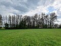
 Erlenbusch bei Kupsal - nördliche Feuchtwiese.jpg 3,024 × 4,032; 6.52 MB
-
 Erlenbusch bei Kupsal - nördliche Wiese am Sumpfwald.jpg 4,032 × 3,024; 6.79 MB
-
 Erlenbusch bei Kupsal - Ostflanke des Auwald am Boydaer Bach.jpg 4,032 × 3,024; 5.76 MB
-
 Erlenbusch bei Kupsal - Sumpfwald am Boydaer Bach.jpg 3,024 × 4,032; 8.56 MB
-
 Erlenbusch bei Kupsal - Sumpfwald mit Caltha palustris.jpg 4,032 × 3,024; 9.41 MB
-
 Erlenbusch bei Kupsal - südliche Feuchtwiese am Sumpfwald.jpg 4,032 × 3,024; 5.87 MB
-
 Erlenbusch bei Kupsal - südliche Feuchtwiese.jpg 4,032 × 3,024; 7.73 MB
-
 Erlenbusch bei Kupsal - Wiese am Sumpfwald.jpg 4,032 × 3,024; 6.74 MB
-
 Forstweg zwischen Erlenbusch und Fließgraben am Boydaer Bach.jpg 3,024 × 4,032; 8.33 MB


