Category:Essendon, Hertfordshire
village and civil parish in Hertfordshire, England, UK  | |||||
| Upload media | |||||
| Instance of | |||||
|---|---|---|---|---|---|
| Location | Welwyn Hatfield, Hertfordshire, East of England, England | ||||
 | |||||
Subcategories
This category has the following 2 subcategories, out of 2 total.
Media in category "Essendon, Hertfordshire"
The following 200 files are in this category, out of 203 total.
(previous page) (next page)-
 20151011 152754-S.jpg 1,291 × 775; 392 KB
-

-
 A414 eastbound - geograph.org.uk - 6063095.jpg 1,024 × 684; 225 KB
-

-
 Autumn colours in the hedgerow - geograph.org.uk - 3221771.jpg 2,560 × 1,920; 1.13 MB
-

-
 Bedwell Park, Hertfordshire - geograph.org.uk - 102083.jpg 640 × 413; 95 KB
-
 Bend on High Road, Essendon - geograph.org.uk - 4549703.jpg 2,462 × 1,780; 1.45 MB
-
 Berkhamsted Lane - geograph.org.uk - 5029127.jpg 640 × 480; 109 KB
-
 Berkhamsted Lane - geograph.org.uk - 5208181.jpg 640 × 480; 93 KB
-
 Blacksmith's Forge in Essendon - geograph.org.uk - 2976848.jpg 2,560 × 1,920; 1.08 MB
-
 Brick water tower, Essendon - geograph.org.uk - 3542274.jpg 739 × 1,000; 1.09 MB
-
 Bridge over the River Lea, Letty Green - geograph.org.uk - 4547469.jpg 2,560 × 1,920; 1.93 MB
-
 Bridge parapets on the River Lea - geograph.org.uk - 3919959.jpg 640 × 480; 101 KB
-
 Buildings near Bedwell Lodge Farm - geograph.org.uk - 4418269.jpg 4,320 × 3,240; 4.82 MB
-

-
 Byway towards Welwyn Garden City - geograph.org.uk - 5354441.jpg 640 × 480; 110 KB
-
 Chairs and Tables For Jubilee Party Outside Essendon Church - geograph.org.uk - 2976843.jpg 2,560 × 1,920; 1.11 MB
-
-
 Church Street, Essendon - geograph.org.uk - 3620982.jpg 1,024 × 779; 218 KB
-
 City of London coal tax post, by Cucumber Lane - geograph.org.uk - 3355807.jpg 733 × 1,024; 271 KB
-
 Coldharbour Moat - geograph.org.uk - 140135.jpg 640 × 480; 154 KB
-
 Cottage near Flint Farm - geograph.org.uk - 399984.jpg 640 × 480; 95 KB
-
 Cottages on Church Street, Essendon - geograph.org.uk - 5353598.jpg 640 × 480; 61 KB
-
 Cottages on Essendon Hill (B158) - geograph.org.uk - 5354422.jpg 640 × 480; 62 KB
-
 Country east of Cucumber Lane - geograph.org.uk - 5029098.jpg 640 × 480; 100 KB
-
 Crop field north of Essendon - geograph.org.uk - 5354413.jpg 640 × 480; 76 KB
-
 Crop field towards Harefield Wood - geograph.org.uk - 5353571.jpg 640 × 480; 74 KB
-
 Cucumber Lane - geograph.org.uk - 140114.jpg 640 × 480; 88 KB
-
 Cucumber Lane - geograph.org.uk - 5029087.jpg 640 × 480; 160 KB
-
 Cucumber Lane - geograph.org.uk - 5029111.jpg 640 × 480; 169 KB
-
 Cucumber Lane - geograph.org.uk - 5208169.jpg 640 × 480; 107 KB
-
 Cucumber Lane - geograph.org.uk - 5208172.jpg 640 × 480; 133 KB
-
 Cucumber Lane - geograph.org.uk - 5208178.jpg 640 × 480; 128 KB
-
 Cucumber Lane - geograph.org.uk - 5208180.jpg 640 × 480; 133 KB
-
 Cucumber Lane - newly resurfaced - geograph.org.uk - 1330722.jpg 640 × 480; 160 KB
-
 Cucumber Lane at junction with Cum Cum Hill - geograph.org.uk - 2323310.jpg 1,600 × 1,200; 592 KB
-
 Cut mark on bridge parapet - geograph.org.uk - 3919970.jpg 640 × 480; 108 KB
-
 Dead Tree on West End Lane - geograph.org.uk - 141051.jpg 640 × 480; 82 KB
-
 Dried-up Ford - geograph.org.uk - 461863.jpg 640 × 480; 97 KB
-
 Dry Ford - geograph.org.uk - 141066.jpg 640 × 480; 131 KB
-
 Elizabeth II postbox on Holwell Lane - geograph.org.uk - 5358964.jpg 2,074 × 2,547; 1.18 MB
-
 Essenden Church Tower Wrapped-Up - geograph.org.uk - 2976833.jpg 2,560 × 1,920; 1.18 MB
-
 Essenden Mill - geograph.org.uk - 4475454.jpg 4,320 × 3,240; 3.81 MB
-
 Essendon Brook - geograph.org.uk - 6414519.jpg 1,600 × 1,067; 920 KB
-
 Essendon Brook, West End Lane ford - geograph.org.uk - 724083.jpg 640 × 480; 108 KB
-

-
 Essendon church - geograph.org.uk - 5591323.jpg 640 × 480; 160 KB
-
 Essendon church - geograph.org.uk - 5596053.jpg 640 × 480; 140 KB
-
 Essendon church weather vane - geograph.org.uk - 5591358.jpg 640 × 640; 86 KB
-
 Essendon churchyard - geograph.org.uk - 5596047.jpg 640 × 480; 172 KB
-
 Essendon churchyard - geograph.org.uk - 5596056.jpg 640 × 480; 188 KB
-

-
 Essendon Country Club 1 2020-09-01.jpg 3,820 × 2,547; 4.56 MB
-
 Essendon Country Club 2 2020-09-01.jpg 3,893 × 2,595; 5.18 MB
-
 Essendon Ford - geograph.org.uk - 3457553.jpg 3,872 × 2,592; 2.36 MB
-
 Essendon Hill - geograph.org.uk - 5618764.jpg 1,978 × 1,436; 802 KB
-
 Essendon Mill - geograph.org.uk - 141072.jpg 640 × 480; 107 KB
-
 Essendon, B158 High Road - geograph.org.uk - 724041.jpg 640 × 480; 72 KB
-

-
 Essendon, Holwell Bridge - geograph.org.uk - 723995.jpg 640 × 480; 95 KB
-

-
 Essendon, Village sign and war memorial - geograph.org.uk - 4414489.jpg 4,320 × 3,240; 4.75 MB
-
 Farmland alongside A414 - geograph.org.uk - 4414544.jpg 4,320 × 3,240; 4.2 MB
-

-
 Farmland from the Lea Valley Walk - geograph.org.uk - 7781.jpg 640 × 480; 130 KB
-
 Field by the entrance to Coldharbour Farm - geograph.org.uk - 3509171.jpg 2,048 × 1,536; 1.5 MB
-
 Field east of West End Lane - geograph.org.uk - 5595455.jpg 640 × 480; 138 KB
-
 Field entrance off Cucumber Lane - geograph.org.uk - 5208176.jpg 640 × 480; 83 KB
-
-
 Field entrance on West End Lane - geograph.org.uk - 4161392.jpg 2,560 × 1,920; 2.18 MB
-
 Flint Farm, West End - geograph.org.uk - 4161162.jpg 2,560 × 1,920; 2.14 MB
-
 Footbridge over Essendon Brook - geograph.org.uk - 6414474.jpg 1,600 × 1,067; 800 KB
-

-
 Footbridge over Wildhill Brook - geograph.org.uk - 6414508.jpg 1,600 × 1,067; 603 KB
-
 Footbridge over Wildhill Brook, Essendon, Hertfordshire 2020-09-01.jpg 3,024 × 4,032; 6.6 MB
-

-
 Footpath off West End Lane, Essendon - geograph.org.uk - 5353593.jpg 640 × 480; 141 KB
-
 Footpath towards Holwell Court - geograph.org.uk - 5354445.jpg 640 × 480; 108 KB
-
 Gates to Essendon Place - geograph.org.uk - 4414464.jpg 4,320 × 3,240; 4.92 MB
-

-
 GOC Newgate Street 035 Sandpit Lodge, Essendon (50997578462).jpg 4,255 × 3,192; 4.39 MB
-
 GOC Newgate Street 039 Essendon Golf Courses (50997578037).jpg 4,608 × 3,456; 5.25 MB
-
 GOC Newgate Street 040 Essendon Golf Courses (50997577912).jpg 4,608 × 3,456; 5.66 MB
-
 GOC Newgate Street 043 Pond Cottage, Essendon (50997459511).jpg 4,228 × 3,165; 4.11 MB
-
 GOC Newgate Street 044 54 and 56 High Road, Essendon (50997458096).jpg 3,882 × 2,913; 4.17 MB
-
 GOC Newgate Street 045 Essendon village sign (50997577372).jpg 3,936 × 2,954; 4.03 MB
-
 GOC Newgate Street 047 Church Cottages, Essendon (50996761963).jpg 4,059 × 3,049; 4.6 MB
-
 GOC Newgate Street 067 Church Cottages, Essendon (51002398143).jpg 4,190 × 2,357; 2.94 MB
-
 Grassland off Holwell Lane (B1455) - geograph.org.uk - 5354431.jpg 640 × 480; 54 KB
-
 Grazing off Woodfield Lane - geograph.org.uk - 5208164.jpg 640 × 480; 44 KB
-
 Hatfield 3 Miles - geograph.org.uk - 5354438.jpg 640 × 480; 57 KB
-
 Hatfield Country Club, Bedwell Park - geograph.org.uk - 432442.jpg 640 × 453; 79 KB
-
 Hatfield London Country Club - geograph.org.uk - 1330740.jpg 480 × 640; 144 KB
-
 Heading east on Berkhamsted Lane - geograph.org.uk - 5208183.jpg 640 × 480; 94 KB
-
 Heading north on Cucumber Lane - geograph.org.uk - 5208174.jpg 640 × 480; 109 KB
-
 High Road Essendon - geograph.org.uk - 2323312.jpg 1,600 × 1,200; 646 KB
-
 Hillend Cottages - geograph.org.uk - 2953163.jpg 2,560 × 1,920; 1.89 MB
-
 Holwell Court Farm - geograph.org.uk - 282338.jpg 640 × 428; 174 KB
-
 Holwell Lane (B1455) - geograph.org.uk - 5354433.jpg 640 × 480; 60 KB
-
 Holwell Lane at the junction of Hertford Road - geograph.org.uk - 4831575.jpg 2,168 × 1,526; 1.07 MB
-
 Holwell Manor Cottages - geograph.org.uk - 5591514.jpg 640 × 428; 95 KB
-
 Hornbeam Lane, Essendon - geograph.org.uk - 6414533.jpg 1,600 × 1,067; 912 KB
-

-
 House on Essendon Hill - geograph.org.uk - 5618765.jpg 2,014 × 1,490; 1.01 MB
-
 House on West End Lane, Essendon - geograph.org.uk - 5354406.jpg 640 × 480; 72 KB
-
 Houses in Essendon - geograph.org.uk - 35214.jpg 640 × 480; 21 KB
-
 Junction of High Road and Cucumber Lane - geograph.org.uk - 1330713.jpg 640 × 480; 157 KB
-
 Kentish Lane before Essendon - geograph.org.uk - 4065598.jpg 2,560 × 1,920; 2.17 MB
-
 Little Berkhamsted Lane - geograph.org.uk - 4065566.jpg 2,560 × 1,920; 1.56 MB
-
 Little Berkhamsted Lane near the junction with Cucumber Lane - geograph.org.uk - 4065581.jpg 2,560 × 1,920; 2.03 MB
-
 Locked Gate, CCTV etc.- Entrance to Hatfield House Estate - geograph.org.uk - 2953093.jpg 2,560 × 1,920; 2.43 MB
-
 Lodge to Bedwell Park House - geograph.org.uk - 4414430.jpg 4,320 × 3,240; 4.59 MB
-
 Lodges at the entrance to Camfield Place - geograph.org.uk - 867470.jpg 640 × 480; 108 KB
-
 London , London Scenery - geograph.org.uk - 5434040.jpg 5,492 × 3,662; 6.34 MB
-
 Looking north down Essendon Hill - geograph.org.uk - 4414523.jpg 4,320 × 3,240; 5.6 MB
-
 Lorries belonging to gravel workings - geograph.org.uk - 3221764.jpg 2,560 × 1,920; 1,008 KB
-
 Low Road, Essendon - geograph.org.uk - 4549442.jpg 2,518 × 1,862; 1.34 MB
-
 Lych gate, Essendon churchyard - geograph.org.uk - 5596063.jpg 640 × 480; 198 KB
-
 Meadow by River Lea - geograph.org.uk - 5591554.jpg 640 × 480; 152 KB
-
 Near Essendon Place - geograph.org.uk - 4414446.jpg 4,320 × 3,240; 4.46 MB
-
 New Housing on Essendon Hill - geograph.org.uk - 4414527.jpg 4,320 × 3,240; 3.56 MB
-
 Nine Acre Wood - geograph.org.uk - 5208170.jpg 640 × 480; 125 KB
-
 Open Farmland - TL2806 - geograph.org.uk - 140147.jpg 640 × 480; 107 KB
-

-
 Path off West End Lane - geograph.org.uk - 4162160.jpg 2,560 × 1,920; 1.93 MB
-
 Ponies by the River Lee (1) - geograph.org.uk - 3335805.jpg 1,024 × 800; 293 KB
-
 Ponies by the River Lee (2) - geograph.org.uk - 5672566.jpg 774 × 1,024; 235 KB
-
 Porch, St Mary the Virgin, Essendon - geograph.org.uk - 3542295.jpg 867 × 1,300; 1.45 MB
-
 Postwar Prefab in Essendon - geograph.org.uk - 2976940.jpg 640 × 480; 91 KB
-
 Postwar Prefabs in Essendon - geograph.org.uk - 2976936.jpg 2,560 × 1,920; 1.16 MB
-
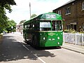 Preserved Green Bus in Essendon - geograph.org.uk - 4804387.jpg 2,592 × 1,944; 1.43 MB
-
 Public Byway - West End Lane - geograph.org.uk - 141056.jpg 640 × 480; 148 KB
-
 Public byway east from West End Lane - geograph.org.uk - 5591283.jpg 640 × 480; 219 KB
-
 Public Right of Way Through Hatfield House Estate - geograph.org.uk - 2953132.jpg 2,560 × 1,920; 2.42 MB
-

-

-
 Rape Seed and Woodland Seen From West End Lane - geograph.org.uk - 2953083.jpg 2,560 × 1,920; 1.99 MB
-
 Rear of Birchwood Cottages, Tylers Causeway, Essendon - geograph.org.uk - 6414539.jpg 1,600 × 1,067; 669 KB
-
 Rectory Close, Essendon - geograph.org.uk - 6414461.jpg 1,600 × 952; 382 KB
-
 River Lea - geograph.org.uk - 7779.jpg 640 × 480; 178 KB
-
 River Lea or Lee - geograph.org.uk - 5354427.jpg 640 × 480; 141 KB
-
 River Lee near Essendon - geograph.org.uk - 724033.jpg 640 × 480; 108 KB
-
 River Lee near Hatfield - geograph.org.uk - 208580.jpg 640 × 480; 149 KB
-
 River Lee near Woolmer's Park - geograph.org.uk - 375859.jpg 640 × 480; 121 KB
-
 River Lee seen from the bridge on the road to Letty Green - geograph.org.uk - 3443665.jpg 4,320 × 3,240; 4.81 MB
-

-
 Row of houses on Low Road, Essendon - geograph.org.uk - 4674575.jpg 2,560 × 1,920; 2.01 MB
-

-
 St Mary the Virgin, Essendon - geograph.org.uk - 3542287.jpg 700 × 1,000; 843 KB
-
 St Mary the Virgin, Essendon - geograph.org.uk - 4414499.jpg 4,320 × 3,240; 5.78 MB
-
 St Mary the Virgin, Essendon churchyard - geograph.org.uk - 3542559.jpg 710 × 1,000; 1.08 MB
-
 Stubble field off Berkhamsted Lane - geograph.org.uk - 5208179.jpg 640 × 480; 72 KB
-
 Stubble fields - geograph.org.uk - 5208173.jpg 640 × 480; 76 KB
-
 Sunset over Hertford Road - geograph.org.uk - 5610475.jpg 2,304 × 1,728; 1,023 KB
-
 Sunset over Holwell Lane - geograph.org.uk - 5612324.jpg 2,304 × 1,728; 1.27 MB
-
 The Candlestick Pub at West End. - geograph.org.uk - 35276.jpg 640 × 480; 18 KB
-
 The Candlestick pub, West End - geograph.org.uk - 4161136.jpg 2,560 × 1,920; 1.97 MB
-

-

-
 The Candlestick, West End - geograph.org.uk - 5591292.jpg 640 × 428; 87 KB
-
 The entrance to Affinity Water on Low Road - geograph.org.uk - 4540678.jpg 2,560 × 1,920; 2.04 MB
-
 The entrance to Essendon Country Club - geograph.org.uk - 4540679.jpg 2,560 × 1,920; 1.31 MB
-
 The entrance to Essendon Place - geograph.org.uk - 4065398.jpg 2,560 × 1,920; 1.45 MB
-
 The entrance to Essendon Place - geograph.org.uk - 867482.jpg 640 × 449; 104 KB
-
 The entrance to West End Farm - geograph.org.uk - 4161188.jpg 2,560 × 1,920; 1.98 MB
-
 The River Lea - geograph.org.uk - 5208211.jpg 640 × 480; 93 KB
-
 The River Lee near Woolmer's Park - geograph.org.uk - 3335800.jpg 1,024 × 768; 155 KB
-
 The road to West End - geograph.org.uk - 399989.jpg 640 × 480; 78 KB
-
 The Rose and Crown, Essendon - geograph.org.uk - 4414482.jpg 4,320 × 3,240; 2.9 MB
-
 The Rose and Crown, Essendon - geograph.org.uk - 5278708.jpg 3,456 × 4,608; 3.9 MB
-
 Tower, Essendon - geograph.org.uk - 4414475.jpg 4,320 × 3,240; 5.28 MB
-
 Track leading to farms, West End - geograph.org.uk - 4161176.jpg 2,459 × 1,918; 1.52 MB
-
 Track off Cucumber Lane - geograph.org.uk - 5208168.jpg 640 × 480; 53 KB
-
 Tylers Causeway - geograph.org.uk - 140123.jpg 640 × 480; 104 KB
-
 Upper West End Farm - geograph.org.uk - 141063.jpg 640 × 480; 95 KB
-
 Valley of Essendon Brook - geograph.org.uk - 6414479.jpg 1,600 × 1,067; 889 KB
-
 Victorian postbox on West End Lane, West End - geograph.org.uk - 5358969.jpg 2,848 × 2,136; 1.49 MB
-
 View from Holwell Lane Hertford - geograph.org.uk - 2208806.jpg 1,600 × 1,200; 550 KB
-
 View from Holwell Lane near Hertford - geograph.org.uk - 2298709.jpg 795 × 594; 159 KB
-
 View from the Lea bridge, Letty Green - geograph.org.uk - 4547463.jpg 2,560 × 1,920; 1.4 MB
-
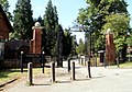
 War memorial, Essendon - geograph.org.uk - 5596066.jpg 640 × 480; 169 KB
-

-
 West End Lane - geograph.org.uk - 4161404.jpg 2,560 × 1,920; 1.66 MB
-
 West End Lane - geograph.org.uk - 4161427.jpg 2,560 × 1,920; 1.95 MB
-
 West End Lane - geograph.org.uk - 4162139.jpg 2,560 × 1,920; 1.52 MB
-
 West End Lane - geograph.org.uk - 4162236.jpg 2,482 × 1,812; 1.91 MB
-
 West End Lane - geograph.org.uk - 4162783.jpg 2,560 × 1,920; 1.93 MB
-
 West End Lane - geograph.org.uk - 5353579.jpg 640 × 480; 86 KB
-
 West End Lane - geograph.org.uk - 5595449.jpg 640 × 428; 132 KB
-
 West End Lane - geograph.org.uk - 5595461.jpg 640 × 480; 229 KB
-
 West End Lane - geograph.org.uk - 5595466.jpg 640 × 480; 175 KB
-
 West End Lane at junction of High Road Essendon - geograph.org.uk - 2323313.jpg 1,594 × 1,121; 849 KB
-
 West End Lane climbs into Essendon - geograph.org.uk - 5596043.jpg 640 × 480; 151 KB
-
 West End Lane, Essendon - geograph.org.uk - 6414466.jpg 1,600 × 960; 479 KB
-
 West End Lane, West End - geograph.org.uk - 5353591.jpg 640 × 480; 90 KB
-
 West End pumping station - geograph.org.uk - 5595479.jpg 640 × 480; 182 KB
-
 West End, West End Lane - geograph.org.uk - 724103.jpg 640 × 480; 99 KB
-
 West side of valley of Essendon Brook - geograph.org.uk - 6414487.jpg 1,600 × 1,067; 583 KB
-
 Woodfield Lane - geograph.org.uk - 5208166.jpg 640 × 480; 114 KB


_-_geograph.org.uk_-_5354419.jpg)


_-_geograph.org.uk_-_5354422.jpg)


_-_geograph.org.uk_-_5354436.jpg)


.jpg)
.jpg)
.jpg)
.jpg)
.jpg)
.jpg)
.jpg)
.jpg)
_-_geograph.org.uk_-_5354431.jpg)


_-_geograph.org.uk_-_5354433.jpg)


_-_geograph.org.uk_-_3335805.jpg)
_-_geograph.org.uk_-_5672566.jpg)


