Category:Estate Maps in the National Library of Wales
Media in category "Estate Maps in the National Library of Wales"
The following 13 files are in this category, out of 13 total.
-
 Badminton Estate map volume 3. f.68v cropped.png 2,298 × 1,122; 6.06 MB
-
 Badminton Estate map volume 3. f.75v.png 1,069 × 1,988; 6.09 MB
-
 Badminton Estate map volume 3. f.85r.png 2,715 × 3,622; 28.18 MB
-
 Badminton Estate map volume 3. The parke of Killelan f.44r.png 3,518 × 3,518; 35.47 MB
-
 Badminton Estate map volume 3. Tretwr f.68v & f.69r.png 7,079 × 3,510; 71.21 MB
-
 Gogerddan estate maps 113. 1738 survey of Estate of Walter Pryse, Llangorse.jpg 3,946 × 3,257; 6.26 MB
-
 Gogerddan estate maps 36 Llanfair Clydogau and Llanddewibrefi estates. f.25v.jpg 1,459 × 2,264; 2.39 MB
-
 Gogerddan estate maps 37 f.64r Cwmsymlog mineworks.jpg 1,642 × 2,390; 2.69 MB
-
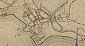
 Gogerddan Map 110, A map of the Borough of Aberystwith and Llanbadarn Fawr.jpg 3,320 × 4,477; 6.47 MB
-
 Gogerddan Map 110, A map of the Borough of Aberystwith.jpg 5,679 × 3,107; 7.65 MB
-
 Gogerddan Map 110, A map of the Borough of Llanbadarn.png 6,342 × 3,470; 37.21 MB
-
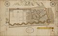 Gogerddan map 115 Gogerddan Gardens 1765.jpg 6,552 × 4,172; 9.36 MB
-
 Gogerddan map 80, Gogerddan Gardens 1765.jpg 4,379 × 2,703; 5.99 MB


