Category:Etchingham
village in the United Kingdom  | |||||
| Upload media | |||||
| Instance of | |||||
|---|---|---|---|---|---|
| Location | Rother, East Sussex, South East England, England | ||||
| Population |
| ||||
| Area |
| ||||
| Said to be the same as | Etchingham (Wikimedia duplicated page, civil parish) | ||||
| official website | |||||
 | |||||
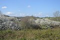
English: Etchingham is a village and civil parish in the Rother District located in East Sussex, southern England. The village is located approximately twelve miles (20 km) north-west of Hastings, on the A265, half a mile west of its junction with the A21.
Subcategories
This category has the following 8 subcategories, out of 8 total.
A
C
E
- Etchingham Methodist Chapel (4 F)
- Etchingham railway station (26 F)
- Etchingham War Memorial (2 F)
H
- Haremere Hall (2 F)
K
O
- Oasts in Etchingham (18 F)
Media in category "Etchingham"
The following 200 files are in this category, out of 563 total.
(previous page) (next page)-
 "Family" at Pashley Manor - geograph.org.uk - 4948841.jpg 480 × 640; 355 KB
-
 'gnikomS oN' - geograph.org.uk - 4300882.jpg 1,287 × 1,679; 443 KB
-
 150th anniversary of the Penny Black, Etchingham.jpg 450 × 234; 29 KB
-
 A channel of the River Rother - geograph.org.uk - 2421756.jpg 640 × 430; 68 KB
-
 A distributary of the River Rother - geograph.org.uk - 2421738.jpg 640 × 430; 63 KB
-
 A ditch in the Rother Valley - geograph.org.uk - 4189805.jpg 640 × 394; 53 KB
-
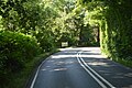
 A265 - geograph.org.uk - 2984869.jpg 640 × 430; 52 KB
-
 A265 - geograph.org.uk - 4725170.jpg 640 × 426; 73 KB
-
 A265 - geograph.org.uk - 5465285.jpg 640 × 426; 53 KB
-
 A265 - geograph.org.uk - 5904882.jpg 1,024 × 848; 131 KB
-
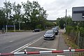
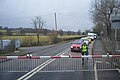
 A265 at Etchingham Level Crossing - geograph.org.uk - 3546260.jpg 640 × 430; 70 KB
-
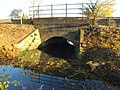
 A265 bridge, River Rother - geograph.org.uk - 3631679.jpg 640 × 430; 75 KB
-
-
 A265, Etchingham (geograph 3630354).jpg 640 × 430; 90 KB
-
 A265, Etchingham - geograph.org.uk - 3614669.jpg 640 × 430; 67 KB
-
 A265, Etchingham - geograph.org.uk - 3631667.jpg 640 × 430; 100 KB
-
 A265, Etchingham - geograph.org.uk - 3684093.jpg 640 × 430; 66 KB
-
 A265, Etchingham - geograph.org.uk - 3769110.jpg 640 × 430; 56 KB
-
 A265, Etchingham - geograph.org.uk - 4755435.jpg 640 × 426; 85 KB
-
 A265, Etchingham - geograph.org.uk - 4945906.jpg 640 × 426; 67 KB
-
 A265, Etchingham - geograph.org.uk - 5378117.jpg 640 × 426; 59 KB
-
 A265, Etchingham - geograph.org.uk - 5418319.jpg 640 × 425; 60 KB
-
 A265, Etchingham - geograph.org.uk - 5449767.jpg 640 × 426; 79 KB
-
 A265, Etchingham - geograph.org.uk - 6536366.jpg 1,024 × 684; 103 KB
-
 A265, westbound - geograph.org.uk - 4755439.jpg 640 × 426; 81 KB
-
 A265, westbound - geograph.org.uk - 4755441.jpg 640 × 426; 90 KB
-
 Access road to Lunsford Farm - geograph.org.uk - 3250916.jpg 4,288 × 3,216; 7.93 MB
-
 Alder Brook - geograph.org.uk - 5770823.jpg 640 × 480; 68 KB
-
 Ancient Field - geograph.org.uk - 5770973.jpg 640 × 476; 73 KB
-
 Approach to Squibs Farm - geograph.org.uk - 391814.jpg 428 × 640; 423 KB
-
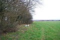
 Arable field, Rother Valley - geograph.org.uk - 3769092.jpg 640 × 430; 42 KB
-
 Assorted Steel Fabrications - geograph.org.uk - 392086.jpg 640 × 428; 168 KB
-
 Athena Farm track - geograph.org.uk - 3636264.jpg 640 × 430; 81 KB
-
 B2099 near Pashley Manor - geograph.org.uk - 2830689.jpg 2,256 × 1,496; 930 KB
-
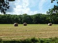 Baled hay south of Ticehurst Road - geograph.org.uk - 3094057.jpg 640 × 480; 125 KB
-
 Bales - geograph.org.uk - 4756524.jpg 640 × 426; 46 KB
-
 Banks of the Rother - geograph.org.uk - 513542.jpg 640 × 479; 154 KB
-
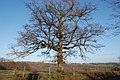 Bare tree - geograph.org.uk - 2830696.jpg 2,256 × 1,496; 917 KB
-
 Barn and Bridge Brooks - geograph.org.uk - 5771690.jpg 640 × 480; 57 KB
-
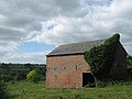
 Barn at Hillside Farm - geograph.org.uk - 5112664.jpg 3,767 × 2,513; 1.61 MB
-
 Barn in Kitchingham Farm - geograph.org.uk - 2411378.jpg 3,072 × 2,304; 1.87 MB
-
 Barn in New House Farm - geograph.org.uk - 2411348.jpg 3,072 × 2,304; 1.77 MB
-
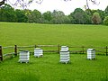 Beehives at Pashley Manor - geograph.org.uk - 4948839.jpg 640 × 480; 287 KB
-
 Bend, A265 - geograph.org.uk - 4755420.jpg 640 × 426; 101 KB
-
 Blossom - geograph.org.uk - 5418377.jpg 640 × 426; 65 KB
-
 Blossom - geograph.org.uk - 5418378.jpg 640 × 426; 83 KB
-
 Borders Farm - geograph.org.uk - 3642829.jpg 640 × 430; 61 KB
-
 Borders Farm - geograph.org.uk - 3647551.jpg 640 × 430; 70 KB
-
 Borders Farm - geograph.org.uk - 3647554.jpg 640 × 430; 101 KB
-
 Borders Farm - geograph.org.uk - 3647556.jpg 640 × 430; 71 KB
-
 Borders Lane, near Underwoods Farm - geograph.org.uk - 2549978.jpg 2,256 × 1,496; 907 KB
-
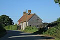
 Bracon House, Etchingham - geograph.org.uk - 1747175.jpg 640 × 426; 73 KB
-
 Brands - geograph.org.uk - 3630417.jpg 640 × 430; 143 KB
-
 Bridge Brook-Broomy Field - geograph.org.uk - 5770815.jpg 640 × 480; 61 KB
-
 Bridge on Church Hill - geograph.org.uk - 1205422.jpg 640 × 480; 93 KB
-
 Bridleway beside Quarryfield Wood - geograph.org.uk - 2411387.jpg 3,072 × 2,304; 1.64 MB
-
 Bridleway to Kitchingham Farm - geograph.org.uk - 2411367.jpg 3,072 × 2,304; 1.89 MB
-
 Bridleway to Kitchingham Farm - geograph.org.uk - 2411407.jpg 3,072 × 2,304; 1.56 MB
-
 Bridleway to London Barn Farm - geograph.org.uk - 3070427.jpg 480 × 640; 160 KB
-
 Burgh Hill - geograph.org.uk - 3633092.jpg 640 × 430; 110 KB
-
 Burgh Hill - geograph.org.uk - 3633095.jpg 640 × 430; 88 KB
-
 Burgh Hill, Hurst Green, East Sussex - geograph.org.uk - 1067714.jpg 640 × 427; 119 KB
-
 Burgh Wood - geograph.org.uk - 3632698.jpg 640 × 430; 136 KB
-
 Burgh Wood - geograph.org.uk - 3632711.jpg 640 × 430; 150 KB
-
 Burgham Oast House - geograph.org.uk - 4360490.jpg 427 × 640; 82 KB
-
 Bus stop, Etchingham, East Sussex - geograph.org.uk - 2520242.jpg 1,600 × 1,200; 777 KB
-
 Bush in a ditch - geograph.org.uk - 5418315.jpg 640 × 426; 46 KB
-
 Bushes by the railway - geograph.org.uk - 5408442.jpg 640 × 426; 59 KB
-
 Buttercup Meadow - geograph.org.uk - 3630369.jpg 640 × 430; 112 KB
-
 Buttercup Meadow - geograph.org.uk - 3631706.jpg 640 × 430; 106 KB
-
 Buttercup Meadow - geograph.org.uk - 3631748.jpg 640 × 430; 113 KB
-
 Calves Lodge Meadow-Horse Brook - geograph.org.uk - 5771798.jpg 640 × 480; 74 KB
-
 Car park for Etchingham Railway Station - geograph.org.uk - 2520241.jpg 1,024 × 698; 143 KB
-
 Car park, Etchingham Station - geograph.org.uk - 2984868.jpg 640 × 430; 68 KB
-
 Car park, Etchingham Station - geograph.org.uk - 3631664.jpg 640 × 430; 69 KB
-
 Cattle grazing in the Rother Valley - geograph.org.uk - 3684104.jpg 640 × 430; 49 KB
-
 Cattle in the Rother Valley - geograph.org.uk - 2634908.jpg 640 × 430; 38 KB
-
 Cattle, Rother floodplain - geograph.org.uk - 3631711.jpg 640 × 430; 82 KB
-
 Church Brook - geograph.org.uk - 5770805.jpg 640 × 480; 83 KB
-
 Church Hill Bridge - geograph.org.uk - 2411326.jpg 3,072 × 2,304; 3.17 MB
-

-
 Church Hill road bridge - geograph.org.uk - 2411279.jpg 3,072 × 2,304; 2.23 MB
-
 Church Hill, Etchingham - geograph.org.uk - 2137662.jpg 4,320 × 3,240; 4.51 MB
-
 Church Wood - geograph.org.uk - 3630372.jpg 640 × 430; 65 KB
-
 Church Wood - geograph.org.uk - 3630381.jpg 640 × 430; 96 KB
-
 Churchwood Farmhouse - geograph.org.uk - 3630383.jpg 640 × 430; 58 KB
-
 Churchwood Farmhouse - geograph.org.uk - 3630386.jpg 640 × 430; 68 KB
-
 Cinderbanks Oast, Burgham - geograph.org.uk - 5771680.jpg 640 × 480; 105 KB
-
 Clapson's Bridge near Willard's Hill - geograph.org.uk - 1507467.jpg 640 × 480; 97 KB
-
 Climbing Burgh Hill - geograph.org.uk - 3632692.jpg 640 × 430; 125 KB
-
 Coppiced trees in Gigmore Wood - geograph.org.uk - 1107500.jpg 640 × 430; 120 KB
-
 Cottage near Lundsford Farm - geograph.org.uk - 2421734.jpg 640 × 430; 61 KB
-
 Cottage, Fontridge Lane - geograph.org.uk - 3636278.jpg 640 × 430; 121 KB
-

-
 Cows lying down on a murky morning - geograph.org.uk - 4156827.jpg 640 × 480; 52 KB
-
 Crop Field by driveway to Squib's Farm - geograph.org.uk - 2548987.jpg 2,256 × 1,496; 916 KB
-
 Crop Fields near Squibs Farm - geograph.org.uk - 2548969.jpg 2,256 × 1,496; 918 KB
-
 Daisy footpath to New House Farm - geograph.org.uk - 2411363.jpg 3,072 × 2,304; 3 MB
-
 Departing Etchingham - geograph.org.uk - 4301529.jpg 4,000 × 3,000; 2.5 MB
-
-
-
 Ditch in the Rother Valley - geograph.org.uk - 4756514.jpg 640 × 426; 53 KB
-
 Drain and footpath towards the railway line - geograph.org.uk - 2821139.jpg 2,256 × 1,496; 913 KB
-
 Drain in the Rother Valley - geograph.org.uk - 3509953.jpg 640 × 430; 58 KB
-
 Drain under the Railway - geograph.org.uk - 4318967.jpg 640 × 480; 125 KB
-
 Dudwell Valley - geograph.org.uk - 3642818.jpg 640 × 430; 69 KB
-
 Dudwell Valley - geograph.org.uk - 3642822.jpg 640 × 430; 59 KB
-
-
 Entering Etchingham - geograph.org.uk - 3631686.jpg 640 × 430; 86 KB
-
 Entering Etchingham along the A265 - geograph.org.uk - 1106218.jpg 640 × 430; 89 KB
-
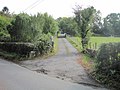
 Entrance off Fysie Lane - geograph.org.uk - 3632683.jpg 640 × 430; 105 KB
-
 Entrance to Brookside farm - geograph.org.uk - 1498779.jpg 640 × 480; 91 KB
-
 Entrance to Burgh Wood - geograph.org.uk - 2222854.jpg 2,304 × 3,072; 2.58 MB
-
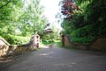
 Entrance to Fontridge Manor - geograph.org.uk - 3636285.jpg 640 × 430; 108 KB
-
 Etchingham - geograph.org.uk - 3630375.jpg 640 × 430; 69 KB
-
 Etchingham - geograph.org.uk - 3630376.jpg 640 × 430; 77 KB
-
 Etchingham Church - geograph.org.uk - 3630377.jpg 640 × 430; 60 KB
-
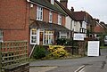
 Etchingham Community Stores - geograph.org.uk - 1747174.jpg 640 × 426; 92 KB
-
 Etchingham Community Stores, High Street - geograph.org.uk - 513582.jpg 640 × 479; 133 KB
-
 Etchingham Community Stores.jpg 230 × 148; 34 KB
-
 Etchingham from Burgh Hill.JPG 3,072 × 2,304; 2.25 MB
-
 Etchingham level crossing - geograph.org.uk - 1106459.jpg 640 × 430; 85 KB
-
 Etchingham Level Crossing - geograph.org.uk - 4300885.jpg 2,420 × 2,000; 1.08 MB
-
 Etchingham Level Crossing - geograph.org.uk - 4755424.jpg 640 × 426; 79 KB
-
 Etchingham Level Crossing - geograph.org.uk - 5233874.jpg 640 × 432; 45 KB
-
 Etchingham Post Office - geograph.org.uk - 1106269.jpg 640 × 430; 59 KB
-
 Etchingham Post Office - geograph.org.uk - 3093782.jpg 640 × 480; 112 KB
-
 Etchingham Primary School - geograph.org.uk - 5112655.jpg 6,196 × 2,852; 3.82 MB
-
 Etchingham Primary School - geograph.org.uk - 5112656.jpg 4,000 × 2,679; 1.99 MB
-
 Etchingham Primary School - geograph.org.uk - 5112657.jpg 3,846 × 2,568; 2.06 MB
-
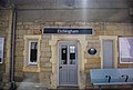
 Etchingham railway station - geograph.org.uk - 4036295.jpg 1,600 × 1,184; 462 KB
-
 Etchingham railway station - geograph.org.uk - 4036303.jpg 1,600 × 1,174; 393 KB
-
 Etchingham Station - geograph.org.uk - 3684096.jpg 640 × 430; 59 KB
-
 Etchingham Station - geograph.org.uk - 4725165.jpg 640 × 426; 46 KB
-
 Etchingham Station - geograph.org.uk - 4725167.jpg 640 × 426; 53 KB
-
 Etchingham Station - geograph.org.uk - 4756501.jpg 640 × 426; 79 KB
-
 Etchingham Station - geograph.org.uk - 5260188.jpg 640 × 426; 46 KB
-
 Etchingham Station - geograph.org.uk - 5378109.jpg 640 × 426; 81 KB
-
 Etchingham Station - geograph.org.uk - 5818320.jpg 1,024 × 681; 239 KB
-
 Etchingham Station - geograph.org.uk - 6013192.jpg 4,000 × 3,000; 1 MB
-
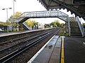
 Etchingham station from the footbridge - geograph.org.uk - 3552176.jpg 3,473 × 2,797; 1,002 KB
-
 Etchingham Station sign - geograph.org.uk - 4725168.jpg 640 × 426; 60 KB
-
 Etchingham Stores - geograph.org.uk - 3630351.jpg 640 × 430; 64 KB
-
 Etchingham Stores - geograph.org.uk - 4755430.jpg 640 × 426; 80 KB
-
 Etchingham Village Sign - geograph.org.uk - 3251571.jpg 3,043 × 3,899; 7.78 MB
-
 EtchinghamVillageHall.jpg 3,234 × 2,426; 608 KB
-
-
 Farm Equipment - geograph.org.uk - 4360495.jpg 640 × 427; 137 KB
-
 Farmland by Fontridge Lane - geograph.org.uk - 3630409.jpg 640 × 430; 91 KB
-
 Farmland by the Hastings Line - geograph.org.uk - 3614928.jpg 640 × 341; 38 KB
-
 Farmland by the Hastings Line - geograph.org.uk - 3614930.jpg 640 × 430; 54 KB
-
 Farmland east of Turze Farm - geograph.org.uk - 2475941.jpg 640 × 430; 53 KB
-
 Farmland in the Rother Valley - geograph.org.uk - 2421706.jpg 640 × 430; 43 KB
-
 Farmland in the Rother Valley - geograph.org.uk - 3769130.jpg 640 × 430; 55 KB
-
 Farmland, Rother Valley - geograph.org.uk - 6536372.jpg 1,024 × 684; 91 KB
-
 Farmland, Rother Valley - geograph.org.uk - 6536374.jpg 1,024 × 960; 169 KB
-
 Field above Myskins - geograph.org.uk - 2892200.jpg 3,872 × 2,592; 3.87 MB
-
 Field by Limden Wood - geograph.org.uk - 2965869.jpg 640 × 430; 104 KB
-
 Field near Borders Farm - geograph.org.uk - 3647552.jpg 640 × 430; 67 KB
-
 Field near Sheepstreet Lane - geograph.org.uk - 5112674.jpg 4,000 × 3,000; 2.95 MB
-
 Field off Sheepstreet Lane - geograph.org.uk - 3057891.jpg 2,256 × 1,496; 899 KB
-
 Field on the edge of Forge Wood - geograph.org.uk - 2821128.jpg 2,256 × 1,496; 915 KB
-
-
 Flat farmland in the Rother Valley - geograph.org.uk - 2984878.jpg 640 × 430; 23 KB
-
 Fleet Wood - geograph.org.uk - 5770905.jpg 480 × 640; 166 KB
-
 Fleet Wood Meadow-Crab Tree Meadow - geograph.org.uk - 5770926.jpg 640 × 480; 48 KB
-
 Flodplain of the River Rother - geograph.org.uk - 3631719.jpg 640 × 430; 77 KB
-
 Flodplain of the River Rother - geograph.org.uk - 3631728.jpg 640 × 430; 89 KB
-
 Flood plain of the River Rother - geograph.org.uk - 1106496.jpg 640 × 430; 52 KB
-
 Floodplain of the River Rother - geograph.org.uk - 4319139.jpg 640 × 480; 63 KB
-
 Fontbridge Lane - geograph.org.uk - 3251643.jpg 4,288 × 3,216; 7.53 MB
-
 Fontridge Lane - geograph.org.uk - 3630404.jpg 640 × 430; 109 KB
-
 Fontridge Lane - geograph.org.uk - 3630405.jpg 640 × 430; 82 KB
-
 Fontridge Lane - geograph.org.uk - 3630407.jpg 640 × 430; 80 KB
-
 Fontridge Lane - geograph.org.uk - 3630411.jpg 640 × 430; 113 KB
-
 Fontridge Lane - geograph.org.uk - 3630415.jpg 640 × 430; 114 KB
-
 Fontridge Lane - geograph.org.uk - 3636262.jpg 640 × 430; 96 KB
-
-
 Footbridge near Park Wood - geograph.org.uk - 2413493.jpg 3,072 × 2,304; 2.06 MB
-
 Footbridge over River Limden - geograph.org.uk - 2222843.jpg 3,072 × 2,304; 3.22 MB
-
 Footbridge over River Limden - geograph.org.uk - 2413510.jpg 3,072 × 2,304; 2.68 MB
-
 Footpath crosses Fysie Lane - geograph.org.uk - 2222848.jpg 3,072 × 2,304; 2.7 MB
-
 Footpath from Fysie Lane - geograph.org.uk - 5113047.jpg 4,608 × 3,456; 3.35 MB
-
 Footpath from Fysie Lane - geograph.org.uk - 5113054.jpg 4,608 × 3,456; 3.28 MB
-
 Footpath leading from Sheepstreet Lane - geograph.org.uk - 5113018.jpg 4,608 × 3,456; 3.33 MB
-
 Footpath off Fysie Lane - geograph.org.uk - 3632674.jpg 640 × 430; 133 KB
-
 Footpath through hedge - geograph.org.uk - 3642814.jpg 640 × 430; 91 KB
-
 Footpath through Pond Bay near Burgh Down Wood - geograph.org.uk - 2222828.jpg 3,072 × 2,304; 3.49 MB
-
 Footpath to Fysie Lane - geograph.org.uk - 2222845.jpg 3,072 × 2,304; 2.59 MB
-
 Footpath to Fysie Lane - geograph.org.uk - 3631731.jpg 640 × 430; 77 KB
-
 Footpath to Gigmore Wood - geograph.org.uk - 2548980.jpg 640 × 424; 77 KB
-
 Footpath to New House Farm - geograph.org.uk - 5113031.jpg 4,608 × 3,456; 3.34 MB
-
 Footpath to Oxenbridge Lane - geograph.org.uk - 3630363.jpg 640 × 430; 79 KB
-
 Footpath to Oxenbridge Lane - geograph.org.uk - 3630365.jpg 640 × 430; 80 KB
-
 Footpath to Oxenbridge Lane - geograph.org.uk - 3630380.jpg 640 × 430; 93 KB
-
 Footpath to Squibs Farm - geograph.org.uk - 3630399.jpg 640 × 430; 57 KB
-
 Footpath to Ticehurst - geograph.org.uk - 5770942.jpg 480 × 640; 74 KB
-
 Forge Brook - geograph.org.uk - 5770851.jpg 640 × 480; 72 KB
-
 Forge Cottage - geograph.org.uk - 3636258.jpg 640 × 430; 72 KB
-
 Forge Hop Garden - geograph.org.uk - 5771817.jpg 640 × 467; 52 KB


.jpg)


