Category:European exploration of New Zealand
| NO WIKIDATA ID FOUND! Search for European exploration of New Zealand on Wikidata | |
| Upload media |
Subcategories
This category has the following 5 subcategories, out of 5 total.
Media in category "European exploration of New Zealand"
The following 32 files are in this category, out of 32 total.
-
 AMH-5546-NA Map showing the journeys of Abel Tasman.jpg 2,400 × 1,871; 693 KB
-
 AMH-7220-KB Map showing the route taken by Abel Tasman.jpg 2,400 × 1,580; 534 KB
-
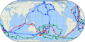
 Approximate route of third voyage of Captain Cook (animated).gif 800 × 401; 44 KB
-

-

-
 Bay of Islands New Zealand (by Captain James Cook, 1773).jpg 1,412 × 1,452; 1.41 MB
-
 Chart of Mercury Bay by Richard Pickersgill (1769).jpg 908 × 709; 121 KB
-
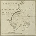 Chart of Tolaga Bay New Zealand (by Captain James Cook, 1773).jpg 1,416 × 1,412; 1.36 MB
-
 Cook 1.gif 800 × 401; 46 KB
-
 Cook 2.gif 800 × 401; 47 KB
-
 Cook chart of New Zealand.jpg 1,093 × 1,508; 301 KB
-
 Cook New Zealand South Cape.jpg 800 × 618; 127 KB
-
 Cook new zealand.jpg 861 × 1,024; 307 KB
-
 Cook Three Voyages 59.png 800 × 401; 273 KB
-

-
 Cook'sFirstVoyage54.png 800 × 401; 236 KB
-
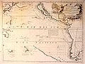
 Cook-map.jpg 630 × 288; 24 KB
-
-

-
 Gilsemans 1642.jpg 2,960 × 1,924; 1.22 MB
-
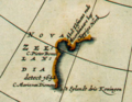
 Isaac Gilsemans Three Kings Islands PUBL-0105-004.jpg 3,266 × 3,827; 2.2 MB
-
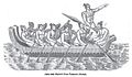 Maori canoe Tasman.jpg 1,166 × 683; 461 KB
-
 NL-HaNA 1.11.01.01 121 0051 Scheepsjournaal Abel Tasman 15.jpg 2,992 × 1,948; 1.36 MB
-
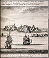
 Ontdekking van Nieuw-Zeeland door Abel Tasman (3382029850).jpg 2,000 × 1,367; 1.15 MB
-
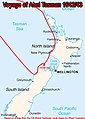
 Tasman's track.jpg 800 × 535; 40 KB
-
 Tasman1642.jpg 323 × 454; 33 KB
-
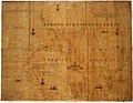 TasmanMap.jpg 1,400 × 1,081; 1.33 MB
-
 Tasmanmap1644.jpg 3,236 × 2,516; 2.83 MB
-
 Tasmanroutes.PNG 600 × 455; 57 KB
-
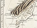
 Three Kings Islands 1643.jpg 400 × 464; 25 KB
-
 Three Kings Islands-Abel Tasman 1642.jpg 960 × 736; 97 KB
-
 Vincenzo Coronelli00.jpg 902 × 678; 194 KB


.gif)
_auch_Polynesien_oder_Inselwelt,_insgemein_der_f%C3%BCnfte_Welttheil_genannt_-_UvA-BC_OTM_HB-KZL_69_11_05.jpg)
_auch_Polynesien_oder_Inselwelt,_insgemein_der_f%C3%BCnfte_Welttheil_genannt_-_UvA-BC_OTM_HB-KZL_101.20.02.jpg)
.jpg)
.jpg)
.jpg)


.jpg)


