Category:Evron, Israel
| Object location | | View all coordinates using: OpenStreetMap |
|---|
kibbutz in Israel  | |||||
| Upload media | |||||
| Instance of | |||||
|---|---|---|---|---|---|
| Location | Mateh Asher Regional Council, Acre Subdistrict, Northern District, Israel | ||||
| Inception |
| ||||
| Population |
| ||||
| Elevation above sea level |
| ||||
| official website | |||||
 | |||||
Media in category "Evron, Israel"
The following 41 files are in this category, out of 41 total.
-
 Evron-745.jpg 5,472 × 3,057; 2.31 MB
-
 Evron-748.jpg 5,159 × 3,133; 2.32 MB
-
 Evron-749.jpg 4,302 × 3,648; 1.84 MB
-
 Evron-750.jpg 3,648 × 5,472; 2.45 MB
-
 Evron-755.jpg 3,648 × 5,472; 4.87 MB
-
 Evron-757.jpg 5,472 × 3,648; 3.01 MB
-
 Evron-758.jpg 4,279 × 3,613; 2.87 MB
-
 Evron-760.jpg 5,472 × 3,648; 4.49 MB
-
 Evron-762.jpg 2,840 × 5,098; 3.08 MB
-
 Evron-767.jpg 5,472 × 3,648; 3.76 MB
-
 Evron-769.jpg 5,472 × 3,648; 4.67 MB
-
 Evron-771.jpg 5,472 × 1,876; 1.97 MB
-
 Evron-772.jpg 5,472 × 3,648; 4.77 MB
-
 Evron-774.jpg 5,050 × 3,474; 1.83 MB
-
 Evron-776.jpg 5,472 × 3,648; 4.45 MB
-
 Evron-779.jpg 5,084 × 2,518; 3.12 MB
-
 Evron-781.jpg 4,795 × 3,132; 3.83 MB
-
 Evron-784.jpg 5,043 × 3,365; 3.86 MB
-
 Evron-788.jpg 5,472 × 3,648; 4.38 MB
-
 Evron-792.jpg 5,472 × 3,648; 4.43 MB
-
 Evron-794.jpg 5,472 × 3,648; 2.16 MB
-
 Evron-796.jpg 5,247 × 3,260; 3.7 MB
-
 Evron-798.jpg 5,472 × 3,648; 3.03 MB
-
 Evron-800.jpg 5,472 × 3,648; 3.52 MB
-
 Evron-803.jpg 5,467 × 3,427; 3.89 MB
-
 Evron-805.jpg 5,472 × 3,648; 3.73 MB
-
 Evron-807.jpg 3,648 × 5,472; 3.94 MB
-
 Evron-808.jpg 3,648 × 5,472; 3.49 MB
-
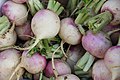 דוכן לפת בשוק.jpg 5,184 × 3,456; 5.77 MB
-
 דוכן תפוחי אדמה.jpg 5,184 × 3,456; 6.5 MB
-
 עברון - הסנדלריה.-JNF036506.jpeg 567 × 567; 49 KB
-
-
 קיבוץ עברון - ברושים.jpg 1,600 × 900; 190 KB
-
 קיבוץ עברון - המבנה המרכזי.jpg 1,600 × 900; 186 KB
-
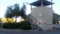 קיבוץ עברון - המגדל.jpg 1,600 × 900; 195 KB
-
 קיבוץ עברון - השלט בכניסה.jpg 900 × 1,600; 195 KB
-
 קיבוץ עברון - חנייה לאופניים.jpg 1,600 × 900; 266 KB
-
 קיבוץ עברון - חצר בית פרטי.jpg 1,600 × 900; 325 KB
-
 קיבוץ עברון - יום שישי בין ערביים.jpg 1,600 × 900; 348 KB
-
 קיבוץ עברון - עצים.jpg 1,600 × 900; 225 KB
-
 שביל בקיבוץ עברון.jpg 1,600 × 900; 262 KB


