Category:Expositurkirche Zöblen
| Object location | | View all coordinates using: OpenStreetMap |
|---|
| This category shows the protected monument with the number 65057 in Austria. (Commons, de, Wikidata) |
|
This category shows the remarkable cultural object in the Austrian state of Tyrol listed by the Tyrolean Art Cadastre with the ID
28359. (on tirisMaps, pdf, more images on Commons, Wikidata) |
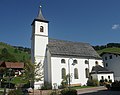
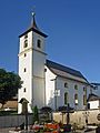
church in Zöblen, Austria  | |||||
| Upload media | |||||
| Instance of | |||||
|---|---|---|---|---|---|
| Named after | |||||
| Location | Zöblen, Reutte district, Tyrol, Austria | ||||
| Street address |
| ||||
| Heritage designation | |||||
 | |||||
Subcategories
This category has the following 2 subcategories, out of 2 total.
F
- Friedhof Zöblen (2 F)
I
Media in category "Expositurkirche Zöblen"
The following 8 files are in this category, out of 8 total.
-
 ZoeblenPfarrkirche1631.jpg 1,500 × 1,188; 917 KB
-
 ZoeblenPfarrkirche1634.jpg 1,374 × 1,000; 391 KB
-
 Zöblen - panoramio (3).jpg 2,120 × 2,816; 1.06 MB
-
 Zöblen - panoramio (8).jpg 2,816 × 2,120; 1.49 MB
-
 Zöblen-Josefskirche-1.jpg 1,920 × 2,560; 1.61 MB
-
 Zöblen-Josefskirche-2.jpg 1,620 × 2,160; 1.31 MB
-
 ZöblenKirche.jpg 1,528 × 1,436; 229 KB
-
 ZöblenKircheHinten.jpg 1,880 × 1,484; 343 KB

.jpg)
.jpg)


