Category:Fási-kert tanösvény
English:
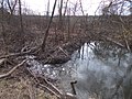
- Fási Garden Environmental Learning Trail. Named after Gábor Fási. Opened 2022-10-05. The educational trail was created on the initiative of the Bonifác Foundation established by the parents of Bagi and the Dózsa György House of Culture and Library with the money of the European Union as a program of the Hungarian Village Program Village Civil Fund (id: FCA-KP-1-2021/1). There were once several water mills in the area. Crab was also fished from the Egres-patak (lit. Gooseberry Creek), which was also served in the tavern in Kisbag, NW outskirt of Bag. During the construction of St. John's Mill (in the 1940s of the 1930s, call as Blacksmith's Mill), the water from the creek was diverted into a canal called the Millers. During the 1940s, the lake here was used for beach skating. During the construction of the gas station, the pond was filled up. When the highway was built, the Gooseberry Creek was diverted into a paved bed. Information board about local birds, mammals, trees: bee eater (Merops apiaster), white stork (Ciconia ciconia), great tit (Parus major), black ruststart (Phoenicurus ochruros), barn swallow (Hirundo rustica), European robin (Erithacus rubecula), common kestrel (Falco tinnunculus); about the Eurasian beaver; about common/red squirrel (Sciurus vulgaris), common badger (Meles meles), wild boar (Sus scrofa), European hare (Lepus europaeus), European hedgehog (Erinaceus europaeus), European roe deer (Capreolus capreolus), greater mouse-eared bat (Myotis myotis), red fox (Vulpes vulpes); silver poplar (Populus alba), common walnut (Juglans regia), Norway maple (Acer platanoides), European horse chestnut (Aesculus) Info: Lajos Horváth (1938-): Bag's story /Year of publication: 1982/ "the future is either green or nothing" (Gábor Fási) +info: local information boards - Dózsa György Road (Road 3105), Bag, Pest County, Hungary.
Magyar:
Fási-kert Környezetvédelmi Tanösvény. Ünnepélyes átadása 2022. október 5-én volt.. A tanösvény a bagi szülők által létrehozott Bonifác Alapítvány és a Dózsa György Művelődési Ház és Könyvtár kezdeményezésére az Európai Unió pénzéből a Magyar Falu Program Falusi Civil Alap (azonosító: FCA-KP-1-2021/1 ) programjaként készült. A területen egykor több vizimalom is volt Az Egres-patakból rákot is halásztak melyet a kisbagi csárdában is felszolgáltak. A Szent János malom (az 1930-as évek 40-es években Kovácsék-malma, Turbina Malom, egy régi fotón: Henger Malom szerepel) építésekor a patak vízét a Malomárok nevű csatornába terelték. Az 1940-es évek idején az itt található tavat strandolásra korcsolyázásra használták. A benzinkút építésekor a tavat feltöltötték. Az autópálya építésekor az Egres-patakot kikövezett mederbe terelték. Bag nagyközség birtokrészletezési vázlatán (20. sz. eleje?) É-D ill. Ny-K irányban a következők szerepenek: Diósberek, Csintovány, Császárút, Malom, Peres, Galgavölgy, Rétszél, Árokalja, Kertalja, Kistatárülés, Nagytatárülés, Bag, Vadaskert, Kis-Bag puszta, Rókalyuk, Százöles, Kereszt dülő, Keresztfa dülő, Tatárülés alatt, Gyertyános, Erdei földek, Oroszló, Farkaslyuk, Tálasvölgy, Hatyagvölgy, Nagyvölgy, Csigahegy - Info: Horváth Lajos (1938-): Bag története /Kiadás éve: 1982/ "a jövő vagy zöld, vagy semmilyen " (Fási Gábor) + info: tájékoztató tábla - Pest megye, Bag, Dózsa György út (3105-ös mellékút) mentén
| Object location | | View all coordinates using: OpenStreetMap |
|---|
Media in category "Fási-kert tanösvény"
The following 22 files are in this category, out of 22 total.
-
 Baumstämme und Seile, Lehrpfad, 2023 Bag.jpg 1,704 × 2,272; 1.64 MB
-
 Egresbach, Lehrpfad, 2023 Bag.jpg 2,272 × 1,704; 972 KB
-
 Lehrpfad von Strasse 3105 Brücke, 2023 Bag.jpg 2,272 × 1,704; 1,011 KB
-
 Lehrpfad, Baum, Egresbach, 2023 Bag.jpg 2,272 × 1,704; 971 KB
-
 Lehrpfad, Egresbach W, 2023 Bag.jpg 1,704 × 2,272; 1.48 MB
-
 Lehrpfad, Gefrorener Graben, 2023 Bag.jpg 1,704 × 2,272; 1.63 MB
-
 Lehrpfad, Graben, Seilgeländer, 2023 Bag.jpg 1,704 × 2,272; 1.76 MB
-
 Lehrpfad, Holzbrücke und Tor, 2023 Bag.jpg 2,272 × 1,704; 994 KB
-
 Lehrpfad, Holzbrücke, 2023 Bag.jpg 2,272 × 1,704; 982 KB
-
 Lehrpfad, Hopse und Hickeln, 2023 Bag.jpg 1,704 × 2,272; 1.68 MB
-
 Lehrpfad, Hütte, Bänke und Tische, 2023 Bag.jpg 2,272 × 1,704; 1,006 KB
-
 Lehrpfad, Süd, 2023 Bag.jpg 2,272 × 1,704; 1,001 KB
-
 Lehrpfad, Tafel 'Auf der Suche nach Säugetieren', 2023 Bag.jpg 2,272 × 1,704; 953 KB
-
 Lehrpfad, Tafel 'Die Riesen des Fási-gartens', 2023 Bag.jpg 2,272 × 1,704; 1,006 KB
-
 Lehrpfad, Tafel 'Eroberer der Uferpromenaden', 2023 Bag.jpg 2,272 × 1,704; 1,020 KB
-
 Lehrpfad, Tafel 'Unsere vielfältigen Vögel', 2023 Bag.jpg 1,704 × 2,272; 1.66 MB
-
 Lehrpfad, Tafel 1, 2023 Bag.jpg 2,272 × 1,704; 969 KB
-
 Lehrpfad, Tierbilder Baum, 2023 Bag.jpg 1,704 × 2,272; 1.8 MB
-
 Lehrpfad, Toter Baum, 2023 Bag.jpg 2,272 × 1,704; 993 KB
-
 Lehrpfad, Vogelhaus, 2023 Bag.jpg 1,704 × 2,272; 1.43 MB
-
 Lehrpfad, Wegweiser S, 2023 Bag.jpg 1,704 × 2,272; 1.7 MB
-
 Lehrpfad, Wegweiser, 2023 Bag.jpg 1,704 × 2,272; 1.58 MB


