Category:FFH-Gebiet Innauen und Leitenwälder
| Diese Kategorie repräsentiert ein Schutzgebiet nach Naturschutzrecht in Deutschland. |
|---|
| Diese Kategorie wurde nach einem klaren Schema angelegt, sie sollte nicht verschoben, gelöscht oder umkategorisiert werden. Sie ist unter anderem in dieser Uploadkarte hinterlegt. Beschreibung und Hintergründe auf der Seite des Wikiprojekts |
| Foto zu Wiki Loves Earth hochladen! - Seite von Wiki Loves Earth Deutschland |
protected area in the European Union defined by the habitats directive in Bayern, Germany  | |||||
| Upload media | |||||
| Instance of | |||||
|---|---|---|---|---|---|
| Location | |||||
| Applies to jurisdiction | |||||
| Inception |
| ||||
| Area |
| ||||
 | |||||
Deutsch: FFH-Gebiet „Innauen und Leitenwälder“ (7939-301) in den Landkreisen Rosenheim und Mühldorf am Inn, Oberbayern.
Subcategories
This category has the following 3 subcategories, out of 3 total.
Media in category "FFH-Gebiet Innauen und Leitenwälder"
The following 13 files are in this category, out of 13 total.
-
 Aerials Bavaria 16.06.2006 09-09-42.jpg 2,048 × 1,536; 2.82 MB
-
 Auenwald-bei-Mühdorf-DSCN0260-WDPA-555522076-Muehldorf-BR-48.2419-LG-12.5180.jpg 4,896 × 3,672; 4.4 MB
-
 Biberschaden (13031744614).jpg 4,096 × 2,731; 2.04 MB
-
 Biberschaden, Biberverbiss (13031512175) (2).jpg 4,096 × 2,731; 1.69 MB
-
 Biberschaden, Biberverbiss (13031533015).jpg 4,096 × 2,731; 3.12 MB
-
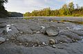
 Kiesbank 1 LSG-00169.01 FFH Gebiet 7939-301.jpg 4,928 × 3,264; 3.83 MB
-
 Kiesbank 2 LSG-00169.01 FFH Gebiet 7939-301.jpg 4,928 × 3,264; 3.68 MB
-
 Kiesbank 3 LSG-00169.01 FFH Gebiet 7939-301.jpg 4,928 × 3,264; 3.19 MB
-
 Lwk-teufelsbruck.jpg 800 × 443; 177 KB
-
 Sandduene 1 LSG-00169.01 FFH Gebiet 7939-301.jpg 4,928 × 3,264; 2.64 MB
-
 Sandduene 2 LSG-00169.01 FFH Gebiet 7939-301.jpg 4,928 × 3,264; 3.5 MB
-
 Wasserburg Innbrücke 4.JPG 2,592 × 1,944; 993 KB
-
 Wasserburg Innenstadt Aerial.jpg 872 × 654; 215 KB


.jpg)
_(2).jpg)
.jpg)


