Category:Faddiley
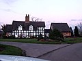
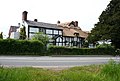
English: Faddiley is a small village (at SJ 590 530) and civil parish in the unitary authority of Cheshire East and the ceremonial county of Cheshire, England. The village is located 4 miles to the west of Nantwich. The parish also includes the small settlements of Larden Green and Woodhey or Woodhey Green, with a total population of a little over 150. Nearby villages include Brindley, Burland, Chorley, Haughton and Ravensmoor.
village and civil parish in Cheshire East, England  | |||||
| Upload media | |||||
| Instance of | |||||
|---|---|---|---|---|---|
| Location | Cheshire East, Cheshire, North West England, England | ||||
| Population |
| ||||
 | |||||
Subcategories
This category has the following 2 subcategories, out of 2 total.
W
- Woodhey Chapel (4 F)
- Woodhey Cross (2 F)
Media in category "Faddiley"
The following 42 files are in this category, out of 42 total.
-
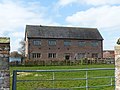
 Barn south of Woodhey Hall.jpg 4,000 × 3,000; 1.74 MB
-
 Bend in Nantwich Road, Boterleyhill - geograph.org.uk - 5193048.jpg 640 × 480; 114 KB
-
 Close up, Elizabeth II postbox, Larden Green - geograph.org.uk - 5194577.jpg 989 × 1,653; 326 KB
-
 Cooks Pit Farm Faddiley.jpg 640 × 470; 123 KB
-
 Dragon's Cottage, Faddiley.jpg 4,103 × 3,138; 7.16 MB
-
 Elizabeth II postbox, Larden Green - geograph.org.uk - 5194576.jpg 2,848 × 2,136; 1.15 MB
-
 Entering Faddiley - geograph.org.uk - 5225386.jpg 640 × 480; 58 KB
-
 Dragon's Cottage, Faddiley - geograph.org.uk - 823064.jpg 640 × 405; 121 KB
-
 Roadside cottage - geograph.org.uk - 126331.jpg 640 × 480; 45 KB
-
 Faddiley - Old Cart House.jpg 640 × 464; 146 KB
-
 Farm building, Hollywell House Farm - geograph.org.uk - 5225381.jpg 640 × 480; 62 KB
-
 Farm track (footpath), Bank Farm - geograph.org.uk - 5225361.jpg 640 × 480; 107 KB
-
 Goodwill Hall, Faddiley - geograph.org.uk - 823359.jpg 640 × 363; 114 KB
-
 Grazing south of Wrexham Road (A534) - geograph.org.uk - 5225377.jpg 640 × 480; 50 KB
-
 Grazing, Botterleyhill - geograph.org.uk - 5193046.jpg 640 × 480; 75 KB
-
 Grazing, Faddiley Bank - geograph.org.uk - 5225356.jpg 640 × 480; 61 KB
-
 House on Willbank Lane, Faddiley - geograph.org.uk - 5225345.jpg 640 × 480; 60 KB
-
 Nantwich Road - geograph.org.uk - 5193049.jpg 640 × 480; 121 KB
-
 Nantwich Road - geograph.org.uk - 5829346.jpg 1,024 × 768; 113 KB
-
 Nantwich Road, - geograph.org.uk - 5193045.jpg 640 × 480; 89 KB
-
 Nantwich Road, Gradeley Green - geograph.org.uk - 5193053.jpg 640 × 480; 111 KB
-
 New Houses, Faddiley Bank - geograph.org.uk - 5225365.jpg 640 × 480; 69 KB
-
 Newly thatched Thatch Inn, Faddiley - geograph.org.uk - 823341.jpg 640 × 434; 149 KB
-
 Old signpost on the A534 at Faddiley - geograph.org.uk - 83470.jpg 640 × 480; 125 KB
-

-
 Sign for the Thatch Inn, Faddiley - geograph.org.uk - 5225338.jpg 410 × 640; 45 KB
-
 Stable at Woodhey Chapel.jpg 4,000 × 3,000; 4.93 MB
-
 Stubble field near Woodhey Green - geograph.org.uk - 5225372.jpg 640 × 480; 71 KB
-
 Stubble field, Larden Green - geograph.org.uk - 5193043.jpg 640 × 480; 72 KB
-
 Thatch Inn Faddiley.jpg 640 × 480; 105 KB
-
 The Gables, Larden Green - geograph.org.uk - 5194582.jpg 2,848 × 2,136; 1.32 MB
-
 The Thatch Inn, Faddiley - geograph.org.uk - 5225336.jpg 640 × 480; 60 KB
-
 The Thatch Inn, Faddiley.jpg 3,456 × 2,304; 3.18 MB
-
 Woodhey Hall Lane - geograph.org.uk - 2810513.jpg 640 × 480; 64 KB
-
 Woodhey Hall Lane - geograph.org.uk - 5225374.jpg 640 × 480; 50 KB
-
 Woodhey Hall.jpg 4,000 × 3,000; 4.92 MB
-
 Woodhey Lane at Cooks Pit Farm - geograph.org.uk - 2810517.jpg 640 × 480; 58 KB
-
 Woodhey Lane-Spring Lane junction - geograph.org.uk - 2810520.jpg 640 × 480; 71 KB
-
 Wrexham Road (A534) - geograph.org.uk - 5225387.jpg 640 × 480; 68 KB
-
 Wrexham Road looking east - geograph.org.uk - 2810509.jpg 640 × 469; 38 KB
-
 Bend in the A534 at Faddileybank - geograph.org.uk - 823013.jpg 640 × 416; 128 KB
-
 Farmhouse at Brindley, Cheshire - geograph.org.uk - 151463.jpg 640 × 480; 61 KB


,_Bank_Farm_-_geograph.org.uk_-_5225361.jpg)

_-_geograph.org.uk_-_5225377.jpg)


,_Faddiley_-_geograph.org.uk_-_5225350.jpg)


_-_geograph.org.uk_-_5225387.jpg)


