Category:Farm Creek Section (Tazewell County, Illinois)
|
This is a category about a place or building that is listed on the National Register of Historic Places in the United States of America. Its reference number is 91002039. |
| Object location | | View all coordinates using: OpenStreetMap |
|---|
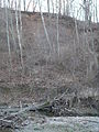
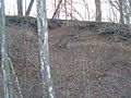
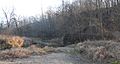
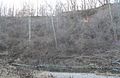
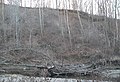
exposed glacial stratification in Tazewell County, Illinois  | |||||
| Upload media | |||||
| Instance of | |||||
|---|---|---|---|---|---|
| Location | Tazewell County, Illinois | ||||
| Heritage designation |
| ||||
 | |||||
Media in category "Farm Creek Section (Tazewell County, Illinois)"
The following 14 files are in this category, out of 14 total.
-
 Farm Creek Section bare earth exposure 1.jpg 1,920 × 2,560; 2.25 MB
-
 Farm Creek Section bare earth exposure 2.jpg 2,560 × 1,920; 2.38 MB
-
 Farm Creek Section bare earth exposure 3.jpg 2,560 × 1,920; 2.24 MB
-
 Farm Creek Section from DS 1.jpg 2,560 × 1,357; 1.43 MB
-
 Farm Creek Section from NE 1.jpg 2,560 × 1,226; 1.39 MB
-
 Farm Creek Section series 1 a.jpg 2,560 × 1,497; 1.83 MB
-
 Farm Creek Section series 1 b.jpg 2,560 × 1,631; 1.81 MB
-
 Farm Creek Section series 1 c.jpg 2,560 × 1,663; 1.82 MB
-
 Farm Creek Section series 1 d.jpg 2,560 × 1,681; 1.91 MB
-
 Farm Creek Section series 1 e.jpg 2,560 × 1,744; 1.86 MB
-
 Farm Creek Section series 1 f.jpg 2,560 × 1,719; 1.89 MB
-
 Farm Creek Section series 1 g.jpg 2,560 × 1,541; 1.65 MB
-
 Farm Creek Section series 2 a.jpg 2,560 × 1,593; 1.83 MB
-
 Farm Creek Section series 2 b.jpg 2,560 × 1,465; 1.76 MB


