Category:Farms in County Kerry
Subcategories
This category has the following 2 subcategories, out of 2 total.
F
- Farmhouses in County Kerry (1 F)
Media in category "Farms in County Kerry"
The following 66 files are in this category, out of 66 total.
-
 Abandoned farmstead - geograph.org.uk - 776066.jpg 637 × 425; 99 KB
-
 Abandoned farmstead - geograph.org.uk - 776859.jpg 637 × 425; 74 KB
-
 Ballytrasna farmstead - geograph.org.uk - 1370309.jpg 640 × 427; 77 KB
-
 Cattle grazing, Barrow - geograph.org.uk - 1983336.jpg 1,024 × 768; 187 KB
-
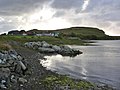
 Coastal fields at Killonecaha - geograph.org.uk - 2722201.jpg 640 × 480; 54 KB
-
 Donkeys at Dooks Mountain - geograph.org.uk - 647635.jpg 640 × 480; 123 KB
-
 Driveway near Ballybrack - geograph.org.uk - 1324476.jpg 640 × 480; 56 KB
-
 Farm at An Garran - geograph.org.uk - 220254.jpg 600 × 450; 75 KB
-
 Farm at Cill Fhiontain - geograph.org.uk - 220242.jpg 600 × 450; 82 KB
-
 Farm at Kilcumin - geograph.org.uk - 1380457.jpg 640 × 480; 83 KB
-
 Farm at Knockaunnacuddoge - geograph.org.uk - 3543718.jpg 640 × 427; 176 KB
-
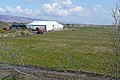
 Farm buildings - geograph.org.uk - 1310572.jpg 640 × 480; 117 KB
-
 Farm buildings - geograph.org.uk - 1310587.jpg 640 × 480; 55 KB
-
 Farm buildings at Reen - geograph.org.uk - 1315399.jpg 640 × 480; 72 KB
-
 Farm buildings near Reen - geograph.org.uk - 1315392.jpg 640 × 480; 78 KB
-
 Farm lane at Cloghbaun Rock - geograph.org.uk - 1311114.jpg 640 × 480; 77 KB
-
 Farm lane junction at Tomies West - geograph.org.uk - 1589826.jpg 640 × 480; 79 KB
-
 Farm lane near Lisheennacannina - geograph.org.uk - 1324495.jpg 640 × 480; 104 KB
-
 Farm machinery near Ownagarry - geograph.org.uk - 1311290.jpg 640 × 480; 84 KB
-
 Farm near Carrahane Strand - geograph.org.uk - 1983281.jpg 1,024 × 768; 172 KB
-
 Farm Track, Brays Head, Valencia - geograph.org.uk - 248719.jpg 640 × 424; 62 KB
-
 Farmhouse at An Baile Breac - geograph.org.uk - 466440.jpg 640 × 407; 143 KB
-

-
 Farmhouse near Minard East - geograph.org.uk - 17830.jpg 640 × 480; 425 KB
-
 Farming in the bog - geograph.org.uk - 774893.jpg 637 × 425; 67 KB
-
 Farming scene in the Black Valley - geograph.org.uk - 781238.jpg 637 × 425; 94 KB
-
 Farmland at Aghort - 1960 - geograph.org.uk - 2751974.jpg 1,732 × 1,249; 715 KB
-
 Farmland at Dunloe - geograph.org.uk - 1309388.jpg 640 × 480; 70 KB
-
 Farmland at Emlagh West - geograph.org.uk - 1819982.jpg 640 × 480; 137 KB
-
 Farmland at Fossa - geograph.org.uk - 1554118.jpg 640 × 480; 89 KB
-
 Farmland at Fossa - geograph.org.uk - 1589807.jpg 640 × 480; 90 KB
-
 Farmland at Killonecaha Townland - geograph.org.uk - 2751796.jpg 1,724 × 1,265; 1.26 MB
-
 Farmland near Anascaul - geograph.org.uk - 1980388.jpg 1,024 × 756; 300 KB
-
 Farmland near Ballinlough - geograph.org.uk - 1589838.jpg 640 × 480; 71 KB
-
 Farmland near Church Hill - geograph.org.uk - 1984485.jpg 1,024 × 765; 139 KB
-
 Farmland near Kilfenora - geograph.org.uk - 1984572.jpg 1,024 × 768; 169 KB
-
 Farmland near Stradbally - geograph.org.uk - 1981889.jpg 1,024 × 770; 221 KB
-
 Farmland near the Finglas River - geograph.org.uk - 1311139.jpg 640 × 480; 52 KB
-
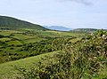
 Farmland overlooking Brandon Bay - geograph.org.uk - 1981758.jpg 1,024 × 762; 283 KB
-
 Farmland, Cullenagh Upper - geograph.org.uk - 2540917.jpg 640 × 425; 225 KB
-
 Farmland, Knockeanagh - geograph.org.uk - 1984596.jpg 1,024 × 765; 246 KB
-
 Farmland, Knockeanagh - geograph.org.uk - 1984636.jpg 1,024 × 768; 291 KB
-
 Farmyard at Ardfergus - geograph.org.uk - 1589821.jpg 640 × 480; 92 KB
-
 Moorland road in the Slieve Mish - geograph.org.uk - 1372009.jpg 640 × 427; 62 KB
-
 Muckross traditional farms, Killarney, Co. Kerry, Ireland.jpg 4,000 × 2,500; 7.62 MB
-
 Muckross traditional farms, Killarney, Co. Kerry.jpg 4,200 × 2,800; 8.59 MB
-
-
 Old farm buildings, Cullenagh Upper - geograph.org.uk - 2501073.jpg 640 × 425; 227 KB
-

-
 Sign-1040744, Dingle Peninsula, Co. Kerry, Ireland.jpg 4,896 × 3,672; 1.39 MB
-
 Signs-1030313, Dingle Peninsula, Co. Kerry, Ireland.jpg 4,896 × 3,672; 2.4 MB
-
 Spreading the lime - geograph.org.uk - 1380393.jpg 640 × 480; 78 KB
-
 Working horses at Muckross traditional farms, Killarney, Co. Kerry, Ireland.jpg 4,200 × 3,150; 8.69 MB
-
 Fahan Farm Buildings - geograph.org.uk - 86064.jpg 600 × 403; 60 KB
-
 Farm at Marthain Mor - geograph.org.uk - 220030.jpg 600 × 450; 76 KB
-
 Farm community west of Glenderry - geograph.org.uk - 334122.jpg 640 × 480; 48 KB
-
 Farm Road near Na Gleannta Theas - geograph.org.uk - 17801.jpg 640 × 480; 479 KB
-
 Farmhouse near An Fheothanach - geograph.org.uk - 447620.jpg 640 × 427; 120 KB
-
 Farmhouse with a view to Beennaman - geograph.org.uk - 460592.jpg 640 × 427; 150 KB
-
 Farmhouse with Ballydavid Head behind - geograph.org.uk - 460329.jpg 640 × 454; 111 KB
-
 Farming Country at Dun an Oir - geograph.org.uk - 17016.jpg 640 × 480; 458 KB
-
 Farmland near Gallarus Oratory - geograph.org.uk - 17677.jpg 640 × 480; 473 KB
-
 Farmland near Reenbeg Point - geograph.org.uk - 17022.jpg 640 × 480; 533 KB
-
 Farmland north of the R561 at Fybagh - geograph.org.uk - 15888.jpg 640 × 480; 300 KB
-
 Farmstead on the Kerry Way - geograph.org.uk - 778346.jpg 637 × 425; 98 KB
-
 Kissane Sheep Farm - geograph.org.uk - 16044.jpg 640 × 480; 376 KB


